Aslockton
Civil Parish in Nottinghamshire Rushcliffe
England
Aslockton

Aslockton is a civil parish located in the Rushcliffe district of Nottinghamshire, England. It is a small village situated about 12 miles east of Nottingham city center. The parish covers an area of about 7.5 square kilometers and has a population of around 1,400 people.
The village of Aslockton has a rich history that dates back to Roman times. It is believed to have been an important settlement during the Roman occupation of Britain, as evidenced by the discovery of Roman artifacts in the area. The village also played a significant role during the medieval period, with the construction of St. Thomas of Canterbury Church in the 13th century.
Today, Aslockton is a picturesque and peaceful village that offers a tranquil countryside setting. It is surrounded by beautiful farmland and countryside, making it an ideal location for outdoor activities such as walking, cycling, and horse riding.
The village has a range of amenities and facilities for its residents, including a primary school, a village hall, a post office, and a few local shops. There are also a couple of traditional pubs in the village where residents and visitors can enjoy a drink or a meal.
Overall, Aslockton is a charming and historic village that offers a high quality of life for its residents. Its idyllic countryside setting, combined with its close proximity to Nottingham, makes it an attractive place to live for those seeking a peaceful rural lifestyle.
If you have any feedback on the listing, please let us know in the comments section below.
Aslockton Images
Images are sourced within 2km of 52.955595/-0.897742 or Grid Reference SK7440. Thanks to Geograph Open Source API. All images are credited.


Aslockton is located at Grid Ref: SK7440 (Lat: 52.955595, Lng: -0.897742)
Administrative County: Nottinghamshire
District: Rushcliffe
Police Authority: Nottinghamshire
What 3 Words
///grounded.matchbox.signs. Near Aslockton, Nottinghamshire
Related Wikis
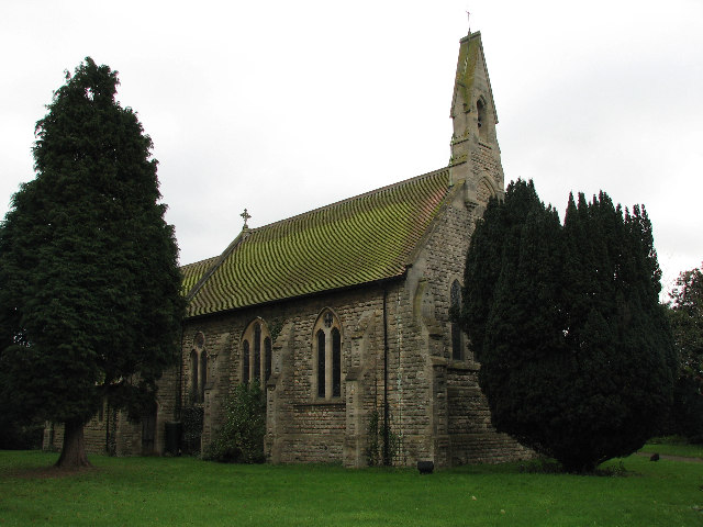
St Thomas's Church, Aslockton
St. Thomas' Church, Aslockton is a late 19th-century Church of England parish church in the village of Aslockton, Nottinghamshire. The church is Grade...
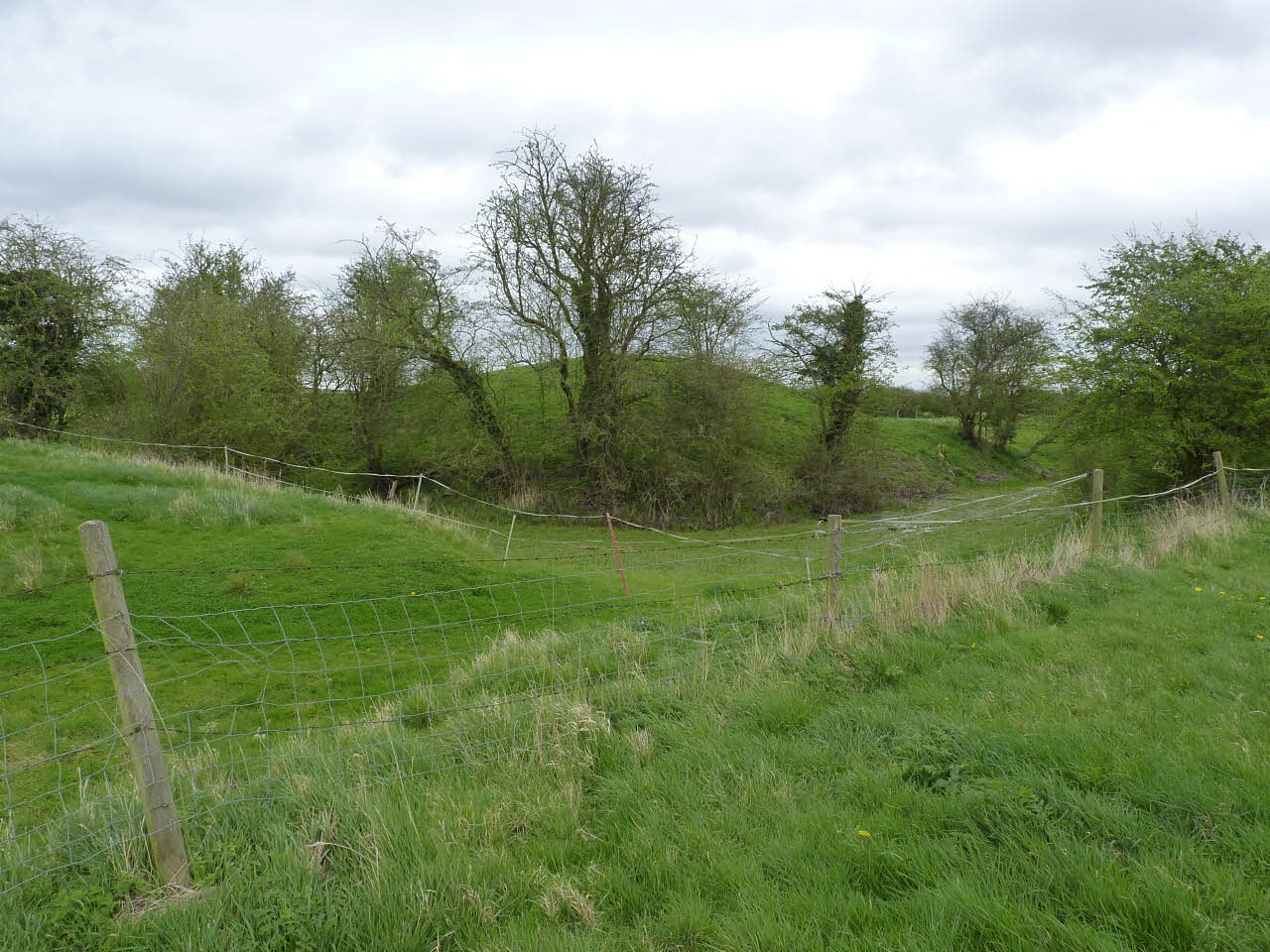
Aslockton Castle
Aslockton Castle is a ruined fortification, a motte-and-bailey castle, in the village of Aslockton, Nottinghamshire. (grid reference SK744402) The original...
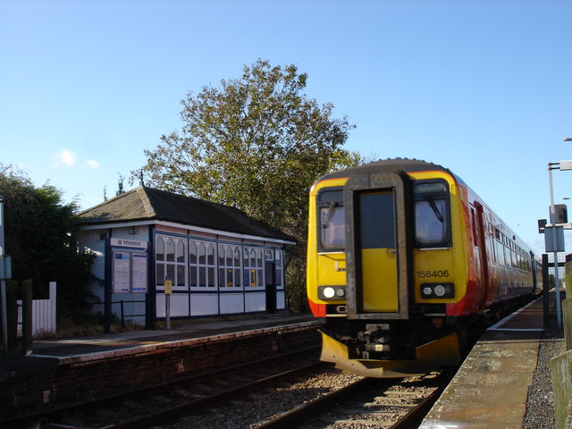
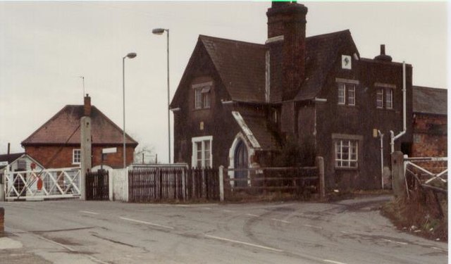
Aslockton railway station
Aslockton railway station serves the English villages of Aslockton and Whatton-in-the-Vale in Nottinghamshire. It also draws passengers from other nearby...
Aslockton
Aslockton is an English village and civil parish 12 miles (19.3 km) east of Nottingham and two miles (3.2 km) east of Bingham, on the north bank of the...
Nearby Amenities
Located within 500m of 52.955595,-0.897742Have you been to Aslockton?
Leave your review of Aslockton below (or comments, questions and feedback).