Aslockton
Settlement in Nottinghamshire Rushcliffe
England
Aslockton

Aslockton is a small village located in the county of Nottinghamshire, England. It lies approximately 10 miles east of Nottingham city center and is part of the Rushcliffe borough. With a population of around 1,000 residents, Aslockton maintains a close-knit community atmosphere.
The village is surrounded by picturesque countryside, with rolling hills and green fields providing a scenic backdrop. Its rural location attracts those seeking a peaceful and tranquil lifestyle, away from the hustle and bustle of city living.
Aslockton is known for its rich history, dating back to the medieval period. The village is home to St. Thomas' Church, a Grade I listed building, and Aslockton Hall, a grand Georgian mansion. These architectural gems provide an insight into the village's past and are popular attractions for visitors.
Despite its small size, Aslockton offers a range of amenities for its residents. The village boasts a primary school, a village hall, a cricket club, and a pub, the "Old Plough." There are also several shops and businesses catering to the needs of the local community.
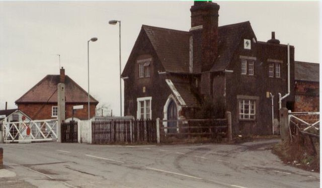
Transport links in Aslockton are well-developed, with regular bus services connecting the village to nearby towns and cities. The village also benefits from a train station, providing convenient access to Nottingham, Grantham, and beyond.
In conclusion, Aslockton is a charming village in Nottinghamshire, offering a peaceful rural lifestyle, a rich history, and a range of amenities for its residents. Its idyllic location and strong sense of community make it an appealing place to live or visit.
If you have any feedback on the listing, please let us know in the comments section below.
Aslockton Images
Images are sourced within 2km of 52.952865/-0.897082 or Grid Reference SK7440. Thanks to Geograph Open Source API. All images are credited.


Aslockton is located at Grid Ref: SK7440 (Lat: 52.952865, Lng: -0.897082)
Administrative County: Nottinghamshire
District: Rushcliffe
Police Authority: Nottinghamshire
What 3 Words
///harshest.standard.grin. Near Aslockton, Nottinghamshire
Related Wikis
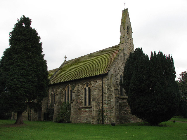
St Thomas's Church, Aslockton
St. Thomas' Church, Aslockton is a late 19th-century Church of England parish church in the village of Aslockton, Nottinghamshire. The church is Grade...
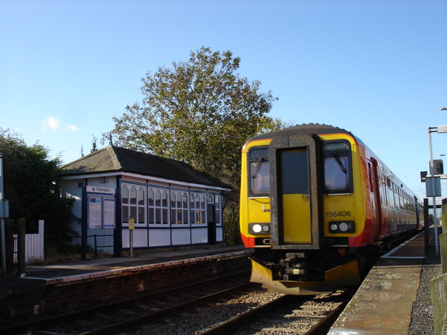
Aslockton railway station
Aslockton railway station serves the English villages of Aslockton and Whatton-in-the-Vale in Nottinghamshire. It also draws passengers from other nearby...
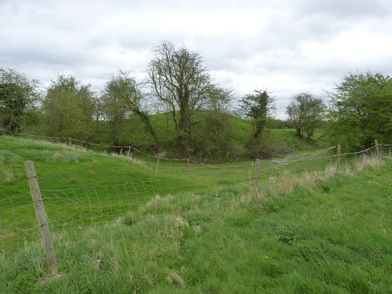
Aslockton Castle
Aslockton Castle is a ruined fortification, a motte-and-bailey castle, in the village of Aslockton, Nottinghamshire. (grid reference SK744402) The original...
Aslockton
Aslockton is an English village and civil parish 12 miles (19.3 km) east of Nottingham and two miles (3.2 km) east of Bingham, on the north bank of the...
Nearby Amenities
Located within 500m of 52.952865,-0.897082Have you been to Aslockton?
Leave your review of Aslockton below (or comments, questions and feedback).