Askwith

Civil Parish in Yorkshire Harrogate

England

Askwith

Snowden Crags Northward view, Crag House in the middle distance, High Snowden beyond.
Snowden Crags Credit: David Spencer

Askwith is a civil parish located in the county of Yorkshire, England. Situated within the Harrogate district, this small rural village is nestled in the Wharfedale valley, approximately 12 miles northwest of Leeds. The parish covers an area of around 7 square miles and has a population of approximately 400 residents.

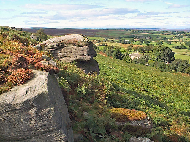
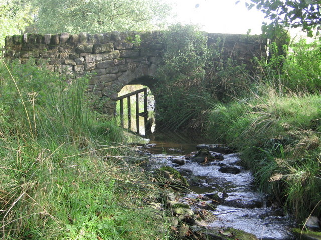
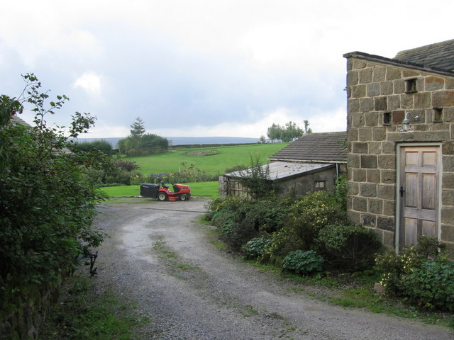
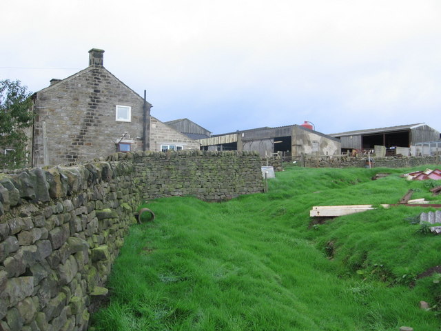
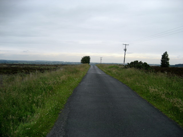
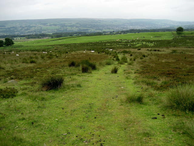
Askwith is surrounded by picturesque countryside, with rolling hills, meandering rivers, and lush green fields. The village itself is made up of a collection of traditional stone-built houses, many of which date back to the 17th and 18th centuries. The architecture reflects the rural charm and character of the area.

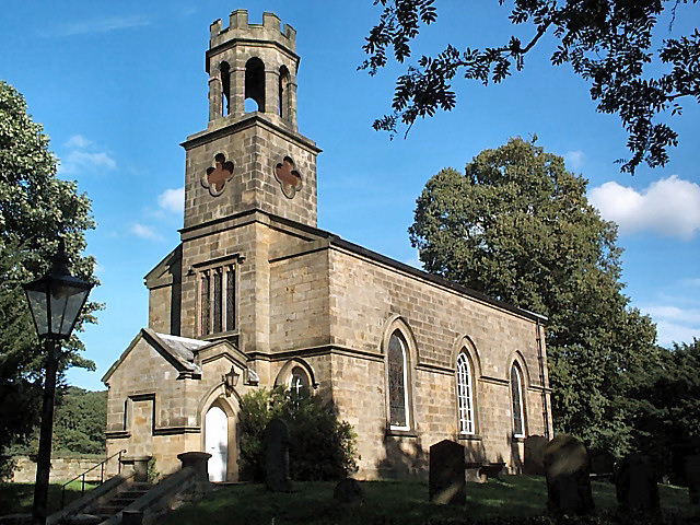
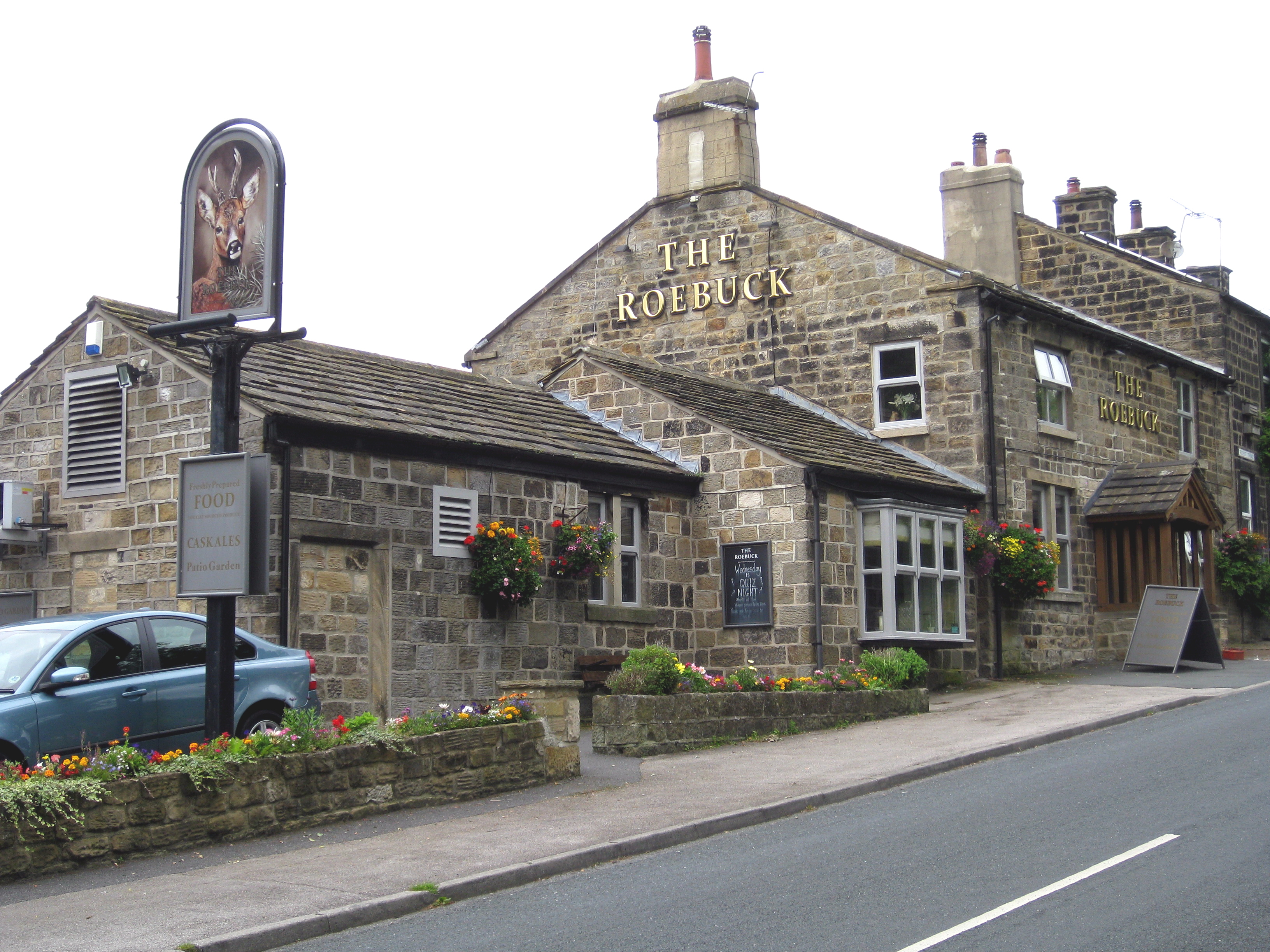
Despite its small size, Askwith has a strong sense of community and offers a range of amenities for its residents. These include a village hall, a primary school, a church, and a pub. The village hall serves as a hub for various social events and activities, bringing the community together.

The natural beauty of the area attracts outdoor enthusiasts and nature lovers. The nearby Yorkshire Dales National Park offers ample opportunities for walking, hiking, and cycling. The village is also surrounded by several notable landmarks, including the historic Bolton Abbey and the iconic Ilkley Moor.

Overall, Askwith is a peaceful and idyllic village that offers a quiet retreat from the hustle and bustle of nearby urban areas. Its stunning surroundings, close-knit community, and range of amenities make it an attractive place to live for those seeking a rural lifestyle.

If you have any feedback on the listing, please let us know in the comments section below.
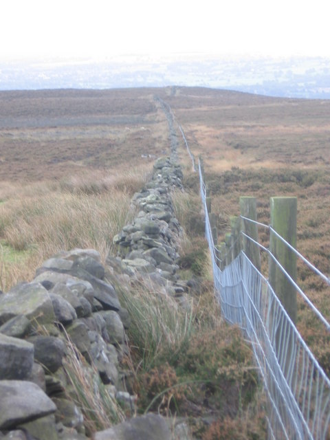
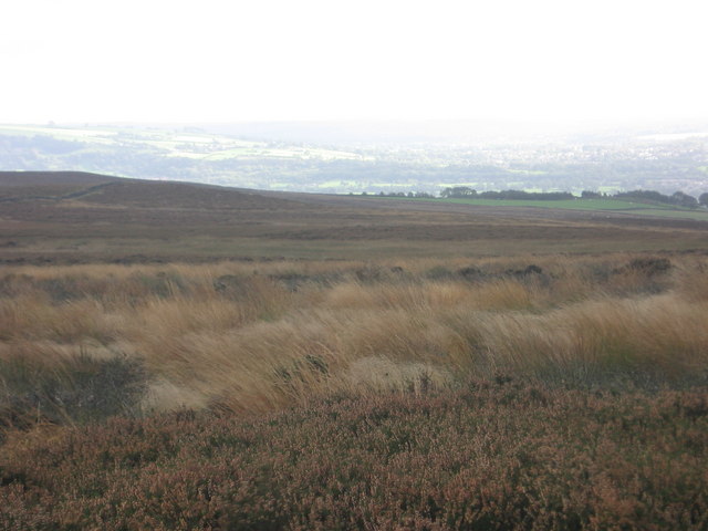
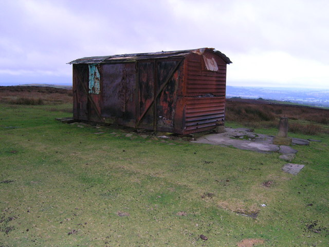
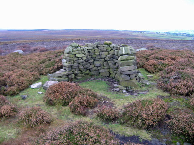
Askwith Images

Images are sourced within 2km of 53.945596/-1.742286 or Grid Reference SE1749. Thanks to Geograph Open Source API. All images are credited.

Snowden Crags Northward view, Crag House in the middle distance, High Snowden beyond.
Snowden Crags
Northward view, Crag House in the middle distance, High Snowden beyond.
Old quarry, Snowden Carr The farmer has shrewdly sheltered two beehives in the bottom.  Eastward view with Hunter's Stones microwave tower (at Norwood Edge) in the distance.
Old quarry, Snowden Carr
The farmer has shrewdly sheltered two beehives in the bottom. Eastward view with Hunter's Stones microwave tower (at Norwood Edge) in the distance.
Snowden Carr Rock-strewn heather moorland sloping down to the east.  Eastward view with the entirely innocuous ( <span class="nowrap"><a title="http://duncan.gn.apc.org/menwith.htm" rel="nofollow ugc noopener" href="http://duncan.gn.apc.org/menwith.htm">Link</a><img style="margin-left:2px;" alt="External link" title="External link - shift click to open in new window" src="https://s1.geograph.org.uk/img/external.png" width="10" height="10"/></span> ) Hunter's Stones microwave tower in the distance.
Snowden Carr
Rock-strewn heather moorland sloping down to the east. Eastward view with the entirely innocuous ( LinkExternal link ) Hunter's Stones microwave tower in the distance.
Tree of Life Stone, Snowden Carr Prehistoric cup marked rock carving (possibly Bronze Age).  Despite the stone's modern name, it is not known whether the carving was intended to depict a tree.
Tree of Life Stone, Snowden Carr
Prehistoric cup marked rock carving (possibly Bronze Age). Despite the stone's modern name, it is not known whether the carving was intended to depict a tree.
Tree of Life Stone, Snowden Carr (detail) Detail of the prehistoric cup marked rock carving.
Tree of Life Stone, Snowden Carr (detail)
Detail of the prehistoric cup marked rock carving.
Dob Park Seen from Snowden Carr Road, this farmland is the former site of Dob Park.  Dob Park Woods lie to the left and the ruined Dob Park Lodge is the speck on the skyline centre-right and just outside the gridsquare.
Dob Park
Seen from Snowden Carr Road, this farmland is the former site of Dob Park. Dob Park Woods lie to the left and the ruined Dob Park Lodge is the speck on the skyline centre-right and just outside the gridsquare.
Hundwith Beck The public footpath crosses this bridge before 
being re-routed through the plantation.
Hundwith Beck
The public footpath crosses this bridge before being re-routed through the plantation.
Whin Hill Farm The entrance to the non-working farm. 
Mown paths through meadows and a lake provide the perfect hide-away!
Whin Hill Farm
The entrance to the non-working farm. Mown paths through meadows and a lake provide the perfect hide-away!
Top Moorside Farm Very much a working farm, the far right hand building is in 
the square! The farmhouse to the left is in square 1649.
Top Moorside Farm
Very much a working farm, the far right hand building is in the square! The farmhouse to the left is in square 1649.
High Round Hill High Round Hill lies to the left of the wall and fence. 
The fence is the line of the parish boundary.
High Round Hill
High Round Hill lies to the left of the wall and fence. The fence is the line of the parish boundary.
Low Round Hill Low Round Hill lies in the middle distance, to the right of the dry stone wall.
Low Round Hill
Low Round Hill lies in the middle distance, to the right of the dry stone wall.
Box-car on the top of Shooting House Hill An unattractive replacement for the stone built shooting house on whose foundations this dilapidated box-car sits. It's presumably still used as a shooting box for the grouse on Askwith Moor.
Box-car on the top of Shooting House Hill
An unattractive replacement for the stone built shooting house on whose foundations this dilapidated box-car sits. It's presumably still used as a shooting box for the grouse on Askwith Moor.
Grouse Butt No. 1 on Askwith Moor
Snowden Carr Road Leads off the ridge, descending to Dob Park.
Snowden Carr Road
Leads off the ridge, descending to Dob Park.
Askwith Moor Road Part of the road that utilises the broad ridge of Snowden Carr between Otley and Blubberhouses.
Askwith Moor Road
Part of the road that utilises the broad ridge of Snowden Carr between Otley and Blubberhouses.
Stoop Hill Walking across a section of moorland from Askwith Moor Road towards Moorside Farm.
Stoop Hill
Walking across a section of moorland from Askwith Moor Road towards Moorside Farm.
Crossroads to Low Snowden A loop road leaves the moor road for Low Snowden descending into farming country.  Ilkley Moor dominates the view westwards.
Crossroads to Low Snowden
A loop road leaves the moor road for Low Snowden descending into farming country. Ilkley Moor dominates the view westwards.
Steep hill to Low Snowden The quiet and steep loop road to Low Snowden provides excellent walking and a route for horse riders, while allowing one to ponder on the need for the US/UK interception facility on Menwith Hill.
Steep hill to Low Snowden
The quiet and steep loop road to Low Snowden provides excellent walking and a route for horse riders, while allowing one to ponder on the need for the US/UK interception facility on Menwith Hill.
Show me another place!

Askwith is located at Grid Ref: SE1749 (Lat: 53.945596, Lng: -1.742286)

Division: West Riding

Administrative County: North Yorkshire

District: Harrogate

Police Authority: North Yorkshire

What 3 Words

///bikes.breezes.bathtubs. Near Burley in Wharfedale, West Yorkshire

Related Wikis

Snowden Crags

Snowden Crags is a prehistoric archaeological site on Askwith Moor in North Yorkshire, England. Local antiquarian Eric Cowling recorded a stone circle...

Askwith

Askwith is a village and civil parish in North Yorkshire, England, with a population of 220 (2001 census), increasing to 240 at the 2011 Census. The village...

Denton Hall, Wharfedale

Denton Hall is an English country house located to the north of the River Wharfe, at Denton, Borough of Harrogate, North Yorkshire, England between Otley...

Church of St Helen, Denton

The Church of St Helen, Denton is a parish church in the hamlet of Denton, near Otley, in North Yorkshire, England. The church was built in 1776 by the...

Denton, North Yorkshire

Denton is a hamlet and civil parish in the Harrogate district of North Yorkshire, England. At the 2011 Census the population of this civil parish was less...

Fewston

Fewston is a village and civil parish in the Harrogate district of North Yorkshire, England. It is situated north of Otley and close to Swinsty and Fewston...

Weston, North Yorkshire

Weston is a village and civil parish in the former Harrogate district of North Yorkshire, England. The village is 1.2 miles (2 km) north–west of Otley...

Newall with Clifton

Newall with Clifton (historically also spelt Newell with Clifton) is a civil parish in North Yorkshire, England. It lies two miles north of Otley in West...

Nearby Amenities

Located within 500m of 53.945596,-1.742286
Barrier: kissing_gate
Material: wood
Lat/Long: 53.9442775/-1.7482094
Barrier: cattle_grid
Source: Bing
Lat/Long: 53.9448183/-1.7426462
Power: pole
Lat/Long: 53.9443883/-1.7495106
The data included in this document is from www.openstreetmap.org. The data is made available under ODbL.

Have you been to Askwith?

Leave your review of Askwith below (or comments, questions and feedback).