Ashurst Wood

Civil Parish in Sussex Mid Sussex

England

Ashurst Wood

Weir Wood Reservoir Dam Looking South-East along the dam, you can just see the water works peeking over the top of the dam. The cars and boats visible are part of the active water sports centre.
Weir Wood Reservoir Dam Credit: Barry Hunter

Ashurst Wood is a civil parish located in the county of Sussex, England. It is situated approximately 25 miles south of London and lies within the district of Mid Sussex. The parish covers an area of around 2.5 square miles and is home to a population of approximately 2,500 residents.

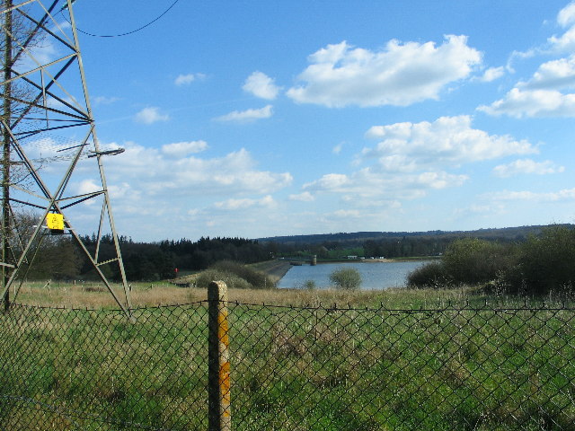
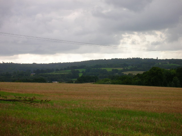
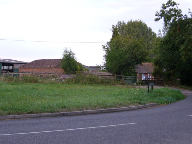
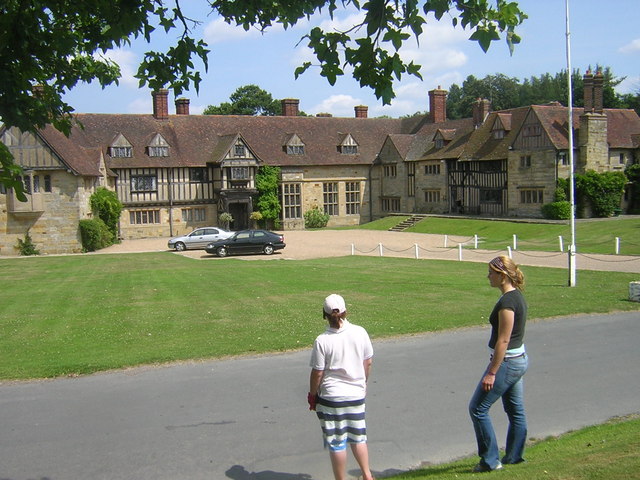
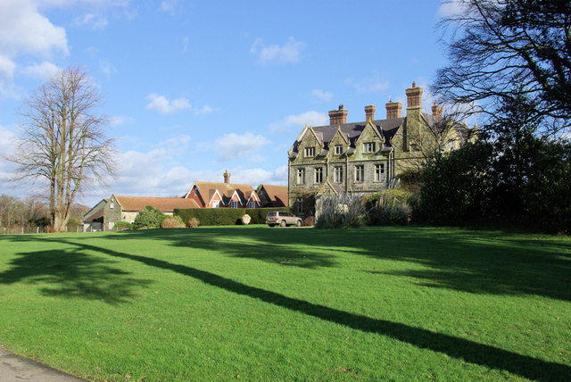
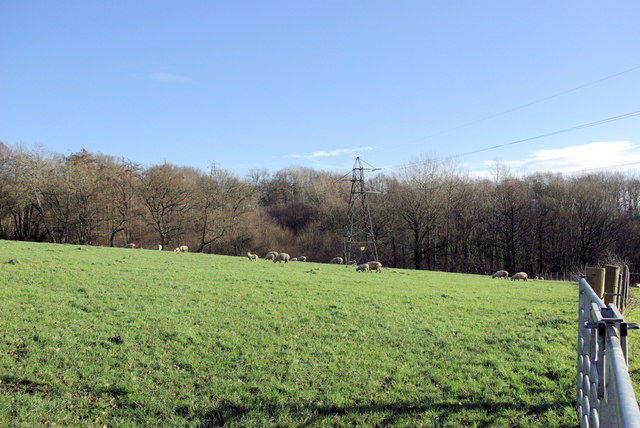
Ashurst Wood is a picturesque village surrounded by beautiful countryside, with the Ashdown Forest nearby, which is known for its stunning landscapes and wildlife. The village itself is characterized by its charming houses, many of which are traditional 17th and 18th-century cottages.

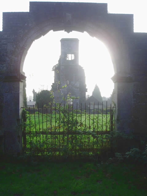
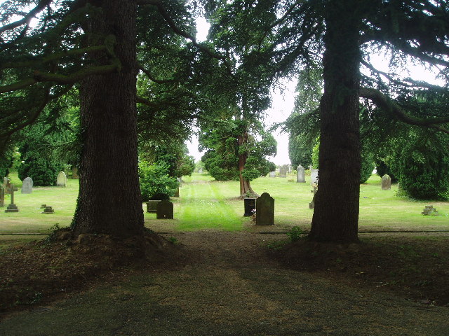
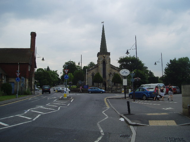
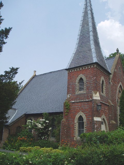
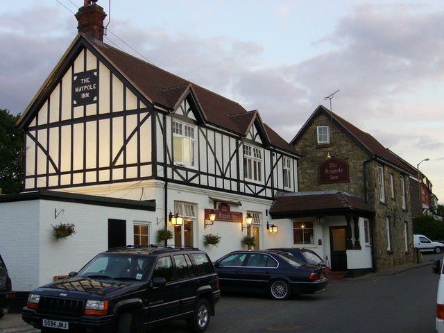
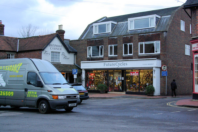
The community in Ashurst Wood is close-knit and friendly, with a strong sense of pride in the village's history and heritage. The local amenities include a primary school, a village hall, a church, and several shops, pubs, and restaurants. The village also has excellent transport links, with regular bus services connecting it to nearby towns and cities.

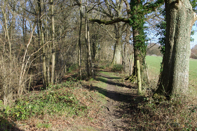
The parish offers a range of recreational activities for residents and visitors alike. There are numerous walking and cycling trails in and around the village, providing opportunities to explore the stunning countryside. Additionally, the Ashdown Forest provides ample space for outdoor activities such as horse riding, birdwatching, and picnicking.

Overall, Ashurst Wood is a peaceful and idyllic village in Sussex, offering a high quality of life for its residents. With its natural beauty, strong community spirit, and convenient location, it is a desirable place to live and visit.

If you have any feedback on the listing, please let us know in the comments section below.
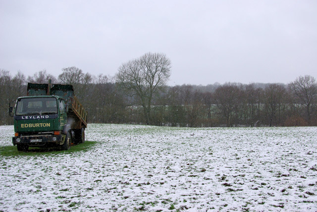
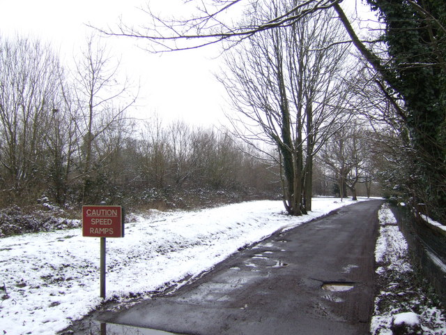
Ashurst Wood Images

Images are sourced within 2km of 51.113423/0.022964 or Grid Reference TQ4136. Thanks to Geograph Open Source API. All images are credited.

Weir Wood Reservoir Dam Looking South-East along the dam, you can just see the water works peeking over the top of the dam. The cars and boats visible are part of the active water sports centre.
Weir Wood Reservoir Dam
Looking South-East along the dam, you can just see the water works peeking over the top of the dam. The cars and boats visible are part of the active water sports centre.
Brambletye House ruins Built in 1631 and abandoned towards the end of the 17th century
Brambletye House ruins
Built in 1631 and abandoned towards the end of the 17th century
Forest Row Cemetery Run by the Forest Row Parish Council with peaceful surroundings. Has won a 'Best cemetery in the South' Award !
Forest Row Cemetery
Run by the Forest Row Parish Council with peaceful surroundings. Has won a 'Best cemetery in the South' Award !
Forest Row centre
Forest Row centre
St Dunstan's Church at Ashurst Wood A small place of worship in this pretty village.
St Dunstan's Church at Ashurst Wood
A small place of worship in this pretty village.
View of Weirwood reservoir and beyond This square contains very little except a farm and sewage works. Thought this view from Forest Way looked far better.
View of Weirwood reservoir and beyond
This square contains very little except a farm and sewage works. Thought this view from Forest Way looked far better.
The Maypole 76 Maypole Road, Ashurst Wood. The village seems to have decided within the last thrity years that it is two words and not Ashurstwood as on older maps
The Maypole
76 Maypole Road, Ashurst Wood. The village seems to have decided within the last thrity years that it is two words and not Ashurstwood as on older maps
Wealden outcrop in Homestall Road which is in East Sussex but continue away from the photographer along that road for a couple of hundred yards and you come to Ashurst Wood, West Sussex. Stoke Brunswick School lies behind the outcrop. The rock is rusty because it contains iron ore.
Wealden outcrop
in Homestall Road which is in East Sussex but continue away from the photographer along that road for a couple of hundred yards and you come to Ashurst Wood, West Sussex. Stoke Brunswick School lies behind the outcrop. The rock is rusty because it contains iron ore.
Near Shovelstrode Farm in Homestall Road near Ashurst Wood. Shovelstrode Farm is out of shot to the right.
Near Shovelstrode Farm
in Homestall Road near Ashurst Wood. Shovelstrode Farm is out of shot to the right.
Stoke Brunswick School A historic building built by Lord and Lady Dewar, combining a hunting lodge with a Hall bought down from Cheshire and landscaped gardens. Now used as a school
Stoke Brunswick School
A historic building built by Lord and Lady Dewar, combining a hunting lodge with a Hall bought down from Cheshire and landscaped gardens. Now used as a school
Future Cycles The lights are coming on in Forest Row as the photographer queues on the A22 - a probable fallen tree ahead - never found out, turned round and went another way.
Future Cycles
The lights are coming on in Forest Row as the photographer queues on the A22 - a probable fallen tree ahead - never found out, turned round and went another way.
Vanguard Way The footpath ascends the hill north of Forest Row. Old ironstone diggings on the left.
Vanguard Way
The footpath ascends the hill north of Forest Row. Old ironstone diggings on the left.
Thornhill An imposing house viewed from the Vanguard Way footpath.
Thornhill
An imposing house viewed from the Vanguard Way footpath.
Sheep grazing Viewed from the Vanguard Way footpath.
Sheep grazing
Viewed from the Vanguard Way footpath.
Sackville School, East Grinstead
Drive behind houses on Ashurst Road Off the A22, East Grinstead.
Drive behind houses on Ashurst Road
Off the A22, East Grinstead.
A Lorry in a Field The lorry has not moved from this spot for over a year, and has remained half tipped.
A Lorry in a Field
The lorry has not moved from this spot for over a year, and has remained half tipped.
Drive to a nursing home Off the A22 at Ashurst Wood.
Drive to a nursing home
Off the A22 at Ashurst Wood.
Show me another place!

Ashurst Wood is located at Grid Ref: TQ4136 (Lat: 51.113423, Lng: 0.022964)

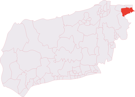
Administrative County: West Sussex

District: Mid Sussex

Police Authority: Sussex

What 3 Words

///rumbles.fattening.cherub. Near Forest Row, East Sussex

Related Wikis

Ashurst Wood

Ashurst Wood is a village and civil parish in the Mid Sussex District of West Sussex, within the historic county of Sussex, England. It is 1 mile (2 km...

Brambletye School

Brambletye School is a coeducational day and boarding preparatory school in East Grinstead, West Sussex. It was founded as a small boys' boarding school...

Stoke Brunswick School

Stoke Brunswick School was a small co-educational day and boarding independent school for children aged 3 to 13 years, situated in Ashurst Wood, West Sussex...

Three Bridges–Tunbridge Wells line

The Three Bridges–Tunbridge Wells line is a mostly disused railway line running from Three Bridges (on the Brighton Main Line) in West Sussex to Tunbridge...

Sackville School, East Grinstead

Sackville School is a coeducational secondary school and sixth form located in East Grinstead, England. In 2020, the number of students was approximately...

Forest Row

Forest Row is a village and a large civil parish in the Wealden District of East Sussex, England. The village is located three miles (5 km) south-east...

Forest Row railway station

Forest Row was a railway station on the Three Bridges to Tunbridge Wells Central Line which closed in 1967, a casualty of the Beeching Axe.The station...

East Grinstead South & Ashurst Wood (electoral division)

East Grinstead South & Ashurst Wood is an electoral division of West Sussex in the United Kingdom, and returns one member to sit on West Sussex County...

Nearby Amenities

Located within 500m of 51.113423,0.022964
Post Box
Operator: Royal Mail
Post Box Type: lamp
Ref: RH19 51D
Royal Cypher: EIIR
Royal Cypher Wikidata: Q33102113
Lat/Long: 51.1103889/0.0270168
Bus Stop
War Memorial
Alt Name: Hammerwood Road
Naptan AltCommonName: Hammerwood Road
Naptan AltIndicator: In Triangle of Road
Naptan AltLandmark: Hammerwood Road
Naptan AltStreet: Wall Hill Road
Naptan AtcoCode: 4400EG0166
Naptan Bearing: SE
Naptan CommonName: War Memorial
Naptan Indicator: In triangle of roads
Naptan Landmark: Hamerwood Road
Naptan NaptanCode: wsxapajd
Naptan ShortCommonName: Ashurstwood War Mem
Naptan Street: Wall Hill Road
Naptan Verified: no
Public Transport: platform
Source: naptan_import
Lat/Long: 51.1106686/0.0261944
Bus Stop
War Memorial
Alt Name: Hammerwood Road
Naptan AltCommonName: Hammerwood Road
Naptan AltIndicator: Outside 42
Naptan AltLandmark: Hammerwood Road
Naptan AltStreet: Wall Hill Road
Naptan AtcoCode: 4400EG0167
Naptan Bearing: W
Naptan CommonName: War Memorial
Naptan Indicator: outside 42
Naptan Landmark: Hammerwood Road
Naptan NaptanCode: wsxapajg
Naptan ShortCommonName: Ashurstwood War Mem
Naptan Street: Wall Hill Road
Naptan Verified: no
Public Transport: platform
Source: naptan_import
Lat/Long: 51.110702/0.0253112
Bus Stop
Three Crowns
Bus: yes
Naptan AtcoCode: 4400EG0168
Naptan Bearing: NW
Naptan CommonName: Three Crowns
Naptan Indicator: adj
Naptan Landmark: Woods Hill Lane
Naptan NaptanCode: wsxapajm
Naptan ShortCommonName: A' Wood Three Crowns
Naptan Street: Wall Hill Road
Naptan Verified: no
Public Transport: platform
Source: naptan_import
Lat/Long: 51.1122673/0.021345
Bus Stop
Three Crowns
Bus: yes
Naptan AtcoCode: 4400EG0169
Naptan Bearing: SE
Naptan CommonName: Three Crowns
Naptan Indicator: o/s pub
Naptan Landmark: Woods Hill Lane
Naptan NaptanCode: wsxapajp
Naptan ShortCommonName: A' Wood Three Crowns
Naptan Street: Wall Hill Road
Naptan Verified: no
Public Transport: platform
Source: naptan_import
Lat/Long: 51.1125249/0.0213417
Bus Stop
Windmill Lane
Bus: yes
Naptan AtcoCode: 4400EG0170
Naptan Bearing: SE
Naptan CommonName: Windmill Lane
Naptan Indicator: adj Windmill Lane
Naptan Landmark: Windmill Lane
Naptan NaptanCode: wsxapajt
Naptan Street: A22 Lewes Road
Naptan Verified: no
Public Transport: platform
Source: naptan_import
Lat/Long: 51.1148986/0.0165032
Lewes Road
Naptan AtcoCode: 4400EG0411
Naptan Bearing: SE
Naptan BusStopType: CUS
Naptan CommonName: Lewes Road
Naptan Indicator: HAR
Naptan Landmark: Hail & Ride
Naptan NaptanCode: wsxgawjp
Naptan Street: Lewes Road
Naptan Verified: no
Source: naptan_import
Lat/Long: 51.1116844/0.0212139
Lewes Road
Naptan AtcoCode: 4400EG0412
Naptan Bearing: NW
Naptan BusStopType: CUS
Naptan CommonName: Lewes Road
Naptan Indicator: HAR
Naptan Landmark: Hail & Ride
Naptan NaptanCode: wsxgawjt
Naptan Street: Lewes Road
Naptan Verified: no
Source: naptan_import
Lat/Long: 51.1116254/0.0209828
Pub
Three Crowns
Lat/Long: 51.1124651/0.0208915
Historic: memorial
Lat/Long: 51.1106532/0.026071
Ashurst Wood
Place: village
Wikidata: Q2683248
Lat/Long: 51.1115747/0.024702
Post Office
Ashurst Wood Post Office
Addr City: East Grinstead
Addr Housenumber: 28-30
Addr Postcode: RH19 3QY
Addr Street: Maypole Road
Addr Village: Ashurst Wood
Brand: Post Office
Brand Wikidata: Q1783168
Brand Wikipedia: en:Post Office Ltd
Fhrs Id: 509124
Phone: +44 1342 825231
Ref Pol Id: 134495
Website: https://www.postoffice.co.uk/branch-finder/1739123/ashurst-wood
Lat/Long: 51.1124617/0.0287606
Barrier: entrance
Lat/Long: 51.1122039/0.0243793
Barrier: bollard
Bicycle: yes
Foot: yes
Lat/Long: 51.1122215/0.024414
Barrier: stile
Foot: yes
Lat/Long: 51.1151945/0.0244006
Barrier: stile
Foot: yes
Lat/Long: 51.1165282/0.0255665
Barrier: stile
Foot: yes
Lat/Long: 51.1171521/0.0266837
Post Box
Brand: Royal Mail
Brand Wikidata: Q638098
Brand Wikipedia: en:Royal Mail
Operator: Royal Mail
Operator Wikidata: Q638098
Post Box Design: type_m
Post Box Type: lamp
Ref: RH19 53
Royal Cypher: EIIR
Royal Cypher Wikidata: Q33102113
Lat/Long: 51.1125019/0.0285909
Post Box
Brand: Royal Mail
Brand Wikidata: Q638098
Brand Wikipedia: en:Royal Mail
Operator: Royal Mail
Operator Wikidata: Q638098
Post Box Type: wall
Ref: RH19 24
Royal Cypher: VR
Royal Cypher Wikidata: Q33102356
Lat/Long: 51.1127364/0.0209102
Crossing
Crossing: uncontrolled
Crossing Island: yes
Kerb: lowered
Tactile Paving: no
Lat/Long: 51.1133399/0.0189235
Barrier: entrance
Lat/Long: 51.1119879/0.0252126
Barrier: entrance
Lat/Long: 51.1118414/0.0234122
Barrier: entrance
Lat/Long: 51.1108134/0.0251352
Barrier: bollard
Lat/Long: 51.1114537/0.0228734
Defibrillator
Booth: K6
Covered: booth
Defibrillator Location: Inside converted red telephone box in front of convenience store on corner of School Lane and Maypole Road.
Disused Amenity: telephone
Emergency: defibrillator
Indoor: no
Man Made: telephone_box
Lat/Long: 51.1124692/0.0286615
The data included in this document is from www.openstreetmap.org. The data is made available under ODbL.

Have you been to Ashurst Wood?

Leave your review of Ashurst Wood below (or comments, questions and feedback).