Arclid

Civil Parish in Cheshire

England

Arclid

Meadowside Small rural housing development.
Meadowside Credit: Peter McDermott

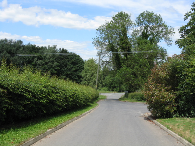
Arclid is a civil parish located in the ceremonial county of Cheshire, England. It is situated about 5 miles east of the town of Sandbach and covers an area of approximately 6 square miles. The parish is largely rural in nature, characterized by open fields, farmland, and scattered residential properties.

The village of Arclid itself is the main settlement within the parish. It is a small and tight-knit community with a population of around 500 people. The village features a mix of traditional and modern architecture, including a number of historic buildings such as the Church of St. Peter, which dates back to the 14th century.

Despite its relatively small size, Arclid offers a range of amenities to its residents. These include a primary school, a village hall, and a pub. The surrounding countryside provides opportunities for outdoor activities such as walking, cycling, and horse riding, with several footpaths and bridleways crisscrossing the area.

Arclid is well-connected to nearby towns and cities via road networks. The A534 runs through the village, providing easy access to Sandbach and Congleton, while the M6 motorway is just a short drive away. This convenient location allows residents to enjoy the tranquility of rural living while still having access to urban amenities and employment opportunities.

In summary, Arclid is a picturesque civil parish in Cheshire, offering a peaceful rural lifestyle within easy reach of larger towns and cities.

If you have any feedback on the listing, please let us know in the comments section below.

Arclid Images

Images are sourced within 2km of 53.15192/-2.322718 or Grid Reference SJ7861. Thanks to Geograph Open Source API. All images are credited.

Meadowside Small rural housing development.
Meadowside
Small rural housing development.
Goldeyslack Lane This green lane, rather overgrown at its far end, may soon become a public bridleway.
Goldeyslack Lane
This green lane, rather overgrown at its far end, may soon become a public bridleway.
A534 Spark Lane looking east
A534 Spark Lane
A534 Spark Lane
Farmland, Moss Mere North-west of the hamlet.
Farmland, Moss Mere
North-west of the hamlet.
Moss End Farm Barns, Moss End Lane Once agricultural, now converted to homes.
Moss End Farm Barns, Moss End Lane
Once agricultural, now converted to homes.
Freshly cut log pile, off Moss End Lane Not too tidy! Perhaps the aftermath of the recent storms?
Freshly cut log pile, off Moss End Lane
Not too tidy! Perhaps the aftermath of the recent storms?
House on the west side of Moss End Lane Possibly Moss End Farmhouse?
House on the west side of Moss End Lane
Possibly Moss End Farmhouse?
Ivy-covered trees along Moss End Lane Looking south on a winter's morning.
Ivy-covered trees along Moss End Lane
Looking south on a winter's morning.
Winter tree, Moss End Farm Barns Towering above the buildings and the leylandii.
Winter tree, Moss End Farm Barns
Towering above the buildings and the leylandii.
The march of bricks and mortar, Little Moss End Farm With a motorway junction less than 4kms away, there must be a lot of pressure to build expensive houses around Moss End.
The march of bricks and mortar, Little Moss End Farm
With a motorway junction less than 4kms away, there must be a lot of pressure to build expensive houses around Moss End.
A534 Spark Lane The A534 is a major east-west route in south Cheshire which runs for 37.3 miles between Wrexham and Congleton (West Heath). The eastern section serves as a link between the M6 motorway at Junction 17 and the A34 trunk route at Congleton
A534 Spark Lane
The A534 is a major east-west route in south Cheshire which runs for 37.3 miles between Wrexham and Congleton (West Heath). The eastern section serves as a link between the M6 motorway at Junction 17 and the A34 trunk route at Congleton
Cattle Crossing the M6 Taken northbound on M6 in Cheshire near Sandbach, at 15:50 on 14th October, 2005.
Cattle Crossing the M6
Taken northbound on M6 in Cheshire near Sandbach, at 15:50 on 14th October, 2005.
Betchton Heath The view north from the A533 at Betchton Heath across the fields towards Drumber Farm.
Betchton Heath
The view north from the A533 at Betchton Heath across the fields towards Drumber Farm.
Convenient for the M6
Brick houses
Brick houses
Pennies cheaper off the M6
Stile near Cottage Farm The path from Overton Hall farm, west across the fields towards Sandbach, is not well trodden. Waymarkers such as this one on the stile to the north-east of Cottage Farm reassure one that this is still the correct route.
Stile near Cottage Farm
The path from Overton Hall farm, west across the fields towards Sandbach, is not well trodden. Waymarkers such as this one on the stile to the north-east of Cottage Farm reassure one that this is still the correct route.
Show me another place!

Arclid is located at Grid Ref: SJ7861 (Lat: 53.15192, Lng: -2.322718)

Unitary Authority: Cheshire East

Police Authority: Cheshire

What 3 Words

///skate.mailers.trials. Near Sandbach, Cheshire

Nearby Locations

Arclid Arclid Green

Related Wikis

Arclid

Arclid is a village and civil parish in the unitary authority of Cheshire East and the ceremonial county of Cheshire, England. It is about two miles...

St John the Evangelist's Church, Sandbach Heath

St John the Evangelist's Church is in Sandbach Heath, about 1 mile (1.6 km) northeast of Sandbach, Cheshire, England. It is an active Anglican parish...

Brickhouses

Brickhouses is a hamlet near Sandbach, Cheshire, England. == See also == Brickhouse (disambiguation) == References ==

2008 M6 motorway crash

A large car crash occurred on 21 October 2008 near Sandbach on the M6 motorway in the United Kingdom. The crash, which involved three lorries and two cars...

Arclid Green

Arclid Green is a village in Cheshire, England. == References ==

Betchton Heath

Betchton Heath is a village in Cheshire, England.

Congleton (borough)

Congleton was, from 1974 to 2009, a local government district with borough status in Cheshire, England. It included the towns of Congleton, Alsager, Middlewich...
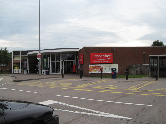
Sandbach services

Sandbach services is a motorway service station on the M6 in Sandbach, Cheshire, England. == History == The services originally opened in 1976 and have...

Related Videos

Smallwood Steam & Vintage Rally, walking down steam engine ally and around the lorries

It's the annual Smallwood Steam & Vintage rally in Cheshire. We visited this show for the first time last year and enjoyed it so ...

Smallwood & Martins Moss - 9 Miles circular route from Sandbach

Welcome back, it's almost here! The end of the stay at home order of the lockdown is almost upon us, from next week we'll be able ...

Sandbach Heath Sand Quarry | 7 mile circular walk / run route from Sandbach, Cheshire

Please note: the route has changed, the path has now been redirected at the airfield, I assume because the quarry have bought ...

Harvey Bundred Birthday Flight

Harvey Bundred 7th Birthday Flight at Cheshire microlight Centre Sandbach.

Nearby Amenities

Located within 500m of 53.15192,-2.322718
Post Box
Collection Times: Mo-Fr 09:00; Sa 07:00
Postal Code: CW11
Ref: CW11 67
Royal Cypher: EIIR
Lat/Long: 53.1544092/-2.3180371
Bus Stop
Arclid Green, Congleton Road / Hemmingshaw Lane
Bus: yes
Naptan AtcoCode: 0600CO071
Naptan Bearing: SW
Naptan CommonName: Hemmingshaw Lane
Naptan Crossing: Hemmingshaw Lane
Naptan Indicator: cnr
Naptan Landmark: Hemmingshaw Lane
Naptan LocalityName: Arclid Green
Naptan NaptanCode: chematd
Naptan ShortCommonName: Hemmingshaw Lane
Naptan Street: Congleton Road
Naptan Verified: no
Network: Cheshire East Council
Operator: Ansa Transport
Public Transport: platform
Source: naptan_import
Lat/Long: 53.1534863/-2.3248764
Bus Stop
Arclid Green, Congleton Road / Hemmingshaw Lane
Bus: yes
Naptan AtcoCode: 0600CO072
Naptan Bearing: NE
Naptan BusStopType: CUS
Naptan CommonName: Hemmingshaw Lane
Naptan Crossing: Hemmingshaw Lane
Naptan Indicator: opp
Naptan Landmark: Hemmingshaw Lane
Naptan LocalityName: Arclid Green
Naptan NaptanCode: chematg
Naptan ShortCommonName: Hemmingshaw Lane
Naptan Street: Congleton Road
Naptan Verified: no
Network: Cheshire East Council
Operator: Ansa Transport
Public Transport: platform
Source: naptan_import
Lat/Long: 53.1536848/-2.3250996
Bus Stop
Arclid, Congleton Road / Springbank Farm
Bus: yes
Naptan AtcoCode: 0600CO16564
Naptan Bearing: NE
Naptan BusStopType: CUS
Naptan CommonName: Springbank Farm
Naptan Indicator: o/s
Naptan Landmark: Springbank Farm
Naptan LocalityName: Arclid
Naptan NaptanCode: chewmjg
Naptan ShortCommonName: Springbank Farm
Naptan Street: Congleton Road
Naptan Verified: no
Network: Cheshire East Council
Operator: Ansa Transport
Public Transport: platform
Source: naptan_import
Lat/Long: 53.1555463/-2.3215245
Bus Stop
Arclid, Newcastle Road / Villa Farm
Bus: yes
Naptan AtcoCode: 0600COD8070
Naptan Bearing: NW
Naptan BusStopType: CUS
Naptan CommonName: Villa Farm
Naptan Crossing: Villa Farm
Naptan Indicator: opp
Naptan Landmark: Garage
Naptan LocalityName: Arclid
Naptan NaptanCode: chewmjd
Naptan ShortCommonName: Villa Farm
Naptan Street: Newcastle Road
Naptan Verified: no
Network: Cheshire East Council
Operator: Ansa Transport
Public Transport: platform
Source: naptan_import
Lat/Long: 53.1542067/-2.3182396
Bus Stop
Arclid, Newcastle Road / Villa Farm
Bus: yes
Naptan AtcoCode: 0600CO19078
Naptan Bearing: SE
Naptan BusStopType: CUS
Naptan CommonName: Villa Farm
Naptan Crossing: Villa Farm
Naptan Indicator: cnr
Naptan Landmark: Villa Farm
Naptan LocalityName: Arclid
Naptan NaptanCode: chewptg
Naptan ShortCommonName: Villa Farm
Naptan Street: Newcastle Road
Network: Cheshire East Council
Operator: Ansa Transport
Public Transport: platform
Source: naptan_import
Lat/Long: 53.1543047/-2.3179755
Barrier: stile
Step Count: 2
Stile: stepover
Lat/Long: 53.1538924/-2.3188588
The data included in this document is from www.openstreetmap.org. The data is made available under ODbL.

Have you been to Arclid?

Leave your review of Arclid below (or comments, questions and feedback).