Anglesey

Civil Parish in Staffordshire East Staffordshire

England

Anglesey

Coors Brewery, Burton upon Trent Brewing is still a major industry in Burton.
Coors Brewery, Burton upon Trent Credit: Stephen McKay

Anglesey is a civil parish located in the county of Staffordshire, England. It is situated in the West Midlands region and covers an area of approximately 4 square kilometers. The parish is part of the district of Lichfield and is located about 7 miles north of the city of Lichfield itself.

Anglesey is a predominantly rural area with a population of around 200 people. The landscape is characterized by gently rolling hills, open fields, and small woodlands, providing a picturesque setting for residents and visitors alike. The parish is surrounded by other rural areas, with the nearest towns being Lichfield to the south and Burton upon Trent to the north.

The village of Anglesey itself is a small, tight-knit community with a charming and tranquil atmosphere. The village features a few small businesses, including a local pub and a convenience store, providing essential amenities for its residents. The parish is also home to a number of historic buildings, including Anglesey Abbey, a Grade II listed building that dates back to the 18th century.

Despite its small size, Anglesey offers a range of recreational activities for residents and visitors. The surrounding countryside provides ample opportunities for walking, cycling, and horse riding, with several public footpaths and bridleways crisscrossing the area. The parish is also within close proximity to the National Forest, a large woodland area that offers further outdoor pursuits.

In summary, Anglesey, Staffordshire is a rural civil parish with a small population and a picturesque countryside setting. It offers a peaceful and welcoming community for those seeking a quiet retreat in the heart of England.

If you have any feedback on the listing, please let us know in the comments section below.
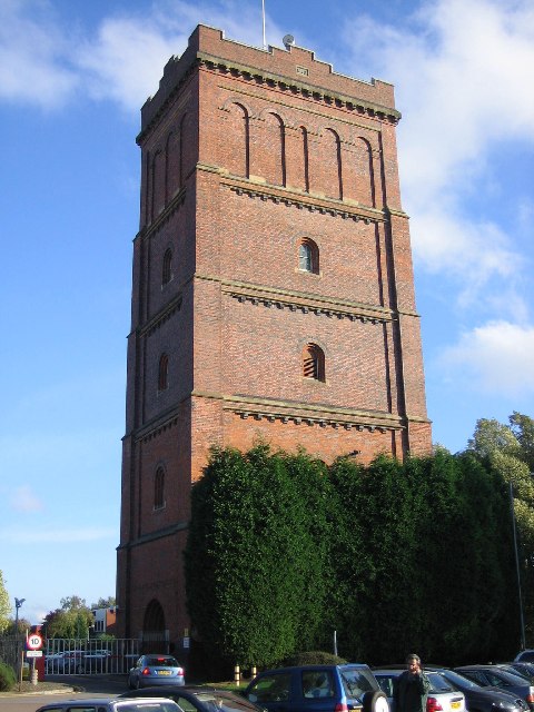
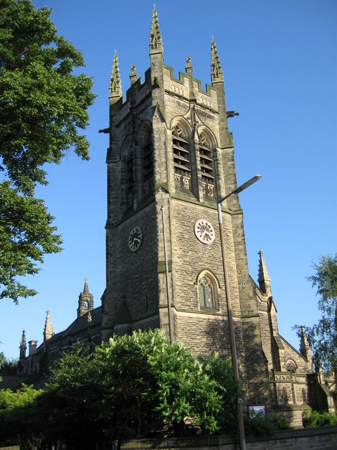
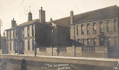
Anglesey Images

Images are sourced within 2km of 52.79482/-1.641351 or Grid Reference SK2421. Thanks to Geograph Open Source API. All images are credited.

Coors Brewery, Burton upon Trent Brewing is still a major industry in Burton.
Coors Brewery, Burton upon Trent
Brewing is still a major industry in Burton.
Ferry Bridge, Burton upon Trent Opened in 1889, this fine suspension bridge over the River Trent, was built by the local ironmasters firm of Thornewill & Warham, and paid for by Sir Michael Arthur Bass (later Lord Burton) (whose wife was a Thornewill) to replace the Stapenhill Ferry.
Ferry Bridge, Burton upon Trent
Opened in 1889, this fine suspension bridge over the River Trent, was built by the local ironmasters firm of Thornewill & Warham, and paid for by Sir Michael Arthur Bass (later Lord Burton) (whose wife was a Thornewill) to replace the Stapenhill Ferry.
Water Tower, Burton on Trent The water tower, dated 1866, was once part of one of the many breweries. It is now part of a leisure area near the River Trent.
Water Tower, Burton on Trent
The water tower, dated 1866, was once part of one of the many breweries. It is now part of a leisure area near the River Trent.
Weir on the River Trent This weir is close to Burton Bridge, Burton on Trent. The Bridge, with its many arches, spans several channels of the River Trent.
Weir on the River Trent
This weir is close to Burton Bridge, Burton on Trent. The Bridge, with its many arches, spans several channels of the River Trent.
War Memorial, Burton On Trent This war memorial is set in its own gardens with benches and paths.
War Memorial, Burton On Trent
This war memorial is set in its own gardens with benches and paths.
Church near the Town Hall This splendid church is near the civic centre along with the Victorian town hall.
Church near the Town Hall
This splendid church is near the civic centre along with the Victorian town hall.
Coors Brewers Maltings, Burton upon Trent Coors Brewers Maltings Division Shobnall Site, is located on Wellington Road. The maltings were originally built by the world famous Bass Brewery, which was taken over by the American brewery Coors, around the late 1990s. The barley that is malted to produce lagers and beers, arrives in articulated lorries (most seem to be from East Anglia) which enter the site by the raised barrier. The barley is stored in corrugated steel silos - some of which can be seen to the right - and is then malted in the large concrete tower, before being taken across town to the brewery.
Coors Brewers Maltings, Burton upon Trent
Coors Brewers Maltings Division Shobnall Site, is located on Wellington Road. The maltings were originally built by the world famous Bass Brewery, which was taken over by the American brewery Coors, around the late 1990s. The barley that is malted to produce lagers and beers, arrives in articulated lorries (most seem to be from East Anglia) which enter the site by the raised barrier. The barley is stored in corrugated steel silos - some of which can be seen to the right - and is then malted in the large concrete tower, before being taken across town to the brewery.
Parkway, Centrum 100, Branston, Burton upon Trent, Staffordshire. Centrum 100 is a modern business park built alongside the A38(T) and its access interchange. It is a mixture of distribution warehouses, manufacturing, offices and retailing. The large white building is called First Point and is the latest development. It was completed in June 2006, for sale or rental. Other units visible include the former Littlewoods Stores distribution warehouse, operated by Wincanton Logistics on the right, with Coors Brewers distribution warehouse on the left. Parkway extension, which leads straight on, was opened in September 1998.
Parkway, Centrum 100, Branston, Burton upon Trent, Staffordshire.
Centrum 100 is a modern business park built alongside the A38(T) and its access interchange. It is a mixture of distribution warehouses, manufacturing, offices and retailing. The large white building is called First Point and is the latest development. It was completed in June 2006, for sale or rental. Other units visible include the former Littlewoods Stores distribution warehouse, operated by Wincanton Logistics on the right, with Coors Brewers distribution warehouse on the left. Parkway extension, which leads straight on, was opened in September 1998.
All Saints Church, Branstone Road, Burton upon Trent, Staffordshire Early evening sunshine adds warmth and colour to the normally dull looking stonework of the imposing clocktower. Note the spelling of Branstone Road - the modern spelling of the village name is Branston (the original home of the world famous pickle).
All Saints Church, Branstone Road, Burton upon Trent, Staffordshire
Early evening sunshine adds warmth and colour to the normally dull looking stonework of the imposing clocktower. Note the spelling of Branstone Road - the modern spelling of the village name is Branston (the original home of the world famous pickle).
Flood defences at Branston, Burton upon Trent, Staffordshire. The embankment provides flood protection to properties along or near to Burton Road, Branston. To the left is Paget High School's playing fields and the 'Golfers Estate' (all roads are named after famous golfers or golf courses). To the right is the edge of Branston Golf and Country Club's golf course, whilst the River Trent is less than 50 metres to the right of the photographer.
Flood defences at Branston, Burton upon Trent, Staffordshire.
The embankment provides flood protection to properties along or near to Burton Road, Branston. To the left is Paget High School's playing fields and the 'Golfers Estate' (all roads are named after famous golfers or golf courses). To the right is the edge of Branston Golf and Country Club's golf course, whilst the River Trent is less than 50 metres to the right of the photographer.
Branston Depot - the original home of Branston Pickle Branston Depot is situated on Burton Road, Branston, Burton upon Trent, Staffordshire. It was built in 1915 as the National Machine Gun Factory and was then taken over by Crosse and Blackwell in the 1920s, with the village giving its name to the world famous pickle that was first produced there. In the 1930s it became a silk factory and was taken over by the Army in the Second World War as their Central Ordnance Depot. They remained there until the 1960s, when it then became Home Office stores, supplying prisons and storing the former AFS 'Green Goddess' fire engines. The 'Green Goddesses', which were used by the military during national firefighters' strikes, moved to a store at nearby Marchington at the end of the 1980s. In 2004, part of the Depot was leased to B&Q and is operated as a distribution depot for them by the logistics firm TNT. A massive fire at the beginning of 2006, destroyed millions of pounds worth of fitted kitchens stock and the warehouse centred on SK23552162.
Branston Depot - the original home of Branston Pickle
Branston Depot is situated on Burton Road, Branston, Burton upon Trent, Staffordshire. It was built in 1915 as the National Machine Gun Factory and was then taken over by Crosse and Blackwell in the 1920s, with the village giving its name to the world famous pickle that was first produced there. In the 1930s it became a silk factory and was taken over by the Army in the Second World War as their Central Ordnance Depot. They remained there until the 1960s, when it then became Home Office stores, supplying prisons and storing the former AFS 'Green Goddess' fire engines. The 'Green Goddesses', which were used by the military during national firefighters' strikes, moved to a store at nearby Marchington at the end of the 1980s. In 2004, part of the Depot was leased to B&Q and is operated as a distribution depot for them by the logistics firm TNT. A massive fire at the beginning of 2006, destroyed millions of pounds worth of fitted kitchens stock and the warehouse centred on SK23552162.
Burton on Trent
Burton on Trent
Stapenhill Viaduct Together with the Ferry Bridge <a href="https://www.geograph.org.uk/photo/61631">SK2521 : Ferry Bridge, Burton upon Trent</a>, the viaduct provided a direct pedestrian route above normal flood levels between Stapenhill and Burton upon Trent town centre. In the background, the Burton southern bypass bridges the Viaduct
Stapenhill Viaduct
Together with the Ferry Bridge SK2521 : Ferry Bridge, Burton upon Trent, the viaduct provided a direct pedestrian route above normal flood levels between Stapenhill and Burton upon Trent town centre. In the background, the Burton southern bypass bridges the Viaduct
Burton upon Trent Fire Station Wholetime station in the Eastern corner of Staffordshire
Burton upon Trent Fire Station
Wholetime station in the Eastern corner of Staffordshire
Winter at Branston View from the railway foot crossing at Branston, with Drakelowe Power station (now demolished), in the background
Winter at Branston
View from the railway foot crossing at Branston, with Drakelowe Power station (now demolished), in the background
View across the rails View across Birmingham South Curve Junction at Branston, with the now demolished Drakelow power station in the background. All the land on the far side of the rails has now been subjected to housing development.
View across the rails
View across Birmingham South Curve Junction at Branston, with the now demolished Drakelow power station in the background. All the land on the far side of the rails has now been subjected to housing development.
Branston pasture and Burton skyline "Crazy Horse Field" at Branston, with a touch of the Burton skyline visible. The tower on the left of the picture is the Bass, (now Coors), Maltings tower. The whole of this area alongside the railway  has now been subjected to housing development.
Branston pasture and Burton skyline
"Crazy Horse Field" at Branston, with a touch of the Burton skyline visible. The tower on the left of the picture is the Bass, (now Coors), Maltings tower. The whole of this area alongside the railway has now been subjected to housing development.
Winter on the Trent The 'new' St. Peter's road bridge crossing the River Trent from the Stapenhill riverbank.
Winter on the Trent
The 'new' St. Peter's road bridge crossing the River Trent from the Stapenhill riverbank.
Show me another place!

Anglesey is located at Grid Ref: SK2421 (Lat: 52.79482, Lng: -1.641351)

Administrative County: Staffordshire

District: East Staffordshire

Police Authority: Staffordshire

What 3 Words

///cheek.master.loans. Near Burton upon Trent, Staffordshire

Nearby Locations

Anglesey

Related Wikis

Nearby Amenities

Located within 500m of 52.79482,-1.641351
Addr City: Burton-on-Trent
Addr Postcode: DE14 3AU
Addr Street: Blackpool Street
Disused Amenity: pub
Old Name: Blackpool Inn
Lat/Long: 52.7921129/-1.6408911
Place Of Worship
The Triumphant Church of God
Addr City: Burton-on-Trent
Addr Postcode: DE14 3LD
Addr Street: South Uxbridge Street
Node Id: 716938845
Religion: christian
Source Name: OS Open Local Important Buildings Layer
Lat/Long: 52.7945084/-1.646128
Post Box
Operator: Royal Mail
Ref: DE14 1016
Lat/Long: 52.7992752/-1.6407778
Post Box
Brand: Royal Mail
Brand Wikidata: Q638098
Operator: Royal Mail
Operator Wikidata: Q638098
Post Box Type: pillar
Ref: DE14 1027
Lat/Long: 52.7963233/-1.6388986
Post Box
Operator: Royal Mail
Ref: DE14 1019
Lat/Long: 52.7936922/-1.6421915
Post Box
Operator: Royal Mail
Ref: DE14 1087
Lat/Long: 52.7930417/-1.6398603
Power: tower
Source: Bing
Lat/Long: 52.7934/-1.637088
Power: tower
Source: Bing
Lat/Long: 52.7958241/-1.6348188
Power: tower
Source: Bing
Lat/Long: 52.7907573/-1.6395
Post Box
Operator: Royal Mail
Ref: DE14 1008
Lat/Long: 52.7952445/-1.6487304
Traffic Calming: hump
Lat/Long: 52.7925989/-1.6454521
Traffic Calming: hump
Lat/Long: 52.7954038/-1.6463954
Bus Stop
South Oak Street
Public Transport: platform
Lat/Long: 52.7940122/-1.6481128
Bus Stop
South Oak Street
Naptan AtcoCode: 3800C343202
Naptan NaptanCode: stadgwmt
Public Transport: platform
Lat/Long: 52.7940674/-1.6479975
Bus Stop
South Broadway Street
Public Transport: platform
Lat/Long: 52.7928104/-1.6465598
Bus Stop
South Broadway Street
Naptan AtcoCode: 3800C328701
Naptan NaptanCode: stadgmap
Public Transport: platform
Lat/Long: 52.7925493/-1.6459268
Bus Stop
Branston Road
Naptan AtcoCode: 3800C301901
Naptan NaptanCode: stadamaj
Public Transport: platform
Lat/Long: 52.7913312/-1.6442263
Bus Stop
Branston Road
Naptan AtcoCode: 3800C301900
Naptan NaptanCode: stadamag
Public Transport: platform
Lat/Long: 52.7914252/-1.6440842
Bus Stop
Anglesey Road
Naptan AtcoCode: 3800C328501
Naptan NaptanCode: stadgmag
Public Transport: platform
Lat/Long: 52.7914982/-1.6437998
Bus Stop
Anglesey Road
Naptan AtcoCode: 3800C328502
Naptan NaptanCode: stadgmaj
Public Transport: platform
Lat/Long: 52.7915956/-1.643545
Bus Stop
Leicester Street
Public Transport: platform
Lat/Long: 52.7928899/-1.6427404
Bus Stop
All Saints Road
Public Transport: platform
Lat/Long: 52.7943382/-1.6410586
Bus Stop
All Saints Road
Public Transport: platform
Lat/Long: 52.7936084/-1.6417265
Bus Stop
Trent Street
Naptan AtcoCode: 3800C328201
Naptan NaptanCode: stadgjwj
Public Transport: platform
Lat/Long: 52.7952659/-1.6398034
Bus Stop
Trent Street
Naptan AtcoCode: 3800C328202
Naptan NaptanCode: stadgjwm
Public Transport: platform
Lat/Long: 52.7955011/-1.6393635
Bus Stop
Watson Street
Naptan AtcoCode: 3800C328101
Naptan NaptanCode: stadgjwd
Public Transport: platform
Lat/Long: 52.7973353/-1.6370434
Bus Stop
Watson Street
Naptan AtcoCode: 3800C328102
Naptan NaptanCode: stadgjwg
Public Transport: platform
Lat/Long: 52.7975032/-1.6365244
Bus Stop
Sheffield Street
Naptan AtcoCode: 3800C343801
Naptan NaptanCode: stadgwpg
Public Transport: platform
Lat/Long: 52.7990819/-1.6409594
Bus Stop
Labours Union Hotel
Naptan AtcoCode: 3800C329302
Naptan NaptanCode: stadgmdt
Public Transport: platform
Lat/Long: 52.797671/-1.643081
Bus Stop
Labours Union Hotel
Public Transport: platform
Lat/Long: 52.797757/-1.6424239
Bus Stop
Anglesey Primary School
Naptan AtcoCode: 3800C303001
Naptan NaptanCode: stadamgw
Public Transport: platform
Lat/Long: 52.7982095/-1.6446099
Bus Stop
Anglesey Primary School
Naptan AtcoCode: 3800C303000
Public Transport: platform
Lat/Long: 52.7982646/-1.6445562
Charging Station
Lat/Long: 52.79641/-1.6348592
Give Way
Direction: backward
Lat/Long: 52.7909614/-1.644119
Give Way
Direction: backward
Lat/Long: 52.7912993/-1.6439449
Give Way
Direction: forward
Lat/Long: 52.7956993/-1.6392003
Give Way
Direction: forward
Lat/Long: 52.7936538/-1.6418767
Give Way
Direction: forward
Lat/Long: 52.7962309/-1.638827
Crossing
Crossing: traffic_signals
Crossing Ref: puffin
Lat/Long: 52.7966112/-1.6382758
Give Way
Direction: forward
Lat/Long: 52.797294/-1.6371761
Give Way
Direction: backward
Lat/Long: 52.7974328/-1.6366931
Defibrillator
Emergency: defibrillator
Indoor: no
Lat/Long: 52.7963188/-1.6388748
Anglesey
Place: suburb
Lat/Long: 52.7974622/-1.643933
The data included in this document is from www.openstreetmap.org. The data is made available under ODbL.

Have you been to Anglesey?

Leave your review of Anglesey below (or comments, questions and feedback).