Alwinton

Civil Parish in Northumberland

England

Alwinton

Public Bridleway, Barrowburn This track, which is a public bridleway, descends towards the former Barrowburn farmhouse, seen straight ahead, and after crossing a ford joins the old road through the valley. In the distance, mainly obscured by trees, is Windyhaugh farmhouse. For a selection of detailed free to download walking routes in the area visit <span class="nowrap"><a title="www.cheviotwalks.co.uk" rel="nofollow ugc noopener" href="http://www.cheviotwalks.co.uk">Link</a><img style="margin-left:2px;" alt="External link" title="External link - shift click to open in new window" src="https://s1.geograph.org.uk/img/external.png" width="10" height="10"/></span>
Public Bridleway, Barrowburn Credit: Geoff Holland

Alwinton is a charming civil parish located in the county of Northumberland, England. Situated in the North Pennines Area of Outstanding Natural Beauty, it is nestled in a picturesque valley surrounded by rolling hills and lush green countryside. The parish covers an area of approximately 79 square kilometers and is home to a small population of around 200 residents.

The village of Alwinton itself is the main settlement within the parish and offers a quaint and peaceful atmosphere. It features a collection of traditional stone houses and cottages, giving it a timeless and idyllic feel. The village is centered around the historic St. Michael’s Church, a beautiful Grade I listed building that dates back to the 12th century.

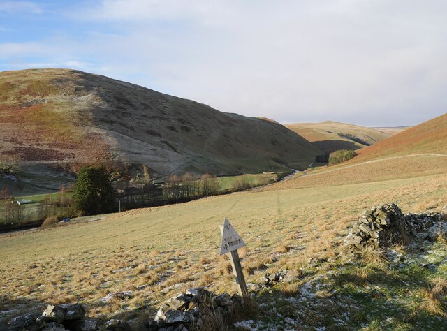
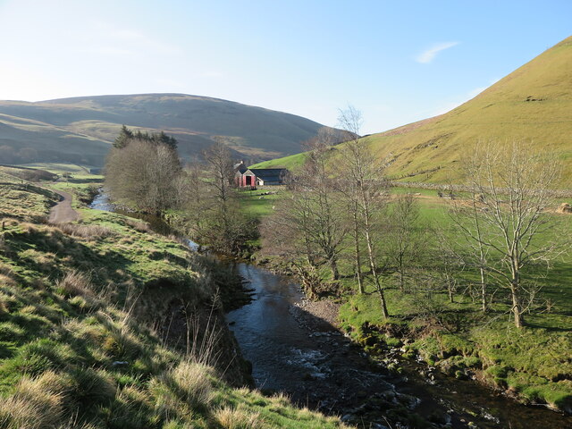
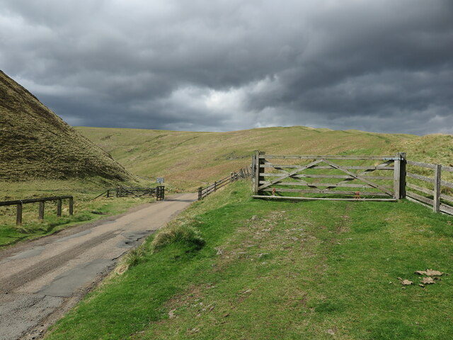
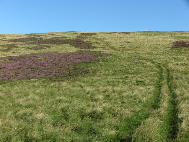
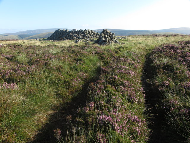
The surrounding landscape is a haven for outdoor enthusiasts, with ample opportunities for hiking, cycling, and wildlife spotting. The nearby Harbottle Forest and Kidland Forest are popular destinations for nature lovers, offering scenic trails and stunning viewpoints. The River Coquet also runs through the parish, providing opportunities for fishing and riverside walks.

Alwinton hosts several events throughout the year, including the Alwinton Border Shepherds Show, a traditional agricultural show that attracts visitors from far and wide. The village also boasts a cozy pub, the Rose and Thistle Inn, which offers a warm welcome to both locals and visitors.

In conclusion, Alwinton is a charming and tranquil civil parish in Northumberland, renowned for its natural beauty, historic charm, and welcoming community.

If you have any feedback on the listing, please let us know in the comments section below.

Alwinton Images

Images are sourced within 2km of 55.381953/-2.214533 or Grid Reference NT8609. Thanks to Geograph Open Source API. All images are credited.

Public Bridleway, Barrowburn This track, which is a public bridleway, descends towards the former Barrowburn farmhouse, seen straight ahead, and after crossing a ford joins the old road through the valley. In the distance, mainly obscured by trees, is Windyhaugh farmhouse. For a selection of detailed free to download walking routes in the area visit <span class="nowrap"><a title="www.cheviotwalks.co.uk" rel="nofollow ugc noopener" href="http://www.cheviotwalks.co.uk">Link</a><img style="margin-left:2px;" alt="External link" title="External link - shift click to open in new window" src="https://s1.geograph.org.uk/img/external.png" width="10" height="10"/></span>
Public Bridleway, Barrowburn
This track, which is a public bridleway, descends towards the former Barrowburn farmhouse, seen straight ahead, and after crossing a ford joins the old road through the valley. In the distance, mainly obscured by trees, is Windyhaugh farmhouse. For a selection of detailed free to download walking routes in the area visit LinkExternal link
Out of bounds to troops A small warning sign in Upper Coquetdale near Barrowburn.  Tindale Law is the prominent hill to the left of shot.

This photograph was taken during the Coronavirus (COVID-19) pandemic of 2020/21/22.
Out of bounds to troops
A small warning sign in Upper Coquetdale near Barrowburn. Tindale Law is the prominent hill to the left of shot. This photograph was taken during the Coronavirus (COVID-19) pandemic of 2020/21/22.
River Coquet near Windyhaugh The River Coquet is considered to be one of Northumberland's finest rivers, and at this point passes the remote farm of Windyhaugh which is visible on the opposite side of the river. The hill in the background is Shillhope Law which overlooks the farm of Barrowburn, obscured by the riverside trees. For a selection of detailed free to download walking routes in the area visit <span class="nowrap"><a title="www.cheviotwalks.co.uk" rel="nofollow ugc noopener" href="http://www.cheviotwalks.co.uk">Link</a><img style="margin-left:2px;" alt="External link" title="External link - shift click to open in new window" src="https://s1.geograph.org.uk/img/external.png" width="10" height="10"/></span>
River Coquet near Windyhaugh
The River Coquet is considered to be one of Northumberland's finest rivers, and at this point passes the remote farm of Windyhaugh which is visible on the opposite side of the river. The hill in the background is Shillhope Law which overlooks the farm of Barrowburn, obscured by the riverside trees. For a selection of detailed free to download walking routes in the area visit LinkExternal link
Barrowburn, Upper Coquetdale The remote farm of Barrowburn enjoys one of the most idyllic locations in Northumberland, nestling beneath the slopes of Shillhope Law and Barrow Law and close to the River Coquet. For a selection of detailed free to download walking routes in the area visit <span class="nowrap"><a title="www.cheviotwalks.co.uk" rel="nofollow ugc noopener" href="http://www.cheviotwalks.co.uk">Link</a><img style="margin-left:2px;" alt="External link" title="External link - shift click to open in new window" src="https://s1.geograph.org.uk/img/external.png" width="10" height="10"/></span>
Barrowburn, Upper Coquetdale
The remote farm of Barrowburn enjoys one of the most idyllic locations in Northumberland, nestling beneath the slopes of Shillhope Law and Barrow Law and close to the River Coquet. For a selection of detailed free to download walking routes in the area visit LinkExternal link
Bridleway and Public Road Converge near Slymefoot The ancient cross-border route called The Street (right), which can be followed from this point in England to Hownam in Scotland, converges here with the narrow single track public road (left) which runs through Upper Coquetdale from the tiny village of Alwinton to just short of Chew Green close to the English/Scottish border. It is one of the most scenic journeys in Northumberland. For a selection of detailed free to download walking routes in the area visit <span class="nowrap"><a title="www.cheviotwalks.co.uk" rel="nofollow ugc noopener" href="http://www.cheviotwalks.co.uk">Link</a><img style="margin-left:2px;" alt="External link" title="External link - shift click to open in new window" src="https://s1.geograph.org.uk/img/external.png" width="10" height="10"/></span>
Bridleway and Public Road Converge near Slymefoot
The ancient cross-border route called The Street (right), which can be followed from this point in England to Hownam in Scotland, converges here with the narrow single track public road (left) which runs through Upper Coquetdale from the tiny village of Alwinton to just short of Chew Green close to the English/Scottish border. It is one of the most scenic journeys in Northumberland. For a selection of detailed free to download walking routes in the area visit LinkExternal link
Track leading to Shillhope Law summit This quad track leads up the hill from the saddle between Shillhope Law and Inner Hill to the east of the fence line. An alternative track winds up the hill on the opposite side of the fence. For a selection of free to download walking routes in the area visit <span class="nowrap"><a title="www.cheviotwalks.co.uk" rel="nofollow ugc noopener" href="http://www.cheviotwalks.co.uk">Link</a><img style="margin-left:2px;" alt="External link" title="External link - shift click to open in new window" src="https://s1.geograph.org.uk/img/external.png" width="10" height="10"/></span>
Track leading to Shillhope Law summit
This quad track leads up the hill from the saddle between Shillhope Law and Inner Hill to the east of the fence line. An alternative track winds up the hill on the opposite side of the fence. For a selection of free to download walking routes in the area visit LinkExternal link
Path up South West Spur of Shillhope Law This path, in essence a mere sheep trace, starts at the base of Shillhope Cleugh and ultimately reaches the summit of Shillhope Law. The buildings in the distance are Bygate Hall Cottages. For a selection of free to download walking routes in the area visit <span class="nowrap"><a title="www.cheviotwalks.co.uk" rel="nofollow ugc noopener" href="http://www.cheviotwalks.co.uk">Link</a><img style="margin-left:2px;" alt="External link" title="External link - shift click to open in new window" src="https://s1.geograph.org.uk/img/external.png" width="10" height="10"/></span>
Path up South West Spur of Shillhope Law
This path, in essence a mere sheep trace, starts at the base of Shillhope Cleugh and ultimately reaches the summit of Shillhope Law. The buildings in the distance are Bygate Hall Cottages. For a selection of free to download walking routes in the area visit LinkExternal link
View towards Bygate Hall Cottages Looking south along the River Coquet with Bygate Hall Cottages up to the right.
View towards Bygate Hall Cottages
Looking south along the River Coquet with Bygate Hall Cottages up to the right.
Upstream along the Coquet Looking upstream along the River Coquet towards Barrowburn. High on the left is a corner of the plantation at Partridge Side.
Upstream along the Coquet
Looking upstream along the River Coquet towards Barrowburn. High on the left is a corner of the plantation at Partridge Side.
Boundary fence on Shillhope Law This fence passes close to the summit of Shillhope Law (behind the photographer) before descending to and across Inner Hill. In the middle distance lies Kyloe Shin and in the distance the huge sweep of the Uswayford Forest. For a selection of detailed free to download walking routes in the area visit <span class="nowrap"><a title="www.cheviotwalks.co.uk" rel="nofollow ugc noopener" href="http://www.cheviotwalks.co.uk">Link</a><img style="margin-left:2px;" alt="External link" title="External link - shift click to open in new window" src="https://s1.geograph.org.uk/img/external.png" width="10" height="10"/></span>
Boundary fence on Shillhope Law
This fence passes close to the summit of Shillhope Law (behind the photographer) before descending to and across Inner Hill. In the middle distance lies Kyloe Shin and in the distance the huge sweep of the Uswayford Forest. For a selection of detailed free to download walking routes in the area visit LinkExternal link
Filling potholes in Upper Coquetdale The large hose squirts tar covered gravel to fill the pothole - and then a bit more. The potholes have become mini pot-hills for later traffic to consolidate.
The machine effectively blocks the road. Fortunately a convenient cattle grid allowed space to pass.
Filling potholes in Upper Coquetdale
The large hose squirts tar covered gravel to fill the pothole - and then a bit more. The potholes have become mini pot-hills for later traffic to consolidate. The machine effectively blocks the road. Fortunately a convenient cattle grid allowed space to pass.
Sheepfold at Bygate Hall Cottages Beside the River Coquet.
Sheepfold at Bygate Hall Cottages
Beside the River Coquet.
Inner Hill near Shillmoor The small hill immediately ahead is Inner Hill whilst the large hill in the background is Shillhope Law. This photograph was taken at roughly the same spot as the one shown at <a title="https://www.geograph.org.uk/photo/1718473" href="https://www.geograph.org.uk/photo/1718473">Link</a> but 10 years and the seasons separate the two. For a selection of detailed free to download walking routes in the area visit <span class="nowrap"><a title="www.cheviotwalks.co.uk" rel="nofollow ugc noopener" href="http://www.cheviotwalks.co.uk">Link</a><img style="margin-left:2px;" alt="External link" title="External link - shift click to open in new window" src="https://s1.geograph.org.uk/img/external.png" width="10" height="10"/></span>
Inner Hill near Shillmoor
The small hill immediately ahead is Inner Hill whilst the large hill in the background is Shillhope Law. This photograph was taken at roughly the same spot as the one shown at Link but 10 years and the seasons separate the two. For a selection of detailed free to download walking routes in the area visit LinkExternal link
Track, Shillhope Law This is the alternative track referred to at <a title="https://www.geograph.org.uk/photo/5545043," href="https://www.geograph.org.uk/photo/5545043,">Link</a> and which climbs the southern slopes of Shillhope Law. For a selection of detailed free to download walking routes in the area visit <span class="nowrap"><a title="www.cheviotwalks.co.uk" rel="nofollow ugc noopener" href="http://www.cheviotwalks.co.uk">Link</a><img style="margin-left:2px;" alt="External link" title="External link - shift click to open in new window" src="https://s1.geograph.org.uk/img/external.png" width="10" height="10"/></span>
Track, Shillhope Law
This is the alternative track referred to at Link and which climbs the southern slopes of Shillhope Law. For a selection of detailed free to download walking routes in the area visit LinkExternal link
Track, Shillhope Law This is the terminating point of the track shown at <a title="https://www.geograph.org.uk/photo/6575900," href="https://www.geograph.org.uk/photo/6575900,">Link</a> the summit of Shillhope Law. In the background is a small walkers' cairn, a shelter cairn and a triangulation pillar. Both the shelter cairn and the triangulation pillar sit on top of the remains of a Bronze Age burial cairn which is a Scheduled Monument and thus protected by law. For a selection of detailed free to download walking routes in the area visit <span class="nowrap"><a title="www.cheviotwalks.co.uk" rel="nofollow ugc noopener" href="http://www.cheviotwalks.co.uk">Link</a><img style="margin-left:2px;" alt="External link" title="External link - shift click to open in new window" src="https://s1.geograph.org.uk/img/external.png" width="10" height="10"/></span>
Track, Shillhope Law
This is the terminating point of the track shown at Link the summit of Shillhope Law. In the background is a small walkers' cairn, a shelter cairn and a triangulation pillar. Both the shelter cairn and the triangulation pillar sit on top of the remains of a Bronze Age burial cairn which is a Scheduled Monument and thus protected by law. For a selection of detailed free to download walking routes in the area visit LinkExternal link
Gate, Shillhope Law This gate stands slightly to the east of the actual summit of Shillhope Law and separates a large area predominately heather covered from the eastern grass covered slopes which fall down to the valley of the Usway Burn. The large hill, slightly right of centre, is Saughy Hill. For a selection of detailed free to download walking walking routes in the area visit <span class="nowrap"><a title="www.cheviotwalks.co.uk" rel="nofollow ugc noopener" href="http://www.cheviotwalks.co.uk">Link</a><img style="margin-left:2px;" alt="External link" title="External link - shift click to open in new window" src="https://s1.geograph.org.uk/img/external.png" width="10" height="10"/></span>
Gate, Shillhope Law
This gate stands slightly to the east of the actual summit of Shillhope Law and separates a large area predominately heather covered from the eastern grass covered slopes which fall down to the valley of the Usway Burn. The large hill, slightly right of centre, is Saughy Hill. For a selection of detailed free to download walking walking routes in the area visit LinkExternal link
Valley of the Usway Burn This is one of the best views of what is one of the finest of all Cheviot valleys extending from the lonely cottage of Batailshiel Haugh (see in the middle distance) to Windy Gyle high on the border ridge. In between lie a plethora of beautiful rounded hills. For a selection of detailed free to download walking routes in the area visit <span class="nowrap"><a title="www.cheviotwalks.co.uk" rel="nofollow ugc noopener" href="http://www.cheviotwalks.co.uk">Link</a><img style="margin-left:2px;" alt="External link" title="External link - shift click to open in new window" src="https://s1.geograph.org.uk/img/external.png" width="10" height="10"/></span>
Valley of the Usway Burn
This is one of the best views of what is one of the finest of all Cheviot valleys extending from the lonely cottage of Batailshiel Haugh (see in the middle distance) to Windy Gyle high on the border ridge. In between lie a plethora of beautiful rounded hills. For a selection of detailed free to download walking routes in the area visit LinkExternal link
Bailey Bridge over the Usway Burn This is the last of three such bailey bridges (heading upstream) straddling the Usway Burn between Shillmoor and Batailshiel Haugh. It is the same bridge as is shown at <a title="https://www.geograph.org.uk/photo/1561769" href="https://www.geograph.org.uk/photo/1561769">Link</a> although on a far brighter day. The bridges were erected a number of years ago by the MoD. When the first Ordnance Survey Six-Inch map of the area was published in 1866 the burn was crossed at this point by a ford. For a selection of detailed free to download walking walking routes in the area visit <span class="nowrap"><a title="www.cheviotwalks.co.uk" rel="nofollow ugc noopener" href="http://www.cheviotwalks.co.uk">Link</a><img style="margin-left:2px;" alt="External link" title="External link - shift click to open in new window" src="https://s1.geograph.org.uk/img/external.png" width="10" height="10"/></span>
Bailey Bridge over the Usway Burn
This is the last of three such bailey bridges (heading upstream) straddling the Usway Burn between Shillmoor and Batailshiel Haugh. It is the same bridge as is shown at Link although on a far brighter day. The bridges were erected a number of years ago by the MoD. When the first Ordnance Survey Six-Inch map of the area was published in 1866 the burn was crossed at this point by a ford. For a selection of detailed free to download walking walking routes in the area visit LinkExternal link
Show me another place!

Alwinton is located at Grid Ref: NT8609 (Lat: 55.381953, Lng: -2.214533)

Unitary Authority: Northumberland

Police Authority: Northumbria

What 3 Words

///tones.unpainted.language. Near Rochester, Northumberland

Nearby Locations

Alwinton

Related Wikis

Barrow Burn

Barrowburn is a hamlet in Upper Coquetdale in the county of Northumberland, England. It comprises a working farm with associated buildings and two holiday...

Shillhope Law

Shillhope Law is a hill in the southern Cheviots, a range of hills in Northumberland, England. Shillhope Law is a relatively unremarkable member of this...

Barrow Burn Meadows

Barrow Burn Meadows is a Site of Special Scientific Interest (SSSI) in north Northumberland, England. The site is a species-rich hay meadow of a sort now...

Usway Burn

The Usway Burn is an upland river on the southern flanks of the Cheviot Hills, in the Northumberland National Park, England. It is a tributary of the River...

Windy Gyle

Windy Gyle is a mountain in the Cheviot Hills range, on the border between England and Scotland. Like the other hills in the area, it is rounded and grass...

Kidland

Kidland is a former civil parish, now in the parish of Alwinton in Northumberland, England, about 2 miles (3 km) northwest of Alwinton village. In 1951...

Barrow Meadow

Barrow Meadow is a Site of Special Scientific Interest (SSSI) in north Northumberland, England. The site is a species-rich hay meadow of a sort now rare...

Featherwood Roman Camps

Featherwood Roman Camps are neighbouring archaeological sites in Northumberland, England, 1 mile (1.6 km) north of Featherwood and about 3 miles (5 km...

Have you been to Alwinton?

Leave your review of Alwinton below (or comments, questions and feedback).