Alvechurch

Civil Parish in Worcestershire Bromsgrove

England

Alvechurch

Worcester & Birmingham Canal, Hopwood Looking along a peaceful stretch of canal close to the Hopwood House Inn.
Worcester & Birmingham Canal, Hopwood Credit: Stephen McKay

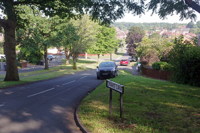
Alvechurch is a civil parish located in the county of Worcestershire, England. Situated about 14 kilometres south of Birmingham, it is nestled between the larger towns of Redditch and Bromsgrove. The picturesque village is situated on the banks of the River Arrow and is surrounded by beautiful Worcestershire countryside.

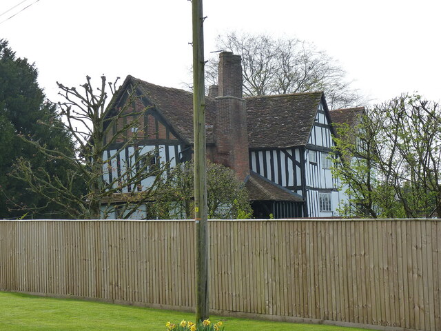
Alvechurch has a rich history dating back to medieval times, with evidence of human settlement in the area since the Iron Age. The village's name is believed to have originated from the Old English words "alor" meaning alder tree and "ceaster" meaning Roman fort or town. Alvechurch was mentioned in the Domesday Book of 1086, indicating its significance during the Norman period.

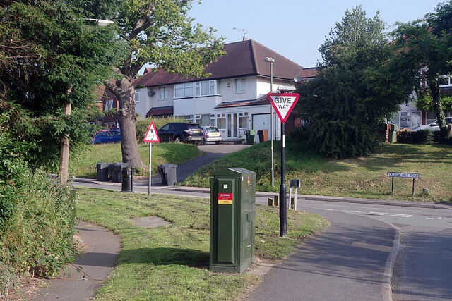
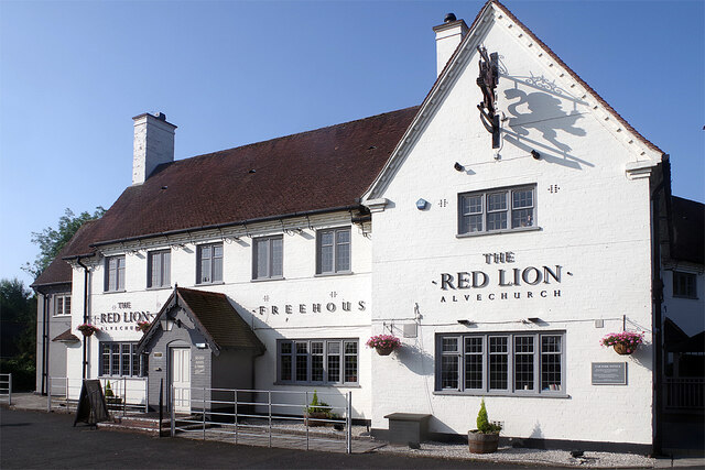
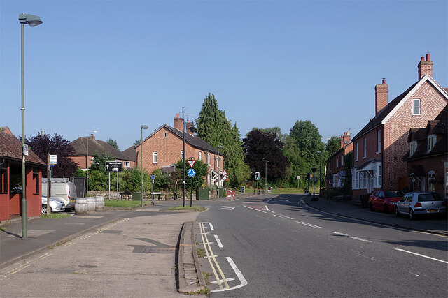
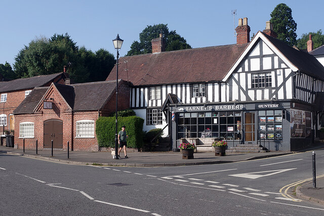
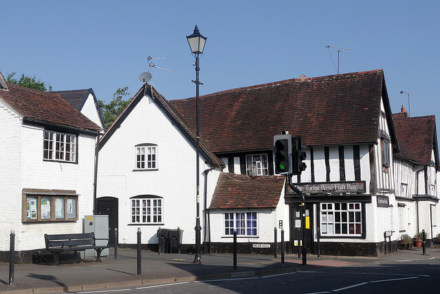
Today, Alvechurch is a thriving community with a population of around 5,000 residents. The village boasts a range of amenities including shops, pubs, a primary school, and a medical center. The historic St. Laurence Church, dating back to the 12th century, is a prominent feature of the village and attracts visitors with its stunning architecture.

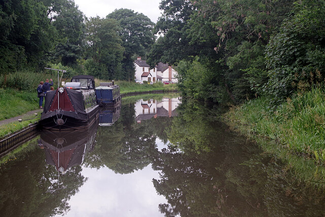
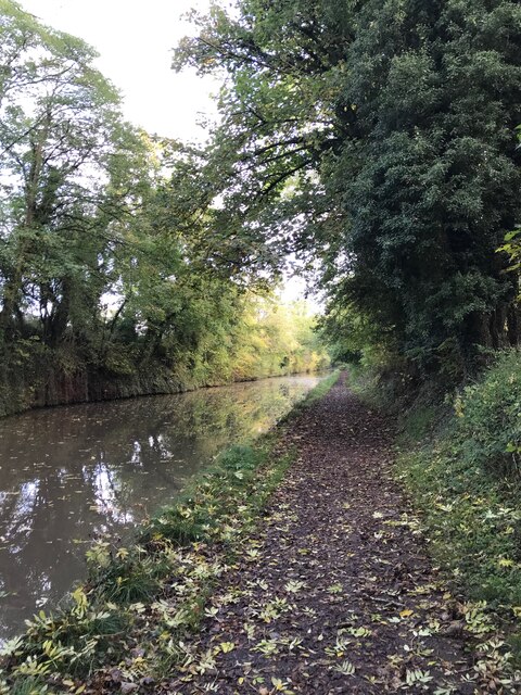
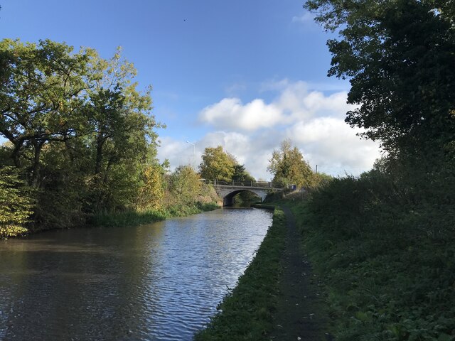
The village is also a popular destination for boating enthusiasts, as it is situated along the Worcester and Birmingham Canal. The canal offers opportunities for leisurely walks, boat trips, and fishing. Alvechurch also hosts an annual music festival, attracting musicians and visitors from across the region.

Overall, Alvechurch exudes a charming and tranquil ambiance, making it an attractive place to live or visit for those seeking a peaceful retreat within easy reach of urban centers.

If you have any feedback on the listing, please let us know in the comments section below.
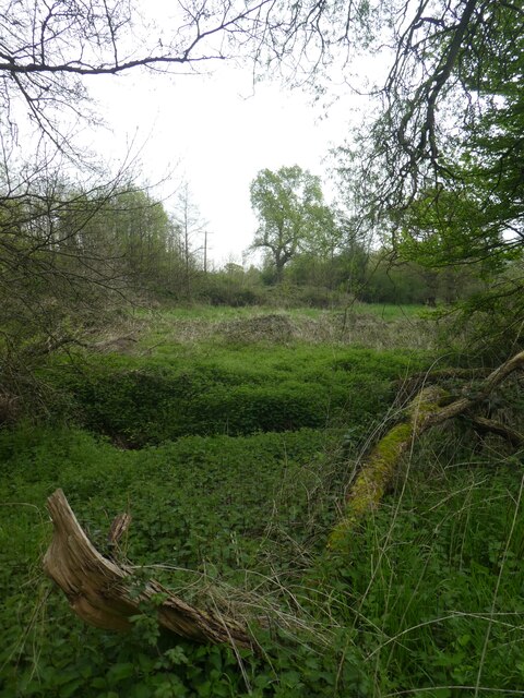
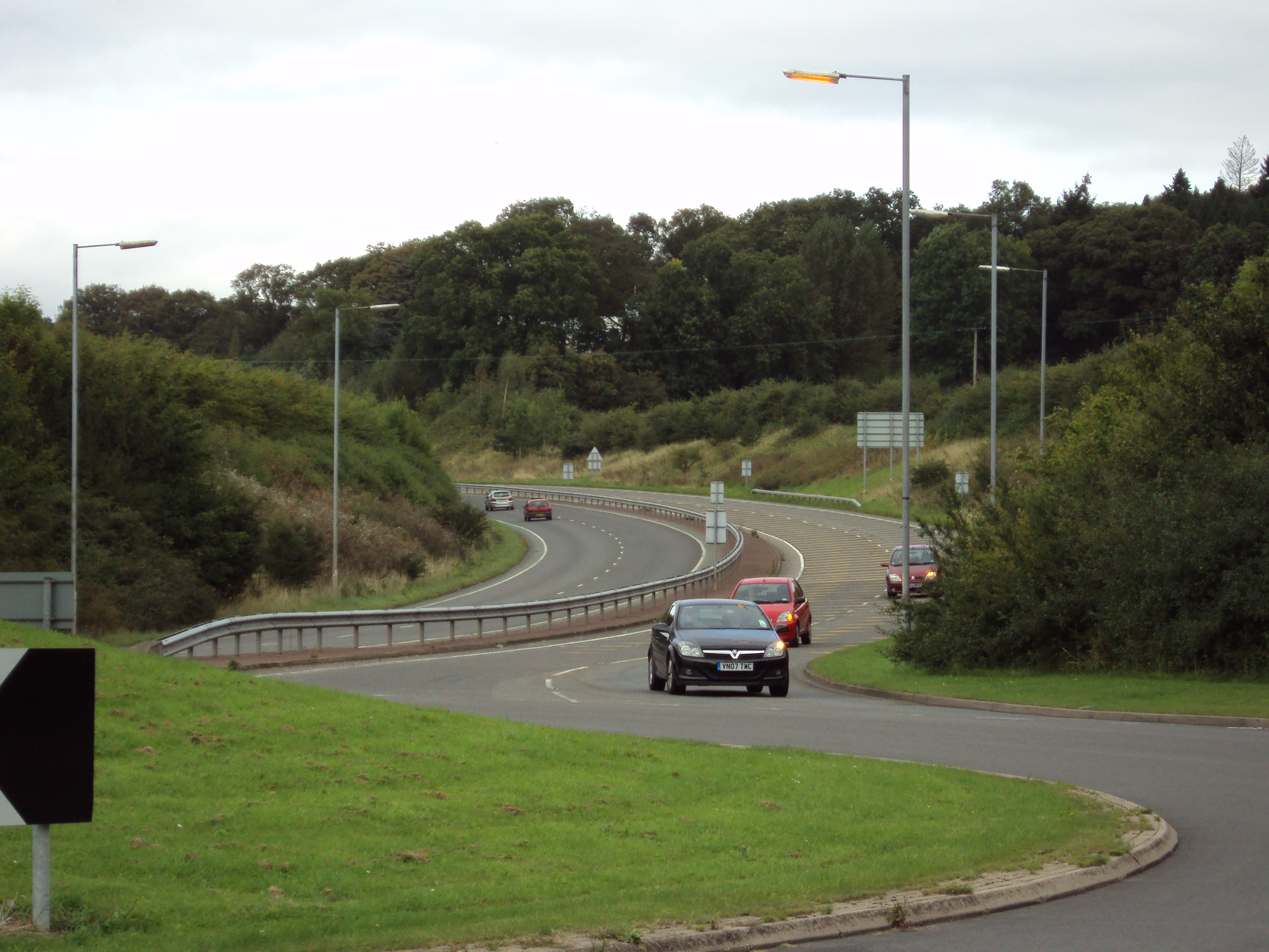
Alvechurch Images

Images are sourced within 2km of 52.358516/-1.944624 or Grid Reference SP0373. Thanks to Geograph Open Source API. All images are credited.

Worcester & Birmingham Canal, Hopwood Looking along a peaceful stretch of canal close to the Hopwood House Inn.
Worcester & Birmingham Canal, Hopwood
Looking along a peaceful stretch of canal close to the Hopwood House Inn.
Callow Hill Road, Alvechurch Seen from the junction with Tanyard Lane and Snake Lane, a substantial semi-detached house overlooks Callow Hill Road.
Callow Hill Road, Alvechurch
Seen from the junction with Tanyard Lane and Snake Lane, a substantial semi-detached house overlooks Callow Hill Road.
The Red Lion, Alvechurch Part of the Vintage Inns chain, the Red Lion is a substantial pub located on Red Lion Street.
The Red Lion, Alvechurch
Part of the Vintage Inns chain, the Red Lion is a substantial pub located on Red Lion Street.
Red Lion Street, Alvechurch This was once the main road between Redditch and Birmingham but Alvechurch is by-passed nowadays so things are much quieter. The bus stop on the left is outside the Red Lion pub.
Red Lion Street, Alvechurch
This was once the main road between Redditch and Birmingham but Alvechurch is by-passed nowadays so things are much quieter. The bus stop on the left is outside the Red Lion pub.
The Square, Alvechurch The Square forms the heart of this large Worcestershire village. The timber framed building, part of which is occupied by a barber's shop and an estate agent, is believed to be of 15th century origin, although much altered. To the left the Old Smithy dates from the mid-19th century. Both are grade II listed.
The Square, Alvechurch
The Square forms the heart of this large Worcestershire village. The timber framed building, part of which is occupied by a barber's shop and an estate agent, is believed to be of 15th century origin, although much altered. To the left the Old Smithy dates from the mid-19th century. Both are grade II listed.
The bottom of Bear Hill, Alvechurch The Tudor Rose Fish Bar occupies 2 Bear Hill at its junction with Red Lion Street. The timber framed building is of 15th century origin, underbuilt in the mid-19th century, and is grade II listed.
The bottom of Bear Hill, Alvechurch
The Tudor Rose Fish Bar occupies 2 Bear Hill at its junction with Red Lion Street. The timber framed building is of 15th century origin, underbuilt in the mid-19th century, and is grade II listed.
Snake Lane, Alvechurch The western part of Alvechurch was developed in the mid-20th century and Snake Lane, seen here from its junction with Bear Hill, forms the core of the area.
Snake Lane, Alvechurch
The western part of Alvechurch was developed in the mid-20th century and Snake Lane, seen here from its junction with Bear Hill, forms the core of the area.
Hopwood Park Service Area This is the location of a Tesla Supercharger Station, and two Model S's and Two Model 3 cars are being charged. There are 16 points, at 120/150Kw.
Hopwood Park Service Area
This is the location of a Tesla Supercharger Station, and two Model S's and Two Model 3 cars are being charged. There are 16 points, at 120/150Kw.
Hopwood Park Services
Worcester & Birmingham Canal
Weatheroak Farmhouse A fine rural farmhouse which dates back in parts to the late 16th century, but has been extensively altered over its 500+ years. It incorporates parts of an early open hall-house, and was Grade II listed <span class="nowrap"><a title="https://britishlistedbuildings.co.uk/101348535-weatheroak-farmhouse-alvechurch#.Yrh-2HbMLIU" rel="nofollow ugc noopener" href="https://britishlistedbuildings.co.uk/101348535-weatheroak-farmhouse-alvechurch#.Yrh-2HbMLIU">Link</a><img style="margin-left:2px;" alt="External link" title="External link - shift click to open in new window" src="https://s1.geograph.org.uk/img/external.png" width="10" height="10"/></span> & <span class="nowrap"><a title="https://historicengland.org.uk/listing/the-list/list-entry/1348535" rel="nofollow ugc noopener" href="https://historicengland.org.uk/listing/the-list/list-entry/1348535">Link</a><img style="margin-left:2px;" alt="External link" title="External link - shift click to open in new window" src="https://s1.geograph.org.uk/img/external.png" width="10" height="10"/></span> in 1952.
Weatheroak Farmhouse
A fine rural farmhouse which dates back in parts to the late 16th century, but has been extensively altered over its 500+ years. It incorporates parts of an early open hall-house, and was Grade II listed LinkExternal link & LinkExternal link in 1952.
OS benchmark - Weatheroak Hill, outbuilding at pub Located on the wall of the micro-brewery attached to the <a href="https://www.geograph.org.uk/photo/151850">SP0574 : Coach and Horses, Weatheroak Hill</a>, and last levelled by the OS in 1965 at 149.605m above Ordnance Datum Newlyn. A mark is shown on the same building on the 1901 map at 489' 6" above Liverpool Datum.
OS benchmark - Weatheroak Hill, outbuilding at pub
Located on the wall of the micro-brewery attached to the SP0574 : Coach and Horses, Weatheroak Hill, and last levelled by the OS in 1965 at 149.605m above Ordnance Datum Newlyn. A mark is shown on the same building on the 1901 map at 489' 6" above Liverpool Datum.
Seat and woodland path at Hopwood Park Services A path passes through the woodland which surrounds an eco-friendly water filtration system
Seat and woodland path at Hopwood Park Services
A path passes through the woodland which surrounds an eco-friendly water filtration system
Fountain at Hopwood Park Services This fountain, besides being decorative, aerates water for the eco-friendly water drainage system
Fountain at Hopwood Park Services
This fountain, besides being decorative, aerates water for the eco-friendly water drainage system
Fountain at Hopwood Park Services (2) This fountain, besides being decorative, aerates water for the eco-friendly water drainage system
Fountain at Hopwood Park Services (2)
This fountain, besides being decorative, aerates water for the eco-friendly water drainage system
Footpath in woodland at Hopwood Park Services
Scrub and stream in grounds of Hopwood Park Services
Show me another place!

Alvechurch is located at Grid Ref: SP0373 (Lat: 52.358516, Lng: -1.944624)

Administrative County: Worcestershire

District: Bromsgrove

Police Authority: West Mercia

What 3 Words

///edits.mole.vows. Near Alvechurch, Worcestershire

Nearby Locations

Alvechurch

Related Wikis

A441 road

A441 is an A-road in England which runs from central Birmingham to Cookhill, Worcestershire. == Route == The A441 starts on the A4540 The Middleway in...

Alvechurch Church of England Middle School

Alvechurch Church of England Middle School (formerly 'Alvechurch Church of England Primary School') is a coeducational Church of England middle school...

Hopwood Park services

Hopwood Park services is a motorway service station in Bromsgrove, Worcestershire, England situated off Junction 2 of the M42 motorway on the A441 road...

Alvechurch

Alvechurch ( ALV-church) is a large village and civil parish in the Bromsgrove district in northeast Worcestershire, England, in the valley of the River...

Nearby Amenities

Located within 500m of 52.358516,-1.944624
Traffic Signals
Source: survey
Lat/Long: 52.3614722/-1.9480087
Phone
Check Date: 2021-09-22
Emergency: phone
Source: survey
Lat/Long: 52.3616859/-1.9476674
Phone
Check Date: 2021-09-22
Emergency: phone
Source: survey
Lat/Long: 52.3620167/-1.9476483
Traffic Signals
Source: survey
Lat/Long: 52.3615466/-1.9481097
Motorway Junction
Hopwood Park Interchange
Ref: 2
Lat/Long: 52.36149/-1.9422036
Power: substation
Ref: 725636
Source: survey
Lat/Long: 52.3629792/-1.945193
ShortDescription: M42/6194B M42 southBound
Bcc Ref: 30080722
Operator: National Highways
Operator Wikidata: Q5760006
Ref: M42/6194B
Traffic Sign: variable_message
Traffic Sign Location: roadside
Variable Message Information: traffic
Lat/Long: 52.3617148/-1.9465596
Power: pole
Source: bing
Lat/Long: 52.3629268/-1.9432765
Power: pole
Source: bing
Lat/Long: 52.3580661/-1.9375473
Power: pole
Source: bing
Lat/Long: 52.3586648/-1.9382273
Power: pole
Ref: 772415
Source: wpd_opendata
Transformer: distribution
Lat/Long: 52.3590014/-1.9385102
Power: pole
Source: bing
Lat/Long: 52.3595379/-1.9388576
Power: pole
Source: bing
Lat/Long: 52.3599441/-1.9392183
Power: pole
Source: bing
Lat/Long: 52.3605174/-1.9397789
Material: wood
Power: pole
Source: bing
Lat/Long: 52.3610219/-1.9402269
Material: wood
Power: pole
Source: bing
Lat/Long: 52.3617492/-1.9408867
Power: substation
Ref: 720295
Source: wpd_opendata
Lat/Long: 52.3623335/-1.9466233
Power: pole
Ref: 720288
Source: wpd_opendata
Transformer: distribution
Lat/Long: 52.3592733/-1.9467232
Power: pole
So: bing
Lat/Long: 52.3595117/-1.9472677
Power: pole
So: bing
Lat/Long: 52.3600473/-1.9481179
Power: pole
So: bing
Lat/Long: 52.3601521/-1.9491076
Power: pole
Source: bing
Lat/Long: 52.3584682/-1.9515002
Power: pole
Source: bing
Lat/Long: 52.3590366/-1.9510496
Power: pole
Source: bing
Lat/Long: 52.3596247/-1.9505708
Power: pole
Source: bing
Lat/Long: 52.3602299/-1.9500773
Power: pole
Ref: 720293
Source: wpd_opendata
Transformer: distribution
Lat/Long: 52.3608728/-1.9494456
Communication Mobile Phone: yes
Man Made: mast
Tower Type: communication
Lat/Long: 52.361277/-1.9462833
The data included in this document is from www.openstreetmap.org. The data is made available under ODbL.

Have you been to Alvechurch?

Leave your review of Alvechurch below (or comments, questions and feedback).