Alvanley

Civil Parish in Cheshire

England

Alvanley

Flush bracket 2825 on Horn's Mill Bridge Flush bracket 2825 is on the south face of Horn's Mill Bridge, so is only visible from the field across Peckmill Brook. The bridge carries the A56 Chester road across the brook.

Benchmark Database: <span class="nowrap"><a title="https://www.bench-marks.org.uk/bm2018" rel="nofollow ugc noopener" href="https://www.bench-marks.org.uk/bm2018">Link</a><img style="margin-left:2px;" alt="External link" title="External link - shift click to open in new window" src="https://s1.geograph.org.uk/img/external.png" width="10" height="10"/></span>
Flush bracket 2825 on Horn's Mill Bridge Credit: John S Turner

Alvanley is a small civil parish located in the county of Cheshire, England. Situated approximately 10 miles east of Chester and 3 miles north of Frodsham, the parish covers an area of around 4 square miles. Alvanley is part of the borough of Cheshire West and Chester.

The village is renowned for its picturesque rural setting, surrounded by lush green fields and rolling countryside. It is predominantly a residential area, with a population of around 500 people. The parish comprises a mix of detached houses, cottages, and farms, giving it a charming and idyllic atmosphere.

Alvanley is known for its community spirit, with several local events and activities organized throughout the year. The village hall serves as a hub for social gatherings and acts as a venue for various community events, including fairs, parties, and meetings.

There are limited amenities within the parish, with the nearest shops and services found in the neighboring town of Frodsham. However, Alvanley benefits from its close proximity to major road links, including the A56 and M56, providing easy access to nearby towns and cities.

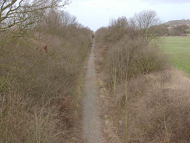
The surrounding area offers numerous opportunities for outdoor pursuits, including walking, cycling, and horse riding. Delamere Forest, a large woodland area, is just a short distance away, providing a popular destination for nature lovers and outdoor enthusiasts.

Overall, Alvanley is a tranquil and close-knit community that offers a peaceful countryside lifestyle while still being conveniently located near major transport links and amenities.

If you have any feedback on the listing, please let us know in the comments section below.
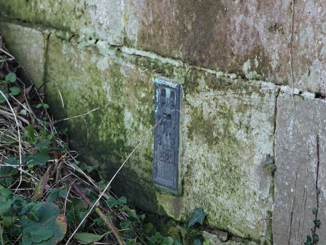
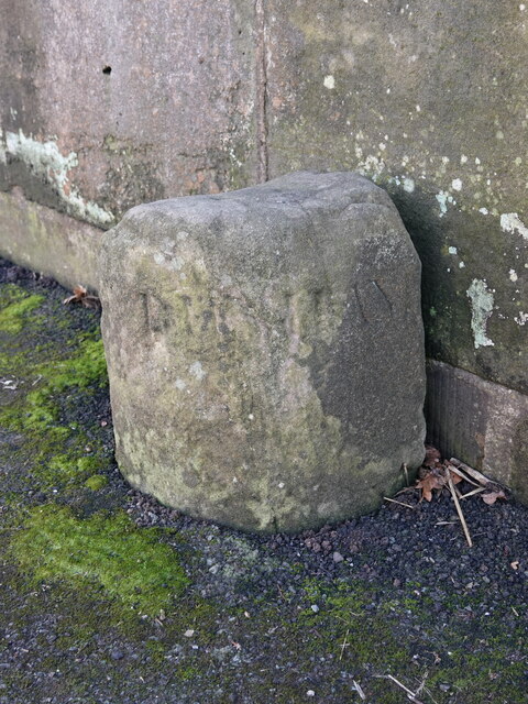
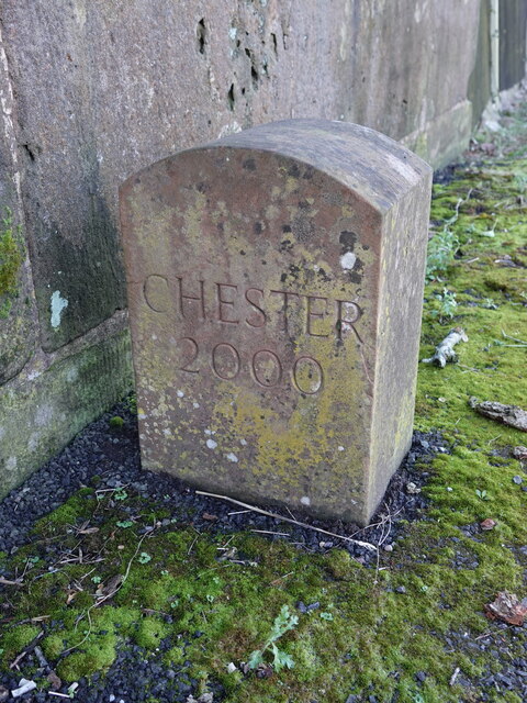
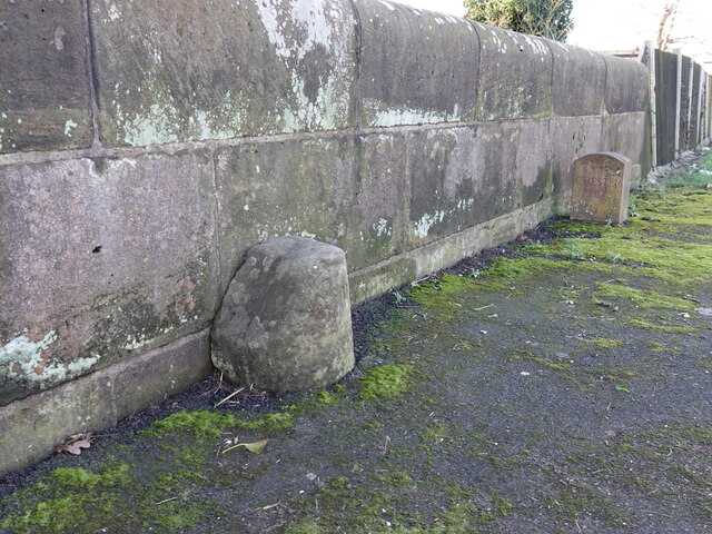
Alvanley Images

Images are sourced within 2km of 53.258666/-2.753003 or Grid Reference SJ4973. Thanks to Geograph Open Source API. All images are credited.

Flush bracket 2825 on Horn's Mill Bridge Flush bracket 2825 is on the south face of Horn's Mill Bridge, so is only visible from the field across Peckmill Brook. The bridge carries the A56 Chester road across the brook.

Benchmark Database: <span class="nowrap"><a title="https://www.bench-marks.org.uk/bm2018" rel="nofollow ugc noopener" href="https://www.bench-marks.org.uk/bm2018">Link</a><img style="margin-left:2px;" alt="External link" title="External link - shift click to open in new window" src="https://s1.geograph.org.uk/img/external.png" width="10" height="10"/></span>
Flush bracket 2825 on Horn's Mill Bridge
Flush bracket 2825 is on the south face of Horn's Mill Bridge, so is only visible from the field across Peckmill Brook. The bridge carries the A56 Chester road across the brook. Benchmark Database: LinkExternal link
Large warehouse, Helsby
Heat Trace
Heat Trace
Church House Farmhouse, Alvanley Grand Georgian brick front. Early C19th. The lower range to the right is probably older. Grade II listed.
Church House Farmhouse, Alvanley
Grand Georgian brick front. Early C19th. The lower range to the right is probably older. Grade II listed.
Old Milepost by the A56, Chester Road, Helsby Cast iron post by the A56, Chester Road in the parish of Helsby, on the verge, on East side of road. Cast iron CCC1898, erected by the County Council in the 19th century. For a wider view see <a href="https://www.geograph.org.uk/photo/7686563">SJ4875 : Old Milepost by the A56, Chester Road, Helsby</a>

Inscription reads:-
: DUNHAM HILL / 2 MILES / CHESTER 8 : : CHESHIRE / 1898 / COUNTY COUNCIL : : FRODSHAM / 3 MILES / WARRINGTON 12 :
Maker:-
: W H SMITH & CO / MAKER / WHITCHURCH :

Milestone Society National ID: CH_CHWA08
Old Milepost by the A56, Chester Road, Helsby
Cast iron post by the A56, Chester Road in the parish of Helsby, on the verge, on East side of road. Cast iron CCC1898, erected by the County Council in the 19th century. For a wider view see SJ4875 : Old Milepost by the A56, Chester Road, Helsby Inscription reads:- : DUNHAM HILL / 2 MILES / CHESTER 8 : : CHESHIRE / 1898 / COUNTY COUNCIL : : FRODSHAM / 3 MILES / WARRINGTON 12 : Maker:- : W H SMITH & CO / MAKER / WHITCHURCH : Milestone Society National ID: CH_CHWA08
Old Milepost by the A56, Chester Road, Helsby Looking south along the A56, Chester Road, Helsby, by the cast iron milepost erected by Cheshire County Council in the 19th century.

See: <a href="https://www.geograph.org.uk/photo/7686551">SJ4875 : Old Milepost by the A56, Chester Road, Helsby</a>

Milestone Society National ID: CH_CHWA08
Old Milepost by the A56, Chester Road, Helsby
Looking south along the A56, Chester Road, Helsby, by the cast iron milepost erected by Cheshire County Council in the 19th century. See: SJ4875 : Old Milepost by the A56, Chester Road, Helsby Milestone Society National ID: CH_CHWA08
Boundary stone by Peckmill Brook Bridge, Dunham-on-the-Hill An old boundary stone in the middle of the bridge that carries the A56 over Peckmill Brook/Hornsmill Brook. The west side of the stone seems to be inscribed 'DUNHAM', but the east side is damaged and doesn't seem to be inscribed. Although modern maps show the west side is now in Helsby, old maps show that the boundary followed the road, so the west side would have been in Alvanley. There is also a more modern 'CHESTER 2000' boundary stone a few metres to the west <a href="https://www.geograph.org.uk/photo/7686762">SJ4874 : Modern boundary stone by Peckmill Brook Bridge, Dunham-on-the-Hill</a>
Boundary stone by Peckmill Brook Bridge, Dunham-on-the-Hill
An old boundary stone in the middle of the bridge that carries the A56 over Peckmill Brook/Hornsmill Brook. The west side of the stone seems to be inscribed 'DUNHAM', but the east side is damaged and doesn't seem to be inscribed. Although modern maps show the west side is now in Helsby, old maps show that the boundary followed the road, so the west side would have been in Alvanley. There is also a more modern 'CHESTER 2000' boundary stone a few metres to the west SJ4874 : Modern boundary stone by Peckmill Brook Bridge, Dunham-on-the-Hill
Modern boundary stone by Peckmill Brook Bridge, Dunham-on-the-Hill A modern boundary stone on the west side  of the bridge that carries the A56 over Peckmill Brook/Hornsmill Brook. The inscription reads 'CHESTER 2000', so presumably it is to commemorate the millennium. This stone is a few metres to the west of the old boundary stone <a href="https://www.geograph.org.uk/photo/7686760">SJ4874 : Boundary stone by Peckmill Brook Bridge, Dunham-on-the-Hill</a> so isn't actually on the boundary, which is the centre of the brook.
Modern boundary stone by Peckmill Brook Bridge, Dunham-on-the-Hill
A modern boundary stone on the west side of the bridge that carries the A56 over Peckmill Brook/Hornsmill Brook. The inscription reads 'CHESTER 2000', so presumably it is to commemorate the millennium. This stone is a few metres to the west of the old boundary stone SJ4874 : Boundary stone by Peckmill Brook Bridge, Dunham-on-the-Hill so isn't actually on the boundary, which is the centre of the brook.
Two boundary stones by Peckmill Brook Bridge, Dunham-on-the-Hill There are two boundary stones on Peckmill Brook/Hornsmill Brook Bridge, Dunham-on-the-Hill - one old <a href="https://www.geograph.org.uk/photo/7686760">SJ4874 : Boundary stone by Peckmill Brook Bridge, Dunham-on-the-Hill</a> and one modern <a href="https://www.geograph.org.uk/photo/7686762">SJ4874 : Modern boundary stone by Peckmill Brook Bridge, Dunham-on-the-Hill</a>
Two boundary stones by Peckmill Brook Bridge, Dunham-on-the-Hill
There are two boundary stones on Peckmill Brook/Hornsmill Brook Bridge, Dunham-on-the-Hill - one old SJ4874 : Boundary stone by Peckmill Brook Bridge, Dunham-on-the-Hill and one modern SJ4874 : Modern boundary stone by Peckmill Brook Bridge, Dunham-on-the-Hill
On the Longster Trail by Alvanley Hall
Path approaching Bowlingalley Farm, Alvanley
Helsby Hill The picture was taking while logging the trigpoint in the picture and a nearby Geocache.
Helsby Hill
The picture was taking while logging the trigpoint in the picture and a nearby Geocache.
Sandstone Outcrop on Helsby Hill
Helsby Hill View north from the trigpoint
Helsby Hill
View north from the trigpoint
Helsby Hill view west from the trigpoint
Helsby Hill
view west from the trigpoint
Helsby Sports and Social Club On the A56 at Helsby, and overlooked by Helsby Hill
Helsby Sports and Social Club
On the A56 at Helsby, and overlooked by Helsby Hill
Old railway Alvanley A view north from Peck Mill Lane bridge onto the trackbed of the former railway line between Mouldsworth and Helsby.
Old railway Alvanley
A view north from Peck Mill Lane bridge onto the trackbed of the former railway line between Mouldsworth and Helsby.
Ordnance Survey flush bracket on The White Lion
Show me another place!

Alvanley is located at Grid Ref: SJ4973 (Lat: 53.258666, Lng: -2.753003)

Unitary Authority: Cheshire West and Chester

Police Authority: Cheshire

What 3 Words

///tangent.twit.phones. Near Helsby, Cheshire

Nearby Locations

Alvanley

Related Wikis

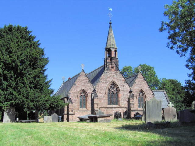
St John the Evangelist's Church, Alvanley

St John the Evangelist's Church is in the village of Alvanley, Cheshire, England. It is an active Anglican parish church in the diocese of Chester, the...

Alvanley

Alvanley is a small rural village and civil parish near Helsby, in the unitary authority of Cheshire West and Chester and the ceremonial county of Cheshire...
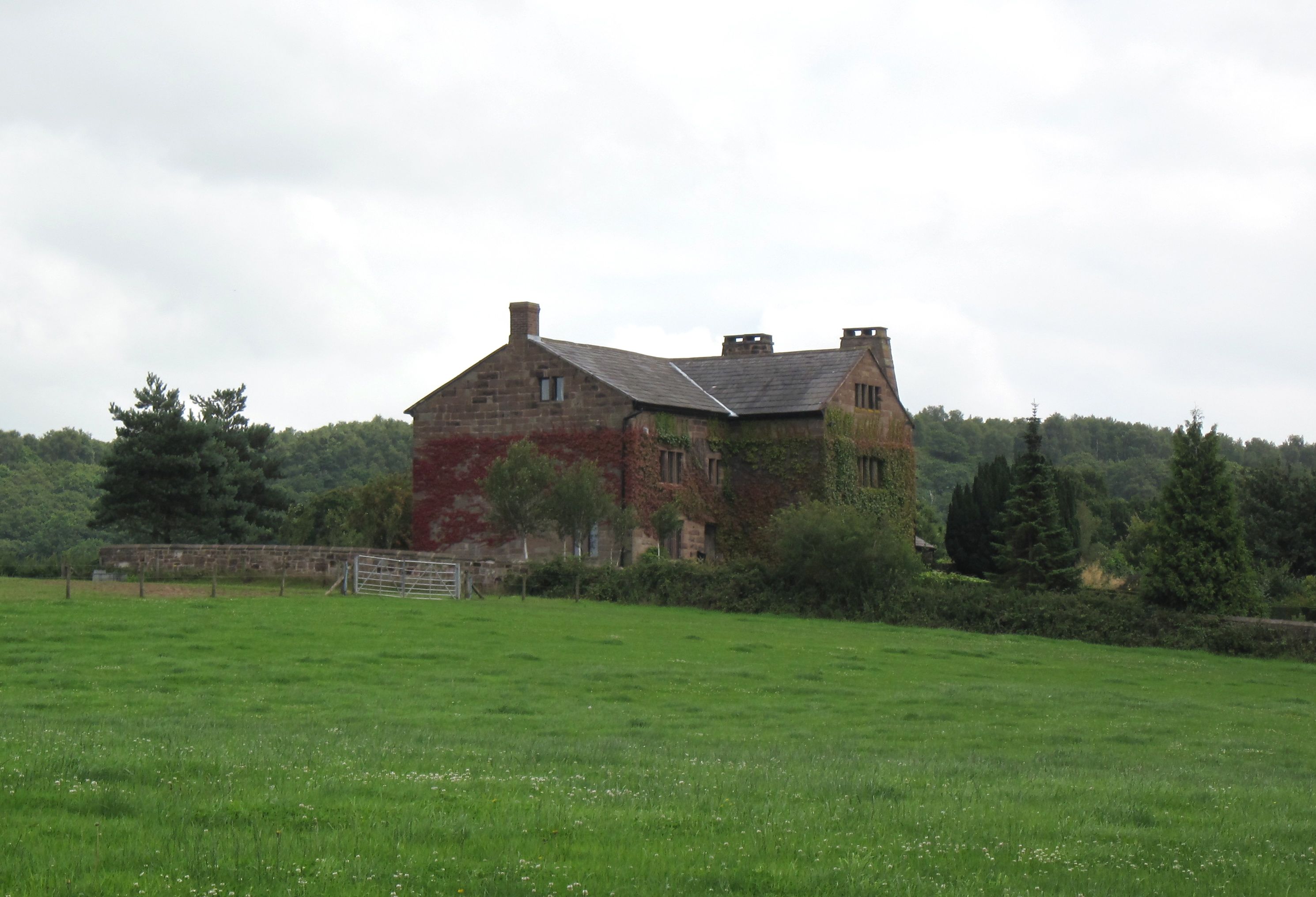
Alvanley Hall

Alvanley Hall is in Manley Road, 0.25 miles (0.4 km) to the southeast of the village of Alvanley, Cheshire, England. It is recorded in the National Heritage...

Austerson Old Hall

Austerson Old Hall is 1 mile (1.6 km) southeast of the village of Alvanley, Cheshire, England. It is recorded in the National Heritage List for England...

Nearby Amenities

Located within 500m of 53.258666,-2.753003
Turning Circle
Lat/Long: 53.2627434/-2.754286
Alvanley
Place: hamlet
Wikidata: Q9149239
Lat/Long: 53.2617626/-2.7545733
Power: tower
Lat/Long: 53.2543024/-2.7517367
Alvanley Agricultural Services
Addr City: Frodsham
Addr Housename: Church House Farm
Addr Postcode: WA6 9DD
Addr Street: Manley Road
Addr Suburb: Alvanley
Shop: agrarian
Lat/Long: 53.2600851/-2.7542141
Post Box
Ref: WA6 1000
Lat/Long: 53.2570241/-2.7483474
Public Bookcase
Booth: K6
Disused Amenity: telephone
Man Made: telephone_box
Public Bookcase Type: phone_box
Tourism: information
Lat/Long: 53.2619406/-2.7557684
Post Box
Post Box Mounting: brick_pillar
Post Box Type: wall
Ref: WA6 218
Lat/Long: 53.2619422/-2.7557177
Bus Stop
Alvanley, Manley Road / White Lion PH
Bus: yes
Naptan AtcoCode: 0610VR467
Naptan Bearing: SE
Naptan BusStopType: CUS
Naptan CommonName: White Lion PH
Naptan Crossing: Frodsham Road
Naptan Indicator: opp
Naptan Landmark: St John's Church
Naptan LocalityName: Alvanley
Naptan NaptanCode: chwdpdp
Naptan ShortCommonName: White Lion PH
Naptan Street: Manley Road
Public Transport: platform
Source: naptan_import
Lat/Long: 53.2608692/-2.754938
Bus Stop
Alvanley, Helsby Road / Paddock Hills
Bus: yes
Naptan AtcoCode: 0610VR19235
Naptan Bearing: NW
Naptan BusStopType: CUS
Naptan CommonName: Paddock Hills
Naptan Indicator: o/s
Naptan Landmark: Paddock Hills
Naptan LocalityName: Alvanley
Naptan NaptanCode: chwadpjw
Naptan ShortCommonName: Paddock Hills
Naptan Street: Helsby Road
Public Transport: platform
Source: naptan_import
Lat/Long: 53.261985/-2.7575812
Bus Stop
Alvanley, Manley Road / White Lion PH
Bus: yes
Naptan AtcoCode: 0610VR466
Naptan Bearing: NW
Naptan BusStopType: CUS
Naptan CommonName: White Lion PH
Naptan Crossing: Frodsham Road
Naptan Indicator: o/s
Naptan Landmark: White Lion PH
Naptan LocalityName: Alvanley
Naptan NaptanCode: chwdptp
Naptan ShortCommonName: White Lion PH
Naptan Street: Manley Road
Public Transport: platform
Source: naptan_import
Lat/Long: 53.2608313/-2.7552371
Bus Stop
Alvanley, Manley Road / Alvanley Hall
Bus: yes
Naptan AtcoCode: 0610VR19066
Naptan Bearing: NW
Naptan BusStopType: CUS
Naptan CommonName: Alvanley Hall
Naptan Indicator: opp
Naptan Landmark: Alvanley Hall
Naptan LocalityName: Alvanley
Naptan NaptanCode: chwtpmp
Naptan ShortCommonName: Alvanley Hall
Naptan Street: Manley Road
Public Transport: platform
Source: naptan_import
Lat/Long: 53.2563415/-2.7473634
The data included in this document is from www.openstreetmap.org. The data is made available under ODbL.

Have you been to Alvanley?

Leave your review of Alvanley below (or comments, questions and feedback).