Alvediston

Civil Parish in Wiltshire

England

Alvediston

Farm buildings near Bigley Barn
Farm buildings near Bigley Barn Credit: Richard Webb

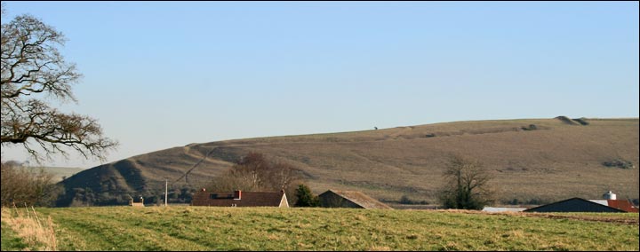
Alvediston is a small civil parish located in the county of Wiltshire, England. Situated in the southern part of the county, it is part of the Cranborne Chase and West Wiltshire Downs Area of Outstanding Natural Beauty. The parish covers an area of approximately 10 square kilometers and has a population of around 200 residents.

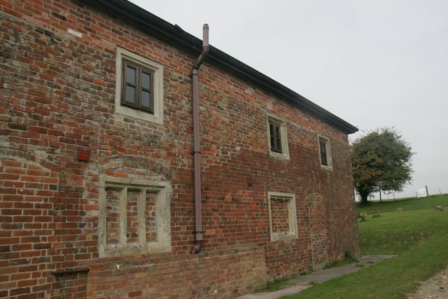
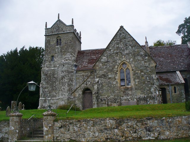
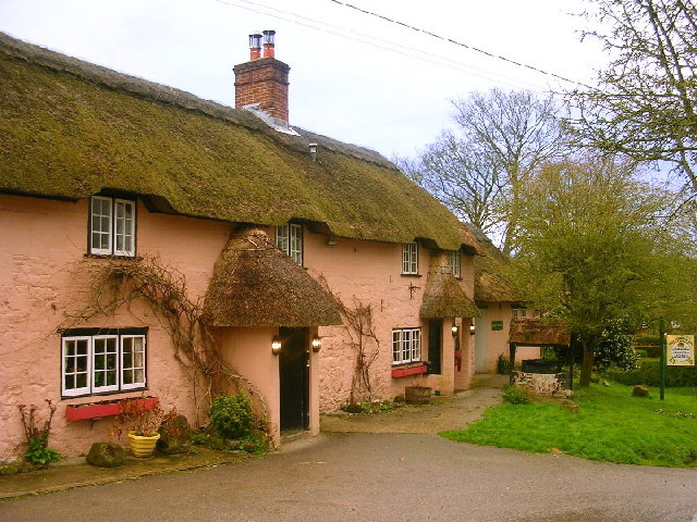
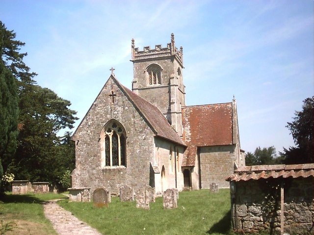
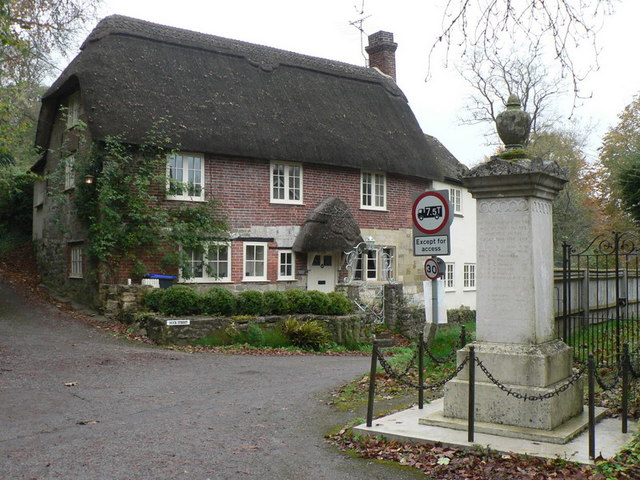
The village of Alvediston itself is a quintessential English village, with a picturesque setting surrounded by rolling hills and farmland. The village is known for its charming thatched cottages, many of which date back several centuries. The centerpiece of the village is the St. Mary's Church, a Grade I listed building that has stood for over 700 years.

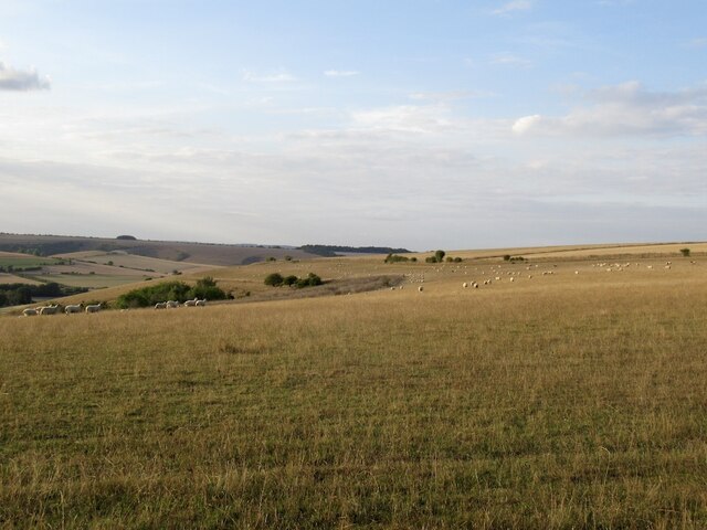
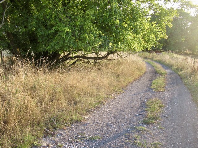
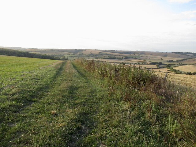
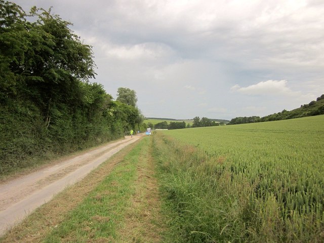
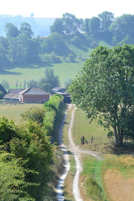
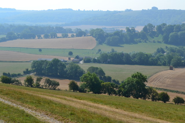
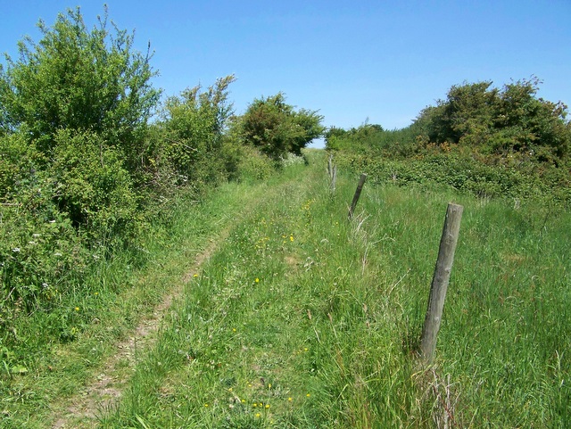
The parish is predominantly rural, with a mix of agricultural land and woodland. Much of the land is used for farming, with sheep and cattle grazing in the fields. The area is also known for its ancient woodland, which is home to a variety of wildlife and provides a peaceful retreat for residents and visitors alike.

Despite its small size, Alvediston has a strong sense of community. The village has a village hall, which is used for various community events and activities. There is also a local pub, the Crown Inn, where residents and visitors can enjoy a traditional English pub experience.

Overall, Alvediston is a charming and idyllic village that offers a peaceful and close-knit community for its residents, as well as a beautiful natural environment for visitors to enjoy.

If you have any feedback on the listing, please let us know in the comments section below.

Alvediston Images

Images are sourced within 2km of 51.0071/-2.044624 or Grid Reference ST9623. Thanks to Geograph Open Source API. All images are credited.

Farm buildings near Bigley Barn
View over Cranbourne Chase South from the Ox Drove towards Rushmere woodlands.
View over Cranbourne Chase
South from the Ox Drove towards Rushmere woodlands.
Ox Drove, Trow Down
Ox Drove, Trow Down
Pincombe Down View from the Ox Drove towards Trow Down.
Pincombe Down
View from the Ox Drove towards Trow Down.
Ox Drove
Ox Drove
Field edge, Bridmore View from the Ox Drove.
Field edge, Bridmore
View from the Ox Drove.
Lower Bridmore
Lower Bridmore
View towards Trow Down Mostly stubble but some parched pasture too.
View towards Trow Down
Mostly stubble but some parched pasture too.
Benchmark on Bigley Buildings, Berwick St John Ordnance Survey benchmark, described on database at <span class="nowrap"><a title="http://www.bench-marks.org.uk/bm70897" rel="nofollow ugc noopener" href="http://www.bench-marks.org.uk/bm70897">Link</a><img style="margin-left:2px;" alt="External link" title="External link - shift click to open in new window" src="https://s1.geograph.org.uk/img/external.png" width="10" height="10"/></span>. See also <a href="https://www.geograph.org.uk/photo/4699698">ST9721 : Bigley Buildings, near Berwick St John</a>.
Benchmark on Bigley Buildings, Berwick St John
Ordnance Survey benchmark, described on database at LinkExternal link. See also ST9721 : Bigley Buildings, near Berwick St John.
Bigley Buildings, near Berwick St John There is an Ordnance Survey cut benchmark on the far side of this attractive building. See <span class="nowrap"><a title="http://www.bench-marks.org.uk/bm70897" rel="nofollow ugc noopener" href="http://www.bench-marks.org.uk/bm70897">Link</a><img style="margin-left:2px;" alt="External link" title="External link - shift click to open in new window" src="https://s1.geograph.org.uk/img/external.png" width="10" height="10"/></span> for database description and 
<a href="https://www.geograph.org.uk/photo/4699692">ST9721 : Benchmark on Bigley Buildings, Berwick St John</a> for close-up view.
Bigley Buildings, near Berwick St John
There is an Ordnance Survey cut benchmark on the far side of this attractive building. See LinkExternal link for database description and ST9721 : Benchmark on Bigley Buildings, Berwick St John for close-up view.
Car park, Chalke Valley History Festival Another view across the car park shown in <a href="https://www.geograph.org.uk/photo/4543503">ST9822 : Car park, Chalke Valley History Festival</a>. the temporary structure is the site office. Behind the trees rise the slopes of Barrow Hill.
Car park, Chalke Valley History Festival
Another view across the car park shown in ST9822 : Car park, Chalke Valley History Festival. the temporary structure is the site office. Behind the trees rise the slopes of Barrow Hill.
Car park, Chalke Valley History Festival Tracks lead vehicles in and out of the car park field. On the right is Barrow Hill.
Car park, Chalke Valley History Festival
Tracks lead vehicles in and out of the car park field. On the right is Barrow Hill.
Entrance road to Chalke Valley History Festival Following a track along the floor of a combe, with a field of wheat rising on the right.
Entrance road to Chalke Valley History Festival
Following a track along the floor of a combe, with a field of wheat rising on the right.
Alvediston Church St Mary's is a Grade II listed building. It was rebuilt in 1866 by T.H. Wyatt using elements from an earlier 12th century church.
Alvediston Church
St Mary's is a Grade II listed building. It was rebuilt in 1866 by T.H. Wyatt using elements from an earlier 12th century church.
Track to Norrington Farm
Downland view north of Norrington Farm
Rolling downland north of Norrington Farm
View over Norrington Farm The early haze warns of a day that will later reach 32°C.
View over Norrington Farm
The early haze warns of a day that will later reach 32°C.
Show me another place!

Alvediston is located at Grid Ref: ST9623 (Lat: 51.0071, Lng: -2.044624)

Unitary Authority: Wiltshire

Police Authority: Wiltshire

What 3 Words

///obey.occur.harsh. Near Ansty, Wiltshire

Related Wikis

Alvediston

Alvediston is a small village and civil parish in Wiltshire, England, about 7 miles (11 km) east of Shaftesbury and 11 miles (18 km) southwest of Salisbury...

Alvediston Manor

Alvediston Manor, Alvediston, Wiltshire, England is an 18th-century house. From 1968 until his death in 1977, it was the home of the former prime minister...

Pincombe Down

Pincombe Down (grid reference ST966217) is a 23.8 hectare biological Site of Special Scientific Interest in southwest Wiltshire, England, notified in 1971...

Gallows Hill SSSI, Wiltshire

Gallows Hill SSSI is a Site of Special Scientific Interest on the north side of the Ebble Valley in south Wiltshire, England. Its chalk grassland and scrub...

Winklebury Hill

Winkelbury Hill (grid reference ST952216) is a 62.95 hectare biological Site of Special Scientific Interest in Berwick St John parish, south-west Wiltshire...

Berwick St John

Berwick St John is a village and civil parish in southwest Wiltshire, England, about 5 miles (8 km) east of Shaftesbury in Dorset. The parish includes...

Ebbesbourne Wake

Ebbesbourne Wake is a village and civil parish in Wiltshire, England, some 10 miles (16 km) south-west of Salisbury, near the head of the valley of the...

Prescombe Down

Prescombe Down (grid reference ST985255) is a biological Site of Special Scientific Interest in Wiltshire, notified in 1951. == Sources == Natural England...

Nearby Amenities

Located within 500m of 51.0071,-2.044624
Windmill Hill
Ele: 170
Natural: peak
Lat/Long: 51.0082669/-2.0509501
The data included in this document is from www.openstreetmap.org. The data is made available under ODbL.

Have you been to Alvediston?

Leave your review of Alvediston below (or comments, questions and feedback).