Altarnun

Civil Parish in Cornwall

England

Altarnun

Wesley Cottage
Wesley Cottage Credit: Paul Barnett

Altarnun is a civil parish located in the county of Cornwall, England. Situated on the edge of Bodmin Moor, it is nestled in a picturesque and rural setting. The parish covers an area of approximately 30 square miles and is home to a population of around 1,200 residents.

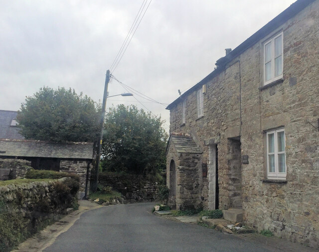
The village of Altarnun serves as the focal point of the parish. It is characterized by its charming stone cottages, historic buildings, and a beautiful 15th-century church, known as St Nonna's. The church is renowned for its impressive stained glass windows and is a popular attraction for visitors.

The surrounding landscape of Altarnun is dominated by the rugged and wild beauty of Bodmin Moor. This expansive moorland offers breathtaking views, ample opportunities for outdoor activities such as hiking and wildlife spotting, and is steeped in myth and legend.

Altarnun has a strong sense of community, with a range of amenities and services available to its residents. These include a primary school, a post office, a village hall, and a local pub. The parish also hosts various events throughout the year, such as the Altarnun Open Gardens and the Altarnun Carnival, which bring the community together and attract visitors from near and far.

Overall, Altarnun is a tranquil and picturesque parish in Cornwall, known for its natural beauty, historic charm, and strong community spirit. It offers a peaceful retreat for residents and visitors alike, with its stunning landscapes and rich heritage.

If you have any feedback on the listing, please let us know in the comments section below.

Altarnun Images

Images are sourced within 2km of 50.590355/-4.539351 or Grid Reference SX2079. Thanks to Geograph Open Source API. All images are credited.

Wesley Cottage
Wesley Cottage
Pair of Tinners' Buildings at Leskernick These buildings are probably of Post Medieval date and would have been built just after streamworking started here (Scale 2m).
Pair of Tinners' Buildings at Leskernick
These buildings are probably of Post Medieval date and would have been built just after streamworking started here (Scale 2m).
Settlement, West Moor
Leskernick prehistoric stone row A single prehistoric stone row measuring 302m long, including at least 56 different sized stones. The row is orientated ENE to WSW and leads ENE from a setting composed of three large recumbent orthostats. There is a noteworthy landscape reveal at the western end of the row where the cairns on top of Brown Gelly suddenly appear from behind rising ground.  <span class="nowrap"><a title="https://stonerows.wordpress.com/gazetteer/region/bodmin-moor/leskernick/" rel="nofollow ugc noopener" href="https://stonerows.wordpress.com/gazetteer/region/bodmin-moor/leskernick/">Link</a><img style="margin-left:2px;" alt="External link" title="External link - shift click to open in new window" src="https://s1.geograph.org.uk/img/external.png" width="10" height="10"/></span>
Leskernick prehistoric stone row
A single prehistoric stone row measuring 302m long, including at least 56 different sized stones. The row is orientated ENE to WSW and leads ENE from a setting composed of three large recumbent orthostats. There is a noteworthy landscape reveal at the western end of the row where the cairns on top of Brown Gelly suddenly appear from behind rising ground. LinkExternal link
Old Boundary Marker Parish Boundary Marker on the southeast side of the A30. This was on the boundary of Altarnun and Bolventor parishes but is now entirely in Altarnun parish. Inscribed ALTARNUN and BOLVENTOR on opposite faces. Grade II Listed <span class="nowrap"><a title="https://historicengland.org.uk/listing/the-list/list-entry/1142827" rel="nofollow ugc noopener" href="https://historicengland.org.uk/listing/the-list/list-entry/1142827">Link</a><img style="margin-left:2px;" alt="External link" title="External link - shift click to open in new window" src="https://s1.geograph.org.uk/img/external.png" width="10" height="10"/></span>

Milestone Society National ID: CW_ALTAR01pb
Old Boundary Marker
Parish Boundary Marker on the southeast side of the A30. This was on the boundary of Altarnun and Bolventor parishes but is now entirely in Altarnun parish. Inscribed ALTARNUN and BOLVENTOR on opposite faces. Grade II Listed LinkExternal link Milestone Society National ID: CW_ALTAR01pb
Altarnun: near South Carne Grass harvest. View towards the moor
Altarnun: near South Carne
Grass harvest. View towards the moor
Altarnun: bridleway by Carne Down Looking south-south-west, with a flight of rooks aloft
Altarnun: bridleway by Carne Down
Looking south-south-west, with a flight of rooks aloft
Digory Isbell’s cottage, Trewint "Let us go to yonder house, where the stone porch is, and ask for something" John Nelson, a Yorkshire stonemason and one of John Wesley's itinerant preachers, made this suggestion to his colleague John Downes on August 29th 1743, as Trewint had no inn. Wesley himself later visited this cottage on six occasions. According to <span class="nowrap"><a title="http://www.wesleycottage.ukonline.co.uk/cottage_history.html" rel="nofollow ugc noopener" href="http://www.wesleycottage.ukonline.co.uk/cottage_history.html">Link</a><img style="margin-left:2px;" alt="External link" title="External link - shift click to open in new window" src="https://s1.geograph.org.uk/img/external.png" width="10" height="10"/></span> , "there is no other place in Cornwall, and few in the country, where the authentic atmosphere of early Methodism can be so keenly felt".

The cottage was restored in 1950 and is now a museum, and has the message "You are welcome; please walk in (remembering that this is a place of worship)". In fact, the museum, on Wesley Way, an attractive back lane through the small village, is currently closed.
Digory Isbell’s cottage, Trewint
"Let us go to yonder house, where the stone porch is, and ask for something" John Nelson, a Yorkshire stonemason and one of John Wesley's itinerant preachers, made this suggestion to his colleague John Downes on August 29th 1743, as Trewint had no inn. Wesley himself later visited this cottage on six occasions. According to LinkExternal link , "there is no other place in Cornwall, and few in the country, where the authentic atmosphere of early Methodism can be so keenly felt". The cottage was restored in 1950 and is now a museum, and has the message "You are welcome; please walk in (remembering that this is a place of worship)". In fact, the museum, on Wesley Way, an attractive back lane through the small village, is currently closed.
Westmoorgate The farm is at the end of a no through road from Trewint, on the edge of Bodmin Moor. On the right is bridleway 502/32/3, from Bolventor. In the background, Trewint Tor is at the summit of Trewint Downs.
Westmoorgate
The farm is at the end of a no through road from Trewint, on the edge of Bodmin Moor. On the right is bridleway 502/32/3, from Bolventor. In the background, Trewint Tor is at the summit of Trewint Downs.
Wall, Hendra Downs A wall, fence and bank between two areas of access land on Bodmin West Moor. About 350 metres away, two ponies stand beside Black Rock. In the distance is <a href="https://www.geograph.org.uk/photo/437320">SX2185 : Cold Northcott wind farm</a>.
Wall, Hendra Downs
A wall, fence and bank between two areas of access land on Bodmin West Moor. About 350 metres away, two ponies stand beside Black Rock. In the distance is SX2185 : Cold Northcott wind farm.
Hendra Downs A view across a large part of the square, from access land below Elephant Rock. The improved terrain on the right is also access land, but access to it seems to be awkward. The A30 crosses the scene in the background, passing Webb's Down and Higher Cannaframe. In between, rows of windswept beeches surround fields.
Hendra Downs
A view across a large part of the square, from access land below Elephant Rock. The improved terrain on the right is also access land, but access to it seems to be awkward. The A30 crosses the scene in the background, passing Webb's Down and Higher Cannaframe. In between, rows of windswept beeches surround fields.
Outhouses, Trewint Outbuildings in Wesley Way, Trewint, just up the street from <a href="https://www.geograph.org.uk/photo/699095">SX2180 : Digory Isbell’s cottage, Trewint</a>.
Outhouses, Trewint
Outbuildings in Wesley Way, Trewint, just up the street from SX2180 : Digory Isbell’s cottage, Trewint.
Trewint The old main road heads through the hamlet, turning into a cul-de-sac for those heading west, as it becomes the slip road for traffic leaving the A30.
Trewint
The old main road heads through the hamlet, turning into a cul-de-sac for those heading west, as it becomes the slip road for traffic leaving the A30.
Black Rock Good day at Black Rock, although the sun didn't last. Two ponies ponder the situation. The isolated tor is actually very close to a field boundary marking the edge of the access land on Hendra Downs.
Black Rock
Good day at Black Rock, although the sun didn't last. Two ponies ponder the situation. The isolated tor is actually very close to a field boundary marking the edge of the access land on Hendra Downs.
The Beacon The rocks appear to be in situ, but large cairns are marked on the maps at this hilltop location. Brown Willy is in the distance.
The Beacon
The rocks appear to be in situ, but large cairns are marked on the maps at this hilltop location. Brown Willy is in the distance.
Elephant Rock A precariously-balanced granite boulder across two others on the slopes below The Beacon.
Elephant Rock
A precariously-balanced granite boulder across two others on the slopes below The Beacon.
Small pool south of Leskernick Hill Looking towards Trewint Downs.
Small pool south of Leskernick Hill
Looking towards Trewint Downs.
Ponies and foals at Leskernick Grazing on the common land.
Ponies and foals at Leskernick
Grazing on the common land.
Show me another place!

Altarnun is located at Grid Ref: SX2079 (Lat: 50.590355, Lng: -4.539351)

Unitary Authority: Cornwall

Police Authority: Devon & Cornwall

What 3 Words

///confetti.buckling.stretcher. Near Trewen, Cornwall

Nearby Locations

Altarnun

Related Wikis

The Beacon, Cornwall

The Beacon on Hendra Downs is a prominent hill, 369 metres (1,211 ft) high, located on the northeastern side of Bodmin Moor in the county of Cornwall,...

Holy Trinity Church, Bolventor

Holy Trinity Church is a former Church of England church in Bolventor, Cornwall, England, UK. It was built in 1846–48 and served as the parish church of...

Trewint

Trewint is a hamlet in the civil parish of Altarnun, east Cornwall, England, UK. Trewint is on the A30 main road west of the village of Altarnun. Trewint...

Altarnun Wesleyan chapel

Altarnun Wesleyan chapel is the former Methodist chapel in Altarnun in Cornwall. Completed in 1859, the chapel has been a Grade II listed building since...

Altarnun

Altarnun ( AWL-tər-NUN, OL-; Standard Written Form: Alternonn) is a village and civil parish in Cornwall, England, United Kingdom. It is located 7 miles...

St Nonna's Church, Altarnun

St Nonna's Church, also known as the Cathedral of the Moors, is the second largest church on Bodmin Moor, Cornwall, located in the village of Altarnun...

Palmersbridge

Palmersbridge is a hamlet on the A30 main road northeast of Bolventor in Cornwall, England, UK. == References ==

Tredaule

Tredaule is a hamlet in Cornwall, England, United Kingdom. It is one mile east of Altarnun.The manor of Tredaule was recorded in the Domesday Book (1086...

Related Videos

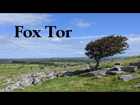
Fox Tor, Near Altarnun, Bodmin Moor - Explore Cornwall

Fox Tor stands within the parish of Altarnun on Bodmin Moor in Cornwall. One of the twenty highest points in Cornwall, Fox Tor ...

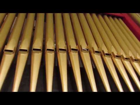
A new organ for Altarnun

In 2017, St Nonna's Church at Altarnun on Bodmin Moor in Cornwall got a new organ. This video shows the organ in 2017 when it ...

Altarnun Church - Doc Martin Filming Location

Located in the beautiful and peaceful village of Altarnun just minutes off the busy A30 near Launceston, St Nonna's Church is a ...

Nearby Amenities

Located within 500m of 50.590355,-4.539351
Power: pole
Lat/Long: 50.5944013/-4.5373157
Power: pole
Lat/Long: 50.5937825/-4.5376311
Power: pole
Lat/Long: 50.5930365/-4.5380548
Power: pole
Lat/Long: 50.5926639/-4.5374816
Power: pole
Lat/Long: 50.5921199/-4.5366342
Power: pole
Lat/Long: 50.5916254/-4.5358554
Power: pole
Lat/Long: 50.5909343/-4.5352329
Power: pole
Lat/Long: 50.5902387/-4.5346021
Hendra Farm
Place: isolated_dwelling
Lat/Long: 50.5897964/-4.5371819
The data included in this document is from www.openstreetmap.org. The data is made available under ODbL.

Have you been to Altarnun?

Leave your review of Altarnun below (or comments, questions and feedback).