Alrewas

Civil Parish in Staffordshire Lichfield

England

Alrewas

Alrewas, Staffordshire Cyclists enjoying the towpath of the Trent and Mersey Canal through the village of Alrewas, near Lichfield. The village church is to the left.
Alrewas, Staffordshire Credit: Martin Clark

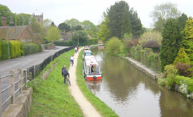
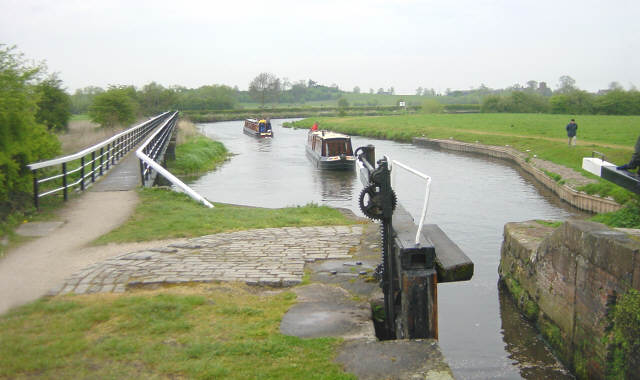
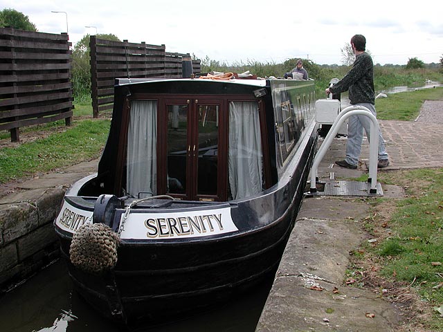
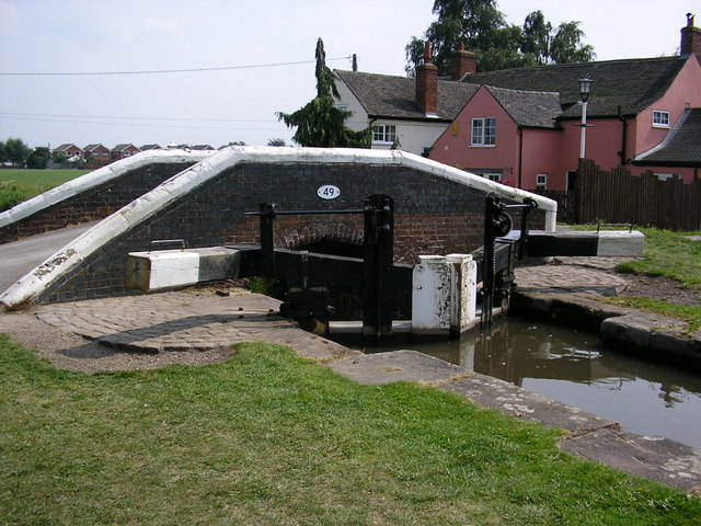
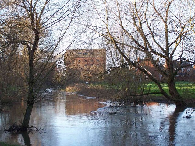
Alrewas is a civil parish located in the county of Staffordshire, England. It is situated approximately 7 miles northeast of the city of Lichfield and 11 miles southwest of the town of Burton upon Trent. The village lies on the banks of the River Trent, which serves as a natural boundary between Staffordshire and Derbyshire.

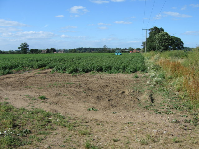
With a population of around 2,500 residents, Alrewas is a small yet vibrant community. The village is known for its picturesque setting, surrounded by lush green fields and rolling countryside, making it a popular destination for nature lovers and those seeking a peaceful retreat.

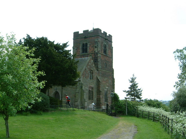
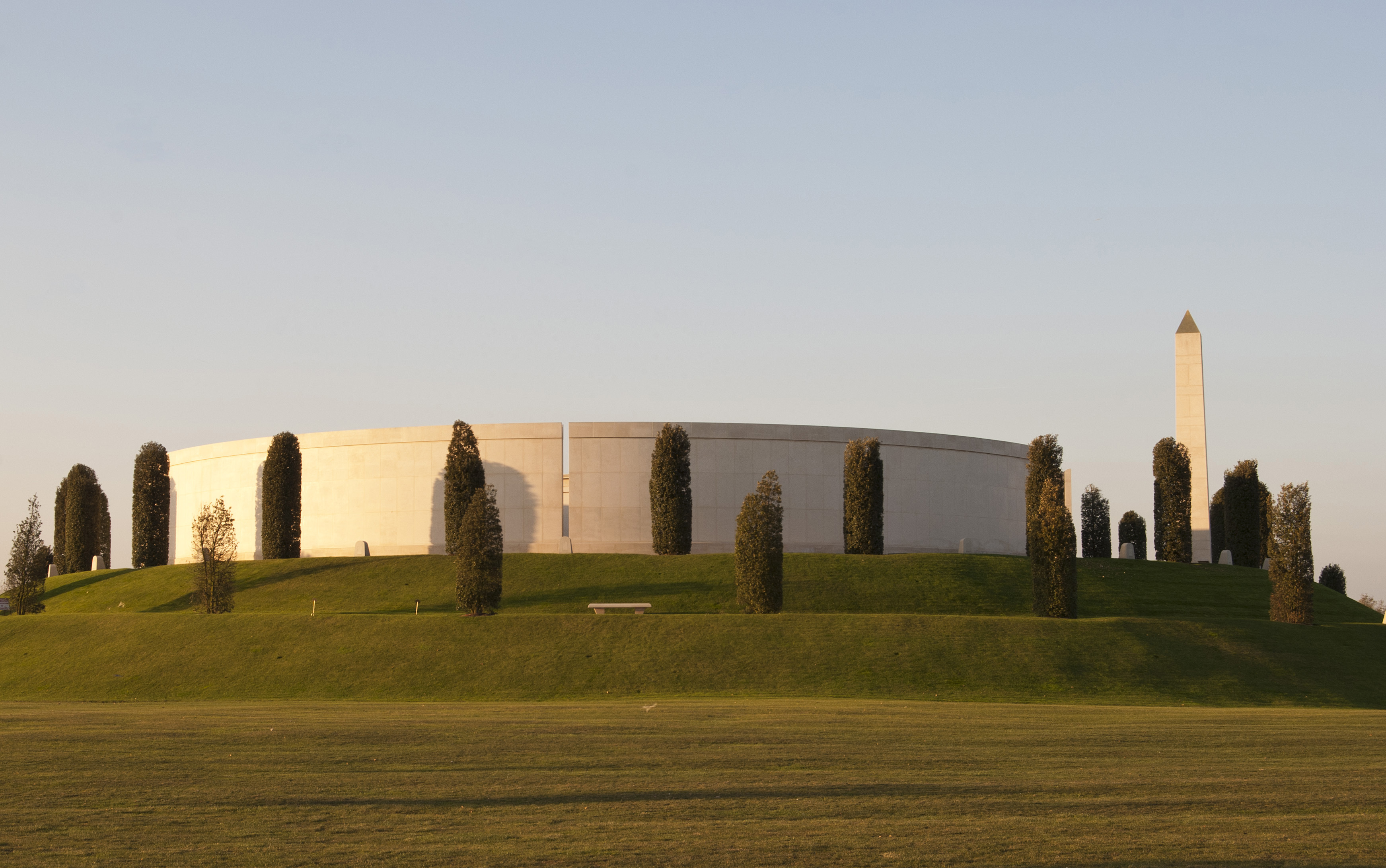
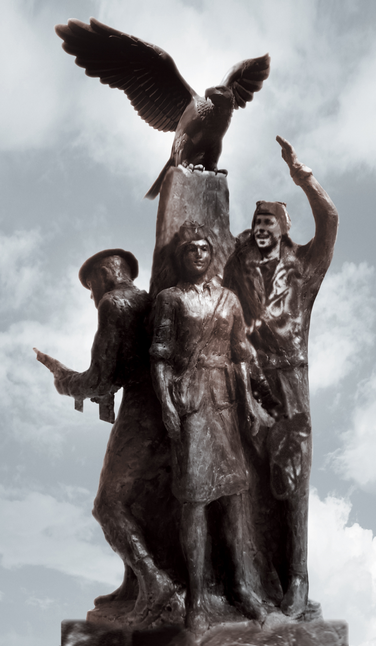
Alrewas is steeped in history, with evidence of human settlement dating back to the Roman era. The village is home to several historic buildings, including All Saints' Church, which dates back to the 12th century and features a unique octagonal tower. The National Memorial Arboretum, a nationally significant site dedicated to honoring fallen servicemen and women, is also located in Alrewas.

In terms of amenities, the village offers a range of local shops, pubs, and restaurants, providing residents and visitors with essential services and a sense of community. The nearby cities of Lichfield and Burton upon Trent provide additional amenities and employment opportunities.

Alrewas enjoys excellent transport links, with the A38 and A513 roads passing through the village, connecting it to nearby towns and cities. The village also benefits from a regular bus service, providing convenient access to surrounding areas.

Overall, Alrewas is a charming village with a rich history, beautiful natural surroundings, and a strong sense of community, making it an attractive place to live or visit in Staffordshire.

If you have any feedback on the listing, please let us know in the comments section below.

Alrewas Images

Images are sourced within 2km of 52.731934/-1.740467 or Grid Reference SK1714. Thanks to Geograph Open Source API. All images are credited.

Alrewas, Staffordshire Cyclists enjoying the towpath of the Trent and Mersey Canal through the village of Alrewas, near Lichfield. The village church is to the left.
Alrewas, Staffordshire
Cyclists enjoying the towpath of the Trent and Mersey Canal through the village of Alrewas, near Lichfield. The village church is to the left.
River Trent near Alrewas Looking north from Alrewas Lock, Staffordshire. A short section of the River Trent forms part of the Trent and Mersey Canal here, which occasionally causes problems in times of flood.
River Trent near Alrewas
Looking north from Alrewas Lock, Staffordshire. A short section of the River Trent forms part of the Trent and Mersey Canal here, which occasionally causes problems in times of flood.
National Memorial Arboretum, near Alrewas One of the moving memorials at this unusual attraction. A beautiful stretch of the River Tame flows along the edge of the site.
National Memorial Arboretum, near Alrewas
One of the moving memorials at this unusual attraction. A beautiful stretch of the River Tame flows along the edge of the site.
The River Tame and the National Memorial Arboretum Footpaths mean one can walk along the river bank.
The River Tame and the National Memorial Arboretum
Footpaths mean one can walk along the river bank.
The 11th Hussars Memorial 11th Hussars PAO memorial at The National Memorial Arboretum.
Sadly since this photo was taken the memorial has now been removed and will be rebuilt in a new location at the Arboretum
The 11th Hussars Memorial
11th Hussars PAO memorial at The National Memorial Arboretum. Sadly since this photo was taken the memorial has now been removed and will be rebuilt in a new location at the Arboretum
The War Memorial in the centre of Alrewas
Wychnor Lock Locking down at Wychnor Lock on the Trent and Mersey Canal
Wychnor Lock
Locking down at Wychnor Lock on the Trent and Mersey Canal
River Meadows The River Mease leaves this grid square just beyond the large tree.  Shortly after this point it joins the River Trent.
River Meadows
The River Mease leaves this grid square just beyond the large tree. Shortly after this point it joins the River Trent.
Final Stretch This is the final stretch of the River Mease as it joins the River Trent 300 metres downstream of this point.
Final Stretch
This is the final stretch of the River Mease as it joins the River Trent 300 metres downstream of this point.
Bagnall Lock Lock No. 13 of the Trent and Mersey Canal with Bridge 49 behind it. The bridge looks as though it is original, so why on earth did they build the lock and bridge so close together that the balance beams have had to be given a 90 degree bend to prevent them fouling the bridge.
Bagnall Lock
Lock No. 13 of the Trent and Mersey Canal with Bridge 49 behind it. The bridge looks as though it is original, so why on earth did they build the lock and bridge so close together that the balance beams have had to be given a 90 degree bend to prevent them fouling the bridge.
Driveway to Broadfields House The house can be seen in the distance.
Driveway to Broadfields House
The house can be seen in the distance.
Salters Bridge This bridge crosses the River Tame. The flag on the right is part of the National Memorial Arboretum. Nearby is a path which is good for bird watching.
Salters Bridge
This bridge crosses the River Tame. The flag on the right is part of the National Memorial Arboretum. Nearby is a path which is good for bird watching.
The Parish Church of St Leonard, Wychnor, Staffs.
Potato field at Overley, near Alrewas, Staffordshire. Main crop potatoes growing in a field alongside the A513 at Overley, between King's Bromley and Alrewas. A pair of irrigation hose reels can clearly be seen.
Potato field at Overley, near Alrewas, Staffordshire.
Main crop potatoes growing in a field alongside the A513 at Overley, between King's Bromley and Alrewas. A pair of irrigation hose reels can clearly be seen.
Sand and gravel The National Memorial Arboretum is sited on what was once sand and gravel workings. This view is taken from near the Far East prisoners of war plot and looks towards the current workings on the skyline. The structure in the foreground is the Lychgate, built in 1942 by prisoners of war and originally located at the entrance to Changi camp burial ground, Singapore.
Sand and gravel
The National Memorial Arboretum is sited on what was once sand and gravel workings. This view is taken from near the Far East prisoners of war plot and looks towards the current workings on the skyline. The structure in the foreground is the Lychgate, built in 1942 by prisoners of war and originally located at the entrance to Changi camp burial ground, Singapore.
Burton to Lichfield rail line Looking towards Burton on Trent from the A513 just East of the junction with the A38
Burton to Lichfield rail line
Looking towards Burton on Trent from the A513 just East of the junction with the A38
All Saints Church Alrewas The church was restored in 1877 but two nave doors date from the 12th century and the chancel dates from the 13th century.
All Saints Church Alrewas
The church was restored in 1877 but two nave doors date from the 12th century and the chancel dates from the 13th century.
Old Mill beside the River Trent, Alrewas
Show me another place!

Alrewas is located at Grid Ref: SK1714 (Lat: 52.731934, Lng: -1.740467)

Administrative County: Staffordshire

District: Lichfield

Police Authority: Staffordshire

What 3 Words

///snore.blanking.magic. Near Alrewas, Staffordshire

Nearby Locations

Alrewas

Related Wikis

Alrewas railway station

Alrewas railway station was a station on the South Staffordshire Railway, which served the village of Alrewas, Staffordshire. The station was located next...

Alrewas

Alrewas ( AWL-ri-wəs) is a village and civil parish in the Lichfield District of Staffordshire, England. == Geography == The village is beside the River...

National Memorial Arboretum

The National Memorial Arboretum is a British site of national remembrance at Alrewas, near Lichfield, Staffordshire. Its objective is to honour the fallen...

All Saints Church, Alrewas

All Saints Church, Alrewas is a parish church in the village of Alrewas, Staffordshire in England. The church is situated in the north west of the village...

Armed Forces Memorial

The Armed Forces Memorial is a national memorial in the United Kingdom, dedicated to the 16,000 servicemen and women of the British Armed Forces killed...

Combined Operations Headquarters

Combined Operations Headquarters was a department of the British War Office set up during Second World War to harass the Germans on the European continent...

Wychnor

Wychnor (or Wichnor, ) is a village and civil parish in Staffordshire, England. It is situated in the East Staffordshire local government district, adjoining...

Polish Forces War Memorial:National Memorial Arboretum

== Setting == The National Memorial Arboretum near Lichfield, Staffordshire, England, comprises 150 acres of woodland and memorials dedicated to the fallen...

Nearby Amenities

Located within 500m of 52.731934,-1.740467
Motorway Junction
Exit To: Rugeley, Tamworth A513
Lat/Long: 52.7286147/-1.7435319
Post Box
Operator: Royal Mail
Operator Wikidata: Q638098
Ref: DE13 1247
Lat/Long: 52.7332942/-1.745287
Alrewas
Abandoned Railway: station
Railway: site
Wikidata: Q4735715
Wikipedia: en:Alrewas railway station
Lat/Long: 52.7304254/-1.7396644
Post Box
Operator: Royal Mail
Operator Wikidata: Q638098
Ref: DE13 1073
Lat/Long: 52.7318033/-1.7404918
Man Made: tower
Note: Approximate position
Source: survey
Tower Type: communication
Lat/Long: 52.7302857/-1.7410034
Mainview Alrewas
Source: survey
Tourism: guest_house
Lat/Long: 52.7324712/-1.7395796
Railway: switch
Lat/Long: 52.7311619/-1.7377549
Railway: level_crossing
Lat/Long: 52.7307383/-1.7388203
Railway: switch
Lat/Long: 52.7308688/-1.7384915
Railway: level_crossing
Lat/Long: 52.7307554/-1.7388711
Defibrillator
Access: yes
Defibrillator Location: outside wall
Emergency: defibrillator
Wheelchair: yes
Lat/Long: 52.7326011/-1.7456239
Alrewas Comminuty Notice Board
Board Type: notice
Information: board
Tourism: information
Lat/Long: 52.732568/-1.7456325
Atm
Atm: yes
Operator: Central England Co-operative
Lat/Long: 52.7326358/-1.7458154
Generator Method: photovoltaic
Generator Output Electricity: yes
Generator Solar Modules: 20
Generator Source: solar
Generator Type: solar_photovoltaic_panel
Location: roof
Power: generator
Lat/Long: 52.7336522/-1.7436238
Generator Method: photovoltaic
Generator Output Electricity: yes
Generator Solar Modules: 14
Generator Source: solar
Generator Type: solar_photovoltaic_panel
Location: roof
Power: generator
Lat/Long: 52.7343559/-1.7461145
Bus Stop
Wellfield Road
Bus: yes
Naptan AtcoCode: 3800C490700
Naptan NaptanCode: stadptdw
Public Transport: platform
Lat/Long: 52.7286174/-1.7440206
Bus Stop
Main Street
Bus: yes
Naptan AtcoCode: 3800C435701
Naptan NaptanCode: stadptag
Public Transport: platform
Lat/Long: 52.7307939/-1.7412418
Bus Stop
Exchange Road
Bus: yes
Naptan AtcoCode: 3800C434501
Naptan NaptanCode: stadpmtg
Public Transport: platform
Lat/Long: 52.7321502/-1.7440796
Bus Stop
Burton Road
Bus: yes
Naptan AtcoCode: 3800C434701
Naptan NaptanCode: stadpmtp
Public Transport: platform
Lat/Long: 52.7319829/-1.7413786
Exhibition Stand Games
Addr City: Burton-on-Trent
Addr Housenumber: 10
Addr Postcode: DE13 7EF
Addr Street: Furlong Close
Shop: party
Website: https://www.exhibitionstandgames.co.uk
Lat/Long: 52.7311039/-1.7461588
Entrance: main
Lat/Long: 52.7326327/-1.7457979
The data included in this document is from www.openstreetmap.org. The data is made available under ODbL.

Have you been to Alrewas?

Leave your review of Alrewas below (or comments, questions and feedback).