Alresford

Civil Parish in Essex Tendring

England

Alresford

River Colne at Fingringhoe Wick Nature Reserve 'Fingringhoe Wick is one of the finest nature reserves in the county. In the reserve you will find nature trails, bird hides and view points with stunning estuary views. 

There were 40 years of gravel extraction on the nature reserve before Essex Wildlife Trust bought it.  It offers a wide range of habitats including areas of grassland, gorse heathland, reedbeds, ponds and the estuary itself.  

Fingringhoe Wick is famous for its Nightingales each spring.  The songsters ring out over the reserve and there are usually about 25 males to be heard.  Thousands of waders and wildfowl use the estuary in the winter and as many as 700 Avocets can be seen.'

See
<span class="nowrap"><a title="http://www.essexwt.org.uk/visitor_centres__nature_reserves/fingringhoe_wick/" rel="nofollow ugc noopener" href="http://www.essexwt.org.uk/visitor_centres__nature_reserves/fingringhoe_wick/">Link</a><img style="margin-left:2px;" alt="External link" title="External link - shift click to open in new window" src="https://s1.geograph.org.uk/img/external.png" width="10" height="10"/></span>
River Colne at Fingringhoe Wick Nature Reserve Credit: PAUL FARMER

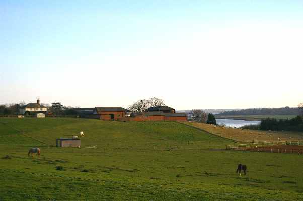
Alresford is a civil parish located in the county of Essex in England. Situated approximately 11 miles northeast of the city of Chelmsford, it is a small village with a population of around 1,200 residents. Alresford is set in a picturesque rural area, surrounded by beautiful countryside and farmland.

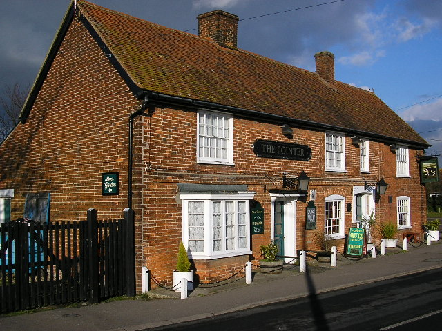
The village is known for its rich history, dating back to the Roman times. It is believed that Alresford was once an important settlement during the Roman occupation, as evidenced by the discovery of various artifacts and remains in the area. Today, the village still retains some of its historic charm, with several old buildings and structures that showcase its past.

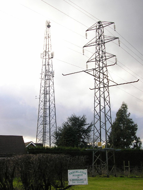
Alresford offers a peaceful and tranquil environment for its residents, away from the hustle and bustle of city life. The village is well-connected to nearby towns and cities, with good transportation links and easy access to major roads.

Although small, Alresford has a strong sense of community. The village has a local church, a primary school, and a village hall that serves as a hub for various community activities and events. There are also a few small businesses and shops in the village, providing essential services and amenities to the residents.

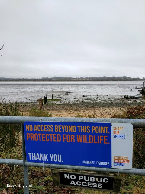
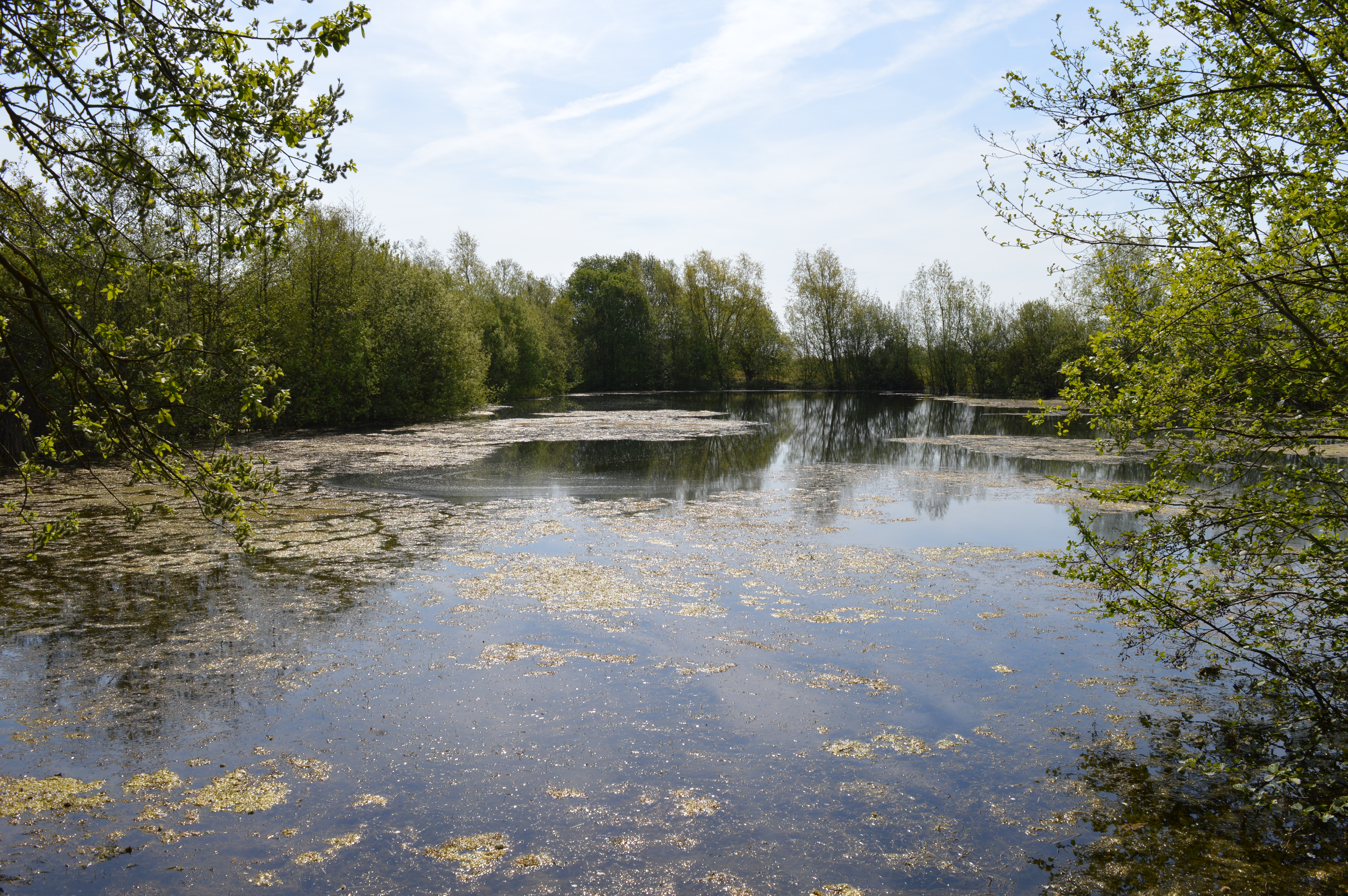
Alresford is surrounded by natural beauty, with ample opportunities for outdoor activities such as walking, cycling, and fishing. The village is also located near the River Blackwater, offering scenic views and recreational opportunities for residents and visitors alike.

In conclusion, Alresford is a peaceful and charming village in Essex, known for its rich history and scenic surroundings. With a close-knit community and a range of amenities, it provides a pleasant and idyllic place to live.

If you have any feedback on the listing, please let us know in the comments section below.

Alresford Images

Images are sourced within 2km of 51.847878/0.998209 or Grid Reference TM0620. Thanks to Geograph Open Source API. All images are credited.

River Colne at Fingringhoe Wick Nature Reserve 'Fingringhoe Wick is one of the finest nature reserves in the county. In the reserve you will find nature trails, bird hides and view points with stunning estuary views. 

There were 40 years of gravel extraction on the nature reserve before Essex Wildlife Trust bought it.  It offers a wide range of habitats including areas of grassland, gorse heathland, reedbeds, ponds and the estuary itself.  

Fingringhoe Wick is famous for its Nightingales each spring.  The songsters ring out over the reserve and there are usually about 25 males to be heard.  Thousands of waders and wildfowl use the estuary in the winter and as many as 700 Avocets can be seen.'

See
<span class="nowrap"><a title="http://www.essexwt.org.uk/visitor_centres__nature_reserves/fingringhoe_wick/" rel="nofollow ugc noopener" href="http://www.essexwt.org.uk/visitor_centres__nature_reserves/fingringhoe_wick/">Link</a><img style="margin-left:2px;" alt="External link" title="External link - shift click to open in new window" src="https://s1.geograph.org.uk/img/external.png" width="10" height="10"/></span>
River Colne at Fingringhoe Wick Nature Reserve
'Fingringhoe Wick is one of the finest nature reserves in the county. In the reserve you will find nature trails, bird hides and view points with stunning estuary views. There were 40 years of gravel extraction on the nature reserve before Essex Wildlife Trust bought it. It offers a wide range of habitats including areas of grassland, gorse heathland, reedbeds, ponds and the estuary itself. Fingringhoe Wick is famous for its Nightingales each spring. The songsters ring out over the reserve and there are usually about 25 males to be heard. Thousands of waders and wildfowl use the estuary in the winter and as many as 700 Avocets can be seen.' See LinkExternal link
Across Alresford Creek I wouldn't fancy fording here!!
Across Alresford Creek
I wouldn't fancy fording here!!
Alresford Tidal Crossing This tidal ford is approached from the aptly named Ford Lane. Seen here at low-tide. A video showing that it is possible cross the ford with the right equipment can be seen at:
<span class="nowrap"><a title="https://youtu.be/3-UXHj5ZVEo" rel="nofollow ugc noopener" href="https://youtu.be/3-UXHj5ZVEo">Link</a><img style="margin-left:2px;" alt="External link" title="External link - shift click to open in new window" src="https://s1.geograph.org.uk/img/external.png" width="10" height="10"/></span>
Alresford Tidal Crossing
This tidal ford is approached from the aptly named Ford Lane. Seen here at low-tide. A video showing that it is possible cross the ford with the right equipment can be seen at: LinkExternal link
New Reserve Fingringhoe Wick This is a view of Essex wildlife Trust’s <span class="nowrap"><a title="http://www.essexwt.org.uk/" rel="nofollow ugc noopener" href="http://www.essexwt.org.uk/">Link</a><img style="margin-left:2px;" alt="External link" title="External link - shift click to open in new window" src="https://s1.geograph.org.uk/img/external.png" width="10" height="10"/></span>  newest acquisition to add to its oldest reserve Fingringhoe Wick  <span class="nowrap"><a title="http://www.essexwt.org.uk/reserves/fingringhoe-wick" rel="nofollow ugc noopener" href="http://www.essexwt.org.uk/reserves/fingringhoe-wick">Link</a><img style="margin-left:2px;" alt="External link" title="External link - shift click to open in new window" src="https://s1.geograph.org.uk/img/external.png" width="10" height="10"/></span>. The plot runs from the trees on the left as far as the sea wall and to the ridge in the distance. Contracts have now been exchanged on this piece of “reclaimed farmland” and in due course the sea wall will be breached as part of a managed retreat in order to create <a href="https://www.geograph.org.uk/photo/550777">TL9613 : New Saltmarsh</a> as has been successfully achieved at their <a href="https://www.geograph.org.uk/photo/550751">TL9614 : Abbots Hall Farm HQ</a>
New Reserve Fingringhoe Wick
This is a view of Essex wildlife Trust’s LinkExternal link newest acquisition to add to its oldest reserve Fingringhoe Wick LinkExternal link. The plot runs from the trees on the left as far as the sea wall and to the ridge in the distance. Contracts have now been exchanged on this piece of “reclaimed farmland” and in due course the sea wall will be breached as part of a managed retreat in order to create TL9613 : New Saltmarsh as has been successfully achieved at their TL9614 : Abbots Hall Farm HQ
View From "Robbies"  Hide This is the view across the River Colne from one of the bird hides on Fingringhoe Wick nature reserve. The reserve is in a worked-out gravel quarry. It is run by Essex Wild Life Trust. The reserve was for many years their headquarters. However, this has moved to <a href="https://www.geograph.org.uk/photo/550751">TL9614 : Abbots Hall Farm HQ</a>, Great Wigborough on the Blackwater. The view clearly shows the sandy beach, mudflats and an operational gravel pit in Alresford  on the other bank. The wreck is that of the barge "Fly" the only one of three sister sips to survive their maiden voyage from a shipyard in Appledore (Devon), Bee and Ant sank in a great storm off Dover in 1899. For more info on the reserve see <span class="nowrap"><a title="https://www.essexwt.org.uk/nature-reserves/fingringhoe" rel="nofollow ugc noopener" href="https://www.essexwt.org.uk/nature-reserves/fingringhoe">Link</a><img style="margin-left:2px;" alt="External link" title="External link - shift click to open in new window" src="https://s1.geograph.org.uk/img/external.png" width="10" height="10"/></span>
View From "Robbies" Hide
This is the view across the River Colne from one of the bird hides on Fingringhoe Wick nature reserve. The reserve is in a worked-out gravel quarry. It is run by Essex Wild Life Trust. The reserve was for many years their headquarters. However, this has moved to TL9614 : Abbots Hall Farm HQ, Great Wigborough on the Blackwater. The view clearly shows the sandy beach, mudflats and an operational gravel pit in Alresford on the other bank. The wreck is that of the barge "Fly" the only one of three sister sips to survive their maiden voyage from a shipyard in Appledore (Devon), Bee and Ant sank in a great storm off Dover in 1899. For more info on the reserve see LinkExternal link
The Ford To judge by the map, this typical Essex weatherboarded house is called "The Ford". (Note the roof line!) It stands beside an ancient ford across Alresford Creek, a branch of the River Colne estuary. In the distance is <a href="https://www.geograph.org.uk/photo/122980">TM0718 : All Saints Church, Brightlingsea</a> which stands in <a href="https://www.geograph.org.uk/gridref/TM0718">TM0718</a> beside Brightlingsea Hall but  2 km from Brightlingsea town centre.
The Ford
To judge by the map, this typical Essex weatherboarded house is called "The Ford". (Note the roof line!) It stands beside an ancient ford across Alresford Creek, a branch of the River Colne estuary. In the distance is TM0718 : All Saints Church, Brightlingsea which stands in TM0718 beside Brightlingsea Hall but 2 km from Brightlingsea town centre.
Ruins of St Peter's Church Many Essex churches are remote from the villages they serve but stand near the house of the lord of the manor who paid for building the church. Perhaps in this case the original manor house has disappeared because this church stands about a kilometre away from Alresford village and from Alresford Hall. The church, built circa 1320 was a remodelling of a 10/11th century church which in turn incorporated tiles from the remains of a Roman villa nearby. It was destroyed by fire in 1971.
Ruins of St Peter's Church
Many Essex churches are remote from the villages they serve but stand near the house of the lord of the manor who paid for building the church. Perhaps in this case the original manor house has disappeared because this church stands about a kilometre away from Alresford village and from Alresford Hall. The church, built circa 1320 was a remodelling of a 10/11th century church which in turn incorporated tiles from the remains of a Roman villa nearby. It was destroyed by fire in 1971.
The Pointer Public house in Wivenhoe Road, Alresford
The Pointer
Public house in Wivenhoe Road, Alresford
Radio mast and pylon In Cockaynes Lane, Alresford. The mast is mainly for data communication for a nearby electricity substation.
Radio mast and pylon
In Cockaynes Lane, Alresford. The mast is mainly for data communication for a nearby electricity substation.
Sewage works Beside the Tenpenny Brook, just south of St Osyth Road, Alresford
Sewage works
Beside the Tenpenny Brook, just south of St Osyth Road, Alresford
Plumptons Track This is the track to Plumptons Farm near Alresford. It is part of a footpath that runs from Ford Lane to Thorrington Mill. <a href="https://www.geograph.org.uk/photo/122980">TM0718 : All Saints Church, Brightlingsea</a> tower can be seen above the trees to the right.
Plumptons Track
This is the track to Plumptons Farm near Alresford. It is part of a footpath that runs from Ford Lane to Thorrington Mill. TM0718 : All Saints Church, Brightlingsea tower can be seen above the trees to the right.
Marsh Farm Paddock This is a view across a paddock towards Marsh Farm near Alresford and the River Colne beyond.
Marsh Farm Paddock
This is a view across a paddock towards Marsh Farm near Alresford and the River Colne beyond.
Alresford Grange This is Alresford Grange taken from the bridle path from Wivenhoe Road to Ford Lane.
Alresford Grange
This is Alresford Grange taken from the bridle path from Wivenhoe Road to Ford Lane.
Towards the Seaside This is the Railway line from Colchester to Clacton at Alresford looking towards Clacton
Towards the Seaside
This is the Railway line from Colchester to Clacton at Alresford looking towards Clacton
Hyacinthoides non-scripta You can tell these are Native Bluebells (Hyacinthoides non-scripta) because they are low to the ground a deep blue to violet in colour, the vividness of which is almost impossible to capture in a photo. They have a heady scent distinctly absent in their Spanish cousins <a href="https://www.geograph.org.uk/photo/422936">TM2420 : Spanish Bluebells</a>. Hybrid Bells <a href="https://www.geograph.org.uk/photo/426187">TQ5880 : Hyacinthoides x massartiana</a> are sometimes difficult to tell from natives. For more info see
<span class="nowrap"><a title="http://www.nhm.ac.uk/nature-online/british-natural-history/survey-bluebells/bluebell-identification/index.html" rel="nofollow ugc noopener" href="http://www.nhm.ac.uk/nature-online/british-natural-history/survey-bluebells/bluebell-identification/index.html">Link</a><img style="margin-left:2px;" alt="External link" title="External link - shift click to open in new window" src="https://s1.geograph.org.uk/img/external.png" width="10" height="10"/></span>
Hyacinthoides non-scripta
You can tell these are Native Bluebells (Hyacinthoides non-scripta) because they are low to the ground a deep blue to violet in colour, the vividness of which is almost impossible to capture in a photo. They have a heady scent distinctly absent in their Spanish cousins TM2420 : Spanish Bluebells. Hybrid Bells TQ5880 : Hyacinthoides x massartiana are sometimes difficult to tell from natives. For more info see LinkExternal link
Old sand jetty, Alresford Creek An overhead conveyor once brought sand from a nearby quarry to this jetty, in Alresford Creek, a tributary of the River Colne.
Old sand jetty, Alresford Creek
An overhead conveyor once brought sand from a nearby quarry to this jetty, in Alresford Creek, a tributary of the River Colne.
Old mooring posts, Alresford Creek These posts form part of the jetty which has been disused since the 1950s.
Old mooring posts, Alresford Creek
These posts form part of the jetty which has been disused since the 1950s.
Old boats at Alresford Creek These boats lie on the north bank of the creek, close to the derelict sand jetty.
Old boats at Alresford Creek
These boats lie on the north bank of the creek, close to the derelict sand jetty.
Show me another place!

Alresford is located at Grid Ref: TM0620 (Lat: 51.847878, Lng: 0.998209)

Administrative County: Essex

District: Tendring

Police Authority: Essex

What 3 Words

///tipping.professed.sounding. Near Alresford, Essex

Related Wikis

Alresford, Essex

Alresford ( or ) is a village and electoral ward in Essex, England. It is centred 9 km (5.6 mi) southeast of Colchester and is 39 km (24 mi) northeast...

Alresford railway station (Essex)

Alresford railway station is on the Sunshine Coast Line, a branch of the Great Eastern Main Line, in the East of England, serving the village of Alresford...

Cockaynes Wood

Cockaynes Wood is a 20.2-hectare (50-acre) nature reserve between Wivenhoe and Alresford in Essex, United Kingdom. It is managed by the Essex Wildlife...

Frating

Frating is a village and small civil parish of the Tendring district of Essex, England. It is about 8 kilometres (5 mi) east of Colchester and 15 kilometres...

Fingringhoe Wick

Fingringhoe Wick is a 48.6-hectare (120-acre) nature reserve in Fingringhoe in Essex. It is managed by the Essex Wildlife Trust, which runs a visitor centre...

Thorington railway station

Thorington railway station (also Thorrington railway station) was a station in Thorrington, Essex on the line (now called the Sunshine Coast Line) from...

Wivenhoe Gravel Pit

Wivenhoe Gravel Pit is a 2.1-hectare (5.2-acre) geological Site of Special Scientific Interest north of Wivenhoe in Essex. It is a Geological Conservation...

Beth Chatto Gardens

The Beth Chatto Gardens, now known as Beth Chatto's Plants & Gardens, are an informal collection of historically significant gardens, with National Heritage...

Related Videos

Wivenhoe | Riverside Town in Essex | Voted one of the best places to live in the UK

Wivenhoe is a small riverside town, close to the University of Essex, with a history of fishing and boat building. Whilst some of this ...

🇬🇧 Wivenhoe Essex UK⎮4K Ultra HD Binaural Audio | Barefoot Walk ☀️ 👣

Hello to subscribers new and old to my channel - thank you! https://www.youtube.com/channel/UCoNN... Video description I ...

swcwalks, book1, walk30, Wivenhoe Circular. 19/8/23

An update of a walk last undertaken in 2009, and filmed on the mobile. It comprises two loops that involve a ferry crossing, making ...

Nearby Amenities

Located within 500m of 51.847878,0.998209
Historic: memorial
Memorial: war_memorial
Lat/Long: 51.8464726/0.99692
Note: stopped here by PCSO during survey :)
Lat/Long: 51.8514364/1.0013431
Power: pole
Source: bing
Lat/Long: 51.8465706/0.997004
Power: pole
Source: bing
Lat/Long: 51.8458808/0.9967324
Power: pole
Source: bing
Lat/Long: 51.8475874/0.9972783
Power: pole
Source: bing
Lat/Long: 51.8485263/0.9975197
Power: pole
Source: bing
Lat/Long: 51.8504879/0.9974601
Power: pole
Source: bing
Lat/Long: 51.8493943/0.9977393
Power: pole
Source: bing
Lat/Long: 51.8442859/0.9961727
Power: pole
Source: bing
Lat/Long: 51.849553/0.9977519
Power: pole
Source: bing
Lat/Long: 51.8450452/0.9964388
Recycling
Lat/Long: 51.851696/1.0014523
Defibrillator
Emergency: defibrillator
Lat/Long: 51.8518574/1.0014146
Generator Method: photovoltaic
Generator Output Electricity: yes
Generator Source: solar
Generator Type: solar_photovoltaic_panel
Location: roof
Power: generator
Lat/Long: 51.8506087/0.9979776
Generator Method: photovoltaic
Generator Output Electricity: yes
Generator Source: solar
Generator Type: solar_photovoltaic_panel
Location: roof
Power: generator
Lat/Long: 51.8513211/1.000185
Generator Method: photovoltaic
Generator Output Electricity: yes
Generator Source: solar
Generator Type: solar_photovoltaic_panel
Location: roof
Power: generator
Lat/Long: 51.8511455/1.0008073
Generator Method: photovoltaic
Generator Output Electricity: yes
Generator Source: solar
Generator Type: solar_photovoltaic_panel
Location: roof
Power: generator
Lat/Long: 51.8514222/1.0002869
Generator Method: photovoltaic
Generator Output Electricity: yes
Generator Source: solar
Generator Type: solar_photovoltaic_panel
Location: roof
Power: generator
Lat/Long: 51.8515713/1.0006893
Generator Method: photovoltaic
Generator Output Electricity: yes
Generator Source: solar
Generator Type: solar_photovoltaic_panel
Location: roof
Power: generator
Lat/Long: 51.8516425/1.0008609
Charging Station
Authentication App: yes
Capacity: 1
Fee: yes
Motorcar: yes
Network: Charge My Street
Operator: Alresford Village Hall
Payment App: yes
Ref: EG-09509
Socket Type2: 1
Socket Type2 Current: 32
Socket Type2 Output: 22kW
Socket Type2 Voltage: 415
Lat/Long: 51.8517433/1.0015012
Charging Station
Authentication App: yes
Capacity: 1
Fee: yes
Motorcar: yes
Network: Charge My Street
Operator: Alresford Village Hall
Payment App: yes
Ref: EG-09508
Socket Type2: 1
Socket Type2 Current: 32
Socket Type2 Output: 22kW
Socket Type2 Voltage: 415
Lat/Long: 51.851734/1.0015012
The data included in this document is from www.openstreetmap.org. The data is made available under ODbL.

Have you been to Alresford?

Leave your review of Alresford below (or comments, questions and feedback).