Alnwick

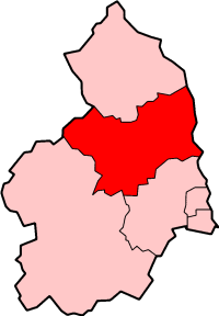
Civil Parish in Northumberland

England

Alnwick

Covered reservoirs From the track to Mount Pleasant.
Covered reservoirs Credit: Russel Wills

Alnwick is a civil parish located in the county of Northumberland, England. It is situated approximately 32 miles north of Newcastle upon Tyne and 5 miles inland from the North Sea coast. The town of Alnwick is the administrative center of the civil parish.

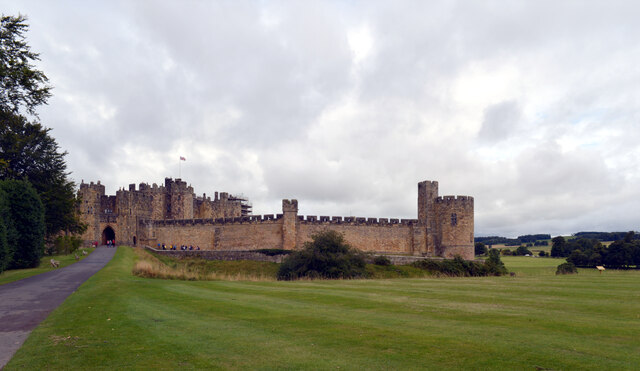
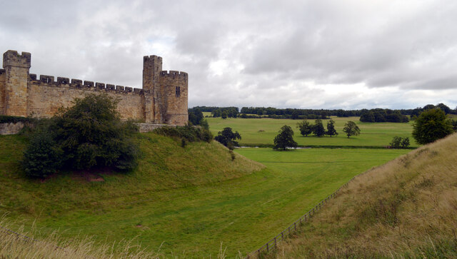
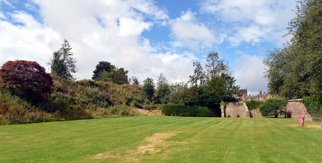
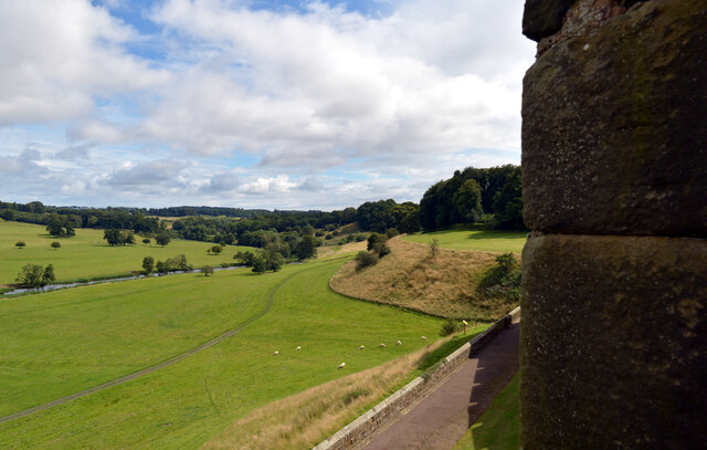
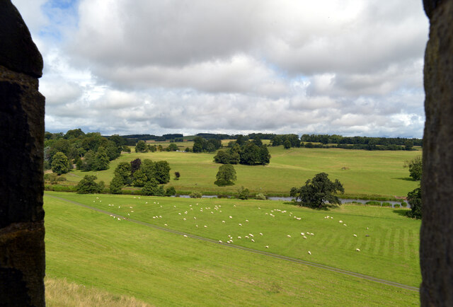
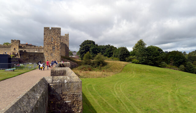
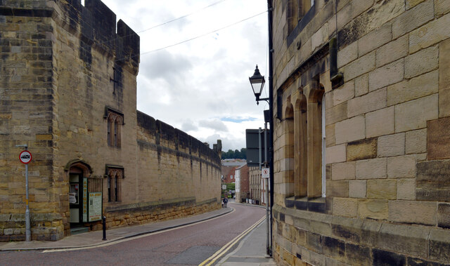
Alnwick is known for its rich history and stunning architecture. One of the most prominent landmarks in the area is Alnwick Castle, a medieval fortress that dates back to the 11th century. It has been used as a filming location for popular movies and TV shows, including the Harry Potter series. The castle is surrounded by beautiful gardens, known as The Alnwick Garden, which attract visitors from all over the world.

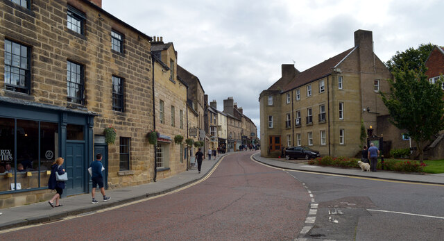
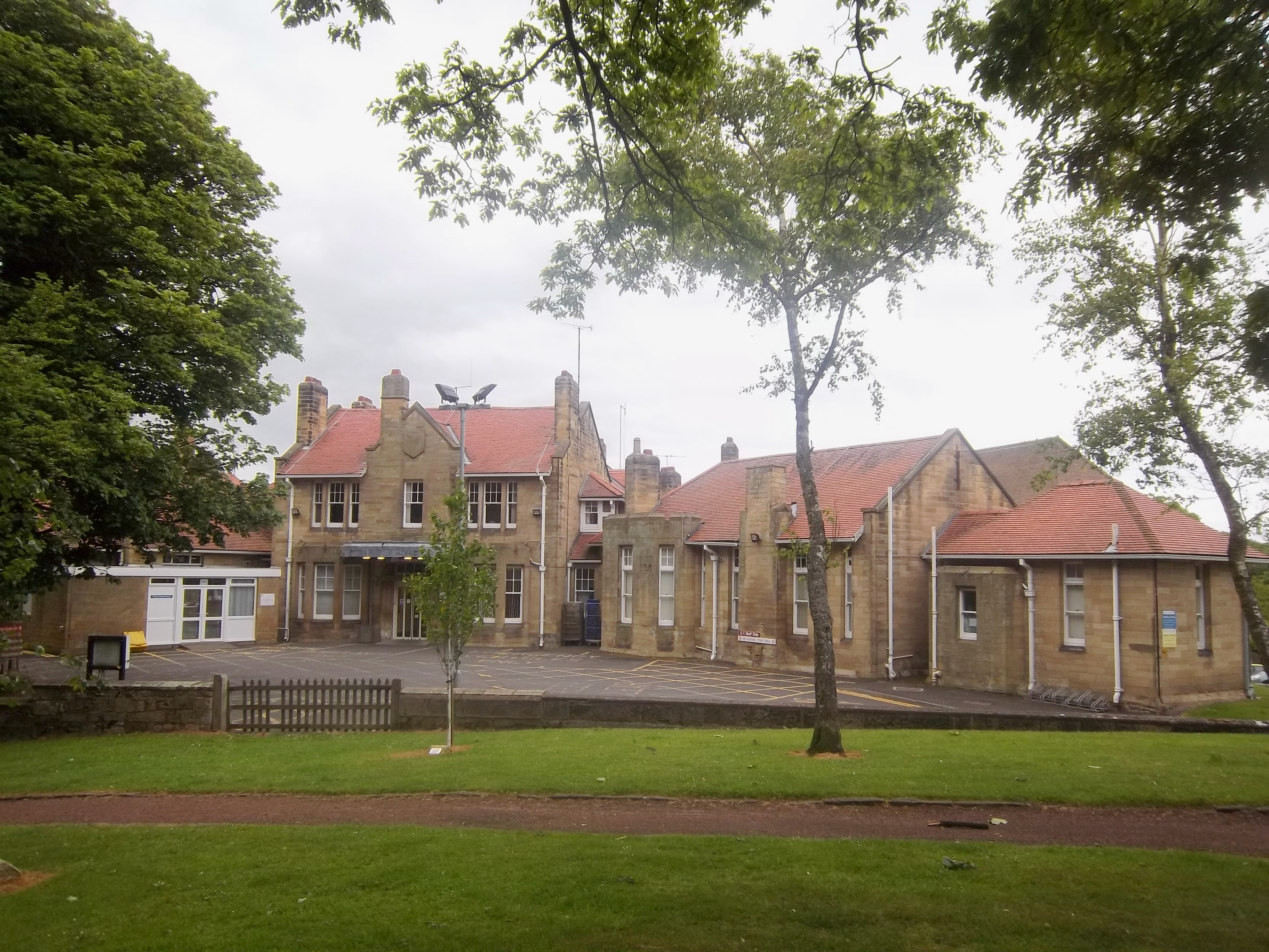
The town itself has a population of around 8,000 people and offers a range of amenities and services for residents and visitors alike. There are several shops, restaurants, and cafes, as well as a market square where a weekly market is held. The town also has a number of schools, a hospital, and sports facilities.

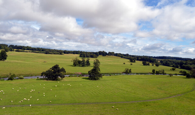
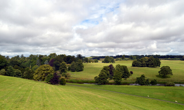
Alnwick is surrounded by picturesque countryside, with the Northumberland National Park and the Northumberland Coast both within easy reach. This makes it a popular destination for outdoor enthusiasts, offering opportunities for hiking, cycling, and birdwatching.

Overall, Alnwick is a charming and historic town in Northumberland, known for its castle, gardens, and stunning natural surroundings.

If you have any feedback on the listing, please let us know in the comments section below.
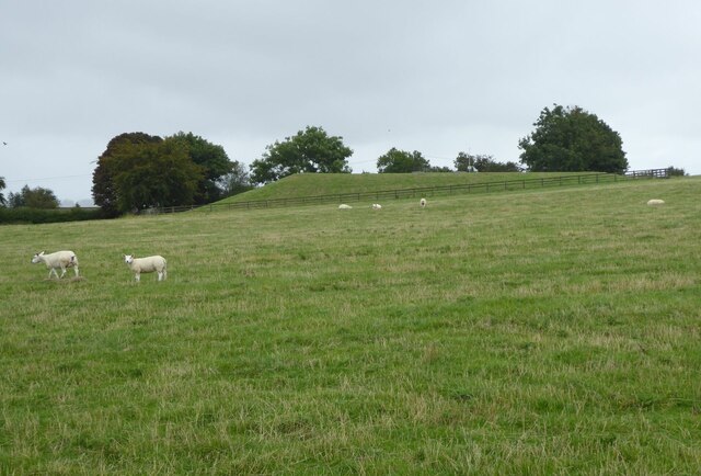
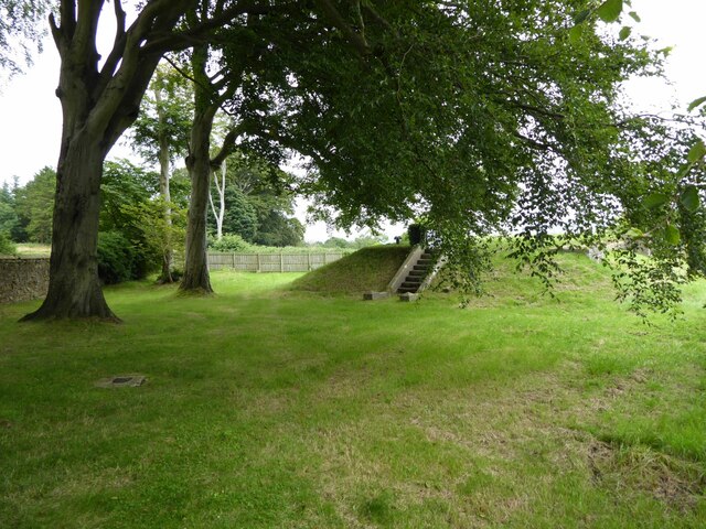
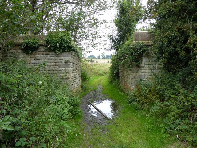
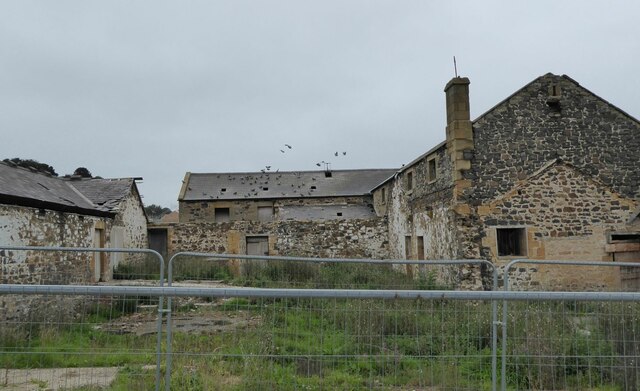
Alnwick Images

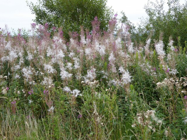
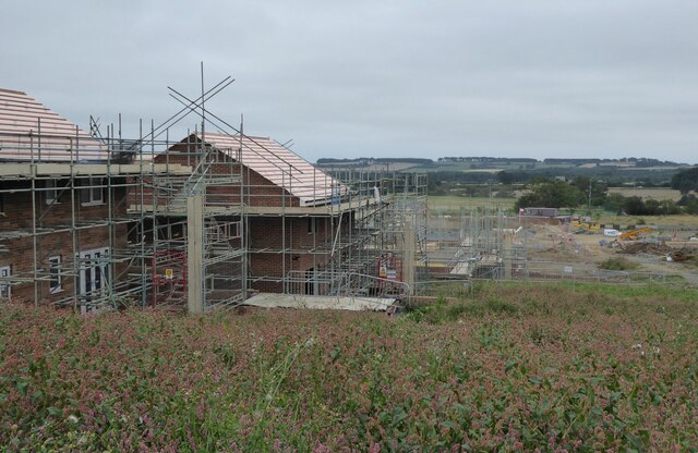
Images are sourced within 2km of 55.409115/-1.692115 or Grid Reference NU1912. Thanks to Geograph Open Source API. All images are credited.

Covered reservoirs From the track to Mount Pleasant.
Covered reservoirs
From the track to Mount Pleasant.
Covered reservoir In the trees beside Rugeley Road.
Covered reservoir
In the trees beside Rugeley Road.
Abutments of a dismantled railway bridge The Alnwick & Cornhill railway is here heading south west around the southern extremities of Alnwick, a major detour, to avoid going anywhere near Alnwick Castle.
Abutments of a dismantled railway bridge
The Alnwick & Cornhill railway is here heading south west around the southern extremities of Alnwick, a major detour, to avoid going anywhere near Alnwick Castle.
Derelict buildings Now occupied by pigeons!
The derelict site is now being encroached upon by new build housing and will soon succumb.
Derelict buildings
Now occupied by pigeons! The derelict site is now being encroached upon by new build housing and will soon succumb.
A fine showing of Rosebay Willowherb With seeds about to blow everywhere!
A fine showing of Rosebay Willowherb
With seeds about to blow everywhere!
New build housing at Greensfield Looking across to where the Alnwick & Cornhill railway used to run.
New build housing at Greensfield
Looking across to where the Alnwick & Cornhill railway used to run.
Alnwick Castle
Alnwick Castle
Moat, Alnwick Castle
Alnwick Castle
Alnwick Castle
Garden, Alnwick Castle
The River Aln seen from Alnwick Castle The River Aln is a short river in Northumberland. It rises in the Cheviot Hills and flows east to its mouth at Alnmouth.
The River Aln seen from Alnwick Castle
The River Aln is a short river in Northumberland. It rises in the Cheviot Hills and flows east to its mouth at Alnmouth.
Alnwick Castle
Alnwick Castle
The River Aln seen from Alnwick Castle walls The River Aln is a short river in Northumberland. It rises in the Cheviot Hills and flows east to its mouth at Alnmouth.
The River Aln seen from Alnwick Castle walls
The River Aln is a short river in Northumberland. It rises in the Cheviot Hills and flows east to its mouth at Alnmouth.
The River Aln seen from Alnwick Castle The River Aln is a short river in Northumberland. It rises in the Cheviot Hills and flows east to its mouth at Alnmouth.
The River Aln seen from Alnwick Castle
The River Aln is a short river in Northumberland. It rises in the Cheviot Hills and flows east to its mouth at Alnmouth.
Alnwick Castle
Alnwick Castle
The River Aln seen from Alnwick Castle The River Aln is a short river in Northumberland. It rises in the Cheviot Hills and flows east to its mouth at Alnmouth.
The River Aln seen from Alnwick Castle
The River Aln is a short river in Northumberland. It rises in the Cheviot Hills and flows east to its mouth at Alnmouth.
Narrowgate, Alnwick
Narrowgate, Alnwick
Narrowgate at its junction with Pottergate, Alnwick
Show me another place!

Alnwick is located at Grid Ref: NU1912 (Lat: 55.409115, Lng: -1.692115)

Unitary Authority: Northumberland

Police Authority: Northumbria

What 3 Words

///tentacles.incisions.sector. Near Alnwick, Northumberland

Nearby Locations

Alnwick

Related Wikis

Nearby Amenities

Located within 500m of 55.409115,-1.692115
Noexit: yes
Lat/Long: 55.4113039/-1.6913827
Noexit: yes
Lat/Long: 55.409007/-1.6909125
Noexit: yes
Lat/Long: 55.4101132/-1.6909101
Noexit: yes
Lat/Long: 55.4081889/-1.6958372
Noexit: yes
Lat/Long: 55.4078965/-1.6953616
Alnwick Junction
Railway: junction
Wikidata: Q124354314
Lat/Long: 55.4083903/-1.6965753
Alnwick
Abandoned Railway: station
Historic: railway_station
Railway: site
Source: NPE
Wikidata: Q4734075
Wikipedia: en:Alnwick railway station
Lat/Long: 55.4101916/-1.6994394
Noexit: yes
Lat/Long: 55.4106103/-1.6882927
Noexit: yes
Lat/Long: 55.4130246/-1.6899303
Noexit: yes
Lat/Long: 55.4128146/-1.6914534
Noexit: yes
Lat/Long: 55.4116154/-1.6926803
Noexit: yes
Lat/Long: 55.412753/-1.6924298
Barrier: lift_gate
Lat/Long: 55.4127687/-1.696283
Noexit: yes
Lat/Long: 55.4128094/-1.6937392
Bus Stop
Bus: yes
Public Transport: platform
Source: GPS survey
Lat/Long: 55.4101802/-1.6983462
Bus Stop
Bench: no
Bus: yes
Covered: no
Public Transport: platform
Shelter: no
Lat/Long: 55.4082558/-1.6991533
Bus Stop
Wagonway Road, Post Office
Bench: no
Bus: yes
Covered: no
Departures Board: timetable
Naptan AtcoCode: 3100U191127
Naptan NaptanCode: nldajgjd
Public Transport: platform
Shelter: no
Lat/Long: 55.4082523/-1.6993142
Bus Stop
Bench: no
Bus: yes
Covered: no
Naptan AtcoCode: 3100U196124
Naptan NaptanCode: nldawtwt
Public Transport: platform
Shelter: no
Lat/Long: 55.4059163/-1.6922997
Bus Stop
Bus: yes
Public Transport: platform
Lat/Long: 55.4087029/-1.6948132
Bus Stop
Alnwick, St Paul’s RC School
Bench: yes
Bus: yes
Departures Board: timetable
Naptan AtcoCode: 3100U194128
Naptan NaptanCode: nldatmtp
Public Transport: platform
Shelter: yes
Lat/Long: 55.4089248/-1.6947727
Bus Stop
Bench: no
Bus: yes
Covered: no
Public Transport: platform
Shelter: no
Lat/Long: 55.4060351/-1.6925735
Bus Stop
Alnwick, Infirmary
Bench: no
Bin: yes
Bus: yes
Covered: yes
Departures Board: timetable
Public Transport: platform
Shelter: yes
Lat/Long: 55.4106081/-1.6995167
Noexit: yes
Lat/Long: 55.4067003/-1.695713
Noexit: yes
Lat/Long: 55.4071952/-1.6960375
Barrier: bollard
Lat/Long: 55.4084927/-1.6970117
Noexit: yes
Lat/Long: 55.4060782/-1.6959355
Noexit: yes
Lat/Long: 55.4102041/-1.6882549
Noexit: yes
Lat/Long: 55.4100352/-1.6922382
Noexit: yes
Lat/Long: 55.4070027/-1.6867932
Noexit: yes
Lat/Long: 55.4070902/-1.6902204
Noexit: yes
Lat/Long: 55.4068899/-1.6886975
Noexit: yes
Lat/Long: 55.411064/-1.6968409
Noexit: yes
Lat/Long: 55.4053937/-1.6914655
Noexit: yes
Lat/Long: 55.4051409/-1.6889388
Barrier: bollard
Bicycle: yes
Foot: yes
Lat/Long: 55.4087111/-1.6966167
Source: Bing
Lat/Long: 55.4046306/-1.6916872
Post Office
Wagonway Road Post Office
Addr City: Alnwick
Addr Housenumber: 21
Addr Postcode: NE66 1QR
Addr Street: Wagonway Road
Brand: Post Office
Brand Wikidata: Q1783168
Opening Hours: Mo-Sa 06:00-19:00; Su 07:00-18:00
Ref Pol Id: 8085
Website: https://www.postoffice.co.uk/branch-finder/2183285/wagonway-road
Lat/Long: 55.4081118/-1.6992911
Gordon Wilson
Addr City: Alnwick
Addr Street: South Road
Craft: blacksmith
Lat/Long: 55.4056982/-1.6914678
Post Box
Ref: NE66 16
Lat/Long: 55.4080413/-1.6994023
Post Box
Ref: NE66 187
Lat/Long: 55.4126506/-1.6965089
Historic: pant
Lat/Long: 55.4113737/-1.6986061
Power: pole
Lat/Long: 55.4086611/-1.6858559
Power: pole
Lat/Long: 55.4091976/-1.6852429
Power: pole
Lat/Long: 55.4098887/-1.6844422
Noexit: yes
Lat/Long: 55.4100293/-1.6983104
Noexit: yes
Lat/Long: 55.4100286/-1.6965026
Noexit: yes
Lat/Long: 55.4101262/-1.6974007
Crossing
Lat/Long: 55.4099695/-1.6975525
Waste Basket
Lat/Long: 55.4113578/-1.6986015
Waste Basket
Lat/Long: 55.408765/-1.6941947
Waste Basket
Check Date: 2021-05-15
Lat/Long: 55.4108535/-1.6994016
Waste Basket
Waste: dog_excrement
Lat/Long: 55.4087538/-1.6940352
Waste Basket
Lat/Long: 55.4081187/-1.6901078
Waste Basket
Lat/Long: 55.408085/-1.6991926
Waste Basket
Lat/Long: 55.4113862/-1.6960705
Waste Basket
Waste: dog_excrement
Lat/Long: 55.4114092/-1.6935893
Waste Basket
Waste: dog_excrement
Lat/Long: 55.408228/-1.6904649
Waste Basket
Lat/Long: 55.4108245/-1.699053
Waste Basket
Waste: dog_excrement
Lat/Long: 55.4110178/-1.6980498
Waste Basket
Vending: excrement_bags
Waste: dog_excrement
Lat/Long: 55.4120532/-1.690266
Waste Basket
Waste: dog_excrement
Lat/Long: 55.4087159/-1.6966717
Waste Basket
Check Date: 2021-02-23
Lat/Long: 55.4106393/-1.6995525
Waste Basket
Lat/Long: 55.4076516/-1.6853355
Waste Basket
Check Date: 2021-02-23
Lat/Long: 55.4078689/-1.6934871
Waste Basket
Check Date: 2021-02-23
Lat/Long: 55.4068913/-1.6927871
afs Country Store
Shop: yes
Lat/Long: 55.4047212/-1.6925618
Alnwick Timber
Shop: trade
Lat/Long: 55.4047015/-1.6931116
Brewers Decorator Centre
Brand: Brewers
Brand Wikidata: Q121435210
Shop: trade
Website: https://www.brewers.co.uk/stores/alnwick/awk
Lat/Long: 55.4050357/-1.6941925
Stone Guard Guest House
Addr City: Alnwick
Addr Housenumber: 2
Addr Postcode: NE66 2NT
Addr Street: Aydon Gardens
Phone: +44 1665 606348
Tourism: guest_house
Website: https://www.stoneguardbnb.com/
Lat/Long: 55.4094451/-1.6968341
Aydon House Bed & Breakfast
Addr City: Alnwick
Addr Housenumber: 1
Addr Postcode: NE66 2NT
Addr Street: Aydon Gardens
Phone: +44 1665 602218
Tourism: guest_house
Website: http://www.aydonhouse.co.uk/
Lat/Long: 55.4094725/-1.696633
Cameo Home Improvements
Addr City: Alnwick
Shop: kitchen
Lat/Long: 55.4049751/-1.6948564
Rule & Son. Roofing
Addr City: Alnwick
Craft: roofer
Lat/Long: 55.4051244/-1.6948414
Bench
Backrest: no
Lat/Long: 55.4065338/-1.6925805
VIP Brewery
Craft: brewery
Lat/Long: 55.4072882/-1.6951082
Noexit: yes
Lat/Long: 55.408102/-1.6934524
Nursing Home
Ravensmount Retirement Home
Addr City: Alnwick
Addr Postcode: NE66 2QG
Addr Street: Alnmouth Road
Phone: +44 1665 603773
Website: https://www.carehome.co.uk/carehome.cfm/searchazref/10004525RAVA
Lat/Long: 55.4075192/-1.6870844
Bus Stop
Bench: no
Bus: yes
Covered: no
Departures Board: timetable
Naptan AtcoCode: 3100U200126
Naptan NaptanCode: nldgjdaj
Public Transport: platform
Shelter: no
Lat/Long: 55.4076297/-1.6854367
Post Box
Ref: NE66 129
Lat/Long: 55.4079187/-1.688234
Bench
Backrest: yes
Lat/Long: 55.4102171/-1.6979965
Bench
Backrest: yes
Check Date: 2021-02-23
Lat/Long: 55.4087679/-1.6941366
Post Box
Brand: Royal Mail
Brand Wikidata: Q638098
Drive Through: no
Operator: Royal Mail
Operator Wikidata: Q638098
Post Box Type: lamp
Ref: NE66 31
Lat/Long: 55.4087676/-1.6942961
Barrier: kissing_gate
Lat/Long: 55.4119384/-1.6874674
Entrance: main
Lat/Long: 55.4102977/-1.6997201
Bus Stop
Alnmouth Road, Ravensmead
Bench: no
Bin: yes
Bus: yes
Departures Board: timetable
Public Transport: platform
Shelter: no
Source: GPS survey
Lat/Long: 55.4080818/-1.689962
Bus Stop
Alnwick, St Paul’s RC School
Bench: no
Bin: no
Bus: yes
Departures Board: timetable
Naptan AtcoCode: 3100U193128
Naptan NaptanCode: nldamgag
Public Transport: platform
Shelter: no
Source: GPS survey
Lat/Long: 55.4091172/-1.6954096
Charging Station
Lat/Long: 55.410713/-1.6978594
Noexit: yes
Lat/Long: 55.4099706/-1.6993671
Noexit: yes
Lat/Long: 55.4122748/-1.6881866
Noexit: yes
Lat/Long: 55.4126658/-1.6922137
Noexit: yes
Lat/Long: 55.4130997/-1.6886142
Noexit: yes
Lat/Long: 55.4131241/-1.6888502
Noexit: yes
Lat/Long: 55.409715/-1.6982054
Noexit: yes
Lat/Long: 55.4100402/-1.6890908
Noexit: yes
Lat/Long: 55.4083571/-1.6852145
Real Fitness
Addr City: Alnwick
Addr Housenumber: 3A
Addr Street: South Road Industrial Estate
Leisure: fitness_centre
Lat/Long: 55.4074649/-1.6953977
Entrance: yes
Lat/Long: 55.4102319/-1.6977928
Crossing
Crossing: zebra
Lat/Long: 55.4087246/-1.6943867
Grit Bin
Lat/Long: 55.4074469/-1.6926454
Grit Bin
Lat/Long: 55.4126446/-1.6963113
Grit Bin
Lat/Long: 55.412171/-1.6924798
Grit Bin
Lat/Long: 55.4116008/-1.6903059
Grit Bin
Lat/Long: 55.4120652/-1.6900618
Noexit: yes
Lat/Long: 55.406202/-1.6964644
Noexit: yes
Lat/Long: 55.4069325/-1.6959252
Generator Method: photovoltaic
Generator Output Electricity: yes
Generator Source: solar
Generator Type: solar_photovoltaic_panel
Location: roof
Power: generator
Lat/Long: 55.4115939/-1.694212
Generator Method: photovoltaic
Generator Output Electricity: yes
Generator Source: solar
Generator Type: solar_photovoltaic_panel
Location: roof
Power: generator
Lat/Long: 55.4120461/-1.6931847
Generator Method: photovoltaic
Generator Output Electricity: yes
Generator Source: solar
Generator Type: solar_photovoltaic_panel
Location: roof
Power: generator
Lat/Long: 55.4124716/-1.6911261
Generator Method: photovoltaic
Generator Output Electricity: yes
Generator Source: solar
Generator Type: solar_photovoltaic_panel
Location: roof
Power: generator
Lat/Long: 55.4128097/-1.6882709
Generator Method: photovoltaic
Generator Output Electricity: yes
Generator Source: solar
Generator Type: solar_photovoltaic_panel
Location: roof
Power: generator
Lat/Long: 55.4069595/-1.6864416
Generator Method: photovoltaic
Generator Output Electricity: yes
Generator Source: solar
Generator Type: solar_photovoltaic_panel
Location: roof
Power: generator
Lat/Long: 55.4063298/-1.6860969
Generator Method: photovoltaic
Generator Output Electricity: yes
Generator Source: solar
Generator Type: solar_photovoltaic_panel
Location: roof
Power: generator
Lat/Long: 55.4062597/-1.6865677
Generator Method: photovoltaic
Generator Output Electricity: yes
Generator Source: solar
Generator Type: solar_photovoltaic_panel
Location: roof
Power: generator
Lat/Long: 55.4062346/-1.6866629
Generator Method: photovoltaic
Generator Output Electricity: yes
Generator Source: solar
Generator Type: solar_photovoltaic_panel
Location: roof
Power: generator
Lat/Long: 55.4062285/-1.6869284
Generator Method: photovoltaic
Generator Output Electricity: yes
Generator Source: solar
Generator Type: solar_photovoltaic_panel
Location: roof
Power: generator
Lat/Long: 55.4063473/-1.68778
Generator Method: photovoltaic
Generator Output Electricity: yes
Generator Source: solar
Generator Type: solar_photovoltaic_panel
Location: roof
Power: generator
Lat/Long: 55.4097027/-1.6888529
Generator Method: photovoltaic
Generator Output Electricity: yes
Generator Source: solar
Generator Type: solar_photovoltaic_panel
Location: roof
Power: generator
Lat/Long: 55.4100552/-1.689911
Generator Method: photovoltaic
Generator Output Electricity: yes
Generator Source: solar
Generator Type: solar_photovoltaic_panel
Location: roof
Power: generator
Lat/Long: 55.4099555/-1.6916786
Generator Method: photovoltaic
Generator Output Electricity: yes
Generator Source: solar
Generator Type: solar_photovoltaic_panel
Location: roof
Power: generator
Lat/Long: 55.4090091/-1.692376
Generator Method: photovoltaic
Generator Output Electricity: yes
Generator Source: solar
Generator Type: solar_photovoltaic_panel
Location: roof
Power: generator
Lat/Long: 55.4090114/-1.6924618
Generator Method: photovoltaic
Generator Output Electricity: yes
Generator Source: solar
Generator Type: solar_photovoltaic_panel
Location: roof
Power: generator
Lat/Long: 55.4090114/-1.6925973
Generator Method: photovoltaic
Generator Output Electricity: yes
Generator Source: solar
Generator Type: solar_photovoltaic_panel
Location: roof
Power: generator
Lat/Long: 55.4090076/-1.6926885
Generator Method: photovoltaic
Generator Output Electricity: yes
Generator Source: solar
Generator Type: solar_photovoltaic_panel
Location: roof
Power: generator
Lat/Long: 55.4073851/-1.68938
Generator Method: photovoltaic
Generator Output Electricity: yes
Generator Source: solar
Generator Type: solar_photovoltaic_panel
Location: roof
Power: generator
Lat/Long: 55.4084518/-1.6976157
Generator Method: photovoltaic
Generator Output Electricity: yes
Generator Source: solar
Generator Type: solar_photovoltaic_panel
Location: roof
Power: generator
Lat/Long: 55.4080345/-1.6973595
Generator Method: photovoltaic
Generator Output Electricity: yes
Generator Solar Modules: 8
Generator Source: solar
Generator Type: solar_photovoltaic_panel
Location: roof
Power: generator
Lat/Long: 55.4075998/-1.6963457
Generator Method: photovoltaic
Generator Output Electricity: yes
Generator Solar Modules: 8
Generator Source: solar
Generator Type: solar_photovoltaic_panel
Location: roof
Power: generator
Lat/Long: 55.4076051/-1.6964959
Generator Method: photovoltaic
Generator Output Electricity: yes
Generator Solar Modules: 8
Generator Source: solar
Generator Type: solar_photovoltaic_panel
Location: roof
Power: generator
Lat/Long: 55.4076105/-1.6966595
Generator Method: photovoltaic
Generator Output Electricity: yes
Generator Solar Modules: 8
Generator Source: solar
Generator Type: solar_photovoltaic_panel
Location: roof
Power: generator
Lat/Long: 55.4076158/-1.6967909
Generator Method: photovoltaic
Generator Output Electricity: yes
Generator Solar Modules: 8
Generator Source: solar
Generator Type: solar_photovoltaic_panel
Location: roof
Power: generator
Lat/Long: 55.4076242/-1.6969411
Generator Method: photovoltaic
Generator Output Electricity: yes
Generator Solar Modules: 8
Generator Source: solar
Generator Type: solar_photovoltaic_panel
Location: roof
Power: generator
Lat/Long: 55.4076356/-1.6971007
Generator Method: photovoltaic
Generator Output Electricity: yes
Generator Solar Modules: 8
Generator Source: solar
Generator Type: solar_photovoltaic_panel
Location: roof
Power: generator
Lat/Long: 55.4076371/-1.6972536
Generator Method: photovoltaic
Generator Output Electricity: yes
Generator Solar Modules: 8
Generator Source: solar
Generator Type: solar_photovoltaic_panel
Location: roof
Power: generator
Lat/Long: 55.4076127/-1.6973703
Generator Method: photovoltaic
Generator Output Electricity: yes
Generator Solar Modules: 8
Generator Source: solar
Generator Type: solar_photovoltaic_panel
Location: roof
Power: generator
Lat/Long: 55.4075572/-1.6974735
Generator Method: photovoltaic
Generator Output Electricity: yes
Generator Solar Modules: 8
Generator Source: solar
Generator Type: solar_photovoltaic_panel
Location: roof
Power: generator
Lat/Long: 55.4074962/-1.6975902
Generator Method: photovoltaic
Generator Output Electricity: yes
Generator Source: solar
Generator Type: solar_photovoltaic_panel
Location: roof
Power: generator
Lat/Long: 55.4061173/-1.6978075
Bus Stop
Alnmouth Road, Ravensmead
Bus: yes
Departures Board: timetable
Naptan AtcoCode: 3100U197127
Naptan NaptanCode: nldgjajg
Public Transport: platform
Shelter: yes
Lat/Long: 55.4081145/-1.690939
Bus Stop
Wagonway Road, Co-op
Bench: no
Bus: yes
Departures Board: timetable
Naptan AtcoCode: 3100U191125
Naptan NaptanCode: nldatpga
Public Transport: platform
Shelter: no
Lat/Long: 55.406848/-1.6985995
Noexit: yes
Lat/Long: 55.4117867/-1.694405
Noexit: yes
Lat/Long: 55.4118909/-1.694244
Noexit: yes
Lat/Long: 55.4117546/-1.6926447
Noexit: yes
Lat/Long: 55.412751/-1.6907178
Noexit: yes
Lat/Long: 55.4126802/-1.6883987
Noexit: yes
Lat/Long: 55.4071506/-1.6875594
Crossing
Crossing: marked
Crossing Markings: yes
Lat/Long: 55.4055985/-1.6926929
Crossing
Crossing: marked
Crossing Markings: yes
Lat/Long: 55.4055762/-1.6929166
Crossing
Crossing: marked
Crossing Markings: yes
Lat/Long: 55.4053859/-1.6929755
Crossing
Crossing: marked
Crossing Markings: yes
Lat/Long: 55.40549/-1.6930106
Noexit: yes
Lat/Long: 55.4101869/-1.6910778
Noexit: yes
Lat/Long: 55.4115741/-1.6880241
Noexit: yes
Lat/Long: 55.4115162/-1.6878042
Noexit: yes
Lat/Long: 55.4115634/-1.688869
Noexit: yes
Lat/Long: 55.411705/-1.6890326
Noexit: yes
Lat/Long: 55.4118025/-1.6954324
Noexit: yes
Lat/Long: 55.4118314/-1.695663
Noexit: yes
Lat/Long: 55.4098717/-1.6898936
Noexit: yes
Lat/Long: 55.4098763/-1.6901404
Noexit: yes
Lat/Long: 55.4105615/-1.6879115
Noexit: yes
Lat/Long: 55.411067/-1.6896066
Noexit: yes
Lat/Long: 55.4110168/-1.6898292
Noexit: yes
Lat/Long: 55.4073638/-1.6896281
Noexit: yes
Lat/Long: 55.4079181/-1.6924471
Noexit: yes
Lat/Long: 55.4080094/-1.6926831
Noexit: yes
Lat/Long: 55.4078176/-1.6913581
Noexit: yes
Lat/Long: 55.4078891/-1.6915512
Noexit: yes
Lat/Long: 55.4080338/-1.6845024
Noexit: yes
Lat/Long: 55.4069835/-1.6879375
Noexit: yes
Lat/Long: 55.40721/-1.6904313
Noexit: yes
Lat/Long: 55.4064792/-1.6878723
Generator Method: photovoltaic
Generator Output Electricity: yes
Generator Source: solar
Generator Type: solar_photovoltaic_panel
Location: roof
Power: generator
Lat/Long: 55.407811/-1.6942065
Noexit: yes
Lat/Long: 55.407935/-1.6938169
Noexit: yes
Lat/Long: 55.4078586/-1.6939916
Noexit: yes
Lat/Long: 55.410432/-1.69609
Pharmacy
Well Pharmacy
Brand: Well Pharmacy
Brand Wikidata: Q7726524
Healthcare: pharmacy
Lat/Long: 55.4101282/-1.6967931
The data included in this document is from www.openstreetmap.org. The data is made available under ODbL.

Have you been to Alnwick?

Leave your review of Alnwick below (or comments, questions and feedback).