Alford

Civil Parish in Lincolnshire East Lindsey

England

Alford

Cut Mark: Bilsby, Holy Trinity Church Cut bench mark on the outward face of the buttress at the north-east angle of the church.  See <span class="nowrap"><a title="https://www.bench-marks.org.uk/bm83274" rel="nofollow ugc noopener" href="https://www.bench-marks.org.uk/bm83274">Link</a><img style="margin-left:2px;" alt="External link" title="External link - shift click to open in new window" src="https://s1.geograph.org.uk/img/external.png" width="10" height="10"/></span> for details of the mark.
Cut Mark: Bilsby, Holy Trinity Church Credit: Brian Westlake

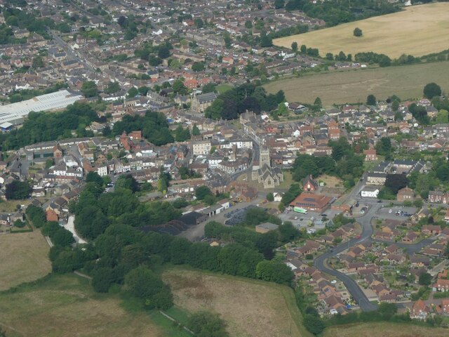
Alford is a civil parish and market town located in the East Lindsey district of Lincolnshire, England. Situated on the eastern edge of the Lincolnshire Wolds, it is approximately 12 miles north-west of Skegness and 24 miles south-east of Grimsby. The town has a population of around 3,500 people.

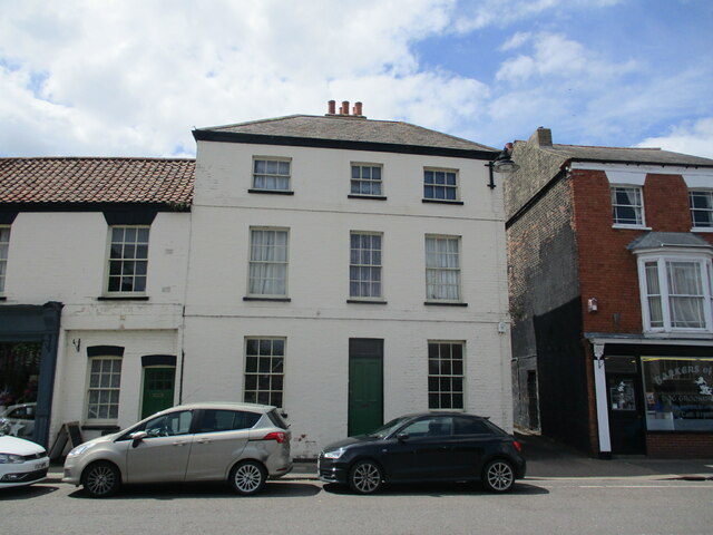
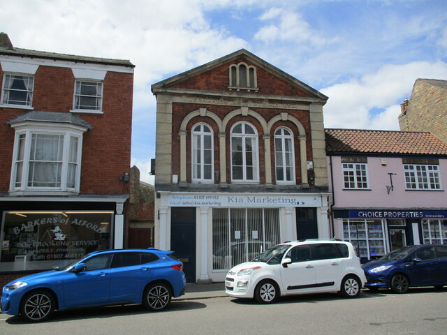
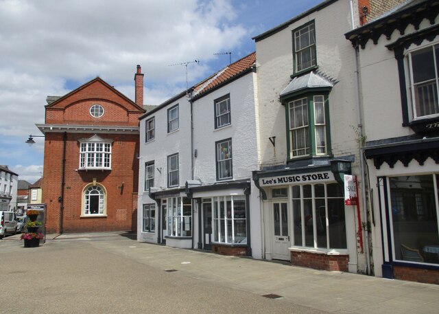
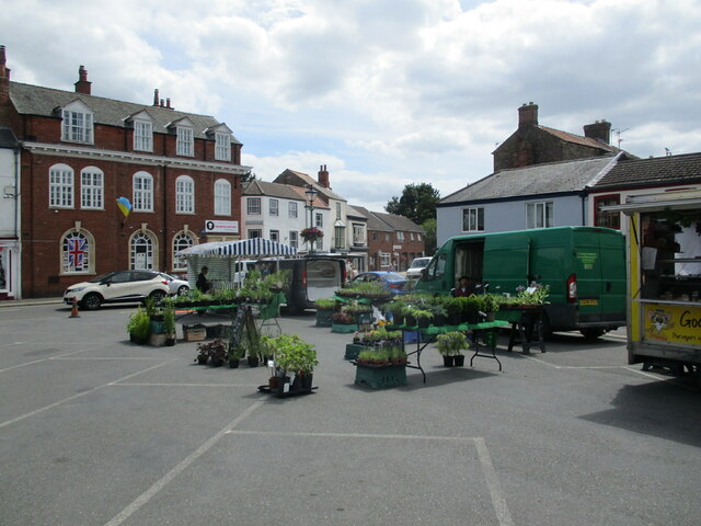
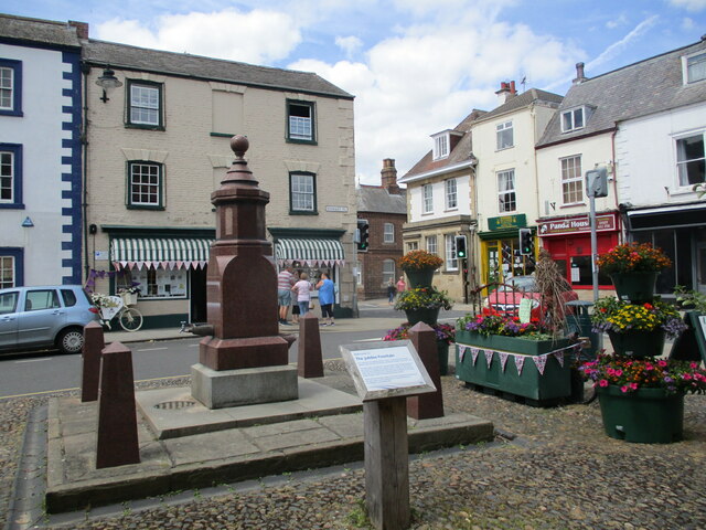
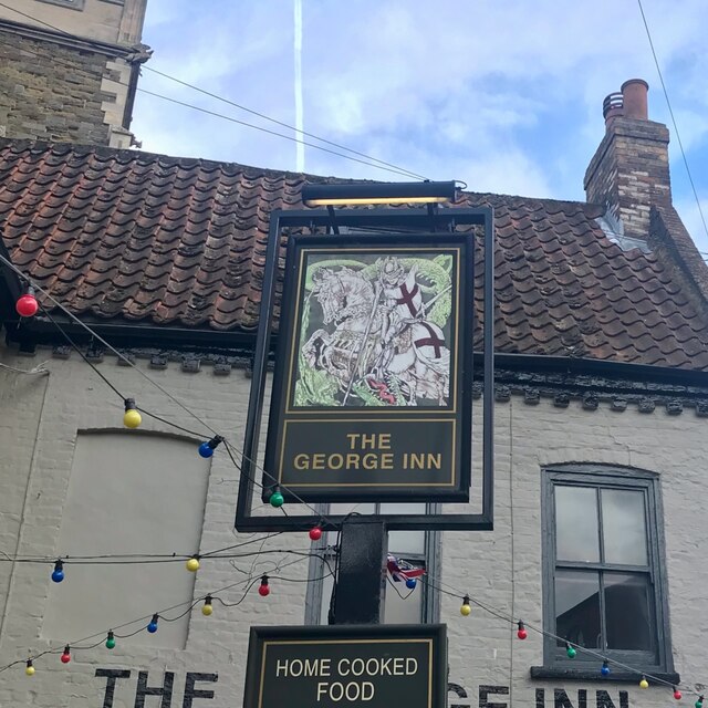
Alford is known for its picturesque and historic market square, which is lined with charming Georgian houses and a market cross dating back to the 14th century. The town's market, held every Tuesday, has been a tradition since medieval times and continues to attract both locals and tourists.

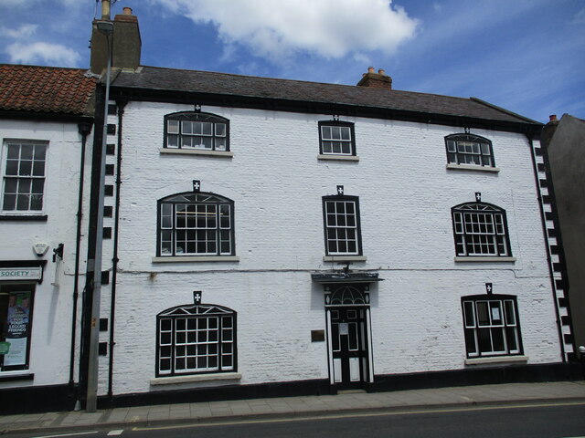
The area is also home to the Alford Manor House, a Grade II* listed building that dates back to the 17th century. It houses a museum showcasing the local history of Alford and its surrounding areas.

Alford is surrounded by beautiful countryside, making it an ideal base for outdoor enthusiasts. The nearby Lincolnshire Wolds offers scenic walking and cycling routes, while the coastal resorts of Skegness and Mablethorpe are just a short drive away, providing access to sandy beaches and seaside attractions.

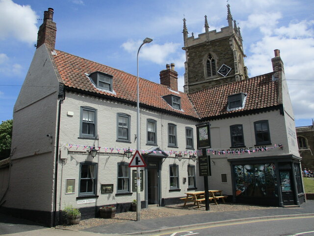
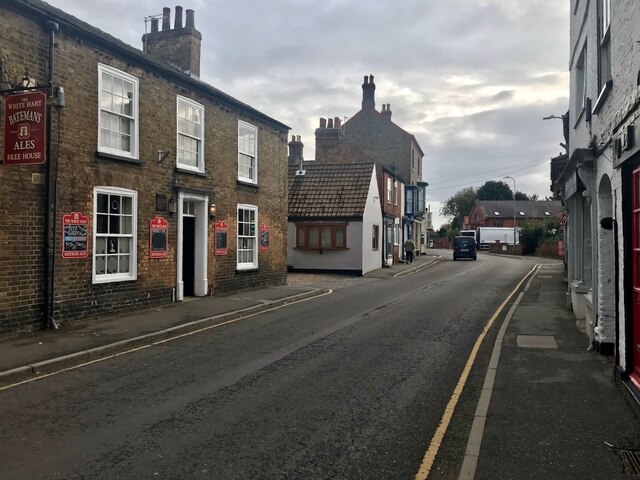
The town has a range of amenities including shops, pubs, restaurants, and schools, catering to the needs of its residents. Alford also hosts various events throughout the year, such as the popular Alford Craft Market, which showcases local arts and crafts.

Overall, Alford is a charming market town with a rich history, picturesque surroundings, and a close-knit community.

If you have any feedback on the listing, please let us know in the comments section below.

Alford Images

Images are sourced within 2km of 53.260756/0.174005 or Grid Reference TF4575. Thanks to Geograph Open Source API. All images are credited.

Cut Mark: Bilsby, Holy Trinity Church Cut bench mark on the outward face of the buttress at the north-east angle of the church.  See <span class="nowrap"><a title="https://www.bench-marks.org.uk/bm83274" rel="nofollow ugc noopener" href="https://www.bench-marks.org.uk/bm83274">Link</a><img style="margin-left:2px;" alt="External link" title="External link - shift click to open in new window" src="https://s1.geograph.org.uk/img/external.png" width="10" height="10"/></span> for details of the mark.
Cut Mark: Bilsby, Holy Trinity Church
Cut bench mark on the outward face of the buttress at the north-east angle of the church. See LinkExternal link for details of the mark.
Direction Sign – Signpost at Bilsby Field, Alford Located at Bilsby Field on the southwest side of the t junction of Farlesthorpe Road and Back Lane in Alford parish. 3 arms and no finial. See also <a title="https://www.geograph.org.uk/photo/6279810" href="https://www.geograph.org.uk/photo/6279810">Link</a>.

Milestone Society National ID: LI_TF4675
Direction Sign – Signpost at Bilsby Field, Alford
Located at Bilsby Field on the southwest side of the t junction of Farlesthorpe Road and Back Lane in Alford parish. 3 arms and no finial. See also Link. Milestone Society National ID: LI_TF4675
Cropmarks in a field at Ailby: aerial 2021
Overgrown farm track near Well Turn
St. Wilfrid's church hall, Alford
Former chapel, Alford
Wheat field near Alford
Barley field near Sleights Holt
12 South Market Place, Alford Late eighteenth century house <span class="nowrap"><a title="https://historicengland.org.uk/listing/the-list/list-entry/1308717?section=official-list-entry" rel="nofollow ugc noopener" href="https://historicengland.org.uk/listing/the-list/list-entry/1308717?section=official-list-entry">Link</a><img style="margin-left:2px;" alt="External link" title="External link - shift click to open in new window" src="https://s1.geograph.org.uk/img/external.png" width="10" height="10"/></span>
12 South Market Place, Alford
Late eighteenth century house LinkExternal link
Former Mechanics Institute, Alford Dated 1854.
Former Mechanics Institute, Alford
Dated 1854.
South Market Place, Alford. East side
Market in Alford
Market in Alford
Drinking fountain, Market Place, Alford Commemorates Queen Victoria's Diamond Jubilee 1897 <span class="nowrap"><a title="https://historicengland.org.uk/listing/the-list/list-entry/1147007?section=official-list-entry" rel="nofollow ugc noopener" href="https://historicengland.org.uk/listing/the-list/list-entry/1147007?section=official-list-entry">Link</a><img style="margin-left:2px;" alt="External link" title="External link - shift click to open in new window" src="https://s1.geograph.org.uk/img/external.png" width="10" height="10"/></span>
Drinking fountain, Market Place, Alford
Commemorates Queen Victoria's Diamond Jubilee 1897 LinkExternal link
6 High Street, Alford Late eighteenth century house <span class="nowrap"><a title="https://historicengland.org.uk/listing/the-list/list-entry/1063033?section=official-list-entry" rel="nofollow ugc noopener" href="https://historicengland.org.uk/listing/the-list/list-entry/1063033?section=official-list-entry">Link</a><img style="margin-left:2px;" alt="External link" title="External link - shift click to open in new window" src="https://s1.geograph.org.uk/img/external.png" width="10" height="10"/></span>
6 High Street, Alford
Late eighteenth century house LinkExternal link
The George Hotel, Alford Dates from the early eighteenth century <span class="nowrap"><a title="https://historicengland.org.uk/listing/the-list/list-entry/1146974?section=official-list-entry" rel="nofollow ugc noopener" href="https://historicengland.org.uk/listing/the-list/list-entry/1146974?section=official-list-entry">Link</a><img style="margin-left:2px;" alt="External link" title="External link - shift click to open in new window" src="https://s1.geograph.org.uk/img/external.png" width="10" height="10"/></span>
The George Hotel, Alford
Dates from the early eighteenth century LinkExternal link
Alford: aerial 2022
Alford: aerial 2022
The sign of The George Inn See <a href="https://www.geograph.org.uk/photo/7213327">TF4576 : The George Hotel, Alford</a>
The sign of The George Inn
South Street, Alford With The White Hart on the left.
South Street, Alford
With The White Hart on the left.
Show me another place!

Alford is located at Grid Ref: TF4575 (Lat: 53.260756, Lng: 0.174005)

Administrative County: Lincolnshire

District: East Lindsey

Police Authority: Lincolnshire

What 3 Words

///mixes.muffin.edge. Near Alford, Lincolnshire

Nearby Locations

Alford

Related Wikis

Alford Manor House

The Manor House is a Grade II* listed building which can be found on West street within Alford, Lincolnshire, England. It is believed to be the largest...

Queen Elizabeth's Grammar School, Alford

Queen Elizabeth's Grammar School, Alford (QEGS) is a selective, co-educational, academy status Grammar School and Sixth Form in Alford, Lincolnshire, England...

Corn Exchange, Alford

The Corn Exchange is a commercial building in the Market Place in Alford, Lincolnshire, England. The structure, which is currently used as a community...

Alford, Lincolnshire

Alford (pronounced OL-fərd) is a town in the East Lindsey district of Lincolnshire, England, at the foot of the Lincolnshire Wolds, which form an Area...

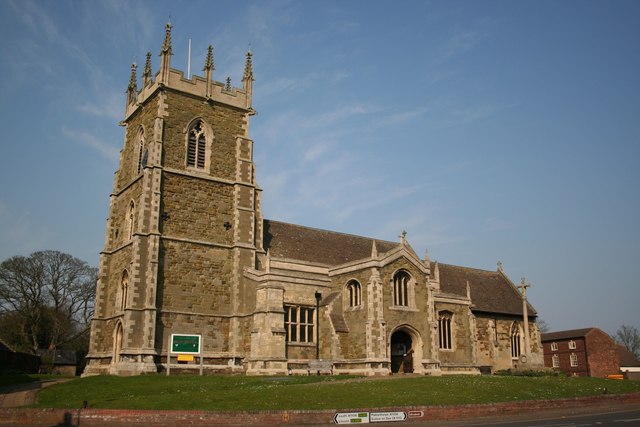
St Wilfrid's Church, Alford

St Wilfrid's, Alford is the Church of England parish church in Alford, Lincolnshire, England. It is a Grade I listed building. == Background == The church...

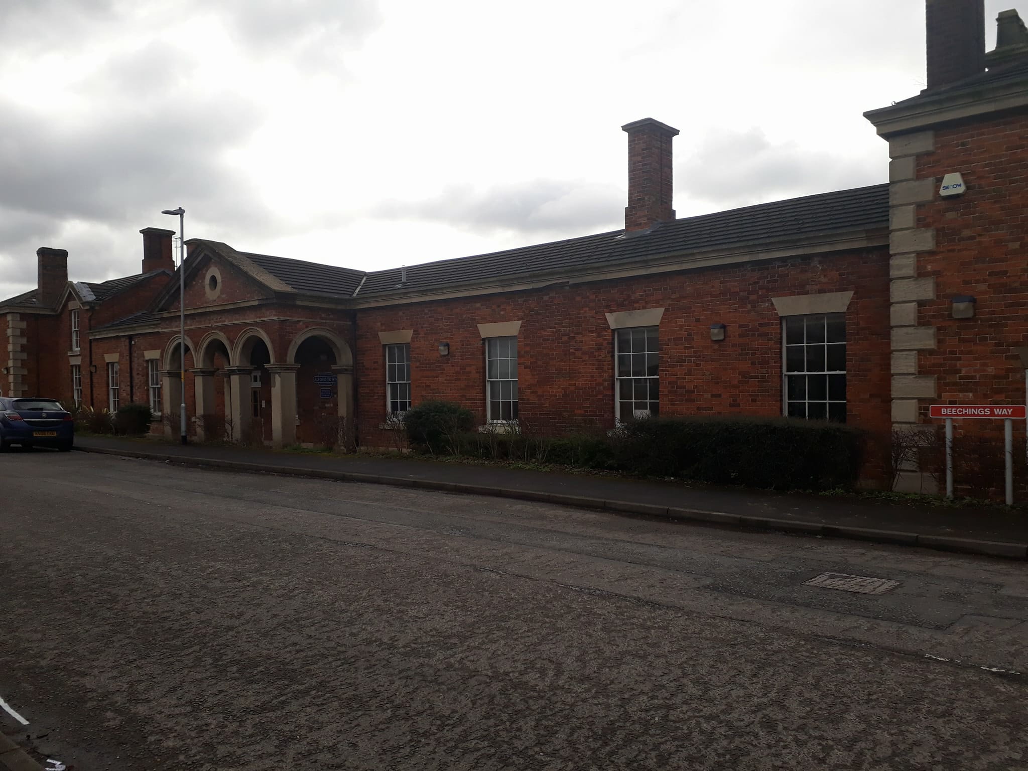
Alford Town railway station

Alford Town was a railway station on the East Lincolnshire Railway which served the town of Alford in Lincolnshire between 1848 and 1970. It originally...

John Spendluffe Technology College

John Spendluffe Technology College is a secondary school with academy status situated on Hanby Lane in the rural market town of Alford, Lincolnshire, England...

Alford Windmill

Alford Windmill is a five-sailed windmill in Alford, Lincolnshire and the only surviving windmill out of four. Though the windmill has been restored to...

Nearby Amenities

Located within 500m of 53.260756,0.174005
Alford
Is In: Lincolnshire, England, UK
Place: town
Source: Bing
Wikidata: Q1876378
Wikipedia: en:Alford, Lincolnshire
Lat/Long: 53.2591409/0.1777346
Crossing
Crossing: traffic_signals
Crossing Ref: pelican
Lat/Long: 53.2615597/0.1791974
Bus Stop
South Street
Naptan AtcoCode: 270000009797
Naptan Bearing: SE
Naptan BusStopType: CUS
Naptan CommonName: South Street
Naptan Indicator: adj
Naptan Landmark: South Street
Naptan NaptanCode: linjdwmw
Naptan Street: Hamilton Road
Naptan Verified: no
Source: naptan_import
Lat/Long: 53.2572795/0.1783105
Bus Stop
South Street
Naptan AtcoCode: 270000009798
Naptan Bearing: NW
Naptan BusStopType: CUS
Naptan CommonName: South Street
Naptan Indicator: opp
Naptan Landmark: South Street
Naptan NaptanCode: linjdwpa
Naptan Street: Hamilton Road
Naptan Verified: no
Source: naptan_import
Lat/Long: 53.257209/0.178232
Bus Stop
1 Hamilton Road
Naptan AtcoCode: 270000009799
Naptan Bearing: NW
Naptan BusStopType: CUS
Naptan CommonName: 1 Hamilton Road
Naptan Indicator: opp
Naptan Landmark: 1 Hamilton Road
Naptan NaptanCode: linjdwpd
Naptan Street: Hamilton Road
Naptan Verified: no
Source: naptan_import
Lat/Long: 53.2595677/0.1741236
Bus Stop
1 Hamilton Road
Naptan AtcoCode: 270000009800
Naptan Bearing: SE
Naptan BusStopType: CUS
Naptan CommonName: 1 Hamilton Road
Naptan Indicator: o/s
Naptan Landmark: Number 1
Naptan NaptanCode: linjdwpg
Naptan Street: Hamilton Road
Naptan Verified: no
Source: naptan_import
Lat/Long: 53.2595726/0.1743487
Bus Stop
Parsons Lane
Naptan AtcoCode: 270000009801
Naptan Bearing: SW
Naptan BusStopType: CUS
Naptan CommonName: Parsons Lane
Naptan Indicator: SW - bound
Naptan Landmark: Parsons Lane
Naptan NaptanCode: linjdwpj
Naptan Street: Chauntry Road
Naptan Verified: no
Source: naptan_import
Lat/Long: 53.2583017/0.1745241
Bus Stop
Marbury Close
Naptan AtcoCode: 270000009802
Naptan Bearing: NW
Naptan BusStopType: CUS
Naptan CommonName: Marbury Close
Naptan Indicator: opp
Naptan Landmark: Marbury Close
Naptan NaptanCode: linjdwpm
Naptan Street: Parsons Lane
Naptan Verified: no
Source: naptan_import
Lat/Long: 53.2569542/0.1764348
Bus Stop
Marbury Close
Naptan AtcoCode: 270000009803
Naptan Bearing: SE
Naptan BusStopType: CUS
Naptan CommonName: Marbury Close
Naptan Indicator: adj
Naptan Landmark: Marbury Close
Naptan NaptanCode: linjdwpt
Naptan Street: Parsons Lane
Naptan Verified: no
Source: naptan_import
Lat/Long: 53.2570532/0.1764249
Bus Stop
Chauntry Road
Naptan AtcoCode: 270000009809
Naptan Bearing: SW
Naptan BusStopType: CUS
Naptan CommonName: Chauntry Road
Naptan Indicator: opp
Naptan Landmark: Number 40
Naptan NaptanCode: linjdwtm
Naptan Street: Chauntry Road
Naptan Verified: no
Source: naptan_import
Lat/Long: 53.2568953/0.1737481
Bus Stop
Chauntry Road
Naptan AtcoCode: 270000009810
Naptan Bearing: NE
Naptan BusStopType: CUS
Naptan CommonName: Chauntry Road
Naptan Indicator: o/s
Naptan Landmark: Number 40
Naptan NaptanCode: linjdwtp
Naptan Street: Chauntry Road
Naptan Verified: no
Source: naptan_import
Lat/Long: 53.2568893/0.1735829
Bus Stop
West Street
Naptan AtcoCode: 270000009811
Naptan Bearing: NW
Naptan BusStopType: CUS
Naptan CommonName: West Street
Naptan Indicator: NW - bound
Naptan Landmark: West Street
Naptan NaptanCode: linjdwtw
Naptan Street: Bourne Road
Naptan Verified: no
Source: naptan_import
Lat/Long: 53.2592094/0.1720812
Bus Stop
West Street
Naptan AtcoCode: 270000009812
Naptan Bearing: SE
Naptan BusStopType: CUS
Naptan CommonName: West Street
Naptan Indicator: SE - bound
Naptan Landmark: West Street
Naptan NaptanCode: linjgada
Naptan Street: Bourne Road
Naptan Verified: no
Source: naptan_import
Lat/Long: 53.2592153/0.1722465
Bus Stop
Christopher Road
Naptan AtcoCode: 270000009813
Naptan Bearing: NW
Naptan BusStopType: CUS
Naptan CommonName: Christopher Road
Naptan Indicator: NW - bound
Naptan Landmark: Christopher Road
Naptan NaptanCode: linjgadg
Naptan Street: Dashwood Road
Naptan Verified: no
Source: naptan_import
Lat/Long: 53.2602108/0.1723869
Bus Stop
Christopher Road
Naptan AtcoCode: 270000009814
Naptan Bearing: SE
Naptan BusStopType: CUS
Naptan CommonName: Christopher Road
Naptan Indicator: SE - bound
Naptan Landmark: Christopher Road
Naptan NaptanCode: linjgadj
Naptan Street: Dashwood Road
Naptan Verified: no
Source: naptan_import
Lat/Long: 53.260309/0.1724219
Bus Stop
Hallam Close
Naptan AtcoCode: 270000009815
Naptan Bearing: SW
Naptan BusStopType: CUS
Naptan CommonName: Hallam Close
Naptan Indicator: opp
Naptan Landmark: Hallam Close
Naptan NaptanCode: linjgadm
Naptan Street: Robinson Avenue
Naptan Verified: no
Source: naptan_import
Lat/Long: 53.2606764/0.1690368
Bus Stop
Queen Elizabeth School
Naptan AtcoCode: 270000009817
Naptan Bearing: SW
Naptan BusStopType: CUS
Naptan CommonName: Queen Elizabeth School
Naptan Indicator: o/s
Naptan Landmark: Queen Elizabeth School
Naptan NaptanCode: linjgadt
Naptan Street: Station Road
Naptan Verified: no
Source: naptan_import
Lat/Long: 53.2589411/0.1705233
Bus Stop
Queen Elizabeth School
Naptan AtcoCode: 270000009818
Naptan Bearing: NE
Naptan BusStopType: CUS
Naptan CommonName: Queen Elizabeth School
Naptan Indicator: opp
Naptan Landmark: Queen Elizabeth School
Naptan NaptanCode: linjgadw
Naptan Street: Station Road
Naptan Verified: no
Source: naptan_import
Lat/Long: 53.2590581/0.1705142
Bus Stop
Methodist Church
Naptan AtcoCode: 270000009819
Naptan Bearing: SW
Naptan BusStopType: CUS
Naptan CommonName: Methodist Church
Naptan Indicator: opp
Naptan Landmark: Methodist Church
Naptan NaptanCode: linjgaga
Naptan Street: West Street
Naptan Verified: no
Source: naptan_import
Lat/Long: 53.2609532/0.1775226
Bus Stop
Parsons Lane
Naptan AtcoCode: 270002700186
Naptan Bearing: NE
Naptan BusStopType: CUS
Naptan CommonName: Parsons Lane
Naptan Indicator: NE - bound
Naptan Landmark: Parsons Lane
Naptan NaptanCode: linagtga
Naptan Street: Chauntry Road
Naptan Verified: no
Source: naptan_import
Lat/Long: 53.2582873/0.1743285
Bus Stop
Coles Avenue
Naptan AtcoCode: 270002700427
Naptan Bearing: NW
Naptan BusStopType: CUS
Naptan CommonName: Coles Avenue
Naptan Indicator: NW - bound
Naptan Landmark: Coles Avenue
Naptan NaptanCode: linagpjg
Naptan Street: Tothby Lane
Naptan Verified: no
Source: naptan_import
Lat/Long: 53.2600318/0.1703686
Bus Stop
Library
Naptan AtcoCode: 270002700461
Naptan Bearing: N
Naptan BusStopType: CUS
Naptan CommonName: Library
Naptan Indicator: opp
Naptan Landmark: Library
Naptan NaptanCode: linagpwt
Naptan Street: South Market Place
Naptan Verified: no
Source: naptan_import
Lat/Long: 53.2606211/0.1802159
Bus Stop
Coles Avenue
Naptan AtcoCode: 2700LACA5841
Naptan Bearing: SE
Naptan BusStopType: CUS
Naptan CommonName: Coles Avenue
Naptan Indicator: SE - bound
Naptan Landmark: Coles Avenue
Naptan NaptanCode: lindwpgm
Naptan Street: Tothby Lane
Naptan Verified: no
Source: naptan_import
Lat/Long: 53.2597819/0.1707608
Bus Stop
Evison Crescent
Naptan AtcoCode: 2700LADD5842
Naptan Bearing: NE
Naptan BusStopType: CUS
Naptan CommonName: Evison Crescent
Naptan Indicator: adj
Naptan Landmark: Evison Crescent
Naptan NaptanCode: lindwpgp
Naptan Street: Dixon Drive
Naptan Verified: no
Source: naptan_import
Lat/Long: 53.261754/0.1681167
Bus Stop
Methodist Church
Naptan AtcoCode: 2700LAMC1943
Naptan Bearing: NE
Naptan BusStopType: CUS
Naptan CommonName: Methodist Church
Naptan Indicator: o/s
Naptan Landmark: Methodist Church
Naptan NaptanCode: linamwtd
Naptan Street: West Street
Naptan Verified: no
Source: naptan_import
Lat/Long: 53.2610882/0.1775145
Bus Stop
Library
Naptan AtcoCode: 2700LAMP0024
Naptan Bearing: S
Naptan CommonName: Library
Naptan Indicator: o/s
Naptan Landmark: Library
Naptan NaptanCode: linadadp
Naptan Street: South Market Place
Naptan Verified: no
Source: naptan_import
Lat/Long: 53.2605867/0.1802375
Post Office
Alford Post Office
Addr City: Alford
Addr Country: GB
Addr Housenumber: 6
Addr Postcode: LN13 9DG
Addr Street: West Street
Branch: Alford
Brand: Post Office
Brand Wikidata: Q1783168
Check Date: 2020-02-20
Contact Website: https://www.postoffice.co.uk/branch-finder/5313112/alford
Opening Hours: Mo-Fr 08:00-18:00; Sa 08:00-14:00; Su 09:00-14:00
Ref Pol Id: 131008
Lat/Long: 53.2613623/0.1785928
Turning Circle
Lat/Long: 53.2610713/0.1685769
Turning Circle
Lat/Long: 53.2608251/0.1675201
Turning Circle
Lat/Long: 53.2621784/0.1677575
Spar Alford
Addr City: Alford
Addr Country: GB
Addr Housenumber: 6
Addr Postcode: LN13 9DG
Addr Street: West Street
Brand: Spar
Brand Wikidata: Q610492
Fhrs Authority: East Lindsey
Fhrs Id: 1225782
Fhrs Local Authority Id: EHFDI/06371/19
Shop: convenience
Lat/Long: 53.2613823/0.17852
McColl's
Brand: McColl's
Brand Wikidata: Q16997477
Brand Wikipedia: en:McColl's
Contact Website: https://www.mccolls.co.uk/storelocator/alford-south-market-place/
Shop: convenience
Lat/Long: 53.2614047/0.1792281
Barrier: yes
Fixme: clarify please type of this barrier
Motor Vehicle: no
Lat/Long: 53.259566/0.1777076
Barrier: cattle_grid
Lat/Long: 53.2629564/0.1681605
Barrier: stile
Lat/Long: 53.263907/0.1689648
Barrier: yes
Lat/Long: 53.2590177/0.1767188
Generator Method: photovoltaic
Generator Output Electricity: yes
Generator Source: solar
Generator Type: solar_photovoltaic_panel
Location: roof
Power: generator
Lat/Long: 53.2628573/0.1780389
Generator Method: photovoltaic
Generator Output Electricity: yes
Generator Source: solar
Generator Type: solar_photovoltaic_panel
Location: roof
Power: generator
Lat/Long: 53.2622605/0.1775132
Generator Method: photovoltaic
Generator Output Electricity: yes
Generator Source: solar
Generator Type: solar_photovoltaic_panel
Location: roof
Power: generator
Lat/Long: 53.2617921/0.171493
Generator Method: photovoltaic
Generator Output Electricity: yes
Generator Source: solar
Generator Type: solar_photovoltaic_panel
Location: roof
Power: generator
Lat/Long: 53.2619301/0.168454
Generator Method: photovoltaic
Generator Output Electricity: yes
Generator Source: solar
Generator Type: solar_photovoltaic_panel
Location: roof
Power: generator
Lat/Long: 53.2624034/0.1684916
Generator Method: photovoltaic
Generator Output Electricity: yes
Generator Source: solar
Generator Type: solar_photovoltaic_panel
Location: roof
Power: generator
Lat/Long: 53.2623842/0.1679981
Generator Method: photovoltaic
Generator Output Electricity: yes
Generator Source: solar
Generator Type: solar_photovoltaic_panel
Location: roof
Power: generator
Lat/Long: 53.2626072/0.1680088
Generator Method: photovoltaic
Generator Output Electricity: yes
Generator Source: solar
Generator Type: solar_photovoltaic_panel
Location: roof
Power: generator
Lat/Long: 53.2611135/0.1670352
Generator Method: photovoltaic
Generator Output Electricity: yes
Generator Source: solar
Generator Type: solar_photovoltaic_panel
Location: roof
Power: generator
Lat/Long: 53.2608873/0.1665953
Generator Method: photovoltaic
Generator Output Electricity: yes
Generator Source: solar
Generator Type: solar_photovoltaic_panel
Location: roof
Power: generator
Lat/Long: 53.2612049/0.1674911
Generator Method: photovoltaic
Generator Output Electricity: yes
Generator Source: solar
Generator Type: solar_photovoltaic_panel
Location: roof
Power: generator
Lat/Long: 53.2610429/0.167754
Generator Method: photovoltaic
Generator Output Electricity: yes
Generator Source: solar
Generator Type: solar_photovoltaic_panel
Location: roof
Power: generator
Lat/Long: 53.2610878/0.1676762
Generator Method: photovoltaic
Generator Output Electricity: yes
Generator Source: solar
Generator Type: solar_photovoltaic_panel
Location: roof
Power: generator
Lat/Long: 53.2603594/0.1693472
Generator Method: photovoltaic
Generator Output Electricity: yes
Generator Source: solar
Generator Type: solar_photovoltaic_panel
Location: roof
Power: generator
Lat/Long: 53.2602792/0.1700258
Generator Method: photovoltaic
Generator Output Electricity: yes
Generator Source: solar
Generator Type: solar_photovoltaic_panel
Location: roof
Power: generator
Lat/Long: 53.259992/0.169602
Generator Method: photovoltaic
Generator Output Electricity: yes
Generator Source: solar
Generator Type: solar_photovoltaic_panel
Location: roof
Power: generator
Lat/Long: 53.2598941/0.1674911
Generator Method: photovoltaic
Generator Output Electricity: yes
Generator Source: solar
Generator Type: solar_photovoltaic_panel
Location: roof
Power: generator
Lat/Long: 53.2587662/0.168446
Generator Method: photovoltaic
Generator Output Electricity: yes
Generator Source: solar
Generator Type: solar_photovoltaic_panel
Location: roof
Power: generator
Lat/Long: 53.2589025/0.1693633
Generator Method: photovoltaic
Generator Output Electricity: yes
Generator Source: solar
Generator Type: solar_photovoltaic_panel
Location: roof
Power: generator
Lat/Long: 53.2593935/0.1697549
Generator Method: photovoltaic
Generator Output Electricity: yes
Generator Source: solar
Generator Type: solar_photovoltaic_panel
Location: roof
Power: generator
Lat/Long: 53.2611103/0.1752722
Generator Method: photovoltaic
Generator Output Electricity: yes
Generator Source: solar
Generator Type: solar_photovoltaic_panel
Location: roof
Power: generator
Lat/Long: 53.2587646/0.1724344
Generator Method: photovoltaic
Generator Output Electricity: yes
Generator Source: solar
Generator Type: solar_photovoltaic_panel
Location: roof
Power: generator
Lat/Long: 53.2585913/0.1730594
Generator Method: photovoltaic
Generator Output Electricity: yes
Generator Source: solar
Generator Type: solar_photovoltaic_panel
Location: roof
Power: generator
Lat/Long: 53.2576173/0.1741376
Generator Method: photovoltaic
Generator Output Electricity: yes
Generator Source: solar
Generator Type: solar_photovoltaic_panel
Location: roof
Power: generator
Lat/Long: 53.2564651/0.1759471
Generator Method: photovoltaic
Generator Output Electricity: yes
Generator Source: solar
Generator Type: solar_photovoltaic_panel
Location: roof
Power: generator
Lat/Long: 53.2573315/0.1753624
Generator Method: photovoltaic
Generator Output Electricity: yes
Generator Source: solar
Generator Type: solar_photovoltaic_panel
Location: roof
Power: generator
Lat/Long: 53.258413/0.176159
Generator Method: photovoltaic
Generator Output Electricity: yes
Generator Source: solar
Generator Type: solar_photovoltaic_panel
Location: roof
Power: generator
Lat/Long: 53.2603544/0.177889
Generator Method: photovoltaic
Generator Output Electricity: yes
Generator Source: solar
Generator Type: solar_photovoltaic_panel
Location: roof
Power: generator
Lat/Long: 53.2591976/0.1797719
Generator Method: photovoltaic
Generator Output Electricity: yes
Generator Source: solar
Generator Type: solar_photovoltaic_panel
Location: roof
Power: generator
Lat/Long: 53.2589328/0.179906
Generator Method: photovoltaic
Generator Output Electricity: yes
Generator Source: solar
Generator Type: solar_photovoltaic_panel
Location: roof
Power: generator
Lat/Long: 53.2573893/0.1788144
Bench
Lat/Long: 53.2612427/0.1795384
Leisure: playground
Lat/Long: 53.2576455/0.1788102
Bench
Lat/Long: 53.261209/0.179474
Post Box
Post Box Type: pillar
Ref: LN13 970
Royal Cypher: GVIR
Royal Cypher Wikidata: Q33102169
Lat/Long: 53.2612106/0.1777318
Entrance: yes
Lat/Long: 53.2571703/0.1782157
Defibrillator
Emergency: defibrillator
Indoor: no
Location: outside Callaby Stores, 72 Hamilton Road, Alford, Lincolnshire, LN13 9AX - to the right of the entrance
Lat/Long: 53.2571901/0.1781861
Atm
Lat/Long: 53.2571816/0.1781988
Bench
Lat/Long: 53.2612387/0.1794928
Bench
Lat/Long: 53.2608512/0.1769781
Historic: stocks
Lat/Long: 53.261197/0.1795303
Information: map
Tourism: information
Lat/Long: 53.261217/0.1795625
Defibrillator
Emergency: defibrillator
Indoor: no
Location: outside Alford Manor House, West Street, Alford, LN13 9HT - where the fence meets the wall on the corner of Park Lane
Ref GB The Circuit: 83F21EE4-39B4-4F98-A0B7-AF0A00C76590
Lat/Long: 53.2614119/0.1781971
Historic: memorial
Lat/Long: 53.2614722/0.1794485
Historic: memorial
Lat/Long: 53.2614938/0.1807266
Entrance: yes
Lat/Long: 53.259244/0.1707414
Bench
Lat/Long: 53.2591963/0.1709732
Defibrillator
Emergency: defibrillator
Indoor: no
Location: outside Alford Police Station, Station Road, Alford LN13 9JB - to left of entrance
Lat/Long: 53.2592383/0.1707242
Bench
Backrest: yes
Material: wood
Lat/Long: 53.2615392/0.1805759
Fen Bank Grethound Sanctuary
Shop: charity
Lat/Long: 53.2611516/0.1802109
Glamourpuss
Shop: cosmetics
Lat/Long: 53.2610697/0.1802029
Bank
Lloyds Bank
Atm: yes
Brand: Lloyds Bank
Brand Wikidata: Q1152847
Brand Wikipedia: en:Lloyds Bank
Lat/Long: 53.2612366/0.1793204
Alford Opticians
Shop: optician
Lat/Long: 53.2608339/0.1803088
Top Toes
Shop: beauty
Lat/Long: 53.2607898/0.180337
Jaytons Cakes
Shop: pastry
Lat/Long: 53.2607553/0.1803772
The Alford Deli
Addr City: Alford
Addr Country: GB
Addr Housenumber: 4
Addr Postcode: LN13 9AF
Addr Street: South Market Place
Fhrs Authority: East Lindsey
Fhrs Id: 157497
Fhrs Local Authority Id: EHFDI/21726/09
Shop: deli
Lat/Long: 53.2607063/0.1803893
Library
Alford Library
Lat/Long: 53.2605916/0.1804523
Toilets
Lat/Long: 53.2606012/0.180738
Haircraft
Shop: hairdresser
Lat/Long: 53.2601985/0.1805341
J B Flower Designs
Shop: florist
Lat/Long: 53.2602731/0.1802632
Barkers of Alford
Shop: pet_grooming
Lat/Long: 53.2604063/0.1801023
Wilkin Chapman
Office: lawyer
Lat/Long: 53.2604705/0.1800232
Choice Properties
Office: estate_agent
Lat/Long: 53.2605234/0.179987
Fast Food
Golden Delight
Addr City: Alford
Addr Country: GB
Addr Housenumber: 24
Addr Postcode: LN13 9AE
Addr Street: South Market Place
Fhrs Authority: East Lindsey
Fhrs Id: 156867
Fhrs Local Authority Id: EHFDI/06666/08
Lat/Long: 53.2605716/0.1799601
NFU Mutual
Office: insurance
Lat/Long: 53.2606293/0.179944
Bon Bon
Shop: confectionery
Lat/Long: 53.260744/0.1799333
Shop: antiques
Lat/Long: 53.260797/0.179944
Revival
Shop: clothes
Lat/Long: 53.2608764/0.1799534
Handyman
Shop: doityourself
Lat/Long: 53.2608932/0.1797818
Alford Kitchen & Housewares
Shop: houseware
Lat/Long: 53.2609029/0.1796423
East Lindsey District Council
Government: administrative
Office: government
Lat/Long: 53.2609558/0.1794773
Angelenes Patisserie
Addr City: Alford
Addr Country: GB
Addr Housenumber: 9a
Addr Postcode: LN13 9EB
Addr Street: Market Place
Fhrs Authority: East Lindsey
Fhrs Id: 156034
Fhrs Local Authority Id: EHFDI/01679/08
Shop: pastry
Lat/Long: 53.2609743/0.1793003
Windmill Hotel & Nayeemas
Addr City: Alford
Addr Country: GB
Addr Housenumber: 10
Addr Postcode: LN13 9EB
Addr Street: Market Place
Fhrs Authority: East Lindsey
Fhrs Id: 743703
Fhrs Local Authority Id: EHFDI/01082/15
Tourism: hotel
Lat/Long: 53.2611427/0.1793553
Alford Craft Market Centre
Shop: stationery
Lat/Long: 53.2615206/0.1792359
Cooplands
Addr City: Alford
Addr Country: GB
Addr Housenumber: 15
Addr Postcode: LN13 9EB
Addr Street: Market Place
Brand: Cooplands
Brand Wikidata: Q5167971
Brand Wikipedia: en:Cooplands
Fhrs Authority: East Lindsey
Fhrs Id: 569268
Fhrs Local Authority Id: EHFDI/11285/13
Shop: bakery
Lat/Long: 53.2615005/0.1796034
Upper Cuts
Shop: hairdresser
Lat/Long: 53.2614379/0.1795779
Cafe
Cafe On The Cobbles
Addr City: Alford
Addr Country: GB
Addr Housenumber: 17
Addr Postcode: LN13 9EB
Addr Street: Market Place
Fhrs Authority: East Lindsey
Fhrs Id: 155763
Fhrs Local Authority Id: EHFDI/00787/08
Lat/Long: 53.2614042/0.1795739
House of Cards
Shop: party
Lat/Long: 53.2613665/0.1795699
Studio 13
Shop: tattoo
Lat/Long: 53.2612879/0.1796155
Snips
Shop: hairdresser
Lat/Long: 53.2612566/0.1796705
Veterinary
Alder Vale Vets
Lat/Long: 53.2612197/0.1798461
Lee's Music Store
Shop: music
Lat/Long: 53.2612077/0.1799105
All Things Sweet
Addr City: Alford
Addr Country: GB
Addr Housenumber: 25
Addr Postcode: LN13 9EB
Addr Street: Market Place
Fhrs Authority: East Lindsey
Fhrs Id: 1135067
Fhrs Local Authority Id: EHFDI/02247/19
Shop: confectionery
Lat/Long: 53.2612093/0.1799749
Fast Food
The Jolly Friar
Addr City: Alford
Addr Country: GB
Addr Housenumber: 1
Addr Postcode: LN13 9EF
Addr Street: Church Street
Fhrs Authority: East Lindsey
Fhrs Id: 155757
Fhrs Local Authority Id: EHFDI/00763/08
Lat/Long: 53.2612879/0.1800849
Clinic
Alford Foot Clinic
Lat/Long: 53.2613673/0.180231
Pub
The George Inn
Addr City: Alford
Addr Country: GB
Addr Housenumber: 13
Addr Postcode: LN13 9DS
Addr Street: High Street
Fhrs Authority: East Lindsey
Fhrs Id: 155760
Fhrs Local Authority Id: EHFDI/00778/08
Lat/Long: 53.2616401/0.1801506
St Barnabas
Shop: charity
Lat/Long: 53.2616257/0.1799467
F P & L A Saywell
Addr City: Alford
Addr Country: GB
Addr Housenumber: 11
Addr Postcode: LN13 9DS
Addr Street: High Street
Fhrs Authority: East Lindsey
Fhrs Id: 155861
Fhrs Local Authority Id: EHFDI/01119/08
Shop: butcher
Lat/Long: 53.2616321/0.1798287
Bank
Yorkshire Building Society
Atm: yes
Brand: Yorkshire Building Society
Brand Wikidata: Q12073381
Brand Wikipedia: en:Yorkshire Building Society
Lat/Long: 53.2616433/0.1794961
Molly May
Shop: gift
Lat/Long: 53.2616417/0.1794156
Restaurant
Festivita
Lat/Long: 53.2616529/0.1793459
Fast Food
Langham Place
Addr City: Alford
Addr Country: GB
Addr Housenumber: 3
Addr Postcode: LN13 9DS
Addr Street: High Street
Fhrs Authority: East Lindsey
Fhrs Id: 1093106
Fhrs Local Authority Id: EHFDI/06823/18
Lat/Long: 53.2616513/0.1792601
Windmill Pet & Tackle
Shop: fishing
Lat/Long: 53.2616449/0.1791823
Alford Masonic Hall
Addr City: Alford
Addr Country: GB
Addr Postcode: LN13 9DP
Addr Street: Chapel Street
Club: freemasonry
Fhrs Authority: East Lindsey
Fhrs Id: 155756
Fhrs Local Authority Id: EHFDI/00760/08
Lat/Long: 53.2621182/0.1790696
Craft Martins
Shop: clothes
Lat/Long: 53.2616016/0.1788872
Restaurant
The Willow Restaurant
Addr City: Alford
Addr Country: GB
Addr Housenumber: 128-129
Addr Postcode: LN13 9DR
Addr Street: West Street
Fhrs Authority: East Lindsey
Fhrs Id: 188584
Fhrs Local Authority Id: EHFDI/05773/08
Lat/Long: 53.2615823/0.1787853
Fast Food
Mr Pizza
Addr City: Alford
Addr Country: GB
Addr Housenumber: 127
Addr Postcode: LN13 9DR
Addr Street: West Street
Fhrs Authority: East Lindsey
Fhrs Id: 205767
Fhrs Local Authority Id: EHFDI/02173/12
Lat/Long: 53.2615615/0.1786539
Cafe
Red Dog'S
Addr City: Alford
Addr Country: GB
Addr Housenumber: 126
Addr Postcode: LN13 9DR
Addr Street: West Street
Fhrs Authority: East Lindsey
Fhrs Id: 1288069
Fhrs Local Authority Id: EHFDI/06757/20
Lat/Long: 53.2615422/0.1785439
Willsons Chartered Surveyors
Office: estate_agent
Lat/Long: 53.2615021/0.1784044
Bar
Alford Conservative Club
Addr City: Alford
Addr Country: GB
Addr Postcode: LN13 9DN
Addr Street: Park Lane
Fhrs Authority: East Lindsey
Fhrs Id: 156778
Fhrs Local Authority Id: EHFDI/05726/08
Lat/Long: 53.2621744/0.1780209
Pharmacy
Lloyds Pharmacy
Addr City: Alford
Addr Country: GB
Addr Housenumber: 101
Addr Postcode: LN13 9DJ
Addr Street: West Street
Brand: Lloyds Pharmacy
Brand Wikidata: Q6662870
Brand Wikipedia: en:LloydsPharmacy
Fhrs Authority: East Lindsey
Fhrs Id: 205771
Fhrs Local Authority Id: EHFDI/20780/11
Healthcare: pharmacy
Lat/Long: 53.2603919/0.1757732
Social Facility
The Chimneys Residential Home
Addr City: Alford
Addr Country: GB
Addr Housenumber: 1
Addr Postcode: LN13 9HY
Addr Street: Station Road
Fhrs Authority: East Lindsey
Fhrs Id: 155867
Fhrs Local Authority Id: EHFDI/01137/08
Social Facility: nursing_home
Lat/Long: 53.2591259/0.1720369
P & N Pitcher
Addr City: Alford
Addr Country: GB
Addr Housenumber: 104
Addr Postcode: LN13 9HA
Addr Street: West Street
Fhrs Authority: East Lindsey
Fhrs Id: 480714
Fhrs Local Authority Id: EHFDI/03311/08
Shop: greengrocer
Lat/Long: 53.2601031/0.1750061
West End Stores
Addr City: Alford
Addr Country: GB
Addr Housenumber: 107
Addr Postcode: LN13 9HA
Addr Street: West Street
Fhrs Authority: East Lindsey
Fhrs Id: 510476
Fhrs Local Authority Id: EHFDI/00979/13
Shop: convenience
Lat/Long: 53.2602041/0.1752904
The Half Moon Hotel & Restaurant
Addr City: Alford
Addr Country: GB
Addr Housenumber: 25-28
Addr Postcode: LN13 9DG
Addr Street: West Street
Fhrs Authority: East Lindsey
Fhrs Id: 155768
Fhrs Local Authority Id: EHFDI/00800/08
Tourism: hotel
Lat/Long: 53.260655/0.1769426
Talking Hads
Shop: hairdresser
Lat/Long: 53.2608106/0.1772323
Fast Food
Pizza King
Addr City: Alford
Addr Country: GB
Addr Housenumber: 22
Addr Postcode: LN13 9DG
Addr Street: West Street
Brand: Pizza King
Cuisine: pizza
Fhrs Authority: East Lindsey
Fhrs Id: 155767
Fhrs Local Authority Id: EHFDI/00797/08
Takeaway: yes
Lat/Long: 53.2608331/0.1772967
James Cycles
Shop: bicycle
Lat/Long: 53.2608587/0.177345
R Arnold
Shop: funeral_directors
Lat/Long: 53.2609566/0.1775917
Shop: antiques
Lat/Long: 53.2610352/0.1777339
Town & Country Antiques
Shop: antiques
Lat/Long: 53.2613433/0.1783776
M L Flooring
Shop: carpet
Lat/Long: 53.2614604/0.1788497
Chilterns Dog Rescue
Shop: charity
Lat/Long: 53.2614781/0.1789275
Hunt's Travel
Shop: travel_agency
Lat/Long: 53.2615021/0.1790401
Alford Barber Shop
Shop: hairdresser
Lat/Long: 53.2614845/0.1798582
Tiger Lily
Shop: toys
Lat/Long: 53.2614845/0.1799735
The Coin and Collectors Centre
Shop: antiques
Lat/Long: 53.2614524/0.1800916
Neil Dowlman
Office: architect
Lat/Long: 53.2614139/0.1801613
Lincolnshire Co-op Funeral Services
Shop: funeral_directors
Lat/Long: 53.2587705/0.1804161
Social Facility
Sandpiper Care Home
Addr City: Alford
Addr Country: GB
Addr Housenumber: 16
Addr Postcode: LN13 9AQ
Addr Street: South Street
Fhrs Authority: East Lindsey
Fhrs Id: 155862
Fhrs Local Authority Id: EHFDI/01121/08
Social Facility: nursing_home
Lat/Long: 53.2594388/0.1798354
Shop: second_hand
Lat/Long: 53.2596386/0.1803048
Dentist
Alford Dental Care
Lat/Long: 53.2599867/0.1802511
Pub
The White Hart
Addr City: Alford
Addr Country: GB
Addr Housenumber: 7
Addr Postcode: LN13 9AG
Addr Street: South Street
Fhrs Authority: East Lindsey
Fhrs Id: 156059
Fhrs Local Authority Id: EHFDI/01766/08
Lat/Long: 53.2599242/0.1804134
Cafe
Access Cafe
Addr City: Alford
Addr Country: GB
Addr Housename: Alford Community Church Access Centre
Addr Housenumber: 47
Addr Postcode: LN13 9EZ
Addr Street: West Street
Fhrs Authority: East Lindsey
Fhrs Id: 1136707
Fhrs Local Authority Id: EHFDI/07728/18
Lat/Long: 53.2598054/0.1745675
Marketplace
Alford Country Market
Addr City: Alford
Addr Country: GB
Addr Postcode: LN13 9EG
Addr Street: Church Street
Fhrs Authority: East Lindsey
Fhrs Id: 156620
Fhrs Local Authority Id: EHFDI/04797/09
Lat/Long: 53.2619979/0.1811296
Alford Coal Supplies
Shop: gas
Lat/Long: 53.2615615/0.1812744
The data included in this document is from www.openstreetmap.org. The data is made available under ODbL.

Have you been to Alford?

Leave your review of Alford below (or comments, questions and feedback).