Brierley

Settlement in Gloucestershire Forest of Dean

England

Brierley

Forest track Forest track in Serridge Inclosure in the Forest of Dean.
Forest track Credit: Philip Halling

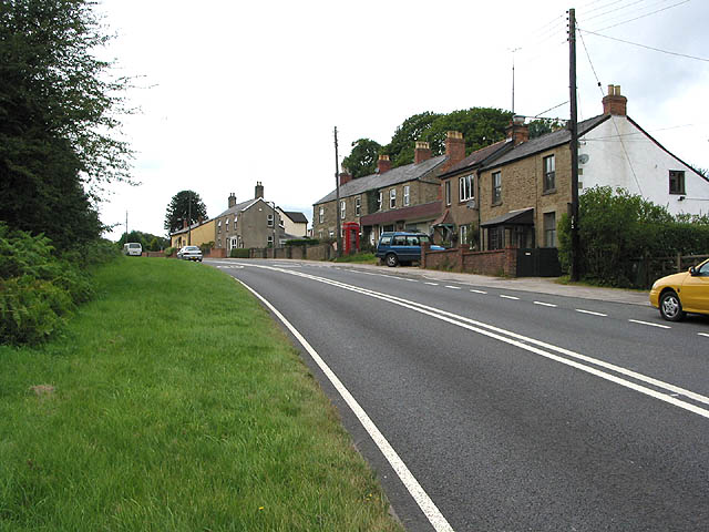
Brierley is a small village located in the county of Gloucestershire, England. Situated in the picturesque Forest of Dean, it is surrounded by lush greenery and offers a peaceful and tranquil setting. The village is nestled between the towns of Coleford and Cinderford, and is easily accessible via the A4136 road.

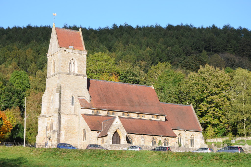
Brierley is home to a close-knit community, and the village exudes a warm and friendly atmosphere. The area is primarily residential, with a mix of traditional stone cottages and modern houses. The village has a small church, St. Peter's Church, which dates back to the 12th century and serves as a focal point for the community.

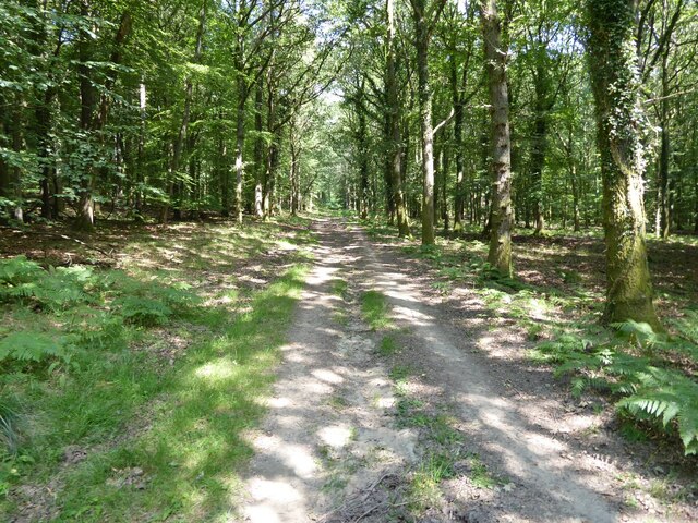
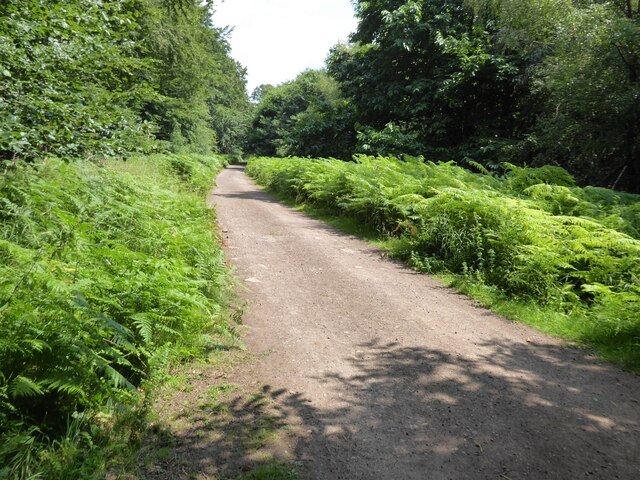
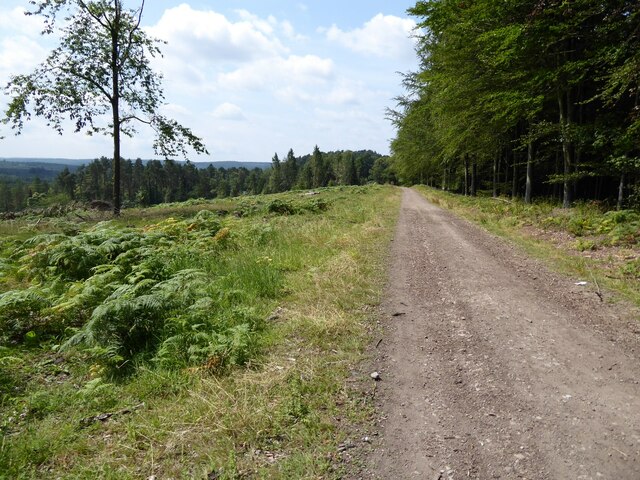
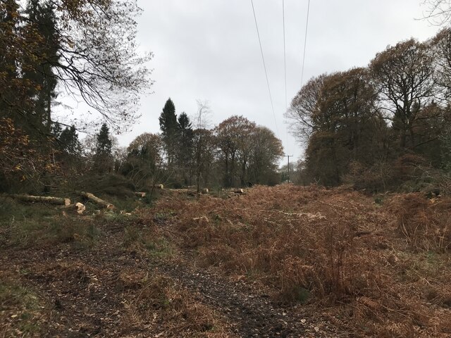
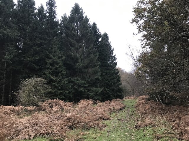
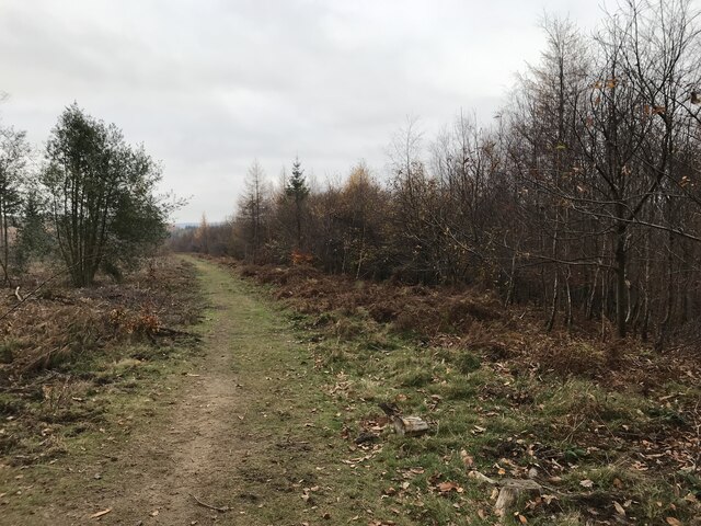
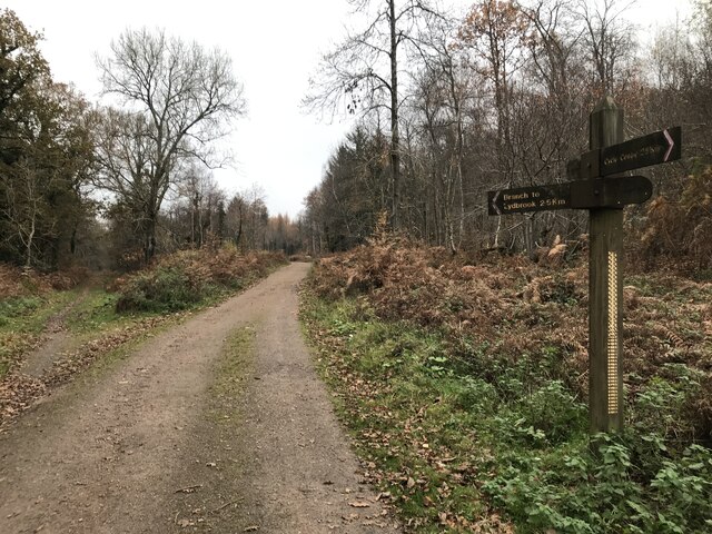
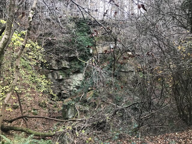
The surrounding Forest of Dean provides ample opportunities for outdoor activities and exploration. Residents and visitors can enjoy scenic walks, cycling, and horse riding through the forest trails. The area is also known for its wildlife, with sightings of deer, badgers, and various bird species being common.

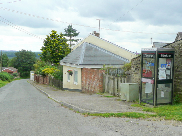
For amenities, Brierley has a village hall that hosts community events and gatherings throughout the year. There are also a few local shops and a primary school nearby, ensuring that basic needs are met within the village itself. For additional services and amenities, residents can easily access the nearby towns of Coleford and Cinderford, which offer a wider range of facilities including supermarkets, cafes, and healthcare facilities.

Overall, Brierley is a charming village in the heart of Gloucestershire's Forest of Dean, offering a peaceful and idyllic setting for residents and visitors alike.

If you have any feedback on the listing, please let us know in the comments section below.
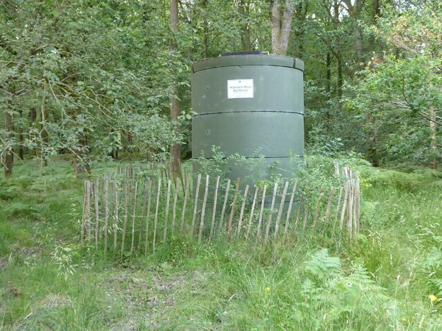
Brierley Images

Images are sourced within 2km of 51.834994/-2.547114 or Grid Reference SO6215. Thanks to Geograph Open Source API. All images are credited.

Forest track Forest track in Serridge Inclosure in the Forest of Dean.
Forest track
Forest track in Serridge Inclosure in the Forest of Dean.
The Wysis Way The Wysis Way following a track in Serridge Inclosure.  The Wysis Way is a long distance path connecting Offa's Dyke and the start of the Thames Path.
The Wysis Way
The Wysis Way following a track in Serridge Inclosure. The Wysis Way is a long distance path connecting Offa's Dyke and the start of the Thames Path.
Forest track Forest track near Serridge Green in the Forest of Dean.
Forest track
Forest track near Serridge Green in the Forest of Dean.
Area of clearfell Area of clearfell at Serridge Green.  With the trees felled there are extensive views over the forest.
Area of clearfell
Area of clearfell at Serridge Green. With the trees felled there are extensive views over the forest.
Hicksters Ways bat roost A fabricated bat roost at Hicksters Ways in the Forest of Dean.
Hicksters Ways bat roost
A fabricated bat roost at Hicksters Ways in the Forest of Dean.
Felled trees
Felled trees
Course of old railway
Forest ride
Forest ride
Old railway junction
Mirystock Bridge
Mirystock Bridge
Old railway
Old railway
Old quarry
Old quarry
Old Boundary Marker Estate Boundary Marker east of a forest track and just north of the A4136 near Mirystock House. Lydbrook parish. inscribed Bourts Inclosure and 1842 this perhaps records the enclosure of part of the Forest of Dean.

Milestone Society National ID: GL_LYDBR01em
Old Boundary Marker
Estate Boundary Marker east of a forest track and just north of the A4136 near Mirystock House. Lydbrook parish. inscribed Bourts Inclosure and 1842 this perhaps records the enclosure of part of the Forest of Dean. Milestone Society National ID: GL_LYDBR01em
Boundary Stone, Ruardean One of the many replacement boundary stone delineating the periphery of the "Forest of Dean". The "Forest" is very specific because resident have "rights in common" like grazing sheep and coal mining, though you may have to be born there to classify as a "free miner". This is on the Northern verge in Barn Lane.

Inscription: D. F. / 2012 / Nᴼ. 121

Milestone Society National ID: GL_DFDRYB121em
Boundary Stone, Ruardean
One of the many replacement boundary stone delineating the periphery of the "Forest of Dean". The "Forest" is very specific because resident have "rights in common" like grazing sheep and coal mining, though you may have to be born there to classify as a "free miner". This is on the Northern verge in Barn Lane. Inscription: D. F. / 2012 / Nᴼ. 121 Milestone Society National ID: GL_DFDRYB121em
Modern Boundary Stone, Ruardean High on the Northern embankment of "Townsend". One of the many replacement boundary stone delineating the periphery of the "Forest of Dean". The "Forest" is very specific because resident have "rights in common" like grazing sheep and coal mining, though you may have to be born there to classify as a "free miner". 

Inscription: D. F. / No 116 / 2010 

Milestone Society National ID: GL_DFRUAR116em
Modern Boundary Stone, Ruardean
High on the Northern embankment of "Townsend". One of the many replacement boundary stone delineating the periphery of the "Forest of Dean". The "Forest" is very specific because resident have "rights in common" like grazing sheep and coal mining, though you may have to be born there to classify as a "free miner". Inscription: D. F. / No 116 / 2010 Milestone Society National ID: GL_DFRUAR116em
Modern Boundary Stone, The Pludds On the North verge of Highbeech Road. One of the many replacement boundary stone delineating the periphery of the "Forest of Dean". The "Forest" is very specific because resident have "rights in common" like grazing sheep and coal mining, though you may have to be born there to classify as a "free miner".

Inscription: D. F. / 20005 / Nᴼ. 118

Milestone Society National ID: GL_DFRUAR118em
Modern Boundary Stone, The Pludds
On the North verge of Highbeech Road. One of the many replacement boundary stone delineating the periphery of the "Forest of Dean". The "Forest" is very specific because resident have "rights in common" like grazing sheep and coal mining, though you may have to be born there to classify as a "free miner". Inscription: D. F. / 20005 / Nᴼ. 118 Milestone Society National ID: GL_DFRUAR118em
Commemorative Plate, Ruardean On the wall of a corner house in Meend Lane (with Barn Lane).

Inscription:
V(crown)R
This road for the distance
of 2675 ↢ yards was made
at the expense of the crown
for the benefit of the
inhabitants and district
1899 - 1900
E.Stafford Howard Esq
Commissioner
Philip Baylis Esq
Dep Surveyor

Milestone Society National ID: GL_DRYBR01cm
Commemorative Plate, Ruardean
On the wall of a corner house in Meend Lane (with Barn Lane). Inscription: V(crown)R This road for the distance of 2675 ↢ yards was made at the expense of the crown for the benefit of the inhabitants and district 1899 - 1900 E.Stafford Howard Esq Commissioner Philip Baylis Esq Dep Surveyor Milestone Society National ID: GL_DRYBR01cm
Stone Stile, Ruardean On Gloucestershire footpath DRD34 entering a closed path that leads to Pettycroft, looking North . The view back towards Ruardean Woodside is <a href="https://www.geograph.org.uk/photo/7297883">SO6217 : Stone Stile, Ruardean</a>.
Stone Stile, Ruardean
On Gloucestershire footpath DRD34 entering a closed path that leads to Pettycroft, looking North . The view back towards Ruardean Woodside is SO6217 : Stone Stile, Ruardean.
Show me another place!

Brierley is located at Grid Ref: SO6215 (Lat: 51.834994, Lng: -2.547114)

Administrative County: Gloucestershire

District: Forest of Dean

Police Authority: Gloucestershire

What 3 Words

///surveyors.employ.parties. Near Ruardean, Gloucestershire

Related Wikis

Brierley, Gloucestershire

Brierley is a village in the Forest of Dean, Gloucestershire, United Kingdom. It has one petrol station and a shop, both of which are both operated by...

The Pludds

The Pludds is a hamlet in the Forest of Dean, Gloucestershire, England (grid reference SO617161). Lydbrook and Joys Green are to the west, Ruardean is...

Drybrook Road railway station

Drybrook Road is a closed station on the Cinderford to Coleford direct railway line in the Forest of Dean in Gloucestershire, near the village of Drybrook...

Ruardean Woodside

Ruardean Woodside is a village in Gloucestershire, England, located in the Forest of Dean and tucked away behind Ruardean Hill and Brierley. There is...

Ruardean Hill

Ruardean Hill is a prominent hill and a village in the English county of Gloucestershire, 20 km (12 mi) west of Gloucester. It lies in the Forest of Dean...

Upper Lydbrook railway station

Upper Lydbrook railway station served the civil parish of Lydbrook, Gloucestershire, England, from 1875 to 1929 on the Severn and Wye Railway. == History... ==

Holy Jesus Church, Lydbrook

Holy Jesus Church at Lydbrook is a Church of England parish church in the English county of Gloucestershire. == Structure == The greater part of the church...

Ruardean

Ruardean is a village in the Forest of Dean, Gloucestershire, England, to the North West of Cinderford. It is situated on a hillside with views west towards...

Nearby Amenities

Located within 500m of 51.834994,-2.547114
Pub
Swan, Brierley
Lat/Long: 51.8345113/-2.5444052
Bus Stop
Church
Naptan AtcoCode: 1600GL671
Naptan Bearing: SW
Naptan CommonName: Church
Naptan NaptanCode: gloagptd
Naptan Street: Brierley Banks
Naptan Verified: no
Source: naptan_import
Lat/Long: 51.8350412/-2.54448
Bus Stop
Swan Inn
Naptan AtcoCode: 1600GL673
Naptan Bearing: W
Naptan CommonName: Swan Inn
Naptan Indicator: Opp
Naptan NaptanCode: gloagpmj
Naptan Street: High St
Naptan Verified: no
Source: naptan_import
Lat/Long: 51.833466/-2.5448529
Bus Stop
Swan Inn
Naptan AtcoCode: 1600GL674
Naptan Bearing: E
Naptan CommonName: Swan Inn
Naptan NaptanCode: gloagpta
Naptan Street: High St
Naptan Verified: no
Source: naptan_import
Lat/Long: 51.8336081/-2.5452319
Bus Stop
Brierley Garage
Naptan AtcoCode: 1600GLF199
Naptan Bearing: W
Naptan CommonName: Brierley Garage
Naptan Indicator: Opp
Naptan NaptanCode: gloagpgm
Naptan Street: High St
Naptan Verified: no
Source: naptan_import
Lat/Long: 51.8330269/-2.5503334
Bus Stop
Brierley Garage
Naptan AtcoCode: 1600GLF200
Naptan Bearing: E
Naptan CommonName: Brierley Garage
Naptan NaptanCode: gloagpgp
Naptan Street: High St
Naptan Verified: no
Source: naptan_import
Lat/Long: 51.8331349/-2.5503057
Bus Stop
Swan Inn
Naptan AtcoCode: 1600GLF875
Naptan Bearing: S
Naptan CommonName: Swan Inn
Naptan NaptanCode: glogmadp
Naptan Street: Brierley Banks
Naptan Verified: no
Source: naptan_import
Lat/Long: 51.8336793/-2.5453779
Fuel
Brierley Service Station
Brand: Jet
Fuel Diesel: yes
Fuel Lpg: yes
Fuel Octane 91: yes
Lat/Long: 51.8332004/-2.550082
Post Box
Operator: Royal Mail
Post Box Type: lamp
Lat/Long: 51.8336287/-2.5468352
Generator Method: photovoltaic
Generator Output Electricity: yes
Generator Source: solar
Generator Type: solar_photovoltaic_panel
Location: roof
Power: generator
Lat/Long: 51.8333229/-2.5525135
Generator Method: photovoltaic
Generator Output Electricity: yes
Generator Source: solar
Generator Type: solar_photovoltaic_panel
Location: roof
Power: generator
Lat/Long: 51.8337008/-2.5468057
The Delves Inclosure № 2
Place: locality
Lat/Long: 51.8319446/-2.543741
Great God Meadow
Place: locality
Lat/Long: 51.8319952/-2.5520598
The data included in this document is from www.openstreetmap.org. The data is made available under ODbL.

Have you been to Brierley?

Leave your review of Brierley below (or comments, questions and feedback).