Alcester

Civil Parish in Warwickshire Stratford-on-Avon

England

Alcester

Red Cross Shop, Alcester The Red Cross shop in Alcester is housed in a black and white beamed building on the High Street
Red Cross Shop, Alcester Credit: Rob Newman

Alcester is a civil parish located in the district of Stratford-on-Avon in Warwickshire, England. Situated approximately 8 miles west of Stratford-upon-Avon, the town lies on the banks of the River Arrow. With a history dating back to Roman times, Alcester is known for its rich heritage and charming character.

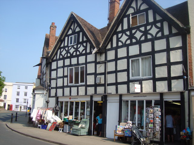
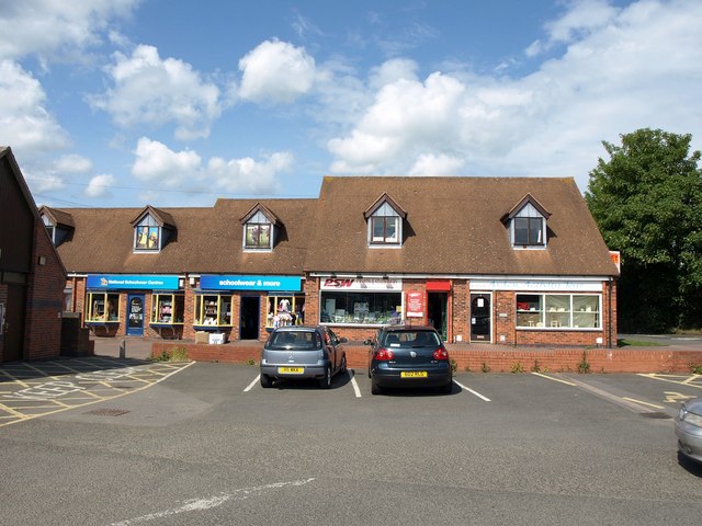
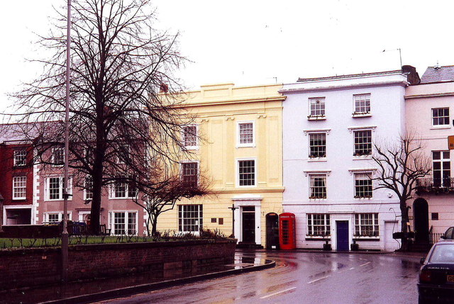
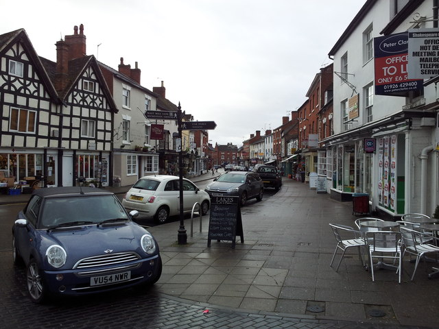
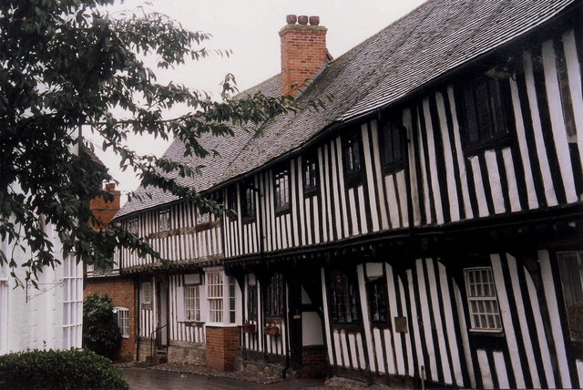
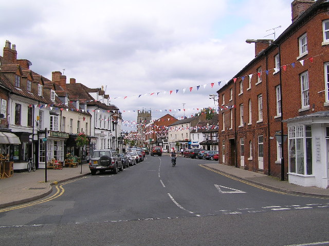
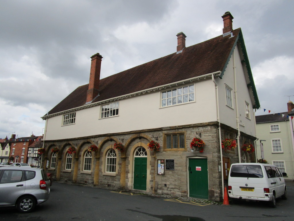
The town boasts a population of around 7,000 residents and covers an area of 1,600 hectares. Alcester offers a mix of architectural styles, including medieval timber-framed buildings, Georgian townhouses, and Victorian terraces, which add to its picturesque appeal. The streets are lined with independent shops, cafes, and restaurants, providing a vibrant and welcoming atmosphere to both residents and visitors.

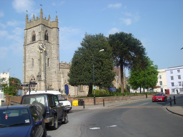
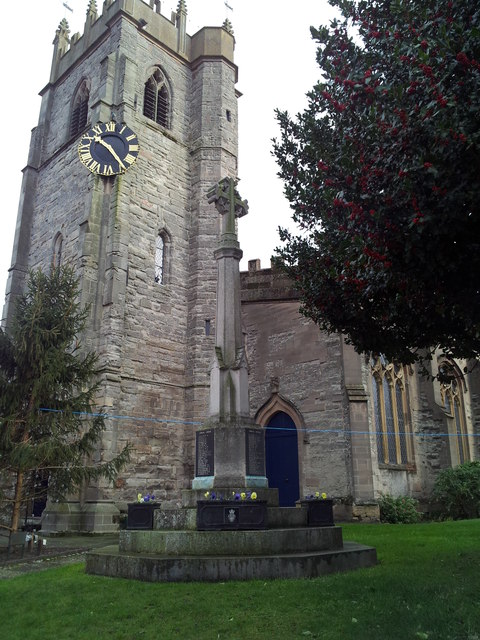
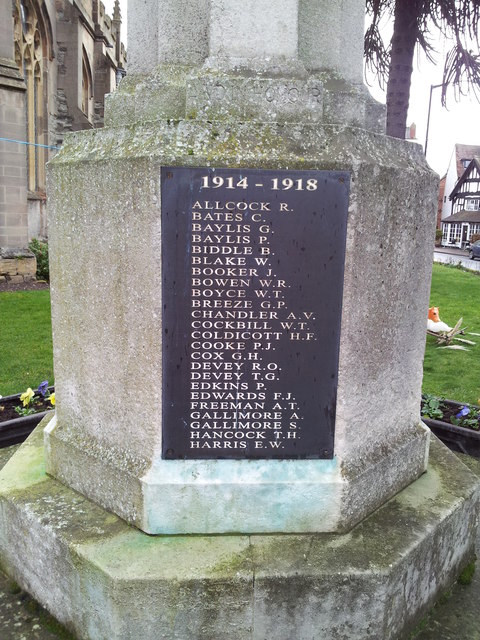
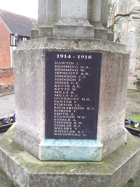
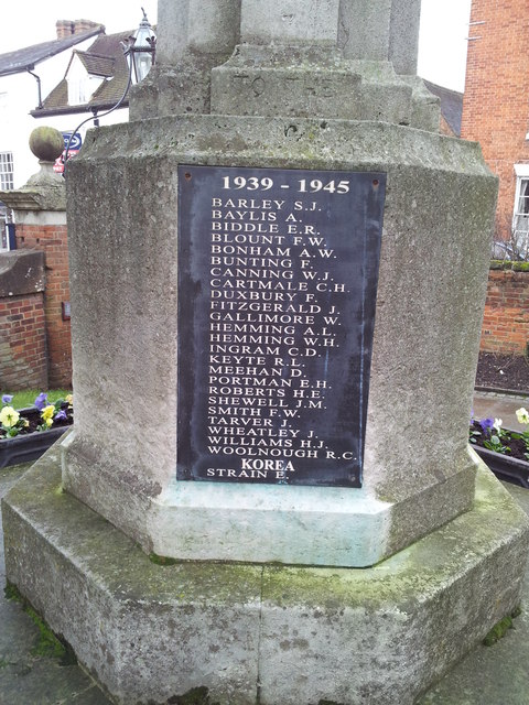
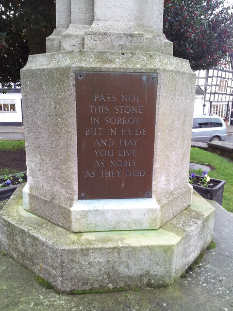
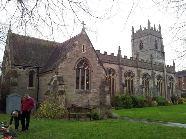
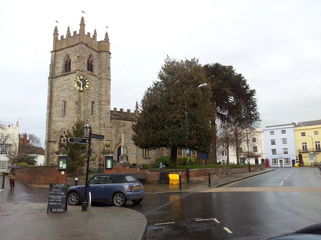
Alcester is home to several historical landmarks, such as the 12th-century St Nicholas Church, which features a magnificent tower and stunning stained glass windows. The Tudor House Museum offers an insight into the town's past, showcasing local artifacts and exhibitions. The Alcester Heritage Centre provides further information on the area's history and hosts regular events and exhibitions throughout the year.

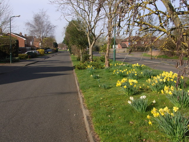
Surrounded by beautiful countryside, Alcester offers plenty of opportunities for outdoor activities. The nearby Ragley Hall, a stately home set within 450 acres of parkland, attracts visitors with its stunning gardens and regular events, including outdoor concerts and country fairs.

Overall, Alcester is a delightful town with a strong sense of community and a wealth of history and heritage. It provides a charming and picturesque setting for residents and visitors alike, making it a popular destination in Warwickshire.

If you have any feedback on the listing, please let us know in the comments section below.

Alcester Images

Images are sourced within 2km of 52.206894/-1.859921 or Grid Reference SP0956. Thanks to Geograph Open Source API. All images are credited.

Red Cross Shop, Alcester The Red Cross shop in Alcester is housed in a black and white beamed building on the High Street
Red Cross Shop, Alcester
The Red Cross shop in Alcester is housed in a black and white beamed building on the High Street
St Nicholas Church, Alcester Standing on the High St in Alcester is St Nicholas Church. The clock is placed in an unusual position on a corner of the tower, but located there it is visible for the length of the High St
St Nicholas Church, Alcester
Standing on the High St in Alcester is St Nicholas Church. The clock is placed in an unusual position on a corner of the tower, but located there it is visible for the length of the High St
Shops in Alcester Modern educationally-oriented shops on Bulls Head Yard at the north end of the town's main car park; they offer schoolwear, crafts and stationery, and activity toys.
Shops in Alcester
Modern educationally-oriented shops on Bulls Head Yard at the north end of the town's main car park; they offer schoolwear, crafts and stationery, and activity toys.
Bridleway leaving Wixford Through to Alcester on section of former Roman Road. Entrance to church on left.
Bridleway leaving Wixford
Through to Alcester on section of former Roman Road. Entrance to church on left.
Yew tree in Wixford churchyard Huge,old tree probably included in the survey carried out some years ago.
Yew tree in Wixford churchyard
Huge,old tree probably included in the survey carried out some years ago.
Path above the flood plain Between Wixford church and The Fish Inn.
Path above the flood plain
Between Wixford church and The Fish Inn.
Church Street, Alcester On a rainy day
Church Street, Alcester
On a rainy day
Alcester war memorial in the grounds of St Nicholas Church
Names on the Alcester War Memorial 1 Close up of the War Memorial <a href="https://www.geograph.org.uk/photo/2806956">SP0957 : Alcester war memorial in the grounds of St Nicholas Church</a>
Names on the Alcester War Memorial 1
Names on the Alcester War Memorial 2 Close up of the War Memorial <a href="https://www.geograph.org.uk/photo/2806956">SP0957 : Alcester war memorial in the grounds of St Nicholas Church</a>
Names on the Alcester War Memorial 2
Names on the Alcester War Memorial 3 Close up of the War Memorial <a href="https://www.geograph.org.uk/photo/2806956">SP0957 : Alcester war memorial in the grounds of St Nicholas Church</a>
Names on the Alcester War Memorial 3
Names on the Alcester War Memorial 4 Close up of the War Memorial <a href="https://www.geograph.org.uk/photo/2806956">SP0957 : Alcester war memorial in the grounds of St Nicholas Church</a>
Names on the Alcester War Memorial 4
St Nicholas Church, Alcester Photographed from the rear
St Nicholas Church, Alcester
Photographed from the rear
Alcester High Street
St Nicholas Church & Church Street, Alcester
Medieval houses, Malt Mill Lane, Alcester
Service road, by Captain's Hill,  Alcester Spring show of daffodils by the B4089.
Service road, by Captain's Hill, Alcester
Spring show of daffodils by the B4089.
Over the A435,  Alcester by-pass Care needed on the footpath but there is a central barrier with appropriate safety gap.
Over the A435, Alcester by-pass
Care needed on the footpath but there is a central barrier with appropriate safety gap.
Show me another place!

Alcester is located at Grid Ref: SP0956 (Lat: 52.206894, Lng: -1.859921)

Administrative County: Warwickshire

District: Stratford-on-Avon

Police Authority: Warwickshire

What 3 Words

///chuckling.germinate.softly. Near Alcester, Warwickshire

Related Wikis

Alcester Town F.C.

Alcester Town Football Club is a football club based in Alcester, Warwickshire, England. They are currently members of the Midland League Division Two...

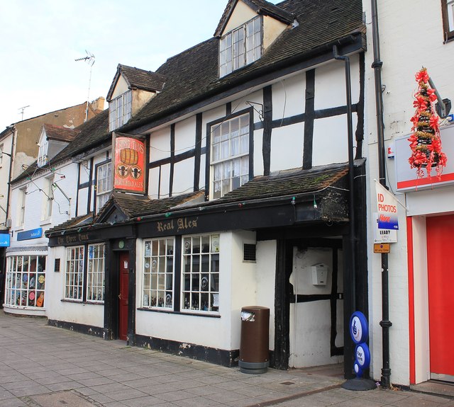
Three Tuns, Alcester

The Three Tuns is a public house in Alcester, Warwickshire, England. Originally built as a private house in the 17th century it is of timber-framed construction...

Alcester

Alcester ( ) is a market town and civil parish in the Stratford-on-Avon District in Warwickshire, England. It is 8 mi (13 km) west of Stratford-upon-Avon...

Alcester Town Hall

Alcester Town Hall is the town hall of Alcester, Warwickshire, England. It is a grade I listed building. == History == The lower part of the two-storey...

St Benedict's Catholic High School, Alcester

St Benedict's Catholic High School is a co-educational Roman Catholic secondary school and sixth form. It is located in Alcester in the English county...

Alcester Abbey

Alcester Abbey was a Benedictine monastery in Alcester, Warwickshire in England, founded in 1138 by the Botellers of Oversley, Warwickshire. Its many endowments...

Alcester railway station

Alcester was a railway station serving Alcester in the English county of Warwickshire. == History == Opened by the Evesham and Redditch Railway, and joining...

Arrow, Warwickshire

Arrow is a village in the Stratford-on-Avon district of Warwickshire, England. Together with the entirely rural hamlet of Weethley, it forms since 1 April...

Nearby Amenities

Located within 500m of 52.206894,-1.859921
Barrier: bollard
Bicycle: yes
Foot: yes
Source: survey
Lat/Long: 52.207629/-1.8629365
Post Box
Collection Times: Mo-Fr 16:00; Sa 07:15
Operator: Royal Mail
Operator Wikidata: Q638098
Post Box Type: wall
Ref: B50 29
Royal Cypher: VR
Royal Cypher Wikidata: Q33102356
Source: GPS Survey
Lat/Long: 52.2104441/-1.8639177
Bench
Source: survey
Lat/Long: 52.2068058/-1.863267
Barrier: kissing_gate
Foot: yes
Source: survey
Lat/Long: 52.210545/-1.8562659
Barrier: stile
Lat/Long: 52.2069596/-1.8638415
Parking
Access: yes
Fee: no
Parking: layby
Lat/Long: 52.2081592/-1.8566013
Barrier: stile
Foot: yes
Material: wood
Stile: stepover
Lat/Long: 52.2055269/-1.8667983
Barrier: stile
Lat/Long: 52.2066384/-1.865216
Barrier: stile
Lat/Long: 52.2067967/-1.8651719
Material: wood
Power: pole
Source: Warwicks CC Aerial Imagery 2013
Lat/Long: 52.2068489/-1.8641889
Material: wood
Power: pole
Source: Warwicks CC Aerial Imagery 2013
Lat/Long: 52.2074061/-1.8644665
Power: pole
Source: Warwicks CC Aerial Imagery 2013
Lat/Long: 52.2077554/-1.8646462
Power: pole
Source: Warwicks CC Aerial Imagery 2013
Lat/Long: 52.2083964/-1.8649654
Power: pole
Source: Warwicks CC Aerial Imagery 2013
Lat/Long: 52.2092478/-1.8658331
Public Bookcase
Oversley Free Mini Exchange Library
Booth: K6
Colour: red
Disused Amenity: telephone
Man Made: telephone_box
Public Bookcase Type: phone_box
Lat/Long: 52.2102663/-1.8641522
Material: wood
Power: pole
Source: bing
Lat/Long: 52.2066706/-1.8663642
Material: wood
Power: pole
Source: bing
Lat/Long: 52.2068604/-1.8648836
Power: pole
Ref: 774644
Source: wpd_opendata
Transformer: distribution
Lat/Long: 52.2055701/-1.8605492
Power: pole
Source: bing
Lat/Long: 52.2054879/-1.861378
Power: pole
Source: bing
Lat/Long: 52.2060912/-1.8620887
Power: pole
Source: bing
Lat/Long: 52.2064853/-1.8625394
Power: pole
Ref: 773052
Source: wpd_opendata
Transformer: distribution
Lat/Long: 52.2105537/-1.8615443
Power: pole
Source: bing
Lat/Long: 52.2112933/-1.8599832
Power: pole
Source: bing
Lat/Long: 52.2109678/-1.8604741
Power: pole
Source: bing
Lat/Long: 52.2100984/-1.860112
Material: wood
Power: pole
Source: bing
Lat/Long: 52.209298/-1.8597981
Power: pole
Source: bing
Lat/Long: 52.2068054/-1.8626882
Material: wood
Power: pole
Ref: 774639
Source: wpd_opendata
Transformer: distribution
Lat/Long: 52.2068448/-1.8616489
Material: wood
Power: pole
Source: bing
Lat/Long: 52.2074456/-1.8609099
Material: wood
Power: pole
Source: bing
Lat/Long: 52.2078549/-1.8603614
Material: wood
Power: pole
Source: bing
Lat/Long: 52.2085255/-1.8594924
Material: wood
Power: pole
Source: bing
Lat/Long: 52.2089808/-1.8579018
Material: wood
Power: pole
Source: bing
Lat/Long: 52.2093539/-1.8568853
Material: wood
Power: pole
Source: bing
Lat/Long: 52.2096941/-1.8560538
Barrier: stile
Bicycle: no
Horse: no
Material: wood
Motor Vehicle: no
Stile: stepover
Lat/Long: 52.2042179/-1.8597366
The data included in this document is from www.openstreetmap.org. The data is made available under ODbL.

Have you been to Alcester?

Leave your review of Alcester below (or comments, questions and feedback).