Adstone

Civil Parish in Northamptonshire

England

Adstone

Field in Maidford
Field in Maidford Credit: David Howard

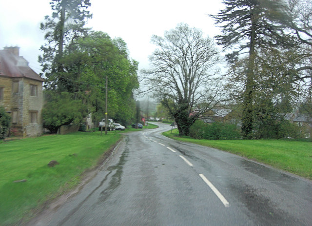
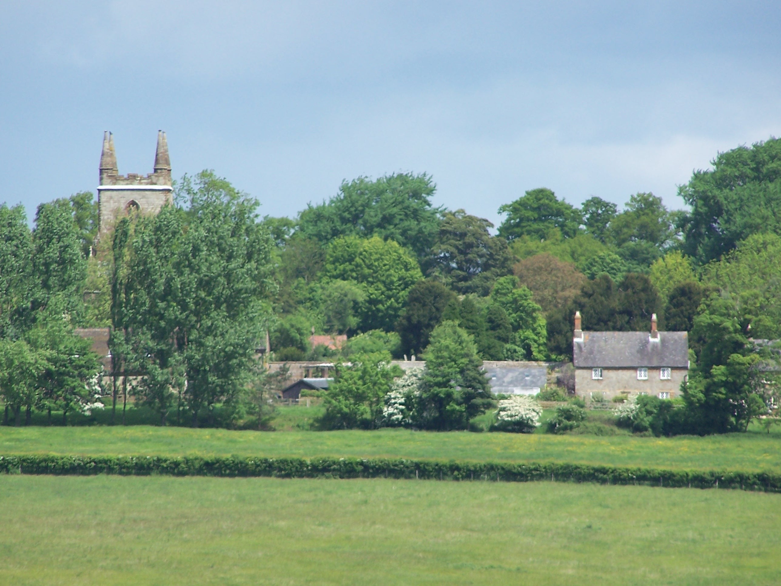
Adstone is a civil parish located in the county of Northamptonshire, England. Situated in the heart of the English countryside, it is a small and picturesque village with a population of approximately 100 residents. Adstone is nestled between the towns of Towcester and Daventry, offering a tranquil and rural setting for its inhabitants.

The village dates back to the medieval period and retains much of its historical charm. Rural architecture dominates the area, with traditional stone-built cottages and farmhouses dotting the landscape. The parish is predominantly agricultural, with farming being the primary source of income for many residents.

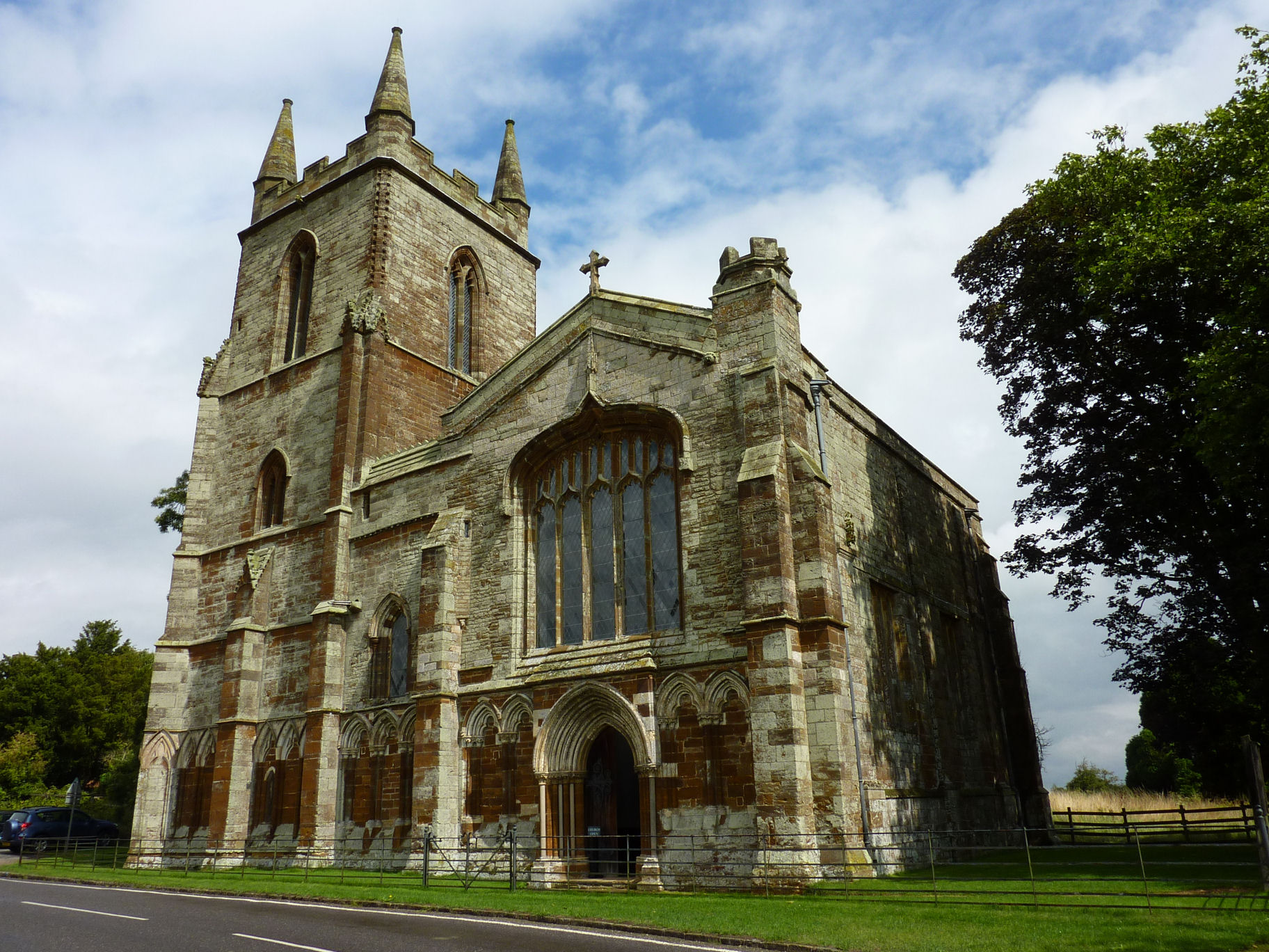
Despite its small size, Adstone boasts a strong sense of community. The village hall serves as the hub for various social activities and events, bringing residents together. The local church, St. Mary's, is a notable landmark and a place of worship for the community.

The surrounding countryside provides ample opportunities for outdoor enthusiasts, with scenic walking trails and bridleways. Adstone is also within close proximity to several nature reserves, including the Grand Union Canal and the Althorp Estate, offering further recreational options.

Although lacking in amenities like shops and schools, Adstone benefits from its proximity to nearby towns, where residents can access a wider range of services and amenities. Public transportation is limited, with only a few bus services available.

In conclusion, Adstone offers a peaceful and idyllic lifestyle for its residents, with its rural charm and strong sense of community. It is a place where one can truly experience the beauty of the English countryside.

If you have any feedback on the listing, please let us know in the comments section below.

Adstone Images

Images are sourced within 2km of 52.157415/-1.131491 or Grid Reference SP5951. Thanks to Geograph Open Source API. All images are credited.

Field in Maidford
Field in Maidford
Inside the quadrangle, Canons Ashby, Northants
St Mary's, Canons Ashby Not surprisingly there are quite a few Geographs of this attractive and unusual church.
One of only four privately owned parish churches in the land.
St Mary's, Canons Ashby
Not surprisingly there are quite a few Geographs of this attractive and unusual church. One of only four privately owned parish churches in the land.
Spiral Bush at Canons Ashby House Canons Ashby House and adjoining church are founded on the remains of an Augustinian Priory. <span class="nowrap"><a title="http://en.wikipedia.org/wiki/Canons_Ashby_Priory" rel="nofollow ugc noopener" href="http://en.wikipedia.org/wiki/Canons_Ashby_Priory">Link</a><img style="margin-left:2px;" alt="External link" title="External link - shift click to open in new window" src="https://s1.geograph.org.uk/img/external.png" width="10" height="10"/></span>
Now a National Trust property.
Spiral Bush at Canons Ashby House
Canons Ashby House and adjoining church are founded on the remains of an Augustinian Priory. LinkExternal link Now a National Trust property.
St Mary's Church, Canons Ashby
Un-named road leaves Canons Ashby Despite the heavy rain and bleak conditions the historic village was thronged by visitors.
Un-named road leaves Canons Ashby
Despite the heavy rain and bleak conditions the historic village was thronged by visitors.
Un-named road northeast of Fourwinds This minor road between Canons Ashby and Adstone doesn't appear to have a designation.
Un-named road northeast of Fourwinds
This minor road between Canons Ashby and Adstone doesn't appear to have a designation.
The hamlet of Adstone The settlement is called Atenestone in the Domesday Book.
The hamlet of Adstone
The settlement is called Atenestone in the Domesday Book.
Canons Ashby West Front
St Mary's Parish Church, Canons Ashby This church is the remaining part of Canons Ashby Priory. <span class="nowrap"><a title="http://en.wikipedia.org/wiki/Canons_Ashby_Priory" rel="nofollow ugc noopener" href="http://en.wikipedia.org/wiki/Canons_Ashby_Priory">Link</a><img style="margin-left:2px;" alt="External link" title="External link - shift click to open in new window" src="https://s1.geograph.org.uk/img/external.png" width="10" height="10"/></span>
St Mary's Parish Church, Canons Ashby
This church is the remaining part of Canons Ashby Priory. LinkExternal link
The original entrance gates at Canons Ashby When Canons Ashby House <span class="nowrap"><a title="http://www.nationaltrust.org.uk/canons-ashby-house/" rel="nofollow ugc noopener" href="http://www.nationaltrust.org.uk/canons-ashby-house/">Link</a><img style="margin-left:2px;" alt="External link" title="External link - shift click to open in new window" src="https://s1.geograph.org.uk/img/external.png" width="10" height="10"/></span> was originally built, these two gates comprised the original entrance.
The original entrance gates at Canons Ashby
When Canons Ashby House LinkExternal link was originally built, these two gates comprised the original entrance.
Entrance to Adstone
Entrance to Adstone
Entrance to Canons Ashby
St Mary's Church
St Mary's Church
Canons Ashby house View of the house taken between the two sets of flower borders
Canons Ashby house
View of the house taken between the two sets of flower borders
Canons Ashby house A view of the house with flower borders and the Priory to the right of the picture reached via a lovely path from the house
Canons Ashby house
A view of the house with flower borders and the Priory to the right of the picture reached via a lovely path from the house
Canons Ashby Priory Detail of the base of the main entrance arch
Canons Ashby Priory
Detail of the base of the main entrance arch
Canons Ashby Priory Detail of stonework to the left of the main priory entrance; much repair work has been done, there still appears more to do
Canons Ashby Priory
Detail of stonework to the left of the main priory entrance; much repair work has been done, there still appears more to do
Show me another place!

Adstone is located at Grid Ref: SP5951 (Lat: 52.157415, Lng: -1.131491)

Unitary Authority: West Northamptonshire

Police Authority: Northamptonshire

What 3 Words

///dwarves.firm.warblers. Near Hinton, Northamptonshire

Nearby Locations

Adstone Adstone

Related Wikis

All Saints Church, Adstone

All Saints Church is a Grade II listed church in Adstone, Northamptonshire, England. == References ==

Adstone

Adstone is a village and civil parish in West Northamptonshire, England. The population at the 2001 census was 65. It remained than 100 at the 2011 census...

Canons Ashby Priory

Canons Ashby Priory was an Augustinian priory at Canons Ashby, Northamptonshire, England. == History == The Priory was founded by Stephen la Leye on a...

Canons Ashby (lost settlement)

The lost village of Canons Ashby is located in ground to the north of Canons Ashby House in the English county of Northamptonshire. Today there is still...

Maidford

Maidford is a civil and ecclesiastical parish in West Northamptonshire and the diocese of Peterborough situated about 6 miles (9.7 km) north-west of Towcester...

Canons Ashby House

Canons Ashby House (previously known as Canons Ashby Hall) is a Grade I listed Elizabethan manor house located...

Canons Ashby

Canons Ashby is a small village and civil parish in West Northamptonshire, England. The population of the village is included in the civil parish of Preston...

Morton Pinkney railway station

Morton Pinkney (also known as Morton Pinkney for Sulgrave) was a railway station on the Stratford-upon-Avon and Midland Junction Railway (SMJ) which served...

Nearby Amenities

Located within 500m of 52.157415,-1.131491
Telephone
Booth: K6
Covered: booth
Operator: BT
Phone: +44 1327 860326
Lat/Long: 52.1589488/-1.1316021
Barrier: stile
Steps: 1
Lat/Long: 52.1557453/-1.1278967
Barrier: stile
Steps: 2
Lat/Long: 52.1557158/-1.1279156
Adstone
Place: village
Wikidata: Q671248
Wikipedia: en:Adstone
Lat/Long: 52.1590025/-1.1306781
Post Box
Operator: Royal Mail
Post Box Type: wall
Ref: NN12 359
Lat/Long: 52.1590655/-1.131259
Defibrillator
Emergency: defibrillator
Lat/Long: 52.1582695/-1.1304657
Man Made: flagpole
Lat/Long: 52.1582921/-1.1303183
The data included in this document is from www.openstreetmap.org. The data is made available under ODbL.

Have you been to Adstone?

Leave your review of Adstone below (or comments, questions and feedback).