Adstock

Civil Parish in Buckinghamshire

England

Adstock

A413 north of Addington
A413 north of Addington Credit: Colin Pyle

Adstock is a civil parish located in the county of Buckinghamshire, in the southeast of England. It is situated approximately 4 miles west of Buckingham and covers an area of around 1,150 acres. The parish is surrounded by the picturesque countryside, characterized by rolling hills, open fields, and woodland areas.

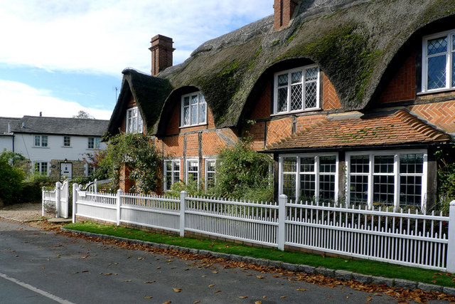
The village of Adstock is small, with a population of around 300 residents. It has a charming and peaceful atmosphere, making it an ideal place for those seeking a rural lifestyle. The village is known for its traditional architecture, with a mix of historic cottages and more modern houses.

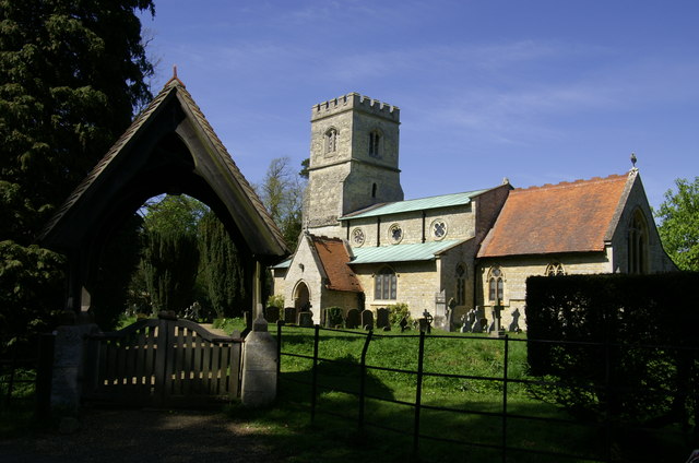
One of the notable features of Adstock is its beautiful 13th-century church, dedicated to St. Cecilia. The church is a Grade I listed building and attracts visitors who appreciate its historical and architectural significance. Adstock also has a village hall, which serves as a hub for community events and gatherings.

The surrounding countryside offers plenty of opportunities for outdoor activities such as walking, cycling, and horse riding. The nearby Adstock Wood is a designated Site of Special Scientific Interest (SSSI) and provides a habitat for a variety of wildlife and plant species.

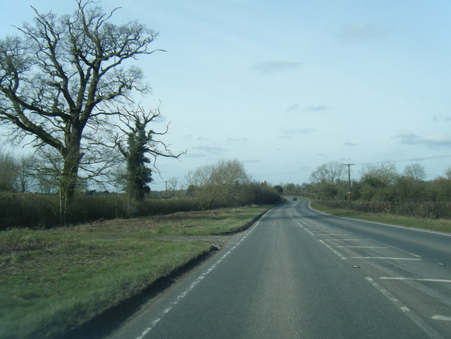
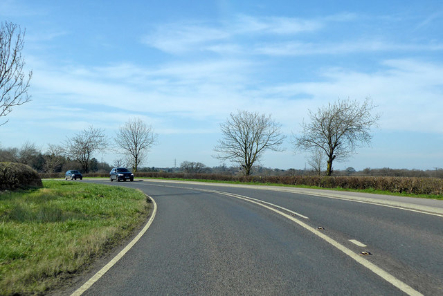
Despite its rural setting, Adstock is conveniently located near major transportation routes. The A413 road passes through the village, connecting it to nearby towns and providing easy access to the M40 motorway.

Overall, Adstock is a charming and tranquil village in Buckinghamshire, offering a peaceful countryside lifestyle with convenient access to modern amenities.

If you have any feedback on the listing, please let us know in the comments section below.

Adstock Images

Images are sourced within 2km of 51.969907/-0.919632 or Grid Reference SP7430. Thanks to Geograph Open Source API. All images are credited.

A413 north of Addington
A413 nearing The Folly Inn, Adstock
Electric lines Electric lines off the North Bucks Way
Electric lines
Electric lines off the North Bucks Way
North Bucks Way North Bucks Way crossing footbridge heading to Hanover Farm
North Bucks Way
North Bucks Way crossing footbridge heading to Hanover Farm
Old Milestone by the A413 near Addington Carved stone post by the A413, in parish of Addington (Aylesbury Vale District), near Hanover Farm, North of Addington Manor Lodge, on wide grass verge, on South side of road. Aylesbury square, erected by the Wendover & Buckingham turnpike trust in the 18th century. 

Inscription reads:-
: BANBURY / 22 / BUCKINGHAM / 5 : : LONDON / 52 / AYLESBURY / 12 / WINSLOW / 1 :  
Carved benchmark on top.

Buckinghamshire HER.
HER Number: 1357000000 <span class="nowrap"><a title="https://www.heritagegateway.org.uk/Gateway/Results_Single.aspx?uid=MBC25710&resourceID=1024" rel="nofollow ugc noopener" href="https://www.heritagegateway.org.uk/Gateway/Results_Single.aspx?uid=MBC25710&resourceID=1024">Link</a><img style="margin-left:2px;" alt="External link" title="External link - shift click to open in new window" src="https://s1.geograph.org.uk/img/external.png" width="10" height="10"/></span>

Milestone Society National ID: BU_LC52
Old Milestone by the A413 near Addington
Carved stone post by the A413, in parish of Addington (Aylesbury Vale District), near Hanover Farm, North of Addington Manor Lodge, on wide grass verge, on South side of road. Aylesbury square, erected by the Wendover & Buckingham turnpike trust in the 18th century. Inscription reads:- : BANBURY / 22 / BUCKINGHAM / 5 : : LONDON / 52 / AYLESBURY / 12 / WINSLOW / 1 : Carved benchmark on top. Buckinghamshire HER. HER Number: 1357000000 LinkExternal link Milestone Society National ID: BU_LC52
Old Milestone by the A413, south of Adstock Carved stone post by the A413, in parish of Adstock (Aylesbury Vale District), South of Adstock near footpath to Addington, on grass verge where footpath sign points over a stile, on South side of road. Aylesbury square, erected by the Wendover & Buckingham turnpike trust in the 18th century. 

Inscription reads:-
: BANBURY / 21 / BUCKINGHAM / 4 : : LONDON / 53 / AYLESBURY / 13 / WINSLOW / 2 : 
Carved benchmark top right. 

Buckinghamshire HER.
HER Number: 1356900000 <span class="nowrap"><a title="https://www.heritagegateway.org.uk/Gateway/Results_Single.aspx?uid=MBC25703&resourceID=1024" rel="nofollow ugc noopener" href="https://www.heritagegateway.org.uk/Gateway/Results_Single.aspx?uid=MBC25703&resourceID=1024">Link</a><img style="margin-left:2px;" alt="External link" title="External link - shift click to open in new window" src="https://s1.geograph.org.uk/img/external.png" width="10" height="10"/></span>

Milestone Society National ID: BU_LC53
Old Milestone by the A413, south of Adstock
Carved stone post by the A413, in parish of Adstock (Aylesbury Vale District), South of Adstock near footpath to Addington, on grass verge where footpath sign points over a stile, on South side of road. Aylesbury square, erected by the Wendover & Buckingham turnpike trust in the 18th century. Inscription reads:- : BANBURY / 21 / BUCKINGHAM / 4 : : LONDON / 53 / AYLESBURY / 13 / WINSLOW / 2 : Carved benchmark top right. Buckinghamshire HER. HER Number: 1356900000 LinkExternal link Milestone Society National ID: BU_LC53
The A413, Adstock Since 2011 the bollards have appeared and a road narrows sign in front of the arrows has gone.
The A413, Adstock
Since 2011 the bollards have appeared and a road narrows sign in front of the arrows has gone.
The A413, Adstock
The A413, Adstock
A413 towards Buckingham By the turning for Adstock.
A413 towards Buckingham
By the turning for Adstock.
A413 towards Buckingham, bridge over a brook No apparent name for the brook, but it flows into the Claydon Brook, then the Padbury Brook (The Twins) and finally the River Great Ouse.
A413 towards Buckingham, bridge over a brook
No apparent name for the brook, but it flows into the Claydon Brook, then the Padbury Brook (The Twins) and finally the River Great Ouse.
Bend on A413 towards Buckingham
Cottages in Adstock Village These cottages are on the main road through the village and close to the church.
Cottages in Adstock Village
These cottages are on the main road through the village and close to the church.
The Thatched Inn and Restaurant, Adstock The date on the signboard is c1645.
The Thatched Inn and Restaurant, Adstock
The date on the signboard is c1645.
The Thatched Inn and Restaurant in Adstock village
St. Cecilia, Adstock
The Church of St. Cecilia, Adstock
Cottage by the Churchyard, Adstock
St. Cecilia, Adstock
Show me another place!

Adstock is located at Grid Ref: SP7430 (Lat: 51.969907, Lng: -0.919632)

Unitary Authority: Buckinghamshire

Police Authority: Thames Valley

What 3 Words

///snows.troll.formal. Near Great Horwood, Buckinghamshire

Nearby Locations

Adstock

Related Wikis

Adstock

For the municipality in Quebec, see Adstock, Quebec Adstock is a village and civil parish about 2.5 miles (4.0 km) northwest of Winslow and 3 miles (4...
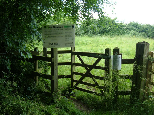
Pilch Fields

Pilch Fields is an 11.1-hectare (27-acre) biological Site of Special Scientific Interest (SSSI) west of Great Horwood in Buckinghamshire. It is managed...

Addington, Buckinghamshire

Addington is a village and civil parish in Buckinghamshire, England, about 2 miles (3.2 km) west of Winslow and 3 miles (4.8 km) south east of Buckingham...

Coombs Quarry

Coombs Quarry is a 0.5 hectare Local Nature Reserve east of Buckingham. It is owned and managed by Buckinghamshire County Council.This very small site...

Padbury

Padbury is a village and civil parish in north Buckinghamshire, England. It is located on the A413 main road that links Buckingham with Winslow. ��2�...

Singleborough

Singleborough is a hamlet in the parish of Great Horwood, in Buckinghamshire, England. It is located about a mile from the main village. The hamlet name...

Claydon Brook

Claydon Brook is a 24.06 km (14.95 mi) long river in Buckinghamshire, England that is a tributary of Padbury Brook, itself a tributary to the River Great...

Thornborough Bridge

Thornborough Bridge is located on the original Bletchley and Buckingham road, now bypassed by a modern bridge in 1974 for the A421. The bridge is accessible...

Nearby Amenities

Located within 500m of 51.969907,-0.919632
Power: pole
Lat/Long: 51.9710355/-0.9212617
Power: pole
Lat/Long: 51.9702904/-0.9217116
Power: pole
Lat/Long: 51.9702141/-0.9228716
Power: pole
Lat/Long: 51.9702446/-0.9241141
Power: pole
Lat/Long: 51.9702064/-0.9203081
Power: pole
Lat/Long: 51.9702141/-0.9217364
Power: pole
Lat/Long: 51.9701937/-0.9189665
Power: pole
Lat/Long: 51.9702268/-0.925047
Power: pole
Lat/Long: 51.9701754/-0.9175962
Power: pole
Lat/Long: 51.9701727/-0.9149706
Power: pole
Lat/Long: 51.9700632/-0.9135889
Power: pole
Lat/Long: 51.9703287/-0.91637
The data included in this document is from www.openstreetmap.org. The data is made available under ODbL.

Have you been to Adstock?

Leave your review of Adstock below (or comments, questions and feedback).