Acaster Malbis

Civil Parish in Yorkshire

England

Acaster Malbis

Moor Lane running alongside Sandhole Plantation
Moor Lane running alongside Sandhole Plantation Credit: Phil Catterall

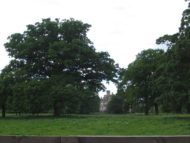
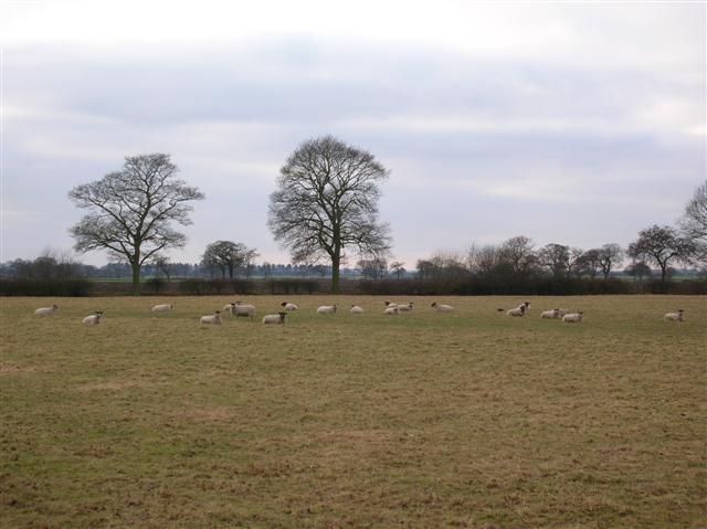
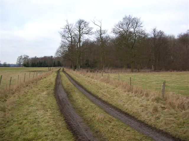
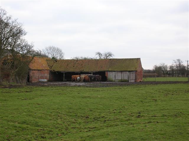
Acaster Malbis is a civil parish located in the county of Yorkshire, England. Situated approximately five miles south-west of the historic city of York, this small village is surrounded by picturesque countryside and offers a tranquil and idyllic setting for residents and visitors alike.

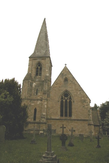
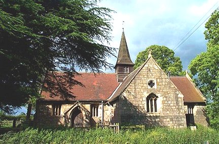
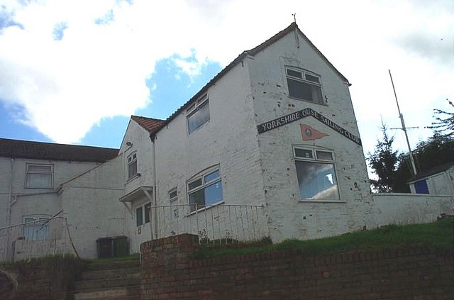
The parish of Acaster Malbis covers an area of around six square miles and is home to a population of approximately 500 people. The village itself retains much of its traditional charm, with a collection of historic buildings, including a Grade II listed church, St John the Baptist, dating back to the 12th century.

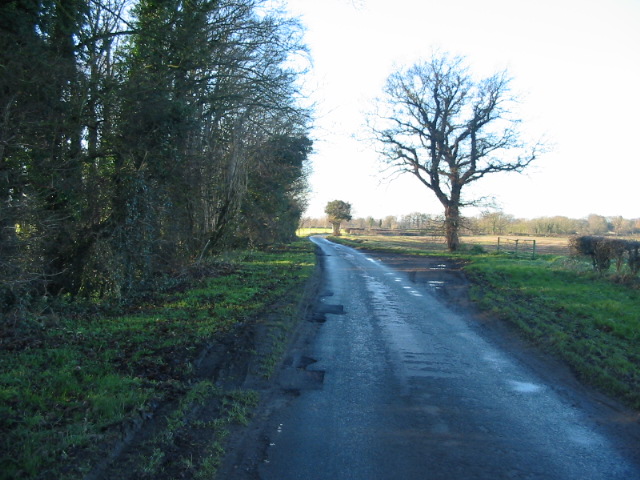
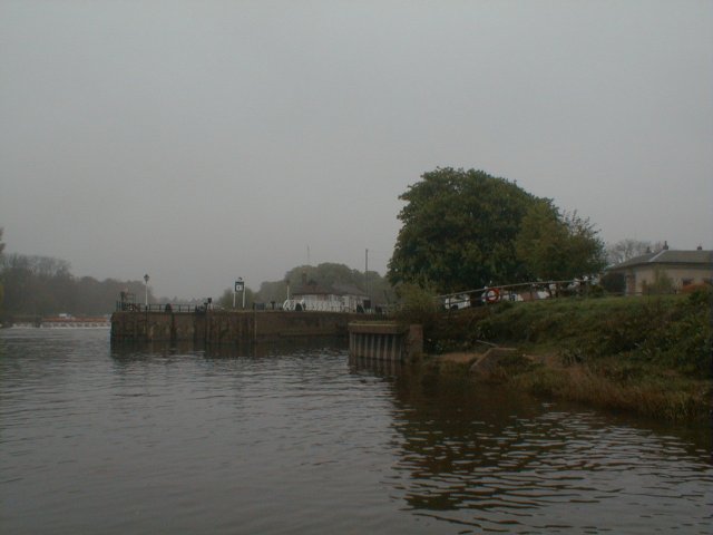
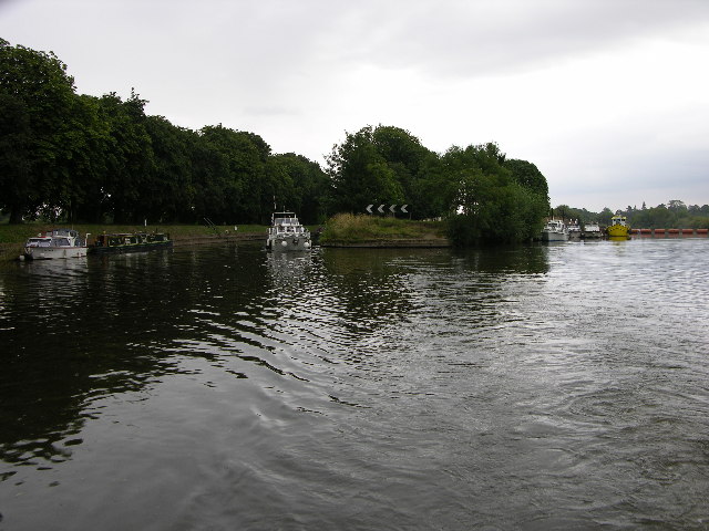
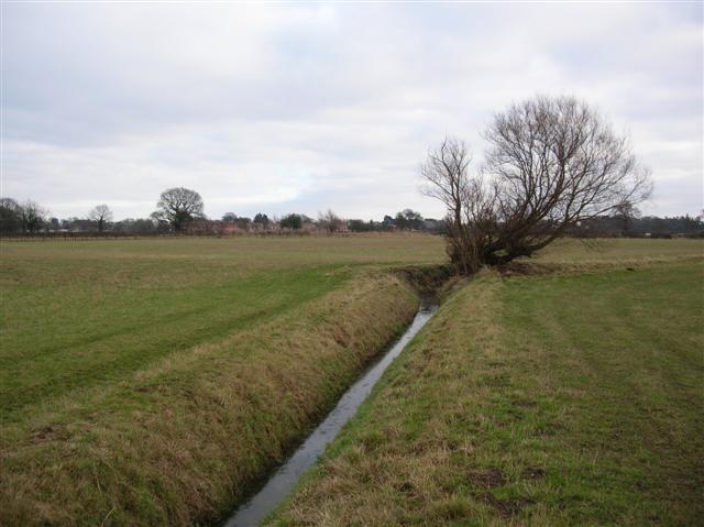
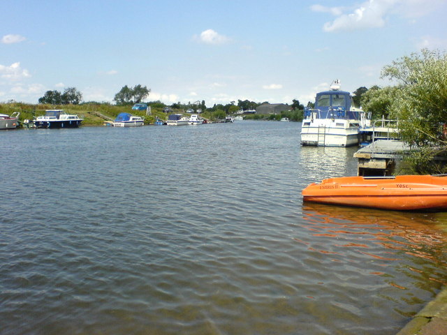
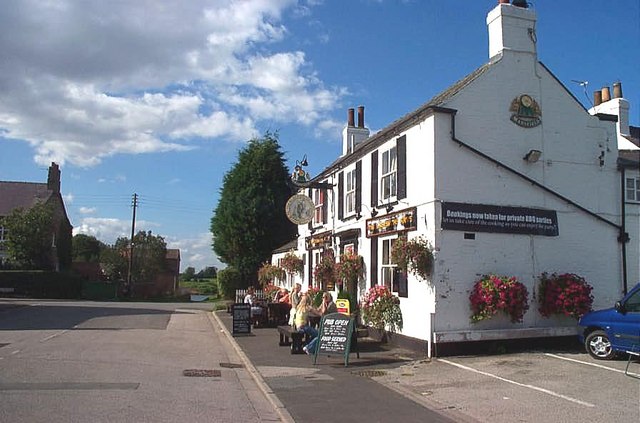
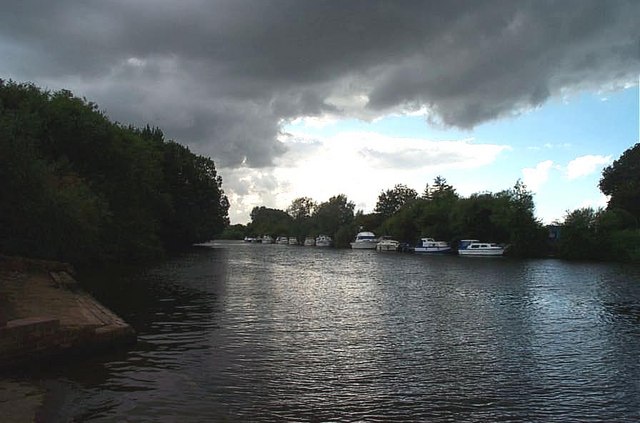
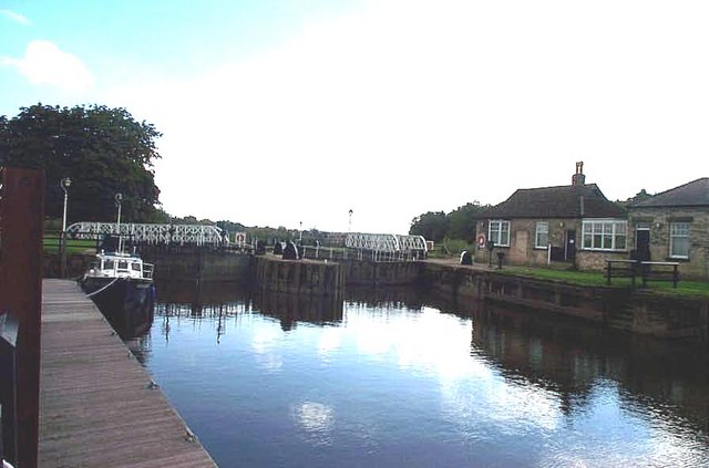
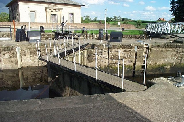
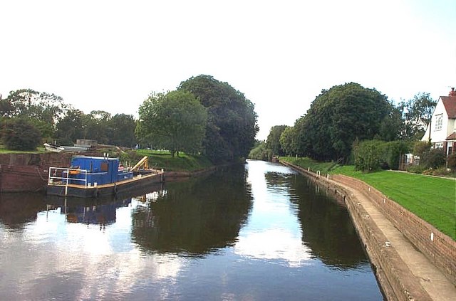
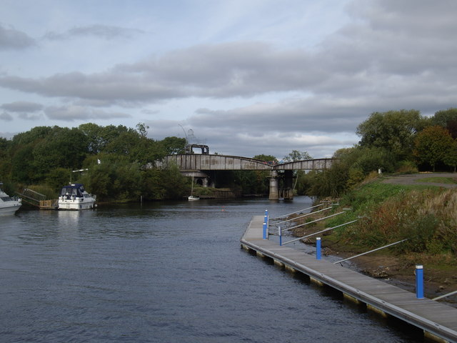
Acaster Malbis benefits from its close proximity to the River Ouse, which flows along its eastern boundary. This river provides ample opportunities for leisure activities such as boating, fishing, and riverside walks. The village also boasts a local pub, The Ship Inn, which has been serving locals and tourists for centuries, offering a warm and welcoming atmosphere.

Although small in size, Acaster Malbis is well-connected to nearby towns and cities. The A64 road runs just north of the village, providing easy access to York and other major destinations in the region. The village is also served by regular bus services, ensuring convenient transport links for residents and visitors.

Overall, Acaster Malbis is a charming and peaceful village, offering a slice of rural tranquility within easy reach of the bustling city of York. Its rich history, beautiful surroundings, and convenient location make it a desirable place to live or visit in Yorkshire.

If you have any feedback on the listing, please let us know in the comments section below.

Acaster Malbis Images

Images are sourced within 2km of 53.895269/-1.113516 or Grid Reference SE5844. Thanks to Geograph Open Source API. All images are credited.

Moor Lane running alongside Sandhole Plantation
Early morning at Naburn This is the limit of the tidal River Ouse.  Above the locks and weir the river is non-tidal and times of passage are less dependent upon the cycle of nature!
Early morning at Naburn
This is the limit of the tidal River Ouse. Above the locks and weir the river is non-tidal and times of passage are less dependent upon the cycle of nature!
Naburn Church
Naburn Church
Moreby Hall
Moreby Hall
River Ouse at Naburn Lock The lock is on the left of the photo and the weir top on the right. This view looks south and the river is tidal beyond this point.
River Ouse at Naburn Lock
The lock is on the left of the photo and the weir top on the right. This view looks south and the river is tidal beyond this point.
Sheep Sheep next to Brocket Wood.
Sheep
Sheep next to Brocket Wood.
Brocket Wood Situated between Appleton Roebuck and Acaster Malbis.
Brocket Wood
Situated between Appleton Roebuck and Acaster Malbis.
Beechlands Farm In Acaster Malbis.
Beechlands Farm
In Acaster Malbis.
Towards Acaster Malbis Stood with back to Foss Field Lane.
Towards Acaster Malbis
Stood with back to Foss Field Lane.
River Ouse at Naburn. Naburn lies just to the S of York and the river here is very popular with leisure craft.
River Ouse at Naburn.
Naburn lies just to the S of York and the river here is very popular with leisure craft.
Acaster Malbis, Holy Trinity Church This Church is placed centrally towards the northern end of the O/S grid which it occupies.
Acaster Malbis, Holy Trinity Church
This Church is placed centrally towards the northern end of the O/S grid which it occupies.
Acaster Malbis Methodist Church This Church is situated in the south eastern corner of the O/S grid it occupies, in the centre of the village of Acaster Malbis.
Acaster Malbis Methodist Church
This Church is situated in the south eastern corner of the O/S grid it occupies, in the centre of the village of Acaster Malbis.
Naburn, The Yorkshire Ouse Sailing Club This building is situated on the south eastern bank of the River Ouse, just off Main Street, Naburn, in the central, eastern quarter of the O/S grid it occupies.
Naburn, The Yorkshire Ouse Sailing Club
This building is situated on the south eastern bank of the River Ouse, just off Main Street, Naburn, in the central, eastern quarter of the O/S grid it occupies.
Naburn, The Blacksmiths Public House This lovely pub is on Main Street, Naburn.
Naburn, The Blacksmiths Public House
This lovely pub is on Main Street, Naburn.
The River Ouse Viewed downstream from the Yorkshire Ouse Sailing Club
The River Ouse
Viewed downstream from the Yorkshire Ouse Sailing Club
Naburn Locks. Naburn Lock is almost dead centre of the O/S grid it occupies. This view is taken from the north looking downstream towards the locks. The boat on the left is a Yorkshire Water Patrol boat.
Naburn Locks.
Naburn Lock is almost dead centre of the O/S grid it occupies. This view is taken from the north looking downstream towards the locks. The boat on the left is a Yorkshire Water Patrol boat.
Naburn, one of the Lock Gates
Naburn Lock. The view upstream.
Show me another place!

Acaster Malbis is located at Grid Ref: SE5844 (Lat: 53.895269, Lng: -1.113516)

Division: West Riding

Unitary Authority: York

Police Authority: North Yorkshire

What 3 Words

///sandpaper.lilac.crusher. Near Copmanthorpe, East Yorkshire

Related Wikis

Acaster Malbis

Acaster Malbis () is a village and civil parish in the unitary authority of the City of York, England. It is located on the River Ouse, almost 5 miles...

Copmanthorpe Preceptory

Copmanthorpe Preceptory was a medieval monastic house in North Yorkshire, England. The manor of Copmanthorpe was given to the Knights Templar by William...

Acaster South Ings

Acaster South Ings is a Site of Special Scientific Interest, or SSSI, near York, England. It consists of two alluvial flood-meadows, and was designated...

Holy Trinity Church, Acaster Malbis

Holy Trinity Church is an active Anglican church in Acaster Malbis, a village in the City of York, in England. It is a grade I listed building. A church...

Naburn

Naburn is a small village and civil parish in the unitary authority of the City of York in the ceremonial county of North Yorkshire, England. It lies on...

Bell Hall

Bell Hall is a grade I listed building, in Naburn, in the rural southern part of the city of York, in England. The house was built in 1680 for John Hewley...

RAF Acaster Malbis

Royal Air Force Acaster Malbis, or more simply RAF Acaster Malbis, is a former Royal Air Force station located 5.9 miles (9.5 km) south of York city centre...

Naburn railway station

Naburn railway station was a railway station which served the village of Naburn, south of York, on the East Coast Main Line. It closed to passengers in...

Nearby Amenities

Located within 500m of 53.895269,-1.113516
Turning Circle
Lat/Long: 53.8942329/-1.1108675
Turning Circle
Lat/Long: 53.8917134/-1.1124322
Bus Stop
Shelter: yes
Website: http://deps.at/?32900859
Lat/Long: 53.8940594/-1.1136181
Post Box
Post Box Type: lamp
Ref: YO23 368D
Royal Cypher: EIIR
Royal Cypher Wikidata: Q33102113
Lat/Long: 53.8938581/-1.1139502
Bench
Lat/Long: 53.89457/-1.1108313
Ainsty Ales
Addr City: York
Addr Housename: Manor Farm Buildings
Addr Postcode: YO23 2UJ
Addr Suburb: Acaster Malbis
Craft: brewery
Lat/Long: 53.894894/-1.1066498
Fixme: Longer than this
Lat/Long: 53.8943944/-1.1091867
Turning Circle
Lat/Long: 53.8940121/-1.1099435
Turning Circle
Lat/Long: 53.8940259/-1.1118928
Generator Method: photovoltaic
Generator Output Electricity: yes
Generator Source: solar
Generator Type: solar_photovoltaic_panel
Location: roof
Power: generator
Lat/Long: 53.8943566/-1.1205867
The data included in this document is from www.openstreetmap.org. The data is made available under ODbL.

Have you been to Acaster Malbis?

Leave your review of Acaster Malbis below (or comments, questions and feedback).