Cas-blaidd
Community in Pembrokeshire
Wales
Cas-blaidd

Cas-blaidd is a small community located in the county of Pembrokeshire, Wales. Situated near the coast, it is known for its picturesque landscapes and charming rural atmosphere. The community is part of the larger electoral ward of Cilgerran, which encompasses several other nearby villages.
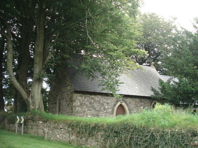
Cas-blaidd is home to a relatively small population, with a mix of residents including families, retirees, and individuals seeking a peaceful countryside lifestyle. The village itself is characterized by traditional Welsh architecture, with stone cottages and well-maintained gardens adding to its appeal.
While Cas-blaidd is primarily a residential area, it benefits from its proximity to the stunning Pembrokeshire Coast National Park, attracting tourists and outdoor enthusiasts throughout the year. The community offers easy access to a variety of outdoor activities, including hiking, cycling, and birdwatching. The nearby River Teifi also presents opportunities for fishing and canoeing.
In terms of amenities, Cas-blaidd has a few local shops and services, providing basic necessities for its residents. Additionally, the community benefits from its close proximity to larger towns such as Cardigan, which offer a wider range of amenities, including supermarkets, schools, and healthcare facilities.
Overall, Cas-blaidd offers a tranquil and scenic setting for those seeking a peaceful rural lifestyle, with the added benefit of being close to the natural beauty of the Pembrokeshire Coast National Park.
If you have any feedback on the listing, please let us know in the comments section below.
Cas-blaidd Images
Images are sourced within 2km of 51.896742/-4.972717 or Grid Reference SM9526. Thanks to Geograph Open Source API. All images are credited.


Cas-blaidd is located at Grid Ref: SM9526 (Lat: 51.896742, Lng: -4.972717)
Unitary Authority: Pembrokeshire
Police Authority: Dyfed-Powys
Also known as: Wolfscastle
What 3 Words
///charts.sailors.hotspot. Near Letterston, Pembrokeshire
Nearby Locations
Related Wikis
Wolf's Castle
Wolfscastle (Welsh: Casblaidd), also spelt Wolf's Castle, is a village and community in Pembrokeshire, between Haverfordwest and Fishguard, in southwest...
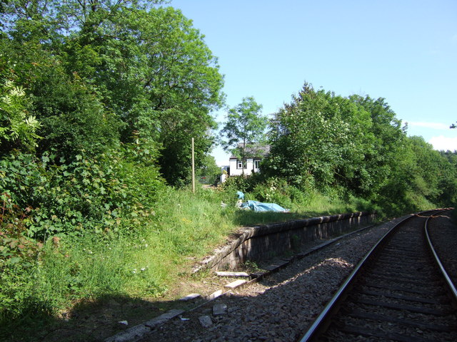
Wolf's Castle Halt railway station
Wolf's Castle Halt railway station was on the Clarbeston Road and Letterston line of the Great Western Railway. It served the villages of Wolf's Castle...

Sealyham House
Sealyham Mansion, overlooking the little River Sealy, is a Georgian country house in Pembrokeshire, Wales, near Wolfscastle and to the southeast of Letterston...
Treffgarne
Treffgarne (Welsh: Trefgarn, or town of the rock) is a small village and parish in Pembrokeshire, south-west Wales. It lies to the south of the Preseli...
Welsh Hook Halt railway station
Welsh Hook Halt railway station served the hamlet of Welsh Hook, Pembrokeshire, Wales, from 1924 to 1964 on the Clarbeston Road and Letterston Railway...

Treffgarne Hall
Treffgarne Hall is a privately owned Grade II listed Georgian country house, located to the west of the village of Treffgarne, West Wales. It was built...
Beulah Halt railway station
Beulah Halt railway station served the village of Little Newcastle, Pembrokeshire, Wales, from 1928 to 1937 on the North Pembrokeshire and Fishguard Railway...
Treffgarne Bridge Quarry
Treffgarne Bridge Quarry is a Site of Special Scientific Interest (or SSSI) in Pembrokeshire, South Wales. It has been designated as a Site of Special...
Nearby Amenities
Located within 500m of 51.896742,-4.972717Have you been to Cas-blaidd?
Leave your review of Cas-blaidd below (or comments, questions and feedback).