Cas-blaidd

Settlement in Pembrokeshire

Wales

Cas-blaidd

Field and farm track near the A40 Looks like the remains of an old milk stand at the roadside
Field and farm track near the A40 Credit: Eirian Evans

Cas-blaidd is a small village located in the county of Pembrokeshire, Wales. Situated on the southwestern coast of the country, it is nestled between the towns of Fishguard and St David's. The village is surrounded by picturesque countryside, offering stunning views of rolling hills and the nearby coastline.

With a population of approximately 500 residents, Cas-blaidd is known for its tight-knit community and peaceful atmosphere. The village is predominantly residential, with a few local businesses catering to the needs of its residents. The traditional architecture, including quaint cottages and stone houses, adds to the charm of the area.

Nature enthusiasts are drawn to Cas-blaidd for its proximity to the Pembrokeshire Coast National Park, which encompasses breathtaking coastal cliffs, sandy beaches, and diverse wildlife. The village is also close to several walking trails, providing ample opportunities for outdoor activities and exploration.

History buffs can explore the rich heritage of the area, with notable landmarks such as Castell Blaidd, a hill fort dating back to the Iron Age. The nearby town of Fishguard is famous for its involvement in the French Revolution, as it was the site of the Last Invasion of Britain in 1797.

Cas-blaidd offers a tranquil and picturesque retreat for those seeking a peaceful countryside getaway, while also providing easy access to the stunning natural beauty and historical sites of Pembrokeshire.

If you have any feedback on the listing, please let us know in the comments section below.
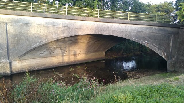
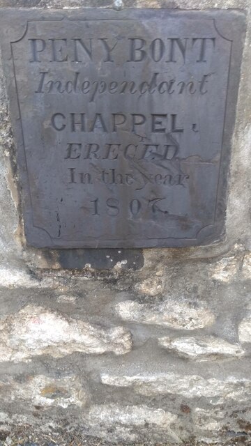
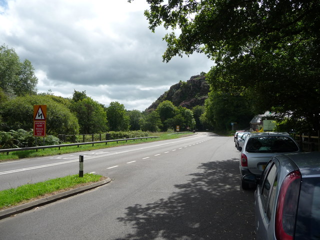
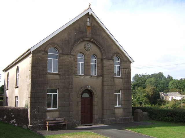
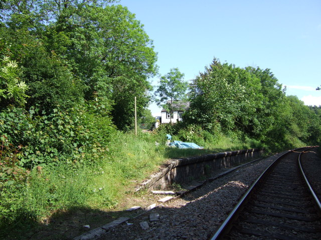
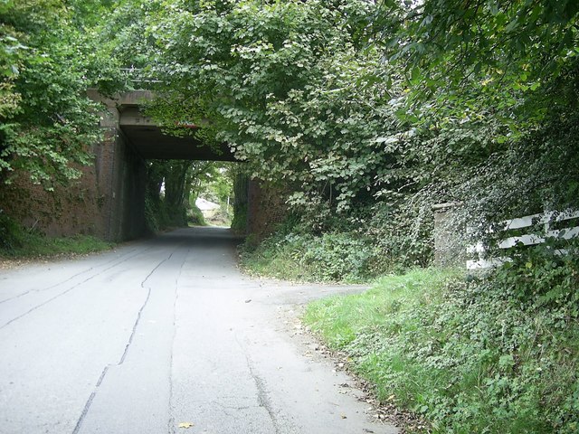
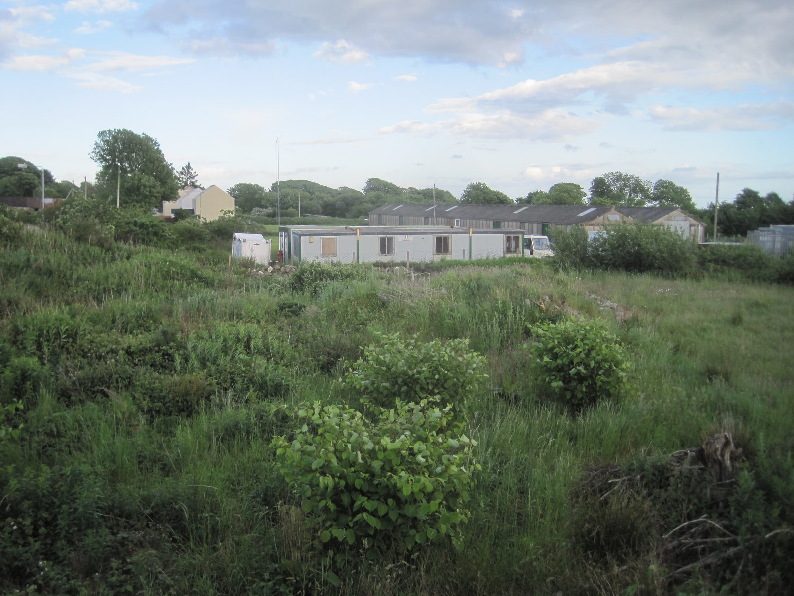
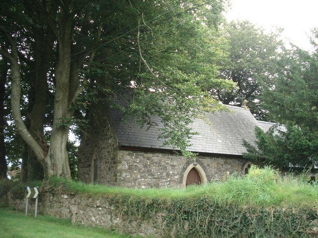
Cas-blaidd Images

Images are sourced within 2km of 51.90183/-4.973198 or Grid Reference SM9526. Thanks to Geograph Open Source API. All images are credited.

Field and farm track near the A40 Looks like the remains of an old milk stand at the roadside
Field and farm track near the A40
Looks like the remains of an old milk stand at the roadside
The Wolfe Inn Traditional country inn and restaurant on the A40
The Wolfe Inn
Traditional country inn and restaurant on the A40
The Road bridge, Wolfscastle Carrying the main Haverfordwest/Fishguard road.
The Road bridge, Wolfscastle
Carrying the main Haverfordwest/Fishguard road.
Old stone bridge, Ford, Wolfscastle Catching the evening sun.
Old stone bridge, Ford, Wolfscastle
Catching the evening sun.
Road over stone bridge, Ford, Wolfscastle This was once the main road.
Road over stone bridge, Ford, Wolfscastle
This was once the main road.
Old road over bridge, Ford, Wolfscastle This was once the main road.
Old road over bridge, Ford, Wolfscastle
This was once the main road.
Road over bridge, Ford, Wolfscastle With the new road bridge in the distance.
Road over bridge, Ford, Wolfscastle
With the new road bridge in the distance.
Pen y Bont 'Chappel' plaque, Ford, Wolfscastle Miss-spelt plaque on the old chapel.
Pen y Bont 'Chappel' plaque, Ford, Wolfscastle
Miss-spelt plaque on the old chapel.
Old plaque on Ford Chapel, Wolfscastle Note the spelling error with 'Chappel'.
Old plaque on Ford Chapel, Wolfscastle
Note the spelling error with 'Chappel'.
Gateway and lamp at Chapel entrance, Ford, Wolfscastle A very pretty entranceway.
Gateway and lamp at Chapel entrance, Ford, Wolfscastle
A very pretty entranceway.
Sheep in the meadow, Ford, Wolfscastle By the side of the river.
Sheep in the meadow, Ford, Wolfscastle
By the side of the river.
Old boundary stone, Ford bridge, Wolfscastle Boundary of St Dogwell's parish.
Old boundary stone, Ford bridge, Wolfscastle
Boundary of St Dogwell's parish.
Boundary stone on Ford bridge, Wolfscastle Boundary of St Dogwell's parish.
Boundary stone on Ford bridge, Wolfscastle
Boundary of St Dogwell's parish.
The A40 south of Wolf's Castle, with Poll Carn and Maiden Castle on the skyline A winding and undulating stretch of the main road, just before it drops down into Treffgarne Gorge.  

The right-most of the tors on the horizon is Poll Carn.  To its left, Maiden Castle - looking much like a ruined castle from this sort of distance, though like Poll Carn it represents the remains of a volcano of the Precambrian era (about as far back as you can go, geologically).  See Sid Howells' contribution <a href="https://www.geograph.org.uk/photo/1583324">SM9524 : Maiden's Castle and Poll Carn</a> for more geological detail.
The A40 south of Wolf's Castle, with Poll Carn and Maiden Castle on the skyline
A winding and undulating stretch of the main road, just before it drops down into Treffgarne Gorge. The right-most of the tors on the horizon is Poll Carn. To its left, Maiden Castle - looking much like a ruined castle from this sort of distance, though like Poll Carn it represents the remains of a volcano of the Precambrian era (about as far back as you can go, geologically). See Sid Howells' contribution SM9524 : Maiden's Castle and Poll Carn for more geological detail.
Minor road junction, near Little Treffgarne The road to the right leads to Wolfscastle, that on the left to Little Treffgarne.
Minor road junction, near Little Treffgarne
The road to the right leads to Wolfscastle, that on the left to Little Treffgarne.
Country road near Wolfscastle This road to Wolfscastle near Upper Danbarch has on one side a small grass verge and a shallow ditch with water flowing downhill towards the stream.
Country road near Wolfscastle
This road to Wolfscastle near Upper Danbarch has on one side a small grass verge and a shallow ditch with water flowing downhill towards the stream.
Part of the Nant-y-Coy lay by on the A40 The Welsh National flag flutters above the road on the rocky outcrop to the south. The lay by is a good parking point for exploring the Treffgarne Gorge area.
Part of the Nant-y-Coy lay by on the A40
The Welsh National flag flutters above the road on the rocky outcrop to the south. The lay by is a good parking point for exploring the Treffgarne Gorge area.
Nant-y-Coy Mill A little sun trap for these visitors dining outside the arts centre in a converted mill.
Nant-y-Coy Mill
A little sun trap for these visitors dining outside the arts centre in a converted mill.
Show me another place!

Cas-blaidd is located at Grid Ref: SM9526 (Lat: 51.90183, Lng: -4.973198)

Unitary Authority: Pembrokeshire

Police Authority: Dyfed Powys

Also known as: Wolf's Castle

What 3 Words

///machine.winners.caressing. Near Letterston, Pembrokeshire

Related Wikis

Wolf's Castle

Wolfscastle (Welsh: Casblaidd), also spelt Wolf's Castle, is a village and community in Pembrokeshire, between Haverfordwest and Fishguard, in southwest...

Wolf's Castle Halt railway station

Wolf's Castle Halt railway station was on the Clarbeston Road and Letterston line of the Great Western Railway. It served the villages of Wolf's Castle...

Sealyham House

Sealyham Mansion, overlooking the little River Sealy, is a Georgian country house in Pembrokeshire, Wales, near Wolfscastle and to the southeast of Letterston...

Welsh Hook Halt railway station

Welsh Hook Halt railway station served the hamlet of Welsh Hook, Pembrokeshire, Wales, from 1924 to 1964 on the Clarbeston Road and Letterston Railway...

Letterston railway station

Letterston railway station served the parish of Letterston, Pembrokeshire, Wales, from 1895 to 1965 on the North Pembrokeshire and Fishguard Railway....

Beulah Halt railway station

Beulah Halt railway station served the village of Little Newcastle, Pembrokeshire, Wales, from 1928 to 1937 on the North Pembrokeshire and Fishguard Railway...

Treffgarne

Treffgarne (Welsh: Trefgarn, or town of the rock) is a small village and parish in Pembrokeshire, south-west Wales. It lies to the south of the Preseli...

Letterston

Letterston (Welsh: Treletert) is a parish and local government community in north Pembrokeshire, Wales. Situated on the A40, Haverfordwest is 10 miles...

Nearby Amenities

Located within 500m of 51.90183,-4.973198
Wolf's Castle
Alt Name: Wolfscastle
Name Cy: Casblaidd
Name En: Wolf's Castle
Place: village
Reg Name: Casblaidd
Wikidata: Q3460673
Wikipedia: en:Wolf's Castle
Lat/Long: 51.8985241/-4.9706988
Turning Circle
Lat/Long: 51.9012911/-4.9745864
Wolf's Castle
Alt Name: Wolf's Castle for Treffgarne Rocks
End Date: 1964-04-06
Historic Railway: halt
Railway: site
Wikidata: Q8029758
Wikipedia: en:Wolf's Castle Halt railway station
Lat/Long: 51.8976264/-4.9709321
Place Of Worship
Pen-y-Bont Congregational Chapel
Religion: christian
Lat/Long: 51.8985054/-4.971575
Turning Circle
Lat/Long: 51.8981411/-4.9731954
Wolfscastle Pottery
Shop: pottery
Lat/Long: 51.9019566/-4.9779025
Bus Stop
Wolf's Castle School
Naptan AtcoCode: 5210AWC51056
Naptan NaptanCode: pemdmwt
Ref: pemajaj
Shelter: yes
Lat/Long: 51.9013121/-4.970771
Bus Stop
Bryngomer
Naptan AtcoCode: 5210WDB48305
Naptan NaptanCode: pemgtda
Ref: pemgtda
Lat/Long: 51.9030885/-4.9705889
Give Way
Direction: backward
Lat/Long: 51.8979263/-4.9706732
Give Way
Direction: forward
Lat/Long: 51.8986556/-4.9687839
Give Way
Direction: forward
Lat/Long: 51.8986152/-4.96867
Parking
Access: yes
Capacity: 6
Lat/Long: 51.9044091/-4.9704599
Bench
Backrest: yes
Material: wood
Lat/Long: 51.9044832/-4.9707363
Direction: W
Generator Method: photovoltaic
Generator Output Electricity: yes
Generator Solar Modules: 12
Generator Source: solar
Generator Type: solar_photovoltaic_panel
Location: roof
Power: generator
Lat/Long: 51.902183/-4.970993
Direction: S
Generator Method: photovoltaic
Generator Output Electricity: yes
Generator Solar Modules: 4
Generator Source: solar
Generator Type: solar_photovoltaic_panel
Location: roof
Power: generator
Lat/Long: 51.9021044/-4.9710077
Direction: 185
Generator Method: photovoltaic
Generator Output Electricity: yes
Generator Solar Modules: 16
Generator Source: solar
Generator Type: solar_photovoltaic_panel
Location: roof
Power: generator
Lat/Long: 51.9009773/-4.9735343
Turning Circle
Lat/Long: 51.8980971/-4.9729397
Power: pole
Lat/Long: 51.8979114/-4.9762957
Power: pole
Lat/Long: 51.8979436/-4.9758142
Public Bookcase
Defibrillator
Access: yes
Booth: KX100
Defibrillator Location: inside old phone box (that is now used as book exchange) in Wolf's Castle
Disused Amenity: telephone
Emergency: defibrillator
Man Made: telephone_box
Public Bookcase Type: phone_box
Lat/Long: 51.8982105/-4.9708209
The data included in this document is from www.openstreetmap.org. The data is made available under ODbL.

Have you been to Cas-blaidd?

Leave your review of Cas-blaidd below (or comments, questions and feedback).