Carn Gwcw

Hill, Mountain in Pembrokeshire

Wales

Carn Gwcw

Field and farm track near the A40 Looks like the remains of an old milk stand at the roadside
Field and farm track near the A40 Credit: Eirian Evans

Carn Gwcw is a prominent hill located in the county of Pembrokeshire, Wales. It stands at an elevation of 202 meters (663 feet) above sea level and is part of the Preseli Hills range. The hill is situated near the village of Crymych, just south of the Preseli Mountains.

Carn Gwcw is known for its stunning panoramic views of the surrounding countryside. From its summit, visitors can enjoy breathtaking vistas of rolling green hills, picturesque farmland, and distant coastal areas. On clear days, it is even possible to see as far as the Preseli Mountains and the Irish Sea.

The hill is a popular destination for hikers and nature enthusiasts, offering a variety of walking trails to explore. One of the most well-known routes is the circular walk starting from Crymych, which takes visitors through scenic woodlands, past ancient burial sites, and up to the summit of Carn Gwcw. Along the way, walkers can admire the diverse flora and fauna that inhabit the area, including heather, gorse, and various bird species.

Carn Gwcw is also steeped in history and folklore. It is believed to be the site of an ancient burial chamber, and legends tell of mythical creatures and spirits that once roamed the hill. The hill's name, which translates to "Cuckoo's Cairn," references the migratory bird that can be heard in the area during the spring and summer months.

Overall, Carn Gwcw is a remarkable natural landmark that offers both scenic beauty and historical intrigue, making it a must-visit destination for those exploring Pembrokeshire.

If you have any feedback on the listing, please let us know in the comments section below.

Carn Gwcw Images

Images are sourced within 2km of 51.899679/-4.9685459 or Grid Reference SM9526. Thanks to Geograph Open Source API. All images are credited.

Field and farm track near the A40 Looks like the remains of an old milk stand at the roadside
Field and farm track near the A40
Looks like the remains of an old milk stand at the roadside
The Wolfe Inn Traditional country inn and restaurant on the A40
The Wolfe Inn
Traditional country inn and restaurant on the A40
The Road bridge, Wolfscastle Carrying the main Haverfordwest/Fishguard road.
The Road bridge, Wolfscastle
Carrying the main Haverfordwest/Fishguard road.
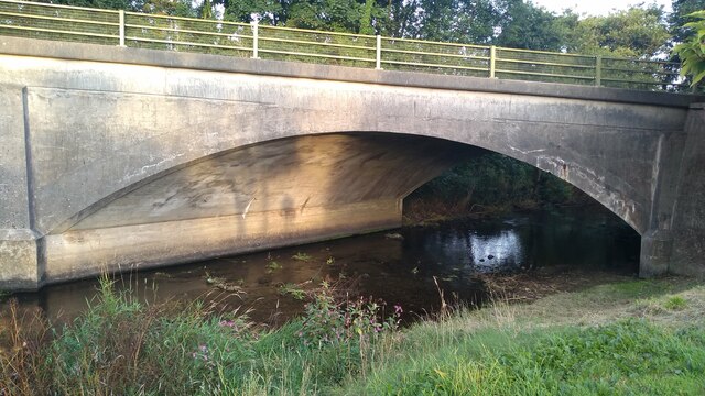
Old stone bridge, Ford, Wolfscastle Catching the evening sun.
Old stone bridge, Ford, Wolfscastle
Catching the evening sun.
Road over stone bridge, Ford, Wolfscastle This was once the main road.
Road over stone bridge, Ford, Wolfscastle
This was once the main road.
Old road over bridge, Ford, Wolfscastle This was once the main road.
Old road over bridge, Ford, Wolfscastle
This was once the main road.
Road over bridge, Ford, Wolfscastle With the new road bridge in the distance.
Road over bridge, Ford, Wolfscastle
With the new road bridge in the distance.
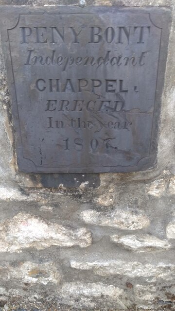
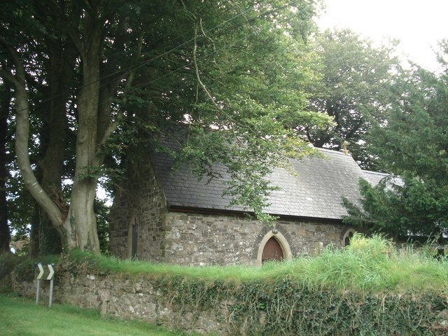
Pen y Bont 'Chappel' plaque, Ford, Wolfscastle Miss-spelt plaque on the old chapel.
Pen y Bont 'Chappel' plaque, Ford, Wolfscastle
Miss-spelt plaque on the old chapel.
Old plaque on Ford Chapel, Wolfscastle Note the spelling error with 'Chappel'.
Old plaque on Ford Chapel, Wolfscastle
Note the spelling error with 'Chappel'.
Gateway and lamp at Chapel entrance, Ford, Wolfscastle A very pretty entranceway.
Gateway and lamp at Chapel entrance, Ford, Wolfscastle
A very pretty entranceway.
Sheep in the meadow, Ford, Wolfscastle By the side of the river.
Sheep in the meadow, Ford, Wolfscastle
By the side of the river.
Old boundary stone, Ford bridge, Wolfscastle Boundary of St Dogwell's parish.
Old boundary stone, Ford bridge, Wolfscastle
Boundary of St Dogwell's parish.
Boundary stone on Ford bridge, Wolfscastle Boundary of St Dogwell's parish.
Boundary stone on Ford bridge, Wolfscastle
Boundary of St Dogwell's parish.
The A40 south of Wolf's Castle, with Poll Carn and Maiden Castle on the skyline A winding and undulating stretch of the main road, just before it drops down into Treffgarne Gorge.  

The right-most of the tors on the horizon is Poll Carn.  To its left, Maiden Castle - looking much like a ruined castle from this sort of distance, though like Poll Carn it represents the remains of a volcano of the Precambrian era (about as far back as you can go, geologically).  See Sid Howells' contribution <a href="https://www.geograph.org.uk/photo/1583324">SM9524 : Maiden's Castle and Poll Carn</a> for more geological detail.
The A40 south of Wolf's Castle, with Poll Carn and Maiden Castle on the skyline
A winding and undulating stretch of the main road, just before it drops down into Treffgarne Gorge. The right-most of the tors on the horizon is Poll Carn. To its left, Maiden Castle - looking much like a ruined castle from this sort of distance, though like Poll Carn it represents the remains of a volcano of the Precambrian era (about as far back as you can go, geologically). See Sid Howells' contribution SM9524 : Maiden's Castle and Poll Carn for more geological detail.
Country road, Little Treffgarne Country road leading to the entrance of Treffgarne Farm.
Country road, Little Treffgarne
Country road leading to the entrance of Treffgarne Farm.
Minor road junction, near Little Treffgarne The road to the right leads to Wolfscastle, that on the left to Little Treffgarne.
Minor road junction, near Little Treffgarne
The road to the right leads to Wolfscastle, that on the left to Little Treffgarne.
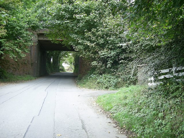
Country road near Wolfscastle This road to Wolfscastle near Upper Danbarch has on one side a small grass verge and a shallow ditch with water flowing downhill towards the stream.
Country road near Wolfscastle
This road to Wolfscastle near Upper Danbarch has on one side a small grass verge and a shallow ditch with water flowing downhill towards the stream.
Footpath sign by tree-lined road Footpath sign pointing the way to Pen-yr-allt, by the tree-lined country road heading for Little Treffgarne.
Footpath sign by tree-lined road
Footpath sign pointing the way to Pen-yr-allt, by the tree-lined country road heading for Little Treffgarne.
Show me another place!

Carn Gwcw is located at Grid Ref: SM9526 (Lat: 51.899679, Lng: -4.9685459)

Unitary Authority: Pembrokeshire

Police Authority: Dyfed Powys

What 3 Words

///foster.encoding.embarks. Near Letterston, Pembrokeshire

Related Wikis

Nearby Amenities

Located within 500m of 51.899679,-4.9685459
Wolf's Castle
Alt Name: Wolfscastle
Name Cy: Casblaidd
Name En: Wolf's Castle
Place: village
Reg Name: Casblaidd
Wikidata: Q3460673
Wikipedia: en:Wolf's Castle
Lat/Long: 51.8985241/-4.9706988
Turning Circle
Lat/Long: 51.9012911/-4.9745864
Wolf's Castle
Alt Name: Wolf's Castle for Treffgarne Rocks
End Date: 1964-04-06
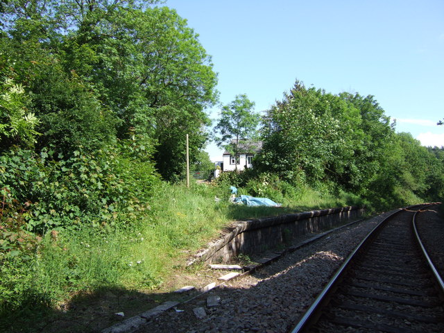
Historic Railway: halt
Railway: site
Wikidata: Q8029758
Wikipedia: en:Wolf's Castle Halt railway station
Lat/Long: 51.8976264/-4.9709321
Place Of Worship
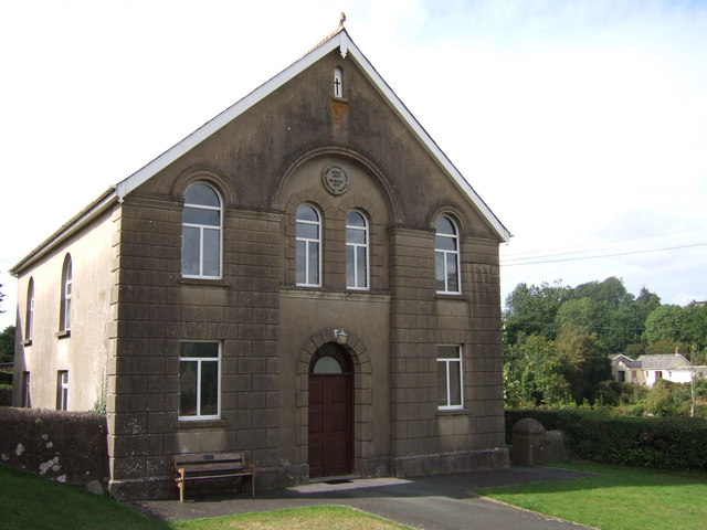
Pen-y-Bont Congregational Chapel
Religion: christian
Lat/Long: 51.8985054/-4.971575
Turning Circle
Lat/Long: 51.8981411/-4.9731954
Bus Stop
Wolf's Castle School
Naptan AtcoCode: 5210AWC51056
Naptan NaptanCode: pemdmwt
Ref: pemajaj
Shelter: yes
Lat/Long: 51.9013121/-4.970771
Bus Stop
Bryngomer
Naptan AtcoCode: 5210WDB48305
Naptan NaptanCode: pemgtda
Ref: pemgtda
Lat/Long: 51.9030885/-4.9705889
Bus Stop
Wolfscastle
Bus: yes
Public Transport: platform
Ref: pemajam
Lat/Long: 51.8971348/-4.9704797
Bus Stop
Wolfscastle
Naptan AtcoCode: 5210AWC51054
Naptan NaptanCode: pemajaj
Ref: pemajaj
Shelter: no
Lat/Long: 51.8967077/-4.9707027
Post Office
Wolfscastle Post Office
Addr Postcode: SA62 5LS
Brand: Post Office
Brand Wikidata: Q1783168
Fixme: verify by survey
Fixme Addr 1: The Wolfe Inn
Fixme Addr 2: Wolfscastle
Fixme Addr City: Haverfordwest
Opening Hours: Fr 09:30-11:30
Ref Pol Id: 135669
Source: pol_branch_list_2018-02
Website: https://www.postoffice.co.uk/branch-finder/422471x/wolfscastle
Lat/Long: 51.89685/-4.97106
Give Way
Direction: backward
Lat/Long: 51.8979263/-4.9706732
Give Way
Direction: forward
Lat/Long: 51.8986556/-4.9687839
Give Way
Direction: forward
Lat/Long: 51.8986152/-4.96867
Direction: W
Generator Method: photovoltaic
Generator Output Electricity: yes
Generator Solar Modules: 12
Generator Source: solar
Generator Type: solar_photovoltaic_panel
Location: roof
Power: generator
Lat/Long: 51.902183/-4.970993
Direction: S
Generator Method: photovoltaic
Generator Output Electricity: yes
Generator Solar Modules: 4
Generator Source: solar
Generator Type: solar_photovoltaic_panel
Location: roof
Power: generator
Lat/Long: 51.9021044/-4.9710077
Direction: 185
Generator Method: photovoltaic
Generator Output Electricity: yes
Generator Solar Modules: 16
Generator Source: solar
Generator Type: solar_photovoltaic_panel
Location: roof
Power: generator
Lat/Long: 51.9009773/-4.9735343
Pub
The Wolfe Inn
Addr City: Haverfordwest
Addr Locality: Wolfscastle
Addr Postcode: SA62 5LS
Brewery: Brains
Contact Facebook: https://www.facebook.com/TheWolfeInn
Email: info@thewolfeinn.co.uk
Opening Hours: Mo 17:30-23:00; Tu-Fr 11:30-14:30,17:30-23:00; Sa 11:30-23:00; Su 12:00-15:00
Phone: +44 1437 741 668
Website: https://thewolfeinn.co.uk/
Wikidata: Q80856266
Lat/Long: 51.8968059/-4.9709958
Turning Circle
Lat/Long: 51.8980971/-4.9729397
Public Bookcase
Defibrillator
Access: yes
Booth: KX100
Defibrillator Location: inside old phone box (that is now used as book exchange) in Wolf's Castle
Disused Amenity: telephone
Emergency: defibrillator
Man Made: telephone_box
Public Bookcase Type: phone_box
Lat/Long: 51.8982105/-4.9708209
The data included in this document is from www.openstreetmap.org. The data is made available under ODbL.

Have you been to Carn Gwcw?

Leave your review of Carn Gwcw below (or comments, questions and feedback).