Bridge of Gaur

Settlement in Perthshire

Scotland

Bridge of Gaur

The 'road' along Allt a' Mheanbh-chruidh View up the track that runs south from Bridge of Gaur. This was an attempt to scout the approach to the Munro a few miles further south, a foray that was foiled by shooting further ahead. A feeding station signifies the abundance of deer around here.
The 'road' along Allt a' Mheanbh-chruidh Credit: Aleks Scholz

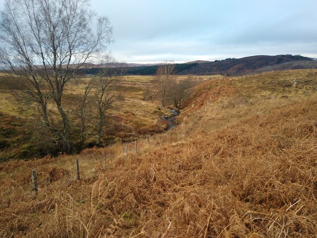
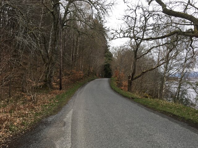
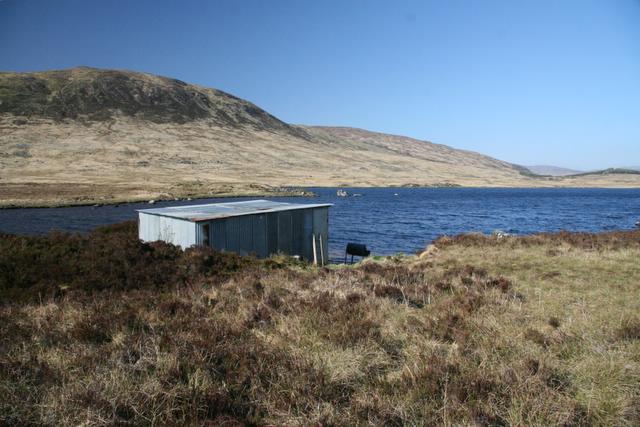
Bridge of Gaur is a picturesque village located in the heart of Perthshire, Scotland. Situated at the southern end of Loch Rannoch, it is nestled within the stunning Scottish Highlands. The village is named after the historic bridge that spans the River Gaur, which offers a charming focal point and a link between the surrounding areas.

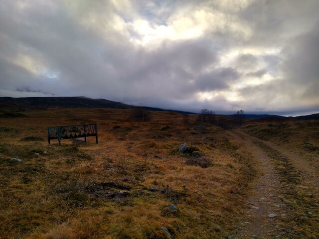
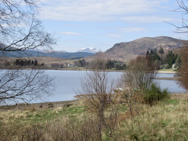
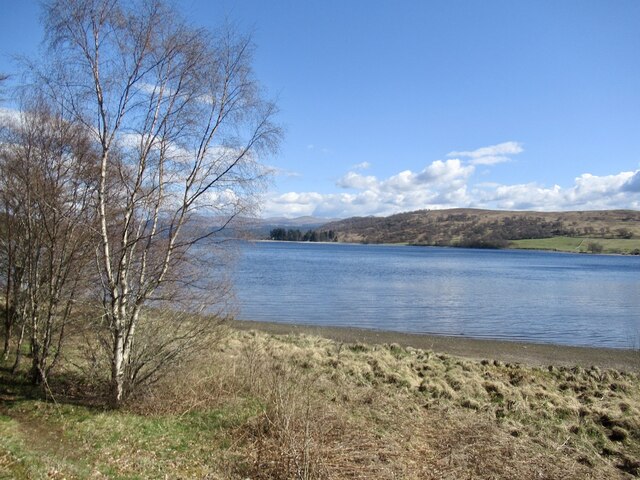
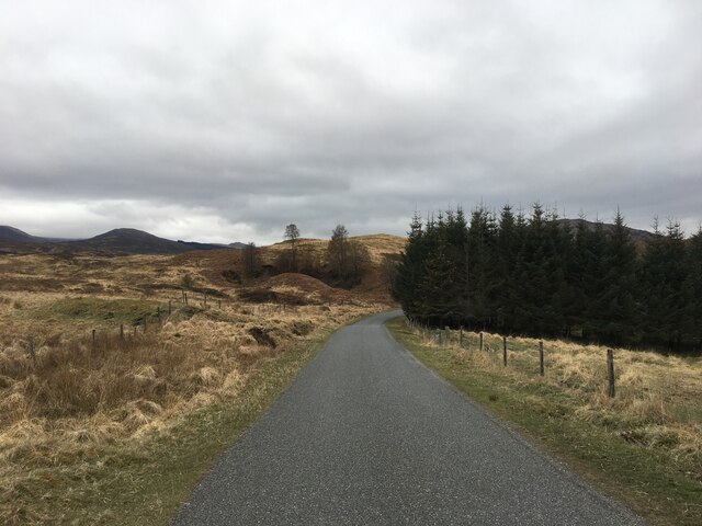
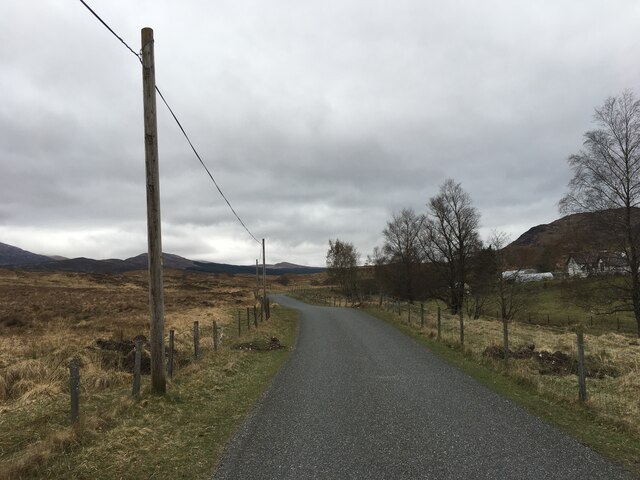
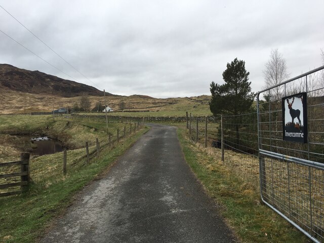
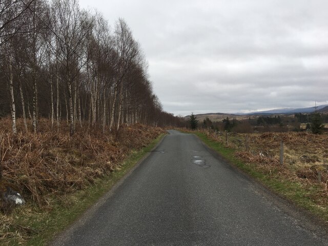
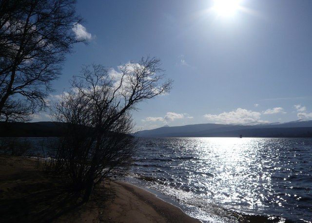
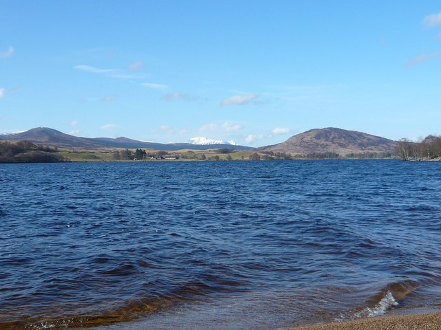
Surrounded by breathtaking natural beauty, Bridge of Gaur serves as an excellent base for outdoor enthusiasts. The area boasts a plethora of walking and cycling trails that wind through the enchanting landscapes. Loch Rannoch, with its crystal-clear waters and serene atmosphere, provides ample opportunities for fishing, boating, and wildlife watching.

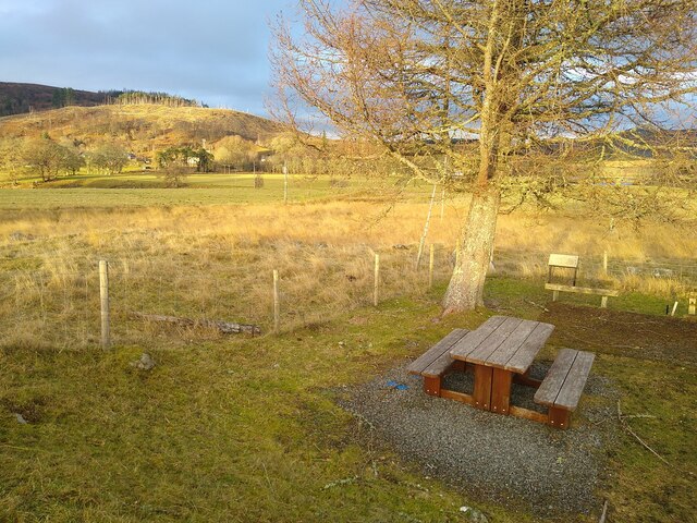
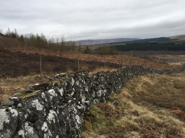
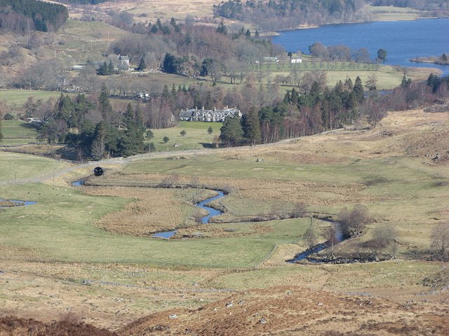
The village itself exudes a tranquil ambiance, with a scattering of traditional stone cottages and a small, friendly community. It offers a peaceful escape from the bustling cities, making it an ideal spot for those seeking relaxation and rejuvenation. The nearby Rannoch Moor, a vast expanse of wilderness, adds to the allure of the area.

History buffs will appreciate the village's historical significance. The ancient bridge, with its unique architecture, stands as a testament to the area's past. Additionally, the surrounding region is dotted with ancient ruins, including the remains of an Iron Age fort and several standing stones.

Despite its remote location, Bridge of Gaur is not completely isolated. It is within easy reach of larger towns such as Kinloch Rannoch and Pitlochry, where visitors can find amenities, shops, and dining options.

In conclusion, Bridge of Gaur offers a charming, idyllic escape in the heart of Perthshire. With its natural beauty, outdoor activities, and historical significance, it is a hidden gem waiting to be explored.

If you have any feedback on the listing, please let us know in the comments section below.

Bridge of Gaur Images

Images are sourced within 2km of 56.677619/-4.4474952 or Grid Reference NN5056. Thanks to Geograph Open Source API. All images are credited.

The 'road' along Allt a' Mheanbh-chruidh View up the track that runs south from Bridge of Gaur. This was an attempt to scout the approach to the Munro a few miles further south, a foray that was foiled by shooting further ahead. A feeding station signifies the abundance of deer around here.
The 'road' along Allt a' Mheanbh-chruidh
View up the track that runs south from Bridge of Gaur. This was an attempt to scout the approach to the Munro a few miles further south, a foray that was foiled by shooting further ahead. A feeding station signifies the abundance of deer around here.
View towards Allt a' Mheanbh-chruidh In the middle of this square, the path comes close to the stream. This is the view of the Allt a' Mheanbh-chruidh, seen from the track, with some wintery brown fern landscape.
View towards Allt a' Mheanbh-chruidh
In the middle of this square, the path comes close to the stream. This is the view of the Allt a' Mheanbh-chruidh, seen from the track, with some wintery brown fern landscape.
Picnic table in Bridge of Gaur The little parking area next to the village hall has a decent tree, a picnic table, and lovely views across the glen. It is a convenient starting place for a number of interesting walks, in an area that is not rich in convenient parking.
Picnic table in Bridge of Gaur
The little parking area next to the village hall has a decent tree, a picnic table, and lovely views across the glen. It is a convenient starting place for a number of interesting walks, in an area that is not rich in convenient parking.
North shore of Loch Rannoch With snow on Beinn a' Chreachain.
North shore of Loch Rannoch
With snow on Beinn a' Chreachain.
Loch Rannoch
Loch Rannoch
Shielings with tree Derelict sheep pens, with a thoroughly protected young tree.
Shielings with tree
Derelict sheep pens, with a thoroughly protected young tree.
Minor road near Finnart
Road towards Bridge of Gaur
B846 at Bridge of Gaur
B846 near Loch Rannoch
Road to Invercomrie
Road to Invercomrie
Cattle track on Meall Chomraidh
Stone wall near Invercomrie
B846 near Bridge of Gaur
Deer watching in Rannoch Forest Looking out from Creagan Aighean, a knoll on the lower slopes of Leagag (580 metres), across the tree-lined stream Allt Chomraidh to the valley of the river Gaur in sunshine beyond. This short 3-mile stretch of the Gaur river west of Loch Rannoch is known for its dam, the hydro-electric power it produces and its fish ladder <a title="https://www.geograph.org.uk/photo/279800" href="https://www.geograph.org.uk/photo/279800">Link</a>
Deer watching in Rannoch Forest
Looking out from Creagan Aighean, a knoll on the lower slopes of Leagag (580 metres), across the tree-lined stream Allt Chomraidh to the valley of the river Gaur in sunshine beyond. This short 3-mile stretch of the Gaur river west of Loch Rannoch is known for its dam, the hydro-electric power it produces and its fish ladder Link
View across Loch Rannoch from small beach by the roadside The peak of Schiehallion is visible in the distance
View across Loch Rannoch from small beach by the roadside
The peak of Schiehallion is visible in the distance
View south across Loch Rannoch to Finnart and the snowy hills beyond Taken from the side of the road to Rannoch Station
View south across Loch Rannoch to Finnart and the snowy hills beyond
Taken from the side of the road to Rannoch Station
Show me another place!

Bridge of Gaur is located at Grid Ref: NN5056 (Lat: 56.677619, Lng: -4.4474952)

Unitary Authority: Perth and Kinross

Police Authority: Tayside

What 3 Words

///status.spouting.liquids. Near Pubil, Perth & Kinross

Nearby Locations

Bridge of Gaur

Related Wikis

Rannoch Barracks

Rannoch Barracks was a military barracks constructed in 1746 at Bridge of Gaur (Braes of Rannoch), Perthshire, Scotland, at the western end of Loch Rannoch...
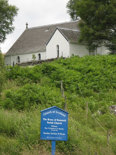
Braes of Rannoch

Braes of Rannoch (wikt:braes, slopes, Gaelic Braigh Raithneach) is a hill with a deserted hamlet and church in Perthshire. The hamlet was formerly, briefly...

River Gaur

The River Gaur (Scottish Gaelic: Gamhair / Uisge Ghamhair) is a river in Perthshire which enters Loch Rannoch. == References ==

River Ericht, Rannoch

The River Ericht (Scottish Gaelic: Eireachd) is a short river which flows generally southwards from the southern end of Loch Ericht for 3 miles / 5 km...

Loch Eigheach

Loch Eigheach is a large upland dammed freshwater loch in the Scottish Highlands. It is located in Rannoch Moor in the Council Area of Perth and Kinross...

The Heart Stone

The Heart Stone or Clach Cridhe in Perth and Kinross, Scotland is an ancient landmark on Rannoch Moor situated on the old 'Road to the Isles'. During the...

Lochan Sròn Smeur

Lochan Sròn Smeur is an upland loch in Tayside, Scotland. == References ==

Meall Buidhe, Glen Lyon

Meall Buidhe is a Munro situated in the southern highlands of Scotland. It forms the northern side of Loch an Daimh and is often climbed in conjunction...

Nearby Amenities

Located within 500m of 56.677619,-4.4474952
Bridge of Gaur
Name Gd: Drochaid Ghamhair
Place: hamlet
Lat/Long: 56.6804691/-4.447113
Parking
Capacity: 6
Fee: no
Parking: surface
Lat/Long: 56.6765591/-4.4431382
Bridge of Gaur
Addr Postcode: PH17 2QD
Tourism: guest_house
Website: https://www.middleofnowhere.co.uk/
Lat/Long: 56.6816234/-4.4454369
Turning Circle
Lat/Long: 56.6810252/-4.4460806
Telephone
Booth: K6
Covered: booth
Source: survey
Lat/Long: 56.6769708/-4.4459169
Post Box
Post Box Type: lamp
Ref: PH17 42
Royal Cypher: scottish_crown
Source: survey
Lat/Long: 56.6769624/-4.4459199
Post Box
Operator: Royal Mail
Operator Wikidata: Q638098
Post Box Mounting: pier
Post Box Type: lamp
Ref: PH17 44
Royal Cypher: scottish_crown
Source: survey
Lat/Long: 56.6810305/-4.4494169
Power: pole
Lat/Long: 56.6782971/-4.4408478
Power: pole
Lat/Long: 56.6781601/-4.4422538
Power: pole
Lat/Long: 56.6780281/-4.443662
Power: pole
Lat/Long: 56.6784316/-4.4394419
Power: pole
Lat/Long: 56.6789491/-4.444027
Power: pole
Lat/Long: 56.6795401/-4.4442763
Power: pole
Lat/Long: 56.6803001/-4.444575
Power: pole
Lat/Long: 56.6809971/-4.4448333
Power: pole
Lat/Long: 56.6809786/-4.44568
Power: pole
Lat/Long: 56.6808762/-4.4467535
Power: pole
Lat/Long: 56.6774587/-4.4434475
Power: pole
Lat/Long: 56.6774291/-4.4443144
Power: pole
Lat/Long: 56.677397/-4.4451657
Power: pole
Lat/Long: 56.6763335/-4.4534465
Power: pole
Lat/Long: 56.6762175/-4.4525144
Power: pole
Lat/Long: 56.6760916/-4.451479
Power: pole
Lat/Long: 56.6762384/-4.4502438
Power: pole
Lat/Long: 56.676405/-4.448876
Power: pole
Lat/Long: 56.6765494/-4.4476429
Power: pole
Lat/Long: 56.6766925/-4.4469445
Power: pole
Lat/Long: 56.6769208/-4.4459832
Power: pole
Lat/Long: 56.6768184/-4.4452892
Power: pole
Lat/Long: 56.6766518/-4.4442471
Power: pole
Lat/Long: 56.6765568/-4.4432768
Power: pole
Lat/Long: 56.6766802/-4.4428186
Power: pole
Lat/Long: 56.6770713/-4.4431331
Power: pole
Lat/Long: 56.6780855/-4.4553174
Power: pole
Lat/Long: 56.6787073/-4.4547783
Power: pole
Lat/Long: 56.6792354/-4.4543291
Power: pole
Lat/Long: 56.6796252/-4.4544302
Power: pole
Lat/Long: 56.680062/-4.4542258
Power: pole
Lat/Long: 56.6797782/-4.4510813
Power: pole
Lat/Long: 56.6796894/-4.4518249
Power: pole
Lat/Long: 56.679587/-4.4525526
Power: pole
Lat/Long: 56.6795746/-4.4526267
Power: pole
Lat/Long: 56.6793378/-4.4542326
Power: pole
Lat/Long: 56.6787536/-4.450447
Power: pole
Lat/Long: 56.679265/-4.4506469
Power: pole
Lat/Long: 56.679054/-4.4496879
Power: pole
Lat/Long: 56.6788683/-4.4489153
Power: pole
Lat/Long: 56.6788054/-4.4494487
Power: pole
Lat/Long: 56.6803229/-4.4514319
Power: pole
Lat/Long: 56.6808127/-4.4518249
Power: pole
Lat/Long: 56.6810088/-4.4510545
Power: pole
Lat/Long: 56.6812716/-4.4500169
Power: pole
Lat/Long: 56.6814419/-4.4493588
Power: pole
Lat/Long: 56.6816097/-4.4483639
Power: pole
Lat/Long: 56.6817959/-4.4472836
Power: pole
Lat/Long: 56.6820069/-4.4463672
The data included in this document is from www.openstreetmap.org. The data is made available under ODbL.

Have you been to Bridge of Gaur?

Leave your review of Bridge of Gaur below (or comments, questions and feedback).