Bridge of Gairn

Settlement in Aberdeenshire

Scotland

Bridge of Gairn

A939 towards Ballater
A939 towards Ballater Credit: Steven Brown

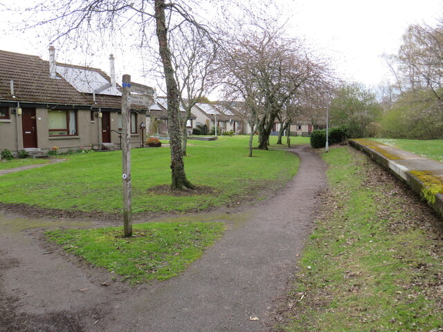
Bridge of Gairn is a small rural village located in Aberdeenshire, Scotland. Situated on the banks of the River Gairn, the village is nestled within the picturesque Cairngorms National Park. With its idyllic setting and stunning natural surroundings, Bridge of Gairn is a popular destination for outdoor enthusiasts and nature lovers.

The village is characterized by its charming stone-built cottages and traditional architecture, which adds to its quaint and peaceful ambiance. The River Gairn, flowing through the village, is known for its crystal-clear waters and attracts anglers from far and wide who come to fish for salmon and trout.

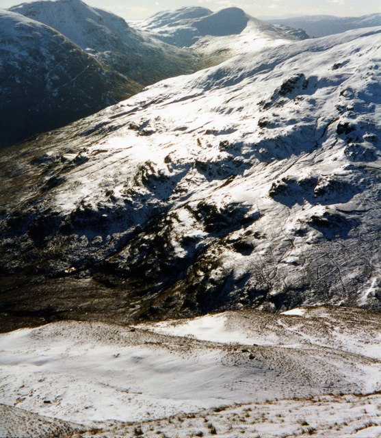
Bridge of Gairn is a gateway to the Cairngorms, offering easy access to a plethora of outdoor activities. Hiking and mountain biking trails crisscross the surrounding hills and forests, providing breathtaking views of the rugged landscapes and abundant wildlife. The nearby Lochnagar Mountain offers challenging climbs for experienced mountaineers.

For those seeking a more leisurely experience, the village is surrounded by tranquil woodland and meadows, perfect for leisurely strolls and picnics. The area is also home to a diverse range of bird species, making it a haven for birdwatchers.

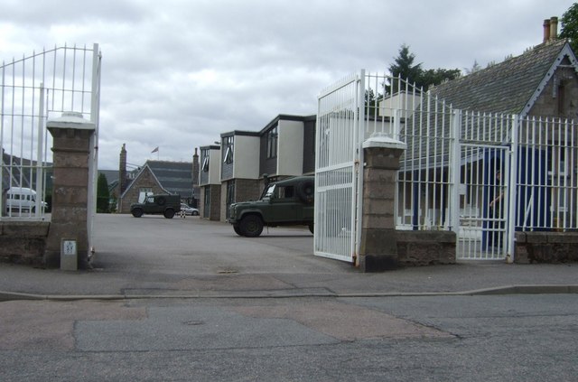
Although small, Bridge of Gairn does offer some amenities, including a local pub where visitors can enjoy a refreshing drink and a warm meal after a day of exploring. The village is also within a short drive of larger towns and cities, providing access to additional services and facilities.

Overall, Bridge of Gairn is a charming village that offers a peaceful and picturesque retreat for those seeking to immerse themselves in the beauty of the Scottish countryside.

If you have any feedback on the listing, please let us know in the comments section below.

Bridge of Gairn Images

Images are sourced within 2km of 57.060259/-3.06691 or Grid Reference NO3597. Thanks to Geograph Open Source API. All images are credited.

A939 towards Ballater
Public car park in Ballater
Top of Craigendarroch
Lay-by on the A93 at Bridge of Gairn
A939 near Bridge of Gairn
A939 towards Tomintoul
Queen Victoria's Railway Carriage, Ballater
The Tea Room, Ballater Station
Old milestone On the south side of the B972 which bypasses Ballater is the 41 miles from Aberdeen stone.   Moss has accumulated since last photographed in 2014.  It is typical of many milestones radiating from Aberdeen.   Circular with a mileage from the city on the bevel.
Old milestone
On the south side of the B972 which bypasses Ballater is the 41 miles from Aberdeen stone. Moss has accumulated since last photographed in 2014. It is typical of many milestones radiating from Aberdeen. Circular with a mileage from the city on the bevel.
Old milestone A view along the B971 with the milestone about 50 metres from the entrance to Monaltrie House.
Old milestone
A view along the B971 with the milestone about 50 metres from the entrance to Monaltrie House.
Old milestone The 42 miles from Aberdeen granite milestone is on Bridge Street in Ballater whereas the 41 miles stone is on the B972 bypassing Ballater.  This style of milestone on many roads spreading out from the city of Aberdeen may have been set up at the end of the 19th century when the administrative counties were recognised.
Old milestone
The 42 miles from Aberdeen granite milestone is on Bridge Street in Ballater whereas the 41 miles stone is on the B972 bypassing Ballater. This style of milestone on many roads spreading out from the city of Aberdeen may have been set up at the end of the 19th century when the administrative counties were recognised.
Old milestone I closer view of the milestone on Bridge Street in Ballater.   Twenty five milestones havae been found on the route from Aberdeen to Braemar starting at 7 and go up to 58.   58 is opposite the tollhouse just before reaching Braemar.
Old milestone
I closer view of the milestone on Bridge Street in Ballater. Twenty five milestones havae been found on the route from Aberdeen to Braemar starting at 7 and go up to 58. 58 is opposite the tollhouse just before reaching Braemar.
River Dee view
River Dee view
Former railway station, Ballater The former railway station building at Ballater, in Royal Deeside.  Ballater was the terminus of a line from Aberdeen until it closed in 1966.  The station building is now home to a tourist information, library and café.  It was severely damaged by fire in 2015, with much of the building destroyed, but has been restored as this image shows.  Ballater lies within the Cairngorms National Park.
Former railway station, Ballater
The former railway station building at Ballater, in Royal Deeside. Ballater was the terminus of a line from Aberdeen until it closed in 1966. The station building is now home to a tourist information, library and café. It was severely damaged by fire in 2015, with much of the building destroyed, but has been restored as this image shows. Ballater lies within the Cairngorms National Park.
Site of Ballater railway station Railway tracks once occupied this site in Ballater, in Royal Deeside.  Ballater lies within the Cairngorms National Park.  The former railway station platform edge is to the right of the image, alongside the path.  Ballater was at the end of a line from Aberdeen, which closed in 1966.
Site of Ballater railway station
Railway tracks once occupied this site in Ballater, in Royal Deeside. Ballater lies within the Cairngorms National Park. The former railway station platform edge is to the right of the image, alongside the path. Ballater was at the end of a line from Aberdeen, which closed in 1966.
Monaltrie Avenue, Ballater Monaltrie Avenue is a residential road in the town of Ballater, in Royal Deeside.  Ballater lies within the Cairngorms National Park.
Monaltrie Avenue, Ballater
Monaltrie Avenue is a residential road in the town of Ballater, in Royal Deeside. Ballater lies within the Cairngorms National Park.
Monaltrie Crescent, Ballater Monaltrie Crescent is a residential road in the town of Ballater, in Royal Deeside.  Ballater lies within the Cairngorms National Park.
Monaltrie Crescent, Ballater
Monaltrie Crescent is a residential road in the town of Ballater, in Royal Deeside. Ballater lies within the Cairngorms National Park.
Station Square, Ballater Station Square in the town of Ballater, in Royal Deeside and within the Cairngorms National Park.

The railway station building is to the left of the image.  The station, which was at the end of a line from Aberdeen, closed in 1966.  The building was severely damaged by fire in 2015 but has been restored.  It is now used as a tourist information centre, library and café.
Station Square, Ballater
Station Square in the town of Ballater, in Royal Deeside and within the Cairngorms National Park. The railway station building is to the left of the image. The station, which was at the end of a line from Aberdeen, closed in 1966. The building was severely damaged by fire in 2015 but has been restored. It is now used as a tourist information centre, library and café.
Show me another place!

Bridge of Gairn is located at Grid Ref: NO3597 (Lat: 57.060259, Lng: -3.06691)

Unitary Authority: Aberdeenshire

Police Authority: North East

What 3 Words

///pocket.shimmered.highlight. Near Ballater, Aberdeenshire

Nearby Locations

Bridge of Gairn

Related Wikis

Nearby Amenities

Located within 500m of 57.060259,-3.06691
Bridge of Gairn
Place: hamlet
Lat/Long: 57.0606058/-3.0689833
Post Box
Brand: Royal Mail
Brand Wikidata: Q638098
Collection Times: Mo-Fr 15:00; Sa 12:00
Operator: Royal Mail
Operator Wikidata: Q638098
Post Box Type: lamp
Ref: AB35 476
Royal Cypher: scottish_crown
Lat/Long: 57.0603356/-3.0683876
Parking
Access: yes
Fee: no
Parking: layby
Lat/Long: 57.0593047/-3.0651011
Power: pole
Lat/Long: 57.0569852/-3.063567
Power: pole
Lat/Long: 57.0569461/-3.0647256
Power: pole
Lat/Long: 57.056883/-3.066166
Power: pole
Lat/Long: 57.0568484/-3.0674235
Power: pole
Lat/Long: 57.0569411/-3.0684498
Power: pole
Lat/Long: 57.0570905/-3.0698924
Power: pole
Lat/Long: 57.057221/-3.0713176
Power: pole
Lat/Long: 57.0573381/-3.0727172
Crossing
Lat/Long: 57.0606535/-3.0717693
Power: pole
Lat/Long: 57.0635746/-3.0613326
Power: pole
Lat/Long: 57.0634367/-3.062465
Power: pole
Lat/Long: 57.0632863/-3.0637414
Power: pole
Lat/Long: 57.0630412/-3.0647639
Power: pole
Lat/Long: 57.0610661/-3.0744832
Power: pole
Lat/Long: 57.0632581/-3.0647581
Power: pole
Lat/Long: 57.0607046/-3.0723714
Power: pole
Lat/Long: 57.0608743/-3.0733442
Power: pole
Lat/Long: 57.0610135/-3.0741681
Power: pole
Lat/Long: 57.0603061/-3.0742591
Power: pole
Lat/Long: 57.0597889/-3.0741001
Power: pole
Lat/Long: 57.0592929/-3.073944
Power: pole
Lat/Long: 57.0585533/-3.0737171
Power: pole
Lat/Long: 57.0577783/-3.0734974
Power: pole
Lat/Long: 57.0625083/-3.0648578
Power: pole
Lat/Long: 57.0618434/-3.0646555
Power: pole
Lat/Long: 57.0612901/-3.0644704
Power: pole
Lat/Long: 57.0605277/-3.0642941
Power: pole
Lat/Long: 57.0597692/-3.0641337
Power: pole
Lat/Long: 57.0590163/-3.0639718
Power: pole
Lat/Long: 57.0584032/-3.0641597
Power: pole
Lat/Long: 57.0576769/-3.0643996
Power: pole
Lat/Long: 57.0617633/-3.0648434
Power: pole
Lat/Long: 57.062194/-3.0651816
Power: pole
Lat/Long: 57.0626419/-3.06553
Power: pole
Lat/Long: 57.0630082/-3.0658075
Power: pole
Lat/Long: 57.0570131/-3.0624974
Power: pole
Lat/Long: 57.0570608/-3.0614293
Material: wood
Power: pole
Lat/Long: 57.0615393/-3.0747043
The data included in this document is from www.openstreetmap.org. The data is made available under ODbL.

Have you been to Bridge of Gairn?

Leave your review of Bridge of Gairn below (or comments, questions and feedback).