Llangwm

Community in Denbighshire

Wales

Llangwm

Church and churchyard The former church of St Jerome, Llangwm.
Church and churchyard Credit: John H Darch

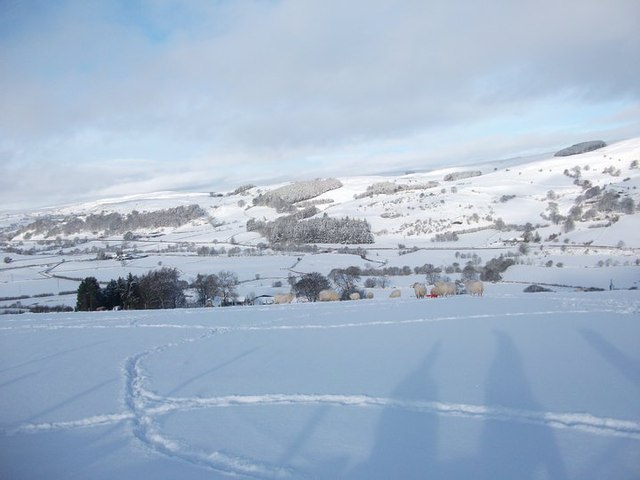
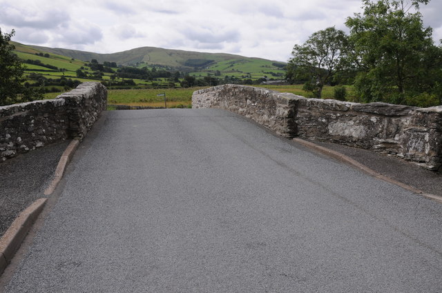
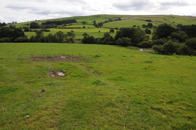
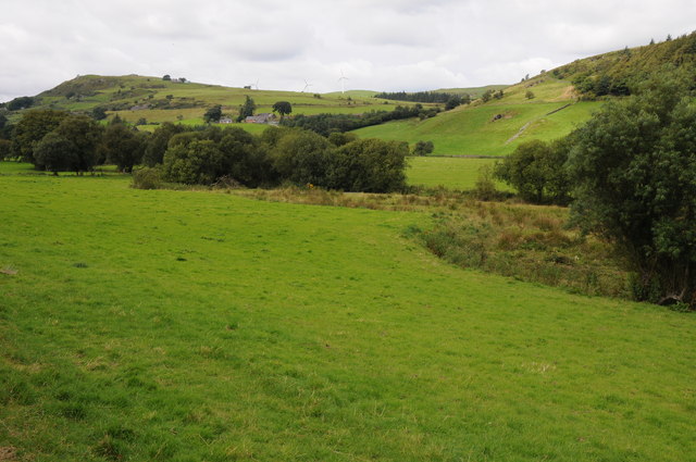
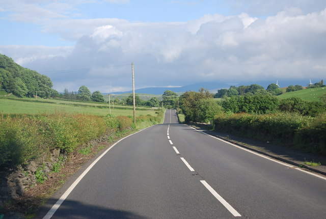
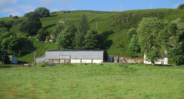
Llangwm is a small community located in the county of Denbighshire, Wales. Situated in the northern part of the country, Llangwm is nestled in the beautiful Vale of Clwyd, surrounded by rolling hills and picturesque countryside.

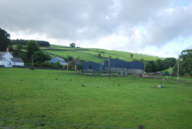
The community of Llangwm consists of a few scattered settlements, including the village of Llangwm itself and nearby hamlets such as Bodfari and Prion. The area is known for its rural charm and tranquility, making it an ideal destination for those seeking a peaceful retreat.

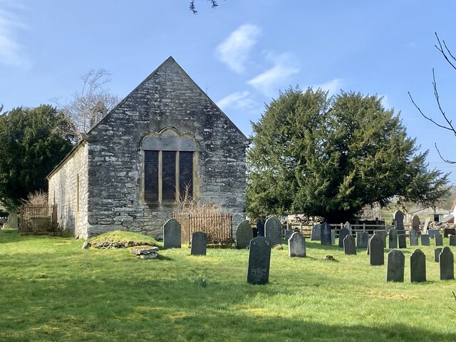
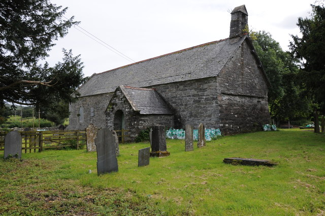
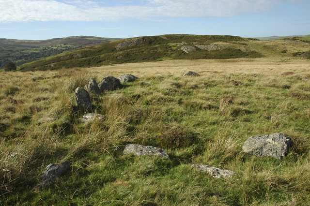
Llangwm is steeped in history, with evidence of human habitation dating back to prehistoric times. The village is home to the historic St. Jerome's Church, a Grade II listed building that dates back to the 14th century. Visitors can explore the church and admire its architectural beauty, as well as learn about the area's rich historical significance.

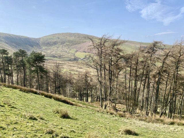
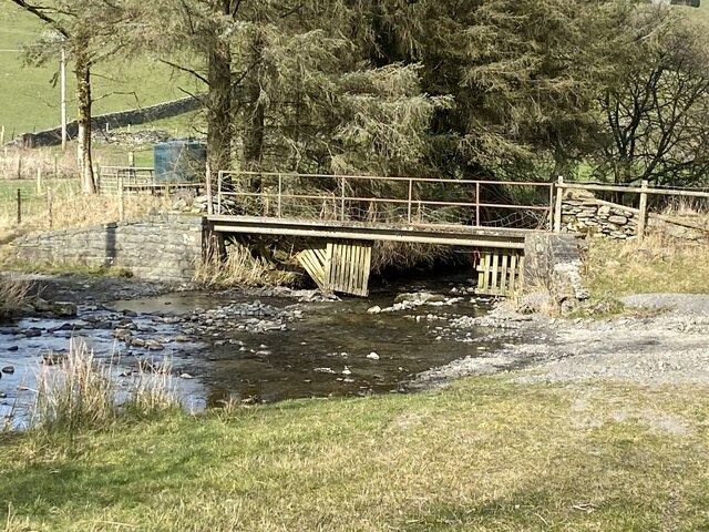
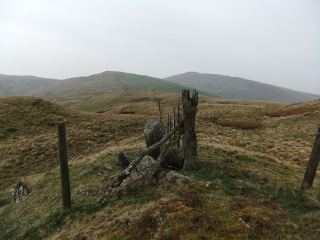
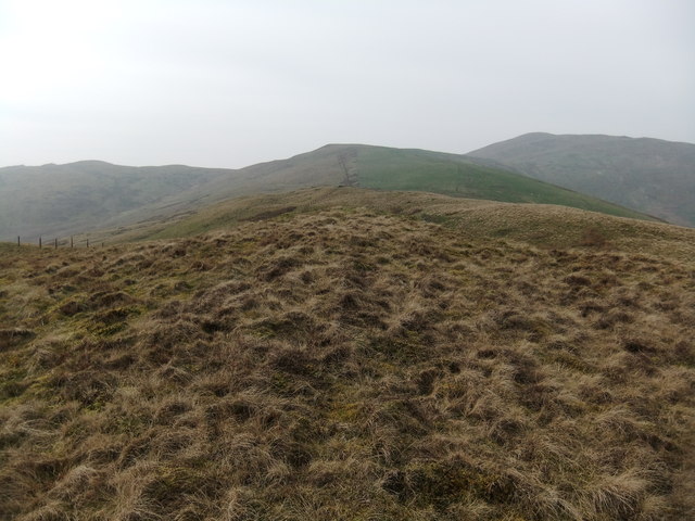
Nature lovers will find plenty to enjoy in Llangwm, as the community is surrounded by stunning natural landscapes. The nearby Clwydian Range Area of Outstanding Natural Beauty offers a range of outdoor activities, such as hiking, cycling, and horse riding. The area is also home to various wildlife species, providing ample opportunities for nature enthusiasts and birdwatchers.

In terms of amenities, Llangwm offers a range of services to its residents and visitors. The village has a primary school, a community center, and a local pub where visitors can relax and enjoy traditional Welsh hospitality.

Overall, Llangwm is a charming community that boasts natural beauty, rich history, and a welcoming atmosphere, making it a delightful destination for both locals and tourists alike.

If you have any feedback on the listing, please let us know in the comments section below.
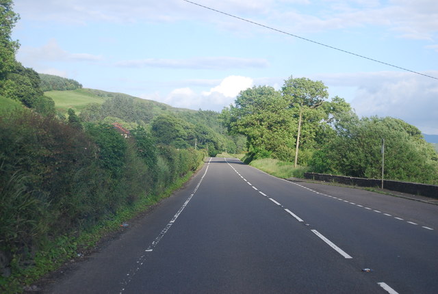
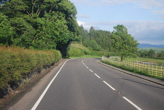
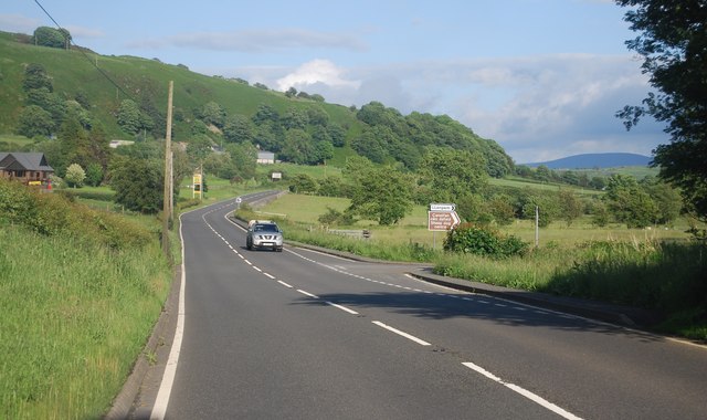
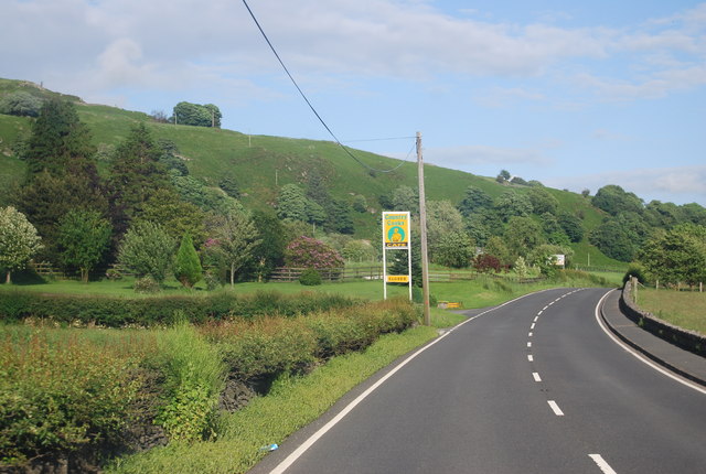
Llangwm Images

Images are sourced within 2km of 52.99103/-3.537391 or Grid Reference SH9644. Thanks to Geograph Open Source API. All images are credited.

Church and churchyard The former church of St Jerome, Llangwm.
Church and churchyard
The former church of St Jerome, Llangwm.
Woodland south of Llangwm In the distance is the 2004' peak of Foel Goch.
Woodland south of Llangwm
In the distance is the 2004' peak of Foel Goch.
Ford and footbridge Leading to Hendre-garthmeilio.
Ford and footbridge
Leading to Hendre-garthmeilio.
Llangwm Valley in the snow Llangwm's landscape at its best here! It is such a divine place in the snow!
Llangwm Valley in the snow
Llangwm's landscape at its best here! It is such a divine place in the snow!
Fence on Pen y Cerrig-serth
522m spot height on Pen y Cerrig-serth
Bridge over Afon Ceirw Bridge carrying a country road to Llangwm over Afon Ceirw,  near its junction with the A5.
Bridge over Afon Ceirw
Bridge carrying a country road to Llangwm over Afon Ceirw, near its junction with the A5.
Farmland near Llangwm Afon Medrad flows through this valley near the small village of Llangwm.
Farmland near Llangwm
Afon Medrad flows through this valley near the small village of Llangwm.
Former church, Llangwm This church in Llangwm is sadly closed and boarded up.
Former church, Llangwm
This church in Llangwm is sadly closed and boarded up.
The Medrad valley The Medrad valley to the west of Llangwm.
The Medrad valley
The Medrad valley to the west of Llangwm.
Hendre Arddwyfaen
Hendre Arddwyfaen
A5 near Arddwyfaen The A5 is a major trunk road that runs 260 miles from London to Holyhead. It follows the course of an old Roman Road (Watling Street).
Wikipedia: <span class="nowrap"><a title="http://en.wikipedia.org/wiki/A5_road_(Great_Britain)" rel="nofollow ugc noopener" href="http://en.wikipedia.org/wiki/A5_road_(Great_Britain)">Link</a><img style="margin-left:2px;" alt="External link" title="External link - shift click to open in new window" src="https://s1.geograph.org.uk/img/external.png" width="10" height="10"/></span>
A5 near Arddwyfaen
The A5 is a major trunk road that runs 260 miles from London to Holyhead. It follows the course of an old Roman Road (Watling Street). Wikipedia: LinkExternal link
A5 The A5 is a major trunk road that runs 260 miles from London to Holyhead. It follows the course of an old Roman Road (Watling Street).
Wikipedia: <span class="nowrap"><a title="http://en.wikipedia.org/wiki/A5_road_(Great_Britain)" rel="nofollow ugc noopener" href="http://en.wikipedia.org/wiki/A5_road_(Great_Britain)">Link</a><img style="margin-left:2px;" alt="External link" title="External link - shift click to open in new window" src="https://s1.geograph.org.uk/img/external.png" width="10" height="10"/></span>
A5
The A5 is a major trunk road that runs 260 miles from London to Holyhead. It follows the course of an old Roman Road (Watling Street). Wikipedia: LinkExternal link
A5 near Ty-gwyn The A5 is a major trunk road that runs 260 miles from London to Holyhead. It follows the course of an old Roman Road (Watling Street).
Wikipedia: <span class="nowrap"><a title="http://en.wikipedia.org/wiki/A5_road_(Great_Britain)" rel="nofollow ugc noopener" href="http://en.wikipedia.org/wiki/A5_road_(Great_Britain)">Link</a><img style="margin-left:2px;" alt="External link" title="External link - shift click to open in new window" src="https://s1.geograph.org.uk/img/external.png" width="10" height="10"/></span>
A5 near Ty-gwyn
The A5 is a major trunk road that runs 260 miles from London to Holyhead. It follows the course of an old Roman Road (Watling Street). Wikipedia: LinkExternal link
A5 at Llangwm turning The A5 is a major trunk road that runs 260 miles from London to Holyhead. It follows the course of an old Roman Road (Watling Street).
Wikipedia: <span class="nowrap"><a title="http://en.wikipedia.org/wiki/A5_road_(Great_Britain)" rel="nofollow ugc noopener" href="http://en.wikipedia.org/wiki/A5_road_(Great_Britain)">Link</a><img style="margin-left:2px;" alt="External link" title="External link - shift click to open in new window" src="https://s1.geograph.org.uk/img/external.png" width="10" height="10"/></span>
A5 at Llangwm turning
The A5 is a major trunk road that runs 260 miles from London to Holyhead. It follows the course of an old Roman Road (Watling Street). Wikipedia: LinkExternal link
Country Cooks by the A5 The A5 is a major trunk road that runs 260 miles from London to Holyhead. It follows the course of an old Roman Road (Watling Street).
Wikipedia: <span class="nowrap"><a title="http://en.wikipedia.org/wiki/A5_road_(Great_Britain)" rel="nofollow ugc noopener" href="http://en.wikipedia.org/wiki/A5_road_(Great_Britain)">Link</a><img style="margin-left:2px;" alt="External link" title="External link - shift click to open in new window" src="https://s1.geograph.org.uk/img/external.png" width="10" height="10"/></span>
Country Cooks by the A5
The A5 is a major trunk road that runs 260 miles from London to Holyhead. It follows the course of an old Roman Road (Watling Street). Wikipedia: LinkExternal link
A long straight, A5 The A5 is a major trunk road that runs 260 miles from London to Holyhead. It follows the course of an old Roman Road (Watling Street).
Wikipedia: <span class="nowrap"><a title="http://en.wikipedia.org/wiki/A5_road_(Great_Britain)" rel="nofollow ugc noopener" href="http://en.wikipedia.org/wiki/A5_road_(Great_Britain)">Link</a><img style="margin-left:2px;" alt="External link" title="External link - shift click to open in new window" src="https://s1.geograph.org.uk/img/external.png" width="10" height="10"/></span>
A long straight, A5
The A5 is a major trunk road that runs 260 miles from London to Holyhead. It follows the course of an old Roman Road (Watling Street). Wikipedia: LinkExternal link
Disgarth Uchaf
Disgarth Uchaf
Show me another place!

Llangwm is located at Grid Ref: SH9644 (Lat: 52.99103, Lng: -3.537391)

Unitary Authority: Conwy

Police Authority: North Wales

What 3 Words

///crop.perfume.forwarded. Near Llangwm, Conwy

Nearby Locations

Llangwm Llangwm

Related Wikis

Llangwm, Conwy

Llangwm is a village and community in Conwy County Borough, in Wales. It is located in the valley of the Afon Medrad, close to the borders with Denbighshire...

Uwchaled Rural District

Uwchaled (from Uwch Aled) was a rural district in the administrative county of Denbighshire, Wales, from 1894 to 1935. The name denoted the upper reaches...

Cerrigydrudion

Cerrigydrudion, sometimes spelt Cerrig-y-drudion, () is a village and community in Conwy, Wales. Until 1974 it was part of the historic county Denbighshire...

Coedydd Dyffryn Alwen

Coedydd Dyffryn Alwen is a Site of Special Scientific Interest in the preserved county of Clwyd, north Wales. It contains a mix of different woodland types...

Meirionnydd Nant Conwy (Assembly constituency)

Meirionnydd Nant Conwy was a constituency of the National Assembly for Wales between 1999 and 2007. It elected one Assembly Member by the first past the...

Caer Euni

Caer Euni [Grid reference SJ 00027 41266] is an Iron Age hillfort, about 2.5 miles (4 km) north-east of the village of Llandderfel and about 5 miles (8...

Llanfihangel Glyn Myfyr

Llanfihangel Glyn Myfyr is a village and community in Conwy County Borough, in Wales. It is located within the historic county of Denbighshire (on the...

Moel y Gydros

Moel y Gydros (English: Bare Hill of Gydros) is a hill located just outside the Snowdonia National Park on the Gwynedd / Conwy border in North Wales. The...

Nearby Amenities

Located within 500m of 52.99103,-3.537391
Llangwm
Is In: Gwynedd
Place: hamlet
Source: npe
Lat/Long: 52.9891712/-3.5413118
School
Llangwm C P School
Check Date: 2024-03-31
Lat/Long: 52.9896949/-3.5405529
Place: farm
Lat/Long: 52.9939284/-3.5341864
Telephone
Booth: K6
Check Date: 2023-10-07
Covered: booth
Operator: BT
Operator Wikidata: Q593786
Phone: +44 1490 420378
Lat/Long: 52.9889495/-3.5412388
Post Box
Collection Times: Mo-Fr 09:00; Sa 07:00
Post Box Type: lamp
Ref: LL21 560
Royal Cypher: EIIR
Royal Cypher Wikidata: Q33102113
Lat/Long: 52.9889765/-3.5412205
Direction: WSW
Generator Method: photovoltaic
Generator Output Electricity: yes
Generator Solar Modules: 12
Generator Source: solar
Generator Type: solar_photovoltaic_panel
Location: roof
Power: generator
Lat/Long: 52.9907103/-3.5408646
Direction: 275
Generator Method: photovoltaic
Generator Output Electricity: yes
Generator Solar Modules: 16
Generator Source: solar
Generator Type: solar_photovoltaic_panel
Location: roof
Power: generator
Lat/Long: 52.9894675/-3.5414466
Direction: 215
Generator Method: photovoltaic
Generator Output Electricity: yes
Generator Solar Modules: 14
Generator Source: solar
Generator Type: solar_photovoltaic_panel
Location: roof
Power: generator
Lat/Long: 52.9907914/-3.5409665
Direction: S
Generator Method: photovoltaic
Generator Output Electricity: yes
Generator Solar Modules: 16
Generator Source: solar
Generator Type: solar_photovoltaic_panel
Location: roof
Power: generator
Lat/Long: 52.9910724/-3.5411234
Barrier: cattle_grid
Lat/Long: 52.9896887/-3.535248
Waste Basket
Lat/Long: 52.9889668/-3.5412155
Grit Bin
Lat/Long: 52.9891605/-3.5405709
Information: guidepost
Tourism: information
Lat/Long: 52.9881005/-3.5413546
Barrier: stile
Lat/Long: 52.9880878/-3.5414091
Barrier: stile
Lat/Long: 52.9878771/-3.5416565
Bench
Backrest: yes
Lat/Long: 52.9888299/-3.5413784
The data included in this document is from www.openstreetmap.org. The data is made available under ODbL.

Have you been to Llangwm?

Leave your review of Llangwm below (or comments, questions and feedback).