Llangwm

Community in Monmouthshire

Wales

Llangwm

Llan y Nant Cottage, Llangwm, Monmouthshire On the corner of Llanynant Road and Chapel Road.
Llan y Nant Cottage, Llangwm, Monmouthshire Credit: Jaggery

Llangwm is a small rural community located in the county of Monmouthshire, Wales. It is situated in the eastern part of the county, approximately 8 miles northeast of the town of Usk and 12 miles northwest of the city of Newport. The community encompasses a total area of around 3 square miles.

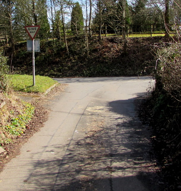
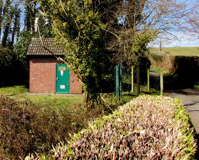
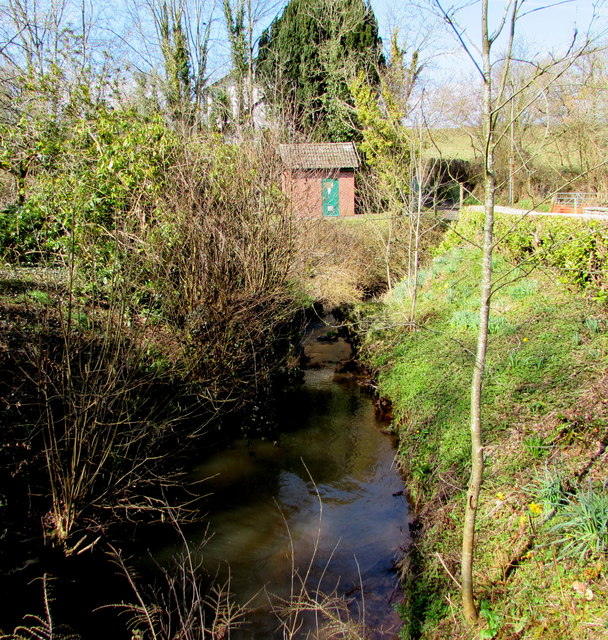
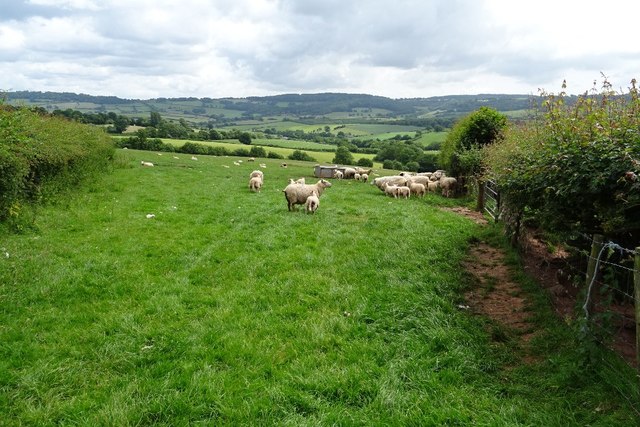
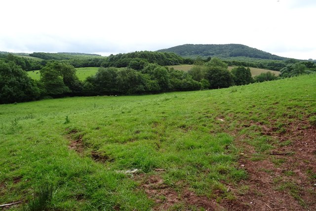
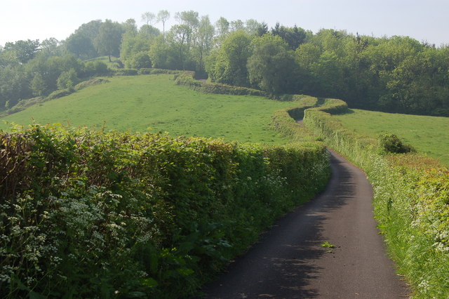
Llangwm is surrounded by picturesque countryside, with rolling hills and farmland dominating the landscape. The community is known for its natural beauty, attracting visitors who enjoy outdoor activities such as hiking, cycling, and birdwatching. The nearby Llangwm Nature Reserve is a popular spot for wildlife enthusiasts, offering opportunities to observe a variety of bird species and other creatures in their natural habitat.

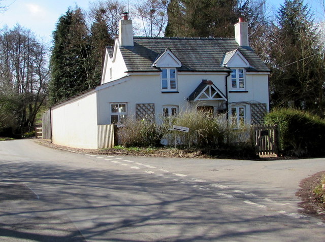
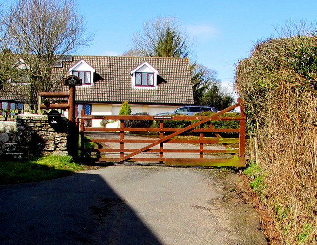
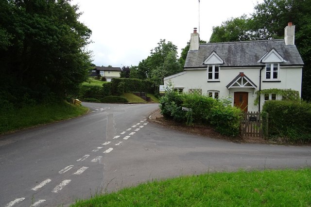
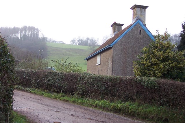
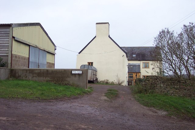
The community itself is small, with a population of around 300 residents. The village of Llangwm serves as the focal point, featuring a number of traditional stone houses and a historic parish church. The village has a close-knit community feel, with locals often engaging in social activities and events.

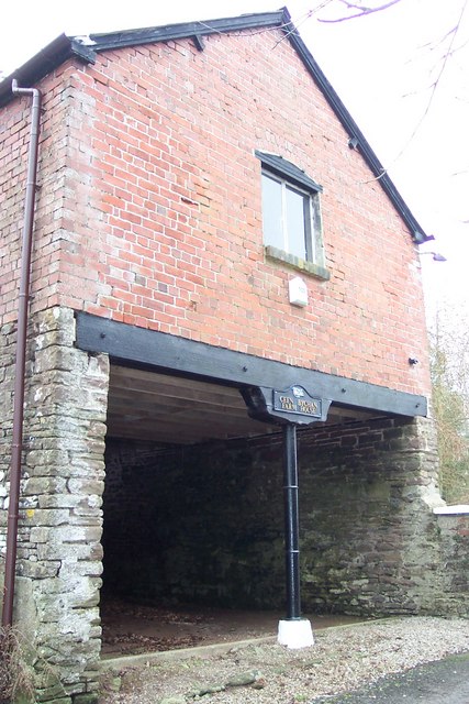
Llangwm boasts a strong sense of Welsh heritage, with the Welsh language still commonly spoken among residents. The community also has a rich history, with evidence of human settlement dating back to prehistoric times. Historical landmarks, such as ancient burial mounds and stone circles, can still be found in the surrounding area.

Overall, Llangwm offers a peaceful and idyllic setting for those seeking a rural retreat, with its natural beauty, strong community spirit, and historical significance.

If you have any feedback on the listing, please let us know in the comments section below.
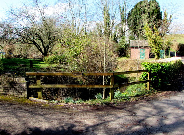
Llangwm Images

Images are sourced within 2km of 51.700176/-2.823415 or Grid Reference SO4300. Thanks to Geograph Open Source API. All images are credited.

Llan y Nant Cottage, Llangwm, Monmouthshire On the corner of Llanynant Road and Chapel Road.
Llan y Nant Cottage, Llangwm, Monmouthshire
On the corner of Llanynant Road and Chapel Road.
Junction of Chapel Road and Llanynant Road, Llangwm, Monmouthshire The Give Way sign on the corner of Llanynant Road faces Chapel Road.
Junction of Chapel Road and Llanynant Road, Llangwm, Monmouthshire
The Give Way sign on the corner of Llanynant Road faces Chapel Road.
Entrance to Chapel Farm, Llangwm, Monmouthshire From the western end of Chapel Road, 120 metres west of the Llanynant Road junction.
Entrance to Chapel Farm, Llangwm, Monmouthshire
From the western end of Chapel Road, 120 metres west of the Llanynant Road junction.
North side of Salem Baptist Chapel, Llangwm, Monmouthshire Viewed from Chapel Road. Built in 1840, the chapel was Grade II listed in 2000.
North side of Salem Baptist Chapel, Llangwm, Monmouthshire
Viewed from Chapel Road. Built in 1840, the chapel was Grade II listed in 2000.
No Through Road sign at the eastern end of Chapel Road,  Llangwm, Monmouthshire Facing Llanynant Road. Chapel Road extends ahead for 120 metres to the entrance <a title="https://www.geograph.org.uk/photo/5720377" href="https://www.geograph.org.uk/photo/5720377">Link</a> to Chapel Farm.
No Through Road sign at the eastern end of Chapel Road, Llangwm, Monmouthshire
Facing Llanynant Road. Chapel Road extends ahead for 120 metres to the entrance Link to Chapel Farm.
Coed Cwnwr Pumping Station, Llangwm, Monmouthshire The brick building is in a Welsh Water site above the brook named Nant y March. Viewed from Chapel Road.
Coed Cwnwr Pumping Station, Llangwm, Monmouthshire
The brick building is in a Welsh Water site above the brook named Nant y March. Viewed from Chapel Road.
Nant y March, Llangwm, Monmouthshire Brook (or stream) below Chapel Road. Coed Cwnwr Pumping Station <a title="https://www.geograph.org.uk/photo/5720426" href="https://www.geograph.org.uk/photo/5720426">Link</a> is in the background.
Nant y March, Llangwm, Monmouthshire
Brook (or stream) below Chapel Road. Coed Cwnwr Pumping Station Link is in the background.
Cefn Bychan Close name sign on a fence, Llangwm, Monmouthshire The wooden sign is on a wooden fence above Nant y March. <a title="https://www.geograph.org.uk/photo/5720437" href="https://www.geograph.org.uk/photo/5720437">Link</a> 
Cefn Bychan Close houses are beyond the left edge of the photo. 
Chapel Road is beyond the right edge. 
The brick building <a title="https://www.geograph.org.uk/photo/5720426" href="https://www.geograph.org.uk/photo/5720426">Link</a> is Coed Cwnwr Pumping Station.
Cefn Bychan Close name sign on a fence, Llangwm, Monmouthshire
The wooden sign is on a wooden fence above Nant y March. Link Cefn Bychan Close houses are beyond the left edge of the photo. Chapel Road is beyond the right edge. The brick building Link is Coed Cwnwr Pumping Station.
Ewes and lambs Ewes and lambs in a field near New House, Wolvesnewton.
Ewes and lambs
Ewes and lambs in a field near New House, Wolvesnewton.
Cottage in Llangwm Cottage on the corner of Chapel Road and Llanynant Road in Llangwm.
Cottage in Llangwm
Cottage on the corner of Chapel Road and Llanynant Road in Llangwm.
Farmland near Nantymark Farmland near Nantymark south of the village of Llangwm.
Farmland near Nantymark
Farmland near Nantymark south of the village of Llangwm.
New House At the top of the hill is Camp House, beside one of the many hill forts around here.
New House
At the top of the hill is Camp House, beside one of the many hill forts around here.
Stable block at Cefn Bychan Farm Empty at the time of photographing.
Stable block at Cefn Bychan Farm
Empty at the time of photographing.
Carna Cottage House is named on OS mapping and viewed from the public road.
Carna Cottage
House is named on OS mapping and viewed from the public road.
Hill from junction at Nantymark
Junction with the B4235, south of Llangwm
Lane climbing the hill near Gaer fawr View looks southwards up this steep lane towards Gaer fawr.
Lane climbing the hill near Gaer fawr
View looks southwards up this steep lane towards Gaer fawr.
Show me another place!

Llangwm is located at Grid Ref: SO4300 (Lat: 51.700176, Lng: -2.823415)

Unitary Authority: Monmouthshire

Police Authority: Gwent

Also known as: Llan-gwm

What 3 Words

///wiped.partly.solved. Near Llangwm, Monmouthshire

Related Wikis

Llangwm, Monmouthshire

Llangwm is a small rural village and former community, now in the community of Llantrisant Fawr, in Monmouthshire, south east Wales. It is located 3 miles...

St Jerome's Church, Llangwm

The Church of St Jerome stands in the settlement of Llangwm Uchaf, (upper) Llangwm, in a remote part of Monmouthshire, Wales. Originally constructed in...
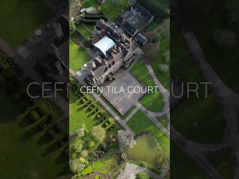
Allt-y-Bela

Allt-y-Bela in Llangwm, Monmouthshire, Wales, is a house of late medieval origin with additions from the sixteenth to the twenty-first centuries. During...

Gwernesney

Gwernesney (Welsh: Gwernesni) is a village in Monmouthshire in southeast Wales. == Location == Gwernesney is located three miles east of Usk on the B4235...

Related Videos

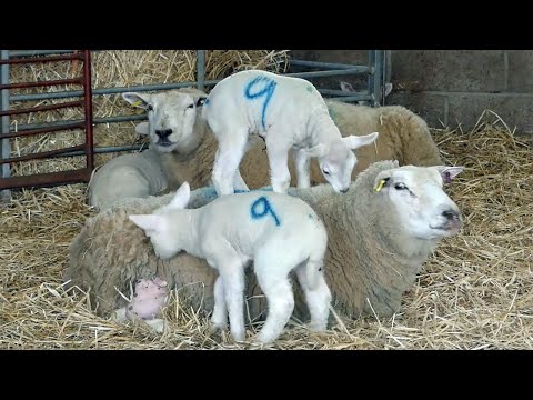
Part 1 Lambing on a small 35 acre Welsh farm. Why sheep are tagged? Bottle milk for lambs.

We follow lambing on a 35 acre farm outside Usk in South Wales. The story starts with a farm tour with Linda. Last year's lambs to ...

USK SHOW 10TH SEPT 2022

This is the first time i have been to this show and im glad i did as it was excellent and had many things to see. With my 2 4k ...

Nearby Amenities

Located within 500m of 51.700176,-2.823415
Place Of Worship
St John
Denomination: anglican
Designation: Church in Wales
Religion: christian
Wikidata: Q29501213
Lat/Long: 51.7017015/-2.8276455
Power: pole
Lat/Long: 51.6986636/-2.8274852
Power: pole
Lat/Long: 51.6997147/-2.8281107
Power: pole
Lat/Long: 51.7003655/-2.8285465
Power: pole
Lat/Long: 51.7009755/-2.8289193
Power: pole
Lat/Long: 51.7002262/-2.8269644
Power: pole
Lat/Long: 51.7007847/-2.8257479
Power: pole
Lat/Long: 51.7011769/-2.8248457
Power: pole
Lat/Long: 51.7016155/-2.8239003
Power: pole
Lat/Long: 51.6980221/-2.8271133
Power: pole
Lat/Long: 51.6969201/-2.8264275
Power: pole
Lat/Long: 51.6960845/-2.8258938
The data included in this document is from www.openstreetmap.org. The data is made available under ODbL.

Have you been to Llangwm?

Leave your review of Llangwm below (or comments, questions and feedback).