Llanddeusant

Community in Carmarthenshire

Wales

Llanddeusant

Descending N from Carreg Yr Ogof towards Llandeusant
Descending N from Carreg Yr Ogof towards Llandeusant Credit: Colin Park

Llanddeusant is a small community located in Carmarthenshire, a county in the southwest of Wales. It is situated within the Brecon Beacons National Park, offering residents and visitors stunning natural landscapes and a peaceful rural environment.

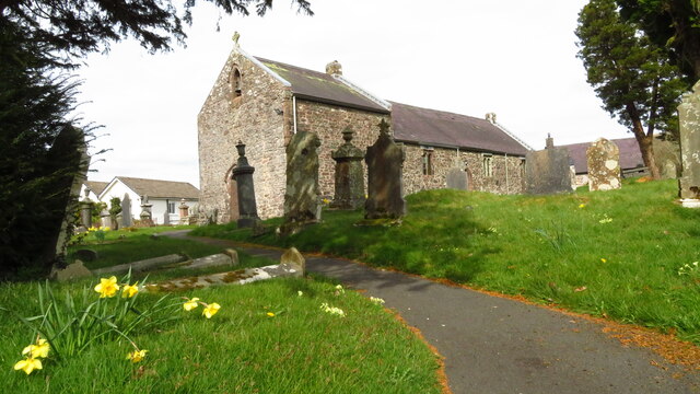
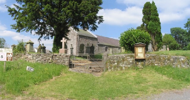
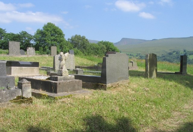
The community is named after its parish church, St. Tyssul's Church, which dates back to the 13th century. The church is a significant historical and cultural landmark, attracting tourists interested in exploring the area's rich heritage.

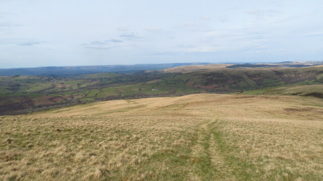
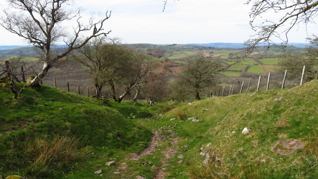
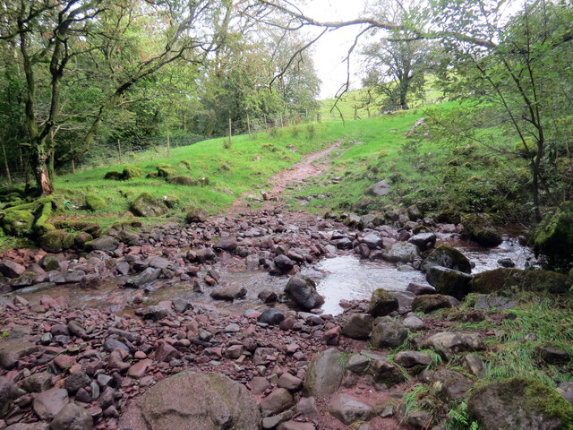
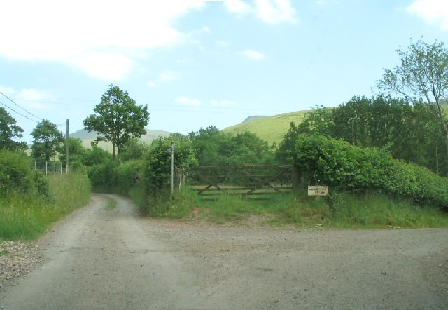
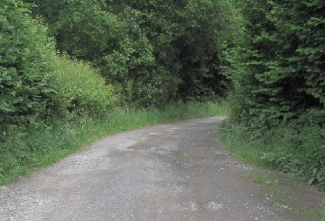
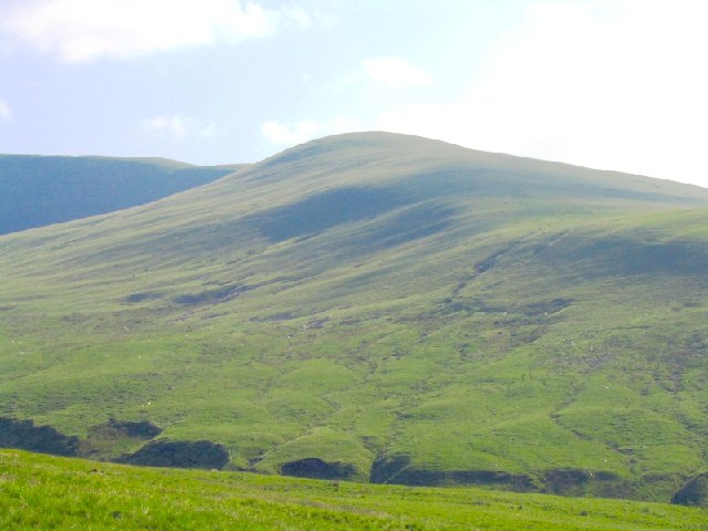
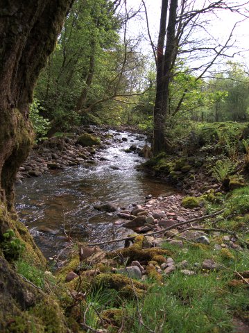
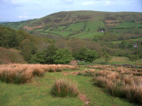
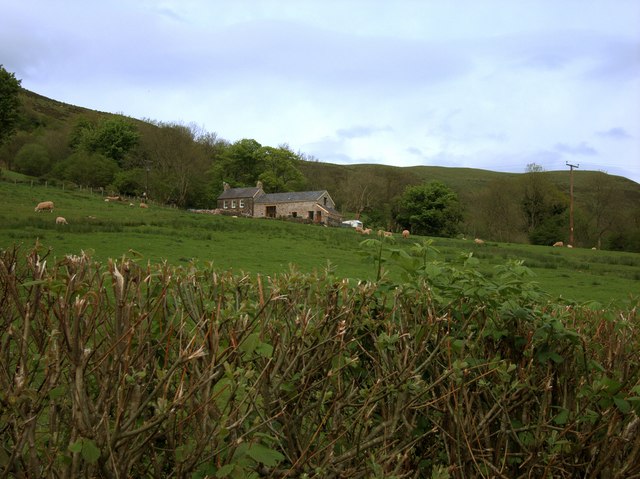
Llanddeusant is known for its picturesque scenery, with rolling hills, lush green valleys, and charming countryside views. It provides an ideal setting for outdoor activities such as hiking, mountain biking, and horseback riding. The nearby Black Mountain and Carmarthen Fans offer breathtaking vistas and challenging trails for outdoor enthusiasts.

The community is relatively small, with a close-knit population that values its Welsh heritage. The Welsh language is still widely spoken in Llanddeusant, contributing to the preservation of local traditions and customs.

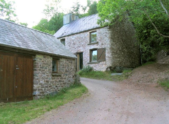
In terms of amenities, Llanddeusant has a primary school and a community center that serves as a hub for various activities and events. There are also a few local businesses, including a pub and a small shop, offering basic necessities to residents and tourists.

Llanddeusant's tranquil and scenic surroundings make it an attractive destination for those seeking a peaceful retreat or a base for exploring the natural beauty of the Brecon Beacons National Park.

If you have any feedback on the listing, please let us know in the comments section below.
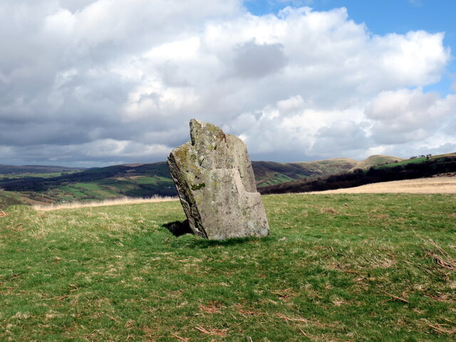
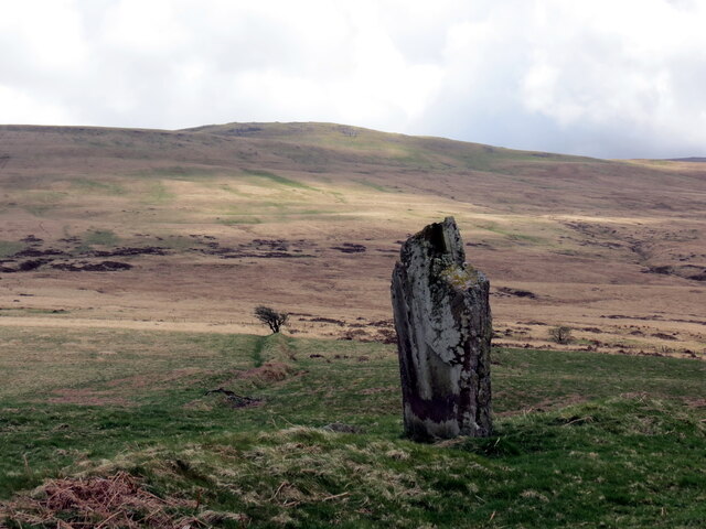
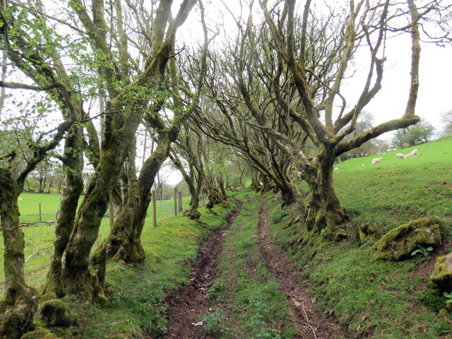
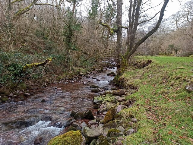
Llanddeusant Images

Images are sourced within 2km of 51.897236/-3.776771 or Grid Reference SN7723. Thanks to Geograph Open Source API. All images are credited.

Descending N from Carreg Yr Ogof towards Llandeusant
Enclosed stony track leading down to Gellygron, Llandeusant
Llandeusant Church (Black Mountain)
Maenhir Tyle-pengam / Tyle-pengam Standing Stone Maenhir posibl o'r Oes Efydd wedi ei leoli ar glos ffarm adfeiliedig Tyle-pengam. 

A possible Bronze Age standing stone located in the yard of the abandoned Tyle-pengam Farm.
Maenhir Tyle-pengam / Tyle-pengam Standing Stone
Maenhir posibl o'r Oes Efydd wedi ei leoli ar glos ffarm adfeiliedig Tyle-pengam. A possible Bronze Age standing stone located in the yard of the abandoned Tyle-pengam Farm.
Maenhir ger Tyle-pengam / Standing stone near Tyle-pengam Maenhir o'r Oes Efydd wedi ei leoli ar dir preifat uwchben Ffarm Tyle-pengam. Yn ol Map y Degwm 1841 gelwid y gefnen lle saif y garreg y Lan. 

A Bronze Age standing stone located on private land above Tyle-pengam Farm (trans. hill of the ?crooked standing stone). According to the 1841 Tithe Map the ridge is known as  y Lan (trans. the hill).
Maenhir ger Tyle-pengam / Standing stone near Tyle-pengam
Maenhir o'r Oes Efydd wedi ei leoli ar dir preifat uwchben Ffarm Tyle-pengam. Yn ol Map y Degwm 1841 gelwid y gefnen lle saif y garreg y Lan. A Bronze Age standing stone located on private land above Tyle-pengam Farm (trans. hill of the ?crooked standing stone). According to the 1841 Tithe Map the ridge is known as y Lan (trans. the hill).
Maenhir ger Tyle-pengam / Standing stone near Tyle-pengam Maenhir o'r Oes Efydd wedi ei leoli ar dir preifat uwchben Ffarm Tyle-pengam.  Y bryn yn y pellter yw Carreg yr Ogof.

A Bronze Age standing stone located on private land above Tyle-pengam Farm (trans. hill of the ?crooked stone). The hill in the distance is Carreg yr Ogof (trans. rock of the cave).
Maenhir ger Tyle-pengam / Standing stone near Tyle-pengam
Maenhir o'r Oes Efydd wedi ei leoli ar dir preifat uwchben Ffarm Tyle-pengam. Y bryn yn y pellter yw Carreg yr Ogof. A Bronze Age standing stone located on private land above Tyle-pengam Farm (trans. hill of the ?crooked stone). The hill in the distance is Carreg yr Ogof (trans. rock of the cave).
Hen heol las / Old green road Hen heol las ddymunol ger Ty Uchaf.

A pleasant old green road near Ty Uchaf (trans. upper house).
Hen heol las / Old green road
Hen heol las ddymunol ger Ty Uchaf. A pleasant old green road near Ty Uchaf (trans. upper house).
Afon Sawdde
Afon Sawdde
Rhydio Garnant / Fording Garnant Llwybr i'r mynydd yn rhydio Garnant < Garwnant.  Gerllaw y safai bwthyn o'r un enw a fu'n gartref i Dafydd Wyn a'i deulu. Bugail y mynydd oedd Dafydd ac fe'i hanfarwolwyd ef mewn cerdd gan Thomas Twynog Jeffreys (1844-1911), brodor o'r plwyf.  

A path to the mountain fords Garnant < Garwnant (trans. rough stream). Nearby stood a cottage of the same name where shepherd Dafydd Wyn and his family resided and were immortalised in a poem by Thomas Twynog Jeffreys (1844-1911), a native of the parish.
Rhydio Garnant / Fording Garnant
Llwybr i'r mynydd yn rhydio Garnant < Garwnant. Gerllaw y safai bwthyn o'r un enw a fu'n gartref i Dafydd Wyn a'i deulu. Bugail y mynydd oedd Dafydd ac fe'i hanfarwolwyd ef mewn cerdd gan Thomas Twynog Jeffreys (1844-1911), brodor o'r plwyf. A path to the mountain fords Garnant < Garwnant (trans. rough stream). Nearby stood a cottage of the same name where shepherd Dafydd Wyn and his family resided and were immortalised in a poem by Thomas Twynog Jeffreys (1844-1911), a native of the parish.
Llanddeusant Church There is a youth hostel close to the church.
Llanddeusant Church
There is a youth hostel close to the church.
Llanddeusant Graveyard This graveyard is across the road from the church. On this side of the road you can be buried in the shadow of the Carmarthen Fans.
Llanddeusant Graveyard
This graveyard is across the road from the church. On this side of the road you can be buried in the shadow of the Carmarthen Fans.
Junction leading to Llyn-y-Fan Fach This is what separates the brave driver from the amateur tourist. Don&amp;#039;t stay on the road to the right. That just goes to a farm. Visitors to the lake must face the track straight ahead.
Junction leading to Llyn-y-Fan Fach
This is what separates the brave driver from the amateur tourist. Don't stay on the road to the right. That just goes to a farm. Visitors to the lake must face the track straight ahead.
Lane to car park below Llyn-y-Fan Fach This narrow, loose, stony, pot-holed lane is passable in any car, but you&amp;#039;ll never get out of first gear.
Lane to car park below Llyn-y-Fan Fach
This narrow, loose, stony, pot-holed lane is passable in any car, but you'll never get out of first gear.
Slopes of Waun Lefrith from the northeast This is the view of the NE slopes of Waun Lefrith, looking SW from below.
Slopes of Waun Lefrith from the northeast
This is the view of the NE slopes of Waun Lefrith, looking SW from below.
Buildings on the road from Llanddeusant to Cross Inn On an unforgivingly windy, steep and narrow road from Llanddeusant to Cross Inn lie a couple of houses. Feels like a long way from anywhere.
Buildings on the road from Llanddeusant to Cross Inn
On an unforgivingly windy, steep and narrow road from Llanddeusant to Cross Inn lie a couple of houses. Feels like a long way from anywhere.
Afon Sychlwch The river is fed by many streams originating below the Bannau Sir Gaer ridge.  There are plenty of round boulders in this area, indicating that an ice-age glacier ended near here.
Afon Sychlwch
The river is fed by many streams originating below the Bannau Sir Gaer ridge. There are plenty of round boulders in this area, indicating that an ice-age glacier ended near here.
Woods near the Afon Sychlwch Looking down from Cefn Nant Lygos, the slope leading up to the western end of the Bannau Sir Gaer ridge.  The river is hidden among the trees at the base of the slope.
Woods near the Afon Sychlwch
Looking down from Cefn Nant Lygos, the slope leading up to the western end of the Bannau Sir Gaer ridge. The river is hidden among the trees at the base of the slope.
Gelli-onen farmhouse Farm building at the end of the public part of the road from Llanddeusant to Llyn y Fan Fach.
Gelli-onen farmhouse
Farm building at the end of the public part of the road from Llanddeusant to Llyn y Fan Fach.
Show me another place!

Llanddeusant is located at Grid Ref: SN7723 (Lat: 51.897236, Lng: -3.776771)

Unitary Authority: Carmarthenshire

Police Authority: Dyfed-Powys

What 3 Words

///hill.crystals.performed. Near Llanddeusant, Carmarthenshire

Related Wikis

Llanddeusant, Carmarthenshire

Llanddeusant () is a community in the Black Mountain Range of the Brecon Beacons National Park in Carmarthenshire, Wales. It is about 5 miles southeast...

Waun Lefrith

Waun Lefrith is a top of Picws Du and is also the westernmost of the Carmarthen Fans (Welsh: Bannau Sir Gaer), a group of peaks within the Black Mountain...
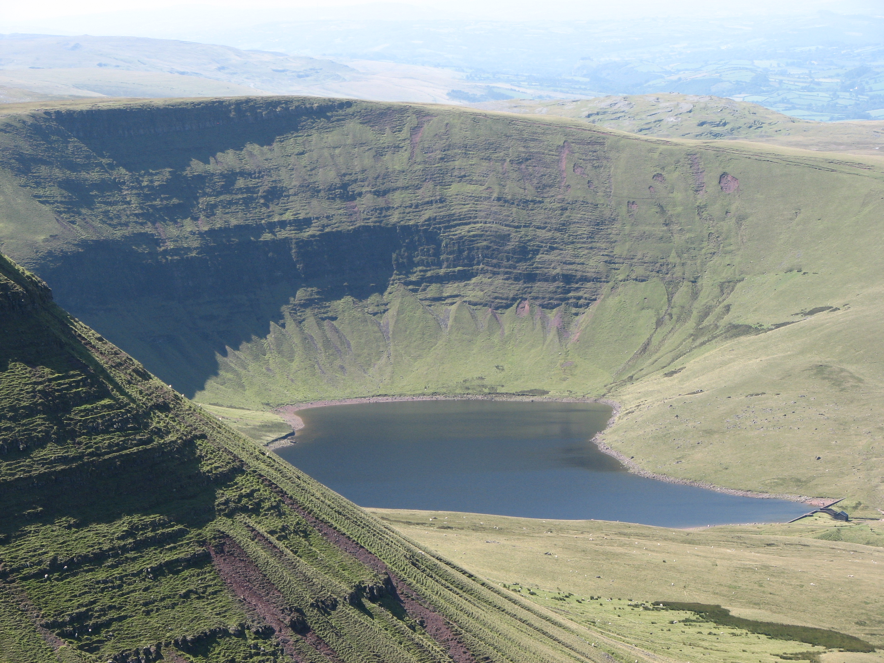
Llyn y Fan Fach

Llyn y Fan Fach (Welsh meaning "little lake (near) the peak") is a lake of approximately 10 hectares (25 acres) on the northern margin of the Black Mountain...

Cae Maes-y-ffynnon

Cae Maes-y-ffynnon is a wet unimproved pasture that is a Site of Special Scientific Interest in Carmarthen & Dinefwr, Wales. == See also == List of Sites...

Garreg Las

Garreg Las is a subsidiary summit of Fan Brycheiniog in the Brecon Beacons National Park (Welsh: Parc Cenedlaethol Bannau Brycheiniog) in Carmarthenshire...

Picws Du

Picws Du is the second highest peak of the Carmarthen Fans (or, in Welsh Bannau Sir Gâr) in the Carmarthenshire section of the Black Mountain in the west...

A4069 road

The A4069 is an A road which connects Llandovery with Gwaun-Cae-Gurwen in Wales, UK. == Route == The route begins at the junction with the A474 at the...

Fan Brycheiniog

Fan Brycheiniog is the highest peak at a height of 802.5 metres (2,633 ft) (above sea level) in the Black Mountain (Y Mynydd Du) region of the Brecon Beacons...

Nearby Amenities

Located within 500m of 51.897236,-3.776771
Building: yes
Lat/Long: 51.8963959/-3.7764503
The data included in this document is from www.openstreetmap.org. The data is made available under ODbL.

Have you been to Llanddeusant?

Leave your review of Llanddeusant below (or comments, questions and feedback).