Llanarthne

Community in Carmarthenshire

Wales

Llanarthne

St David's church, Llanarthney
St David's church, Llanarthney Credit: Dave Kelly

Llanarthne is a small community located in the county of Carmarthenshire, Wales. Situated approximately 10 miles to the northwest of the town of Carmarthen, Llanarthne is nestled in the picturesque Tywi Valley, surrounded by stunning countryside and rolling hills.

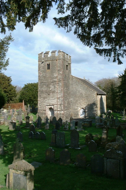
The community is predominantly rural and is home to a population of around 500 residents. The village itself is centered around the historic Llanarthne Church, which dates back to the 13th century and is a significant landmark in the area. The church is known for its beautiful stained glass windows and remains an active place of worship.

Llanarthne is also famous for its National Botanic Garden of Wales, a world-renowned attraction that showcases a wide range of plants and flowers in a stunning setting. The garden offers visitors the opportunity to explore themed gardens, glasshouses, and beautiful landscapes, making it a popular destination for tourists and locals alike.

The community provides a peaceful and tranquil lifestyle, with a strong sense of community spirit. It is well-connected by road, with the A48 passing nearby, providing easy access to the larger towns and cities in the region. Llanarthne also benefits from a range of local amenities, including a primary school, village hall, and a few small businesses.

Overall, Llanarthne is a charming community that offers a beautiful natural environment, rich history, and a range of attractions for visitors to enjoy. It is a place where residents can enjoy a peaceful countryside lifestyle while still having access to essential amenities and nearby urban areas.

If you have any feedback on the listing, please let us know in the comments section below.
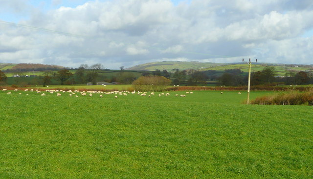
Llanarthne Images

Images are sourced within 2km of 51.850436/-4.151331 or Grid Reference SN5119. Thanks to Geograph Open Source API. All images are credited.

St David's church, Llanarthney
Ordnance Survey Flush Bracket This OS Flush Bracket (875) can be found on the south face of a roadside wall at the Golden Grove Arms, Llanarthne. It was used during the Second Geodetic Levelling of England & Wales (1912-21) Carmarthen - Llandovery Levelling Line. Also the Third Geodetic Levelling of England & Wales (1950-68) Llandovery - Carmarthen Levelling Line. It marks a point 79.1530ft above mean sea level.
Ordnance Survey Flush Bracket
This OS Flush Bracket (875) can be found on the south face of a roadside wall at the Golden Grove Arms, Llanarthne. It was used during the Second Geodetic Levelling of England & Wales (1912-21) Carmarthen - Llandovery Levelling Line. Also the Third Geodetic Levelling of England & Wales (1950-68) Llandovery - Carmarthen Levelling Line. It marks a point 79.1530ft above mean sea level.
Ordnance Survey Flush Bracket (874) This heavily painted over OS Flush Bracket (874) can be found on the north face of the stables at Bremenda Uchafa. It was used during the Second Geodetic Levelling of England & Wales (1912-21) Carmarthen - Llandovery Levelling Line. Also the Third Geodetic Levelling of England & Wales (1950-68) Llandovery - Carmarthen Levelling Line. It marks a point 81.5330ft above mean sea level.
Ordnance Survey Flush Bracket (874)
This heavily painted over OS Flush Bracket (874) can be found on the north face of the stables at Bremenda Uchafa. It was used during the Second Geodetic Levelling of England & Wales (1912-21) Carmarthen - Llandovery Levelling Line. Also the Third Geodetic Levelling of England & Wales (1950-68) Llandovery - Carmarthen Levelling Line. It marks a point 81.5330ft above mean sea level.
Ordnance Survey Flush Bracket (873) This OS Flush Bracket (873) can be found on the south east face of Pont ar Ffinnant. It was used during the Second Geodetic Levelling of England & Wales (1912-21) Carmarthen - Llandovery Levelling Line. Also the Third Geodetic Levelling of England & Wales (1950-68) Llandovery - Carmarthen Levelling Line. It marks a point 63.6340ft above mean sea level.
Ordnance Survey Flush Bracket (873)
This OS Flush Bracket (873) can be found on the south east face of Pont ar Ffinnant. It was used during the Second Geodetic Levelling of England & Wales (1912-21) Carmarthen - Llandovery Levelling Line. Also the Third Geodetic Levelling of England & Wales (1950-68) Llandovery - Carmarthen Levelling Line. It marks a point 63.6340ft above mean sea level.
Emlyn Arms Cerddwyr yn mynd heibio i Dafarn yr Emlyn Arms. Yn ystod Nadolig 1909 daeth y tafarn i sylw'r wlad am ddigwyddiad goruwchnaturiol wrth i boltergeist ymweld a'r lle gan greu anrhefn llwyr a gadael y bobl a'i gwelodd yn glwyfol tu hwnt. 

Walkers passing the Emlyn Arms. During Christmas 1909 the public house made national headlines by an event which could only be described as extraordinary. The premises was visited by a poltergeist which resulted in chaos and left those who witnessed the unearthly goings on highly traumatised.
Emlyn Arms
Cerddwyr yn mynd heibio i Dafarn yr Emlyn Arms. Yn ystod Nadolig 1909 daeth y tafarn i sylw'r wlad am ddigwyddiad goruwchnaturiol wrth i boltergeist ymweld a'r lle gan greu anrhefn llwyr a gadael y bobl a'i gwelodd yn glwyfol tu hwnt. Walkers passing the Emlyn Arms. During Christmas 1909 the public house made national headlines by an event which could only be described as extraordinary. The premises was visited by a poltergeist which resulted in chaos and left those who witnessed the unearthly goings on highly traumatised.
Derlwyn Isaf Cerddwyr yn agosau at anhedd-dy o'r enw Derlwyn Isaf.

Walkers approaching a property known as Derlwyn Isaf (Trans [lower] oakgrove)
Derlwyn Isaf
Cerddwyr yn agosau at anhedd-dy o'r enw Derlwyn Isaf. Walkers approaching a property known as Derlwyn Isaf (Trans [lower] oakgrove)
Milestone - Carmarthen 8
Church at Llanarthne
Car Park and Picnic Area on the B4300 A small car park and some picnic tables in the trees on the eastbound B4300 between Capel Dewi and Llanarthne.
Car Park and Picnic Area on the B4300
A small car park and some picnic tables in the trees on the eastbound B4300 between Capel Dewi and Llanarthne.
Towy valley floor 1 Looking north-west near Penybanc Uchaf.
Towy valley floor 1
Looking north-west near Penybanc Uchaf.
Towy valley floor 2 Looking north from the B4300 between Llanarthne and Bremenda.
Towy valley floor 2
Looking north from the B4300 between Llanarthne and Bremenda.
View to Bremenda Isaf Within the pastoral countryside of the Towy valley.
View to Bremenda Isaf
Within the pastoral countryside of the Towy valley.
B4300 near Llanarthne Looking east.
B4300 near Llanarthne
Looking east.
Crossroads in Llanarthne village, Camarthenshire The church seems to have been recently whitewashed on the exterior.
Crossroads in Llanarthne village, Camarthenshire
The church seems to have been recently whitewashed on the exterior.
Phone box by the B4310 near the Botanic Gardens of Wales
Clover Field, Waun Las National Nature Reserve, National Botanic Garden of Wales This Nature Reserve is part of the National Botanic Garden of Wales, and is centred on the farm of Waun Las. This clover has been sown to improve the quality of the soil. Paxton's Tower is on the horizon
Clover Field, Waun Las National Nature Reserve, National Botanic Garden of Wales
This Nature Reserve is part of the National Botanic Garden of Wales, and is centred on the farm of Waun Las. This clover has been sown to improve the quality of the soil. Paxton's Tower is on the horizon
Lake: National Botanic Garden of Wales
National Botanic Garden of Wales on a mid November afternoon Visitors to the Gardens making their way to the exit as the November afternoon sun highlights the fountain at the Entrance building
National Botanic Garden of Wales on a mid November afternoon
Visitors to the Gardens making their way to the exit as the November afternoon sun highlights the fountain at the Entrance building
Show me another place!

Llanarthne is located at Grid Ref: SN5119 (Lat: 51.850436, Lng: -4.151331)

Unitary Authority: Carmarthenshire

Police Authority: Dyfed-Powys

Also known as: Llanarthney

What 3 Words

///searches.repeated.cyclones. Near Llanddarog, Carmarthenshire

Related Wikis

National Botanic Garden of Wales

The National Botanic Garden of Wales (Welsh: Gardd Fotaneg Genedlaethol Cymru) is a botanical garden located in Llanarthney in the River Tywi valley, Carmarthenshire...

Llanarthney

Llanarthney (Welsh: Llanarthne; ) is a village and community in Carmarthenshire, south-west Wales. It is situated on the B4300 road, 12 km (7.5 miles)...

Llanarthney Halt railway station

Llanarthney railway station served the village of Llanarthney, in the historical county of Carmarthenshire, Wales, from 1865 to 1963 on the Llanelly Railway...

Paxton's Tower

Paxton's Tower is a Neo-Gothic folly erected in honour of Lord Nelson. It is situated on the top of a hill near Llanarthney in the River Tywi valley in...

District of Carmarthen

Carmarthen District Council (Welsh: Caerfyrddin) was one of six local government districts of the county of Dyfed, west Wales, from 1974 to 1996. ��2...

Llanegwad

Llanegwad () is a village and community located in Carmarthenshire, Wales. The population taken at the 2011 census was 1,473.Llanegwad is built up mainly...

Afon Cothi

The Afon Cothi (also known as the River Cothy) in Carmarthenshire is the largest tributary of the River Tywi in south Wales. From its source at Blaen Cothi...

Llanddarog

Llanddarog () is a community located in Carmarthenshire, Wales.The community population at the 2011 census was 1,198., and includes the villages of Cwmisfael...

Nearby Amenities

Located within 500m of 51.850436,-4.151331
Source: Bing
Lat/Long: 51.8461397/-4.1516615
The data included in this document is from www.openstreetmap.org. The data is made available under ODbL.

Have you been to Llanarthne?

Leave your review of Llanarthne below (or comments, questions and feedback).