Dinas

Community in Pembrokeshire

Wales

Dinas
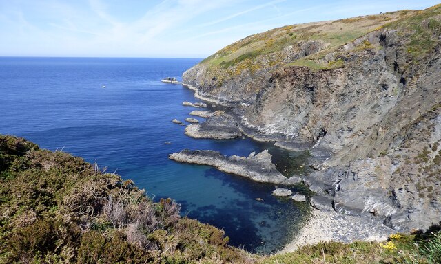
Cliffs at Pen Castell
Cliffs at Pen Castell Credit: Sandy Gerrard

The requested URL returned error: 429 Too Many Requests

If you have any feedback on the listing, please let us know in the comments section below.

Dinas Images

Images are sourced within 2km of 52.007872/-4.910405 or Grid Reference SN0038. Thanks to Geograph Open Source API. All images are credited.
Cliffs at Pen Castell
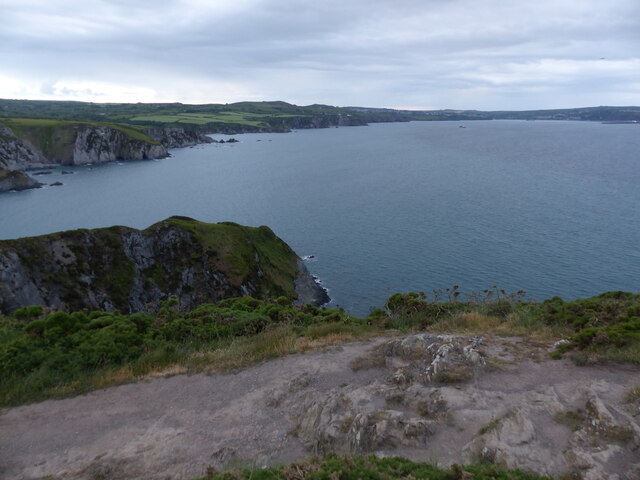
View of the coast from near Pen Castell
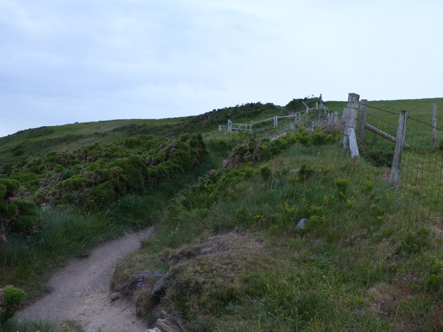
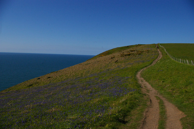
Coast path heading north
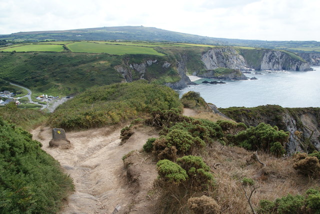
Coastal path on Dinas Island There is a diversion in place to avoid an eroded section of cliff, but the diversion is not enforced. The marker on the stone to the left acts merely as a recommendation.
Coastal path on Dinas Island
There is a diversion in place to avoid an eroded section of cliff, but the diversion is not enforced. The marker on the stone to the left acts merely as a recommendation.
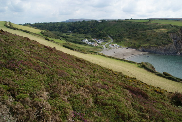
Hillside above Pwllgwaelod The whole of Dinas Island is on a slope but it is steeper at this southern end.
Hillside above Pwllgwaelod
The whole of Dinas Island is on a slope but it is steeper at this southern end.
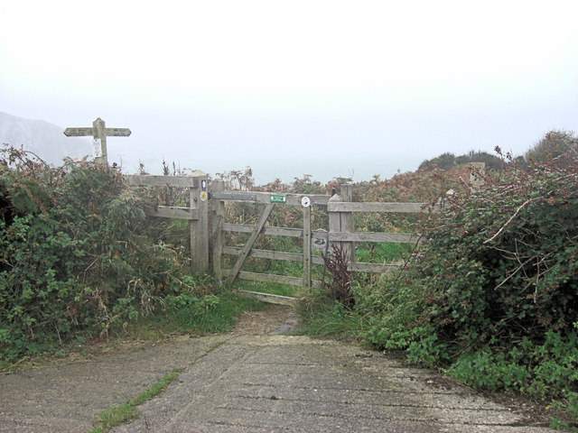
Start of Dinas Head footpath
Pembrokeshire coast path on the west side of Dinas Island
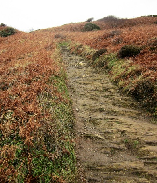
Coast path on Dinas Island A steep ascent away from Pwllgwaelod up footpath PP16 46/1, with the path's surface the rock itself.
Coast path on Dinas Island
A steep ascent away from Pwllgwaelod up footpath PP16 46/1, with the path's surface the rock itself.
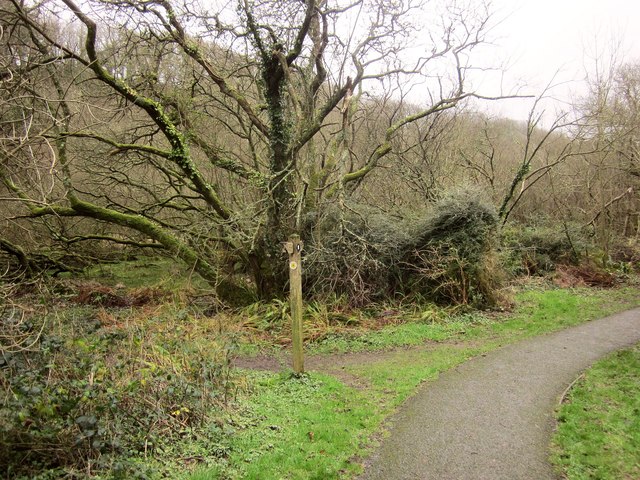
Path junction, Cwm-yr-Eglwys Footpath PP16 45/2 joins the coast path here from the left. (The coast path is mapped as an alternative to the strenuous route around Dinas Island). On the left is the swampy woodland shown in <a href="https://www.geograph.org.uk/photo/4529419">SN0139 : Swampy woodland, Cwm Dewi</a>.
Path junction, Cwm-yr-Eglwys
Footpath PP16 45/2 joins the coast path here from the left. (The coast path is mapped as an alternative to the strenuous route around Dinas Island). On the left is the swampy woodland shown in SN0139 : Swampy woodland, Cwm Dewi.
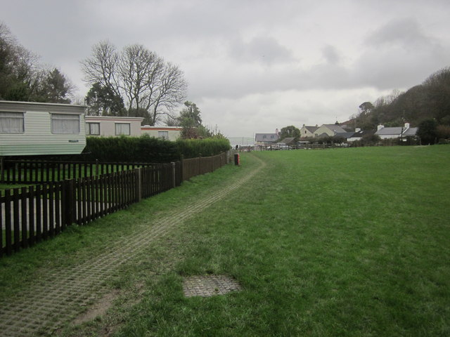
Cwm-yr-Eglwys Caravan Park The easy inland version of the coast path runs through this caravan site to the sea by the ruined church.
Cwm-yr-Eglwys Caravan Park
The easy inland version of the coast path runs through this caravan site to the sea by the ruined church.
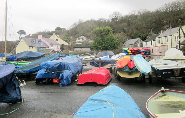
Boat park, Cwm-yr-Eglwys From the inland arm of the coast path.
Boat park, Cwm-yr-Eglwys
From the inland arm of the coast path.
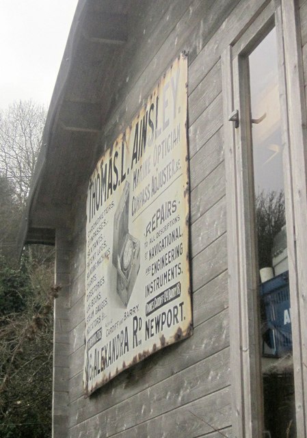
Old advert, Cwm-yr-Eglwys An advertising sign for Thomas L Ainsley, a marine optician of Alexandra Road, Newport, and fixed to the side of a hut near the car park. I can find a reference to him trading as a bookseller as well as a marine optician, and based in Cardiff, but nothing for Newport. I must search out an old Kelly's ...
Old advert, Cwm-yr-Eglwys
An advertising sign for Thomas L Ainsley, a marine optician of Alexandra Road, Newport, and fixed to the side of a hut near the car park. I can find a reference to him trading as a bookseller as well as a marine optician, and based in Cardiff, but nothing for Newport. I must search out an old Kelly's ...
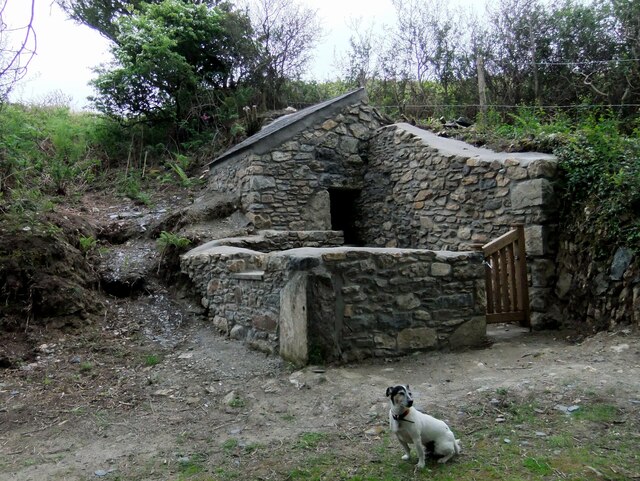
Pig sty, Pen-y-wennol The pig sty at the site of the now-ruined farm of Pen-y-wennol was restored to  immaculate condition in 2011, when this photo was taken. It has since become very overgrown. It can be viewed from a footpath running along the hillside.

Pen-y-wennol: top of the shuttle, probably a reference to the steep winding road from the village to access the place - although 'gwennol' is also the word for swallow (the bird).
Pig sty, Pen-y-wennol
The pig sty at the site of the now-ruined farm of Pen-y-wennol was restored to immaculate condition in 2011, when this photo was taken. It has since become very overgrown. It can be viewed from a footpath running along the hillside. Pen-y-wennol: top of the shuttle, probably a reference to the steep winding road from the village to access the place - although 'gwennol' is also the word for swallow (the bird).
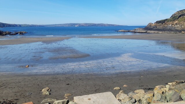
Pwllgwaelod Beach
Pwllgwaelod Beach
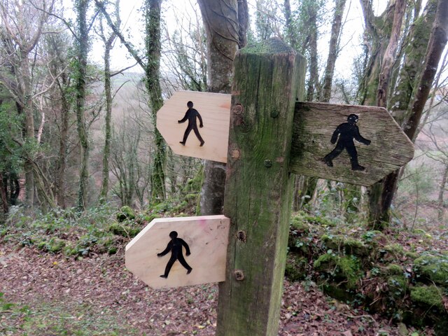
Foot path direction signs New signage added to old. The figures look very masculine, striding out with an apprearance of urgency rather than pleasure.
Foot path direction signs
New signage added to old. The figures look very masculine, striding out with an apprearance of urgency rather than pleasure.
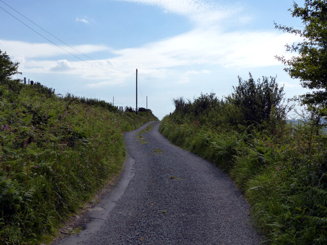
Lane heading south-west on hill above Dinas Cross
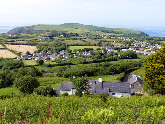
Dinas Cross seen from the scenic view point
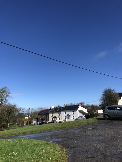
Hillside houses south of Dinas Cross
Show me another place!

Dinas is located at Grid Ref: SN0038 (Lat: 52.007872, Lng: -4.910405)

Unitary Authority: Pembrokeshire

Police Authority: Dyfed-Powys

Also known as: Dinas Cross

What 3 Words

///universe.vivid.blunders. Near Fishguard, Pembrokeshire

Related Wikis

Dinas Cross

Dinas Cross (Welsh: Dinas) is a village, a community and a former parish in Pembrokeshire, Wales. Located between Fishguard and Newport in the Pembrokeshire...

Brynhenllan

Bryn-henllan, Bryn Henllan or Brynhenllan is a small settlement in the community of Dinas Cross, north Pembrokeshire, Wales, just north of the A487 road...

Cwm Dewi

Cwm Dewi is a Site of Special Scientific Interest (or SSSI) in Pembrokeshire, South Wales. It has been designated as a Site of Special Scientific Interest...

Pwllgwaelod

Pwllgwaelod (originally Y Pwll Gwaelod, Welsh for The Bottom Cove/Creek) is a small scattered hamlet centred on a bay on the south-western side of the...

Nearby Amenities

Located within 500m of 52.007872,-4.910405
Post Box
Post Box Type: lamp
Royal Cypher: EIIR
Royal Cypher Wikidata: Q33102113
Lat/Long: 52.007241/-4.9091585
Barrier: stile
Material: stone
Stile: stepover
Lat/Long: 52.0096865/-4.9115056
Barrier: kissing_gate
Lat/Long: 52.0060002/-4.9161403
Crossing
Lat/Long: 52.0058357/-4.9168808
Give Way
Direction: forward
Lat/Long: 52.0082864/-4.9071871
Give Way
Direction: forward
Lat/Long: 52.0065998/-4.9099315
Give Way
Direction: forward
Lat/Long: 52.0110274/-4.9080453
Power: pole
Lat/Long: 52.0078091/-4.9031357
Power: pole
Lat/Long: 52.0070802/-4.9052212
Power: pole
Lat/Long: 52.006376/-4.9062391
Power: pole
Lat/Long: 52.0051459/-4.9081957
Power: pole
Lat/Long: 52.0045185/-4.9091667
Ford: yes
Lat/Long: 52.0084102/-4.9138782
Ford: yes
Lat/Long: 52.0078012/-4.9115843
Barrier: kissing_gate
Wheelchair: no
Lat/Long: 52.0089155/-4.9084454
Barrier: stile
Stile: stepover
Lat/Long: 52.0088633/-4.9116808
Telephone
Defibrillator
Booth: KX100
Colour: green
Covered: booth
Defibrillator Location: inside telephone box painted green
Emergency: defibrillator
Man Made: telephone_box
Lat/Long: 52.0063304/-4.9102365
Historic: monument
Lat/Long: 52.0058796/-4.9108279
Cafe
Te Orinda
Check Date: 2022-08-12
Opening Hours: PH,Fr-Su 10:00-16:00
Payment Mastercard: yes
Payment Visa: yes
Wheelchair: yes
Lat/Long: 52.0090995/-4.9079956
The data included in this document is from www.openstreetmap.org. The data is made available under ODbL.

Have you been to Dinas?

Leave your review of Dinas below (or comments, questions and feedback).