Brewood

Settlement in Staffordshire South Staffordshire

England

Brewood

Engleton Hall
Engleton Hall Credit: Geoff Pick

Brewood is a charming village located in the county of Staffordshire, in the West Midlands region of England. Situated about eight miles northeast of Wolverhampton, it lies on the banks of the River Penk. With a population of around 4,500 residents, Brewood maintains a close-knit community feel.

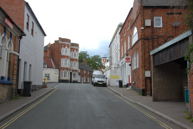
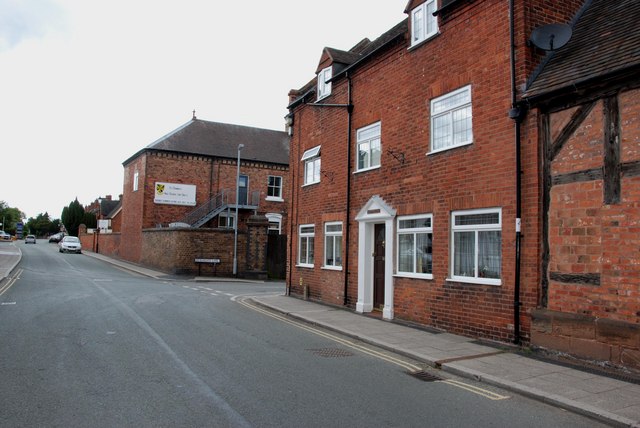
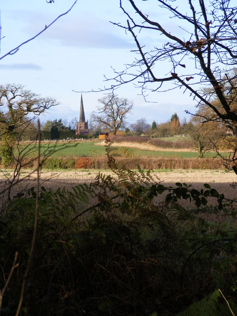
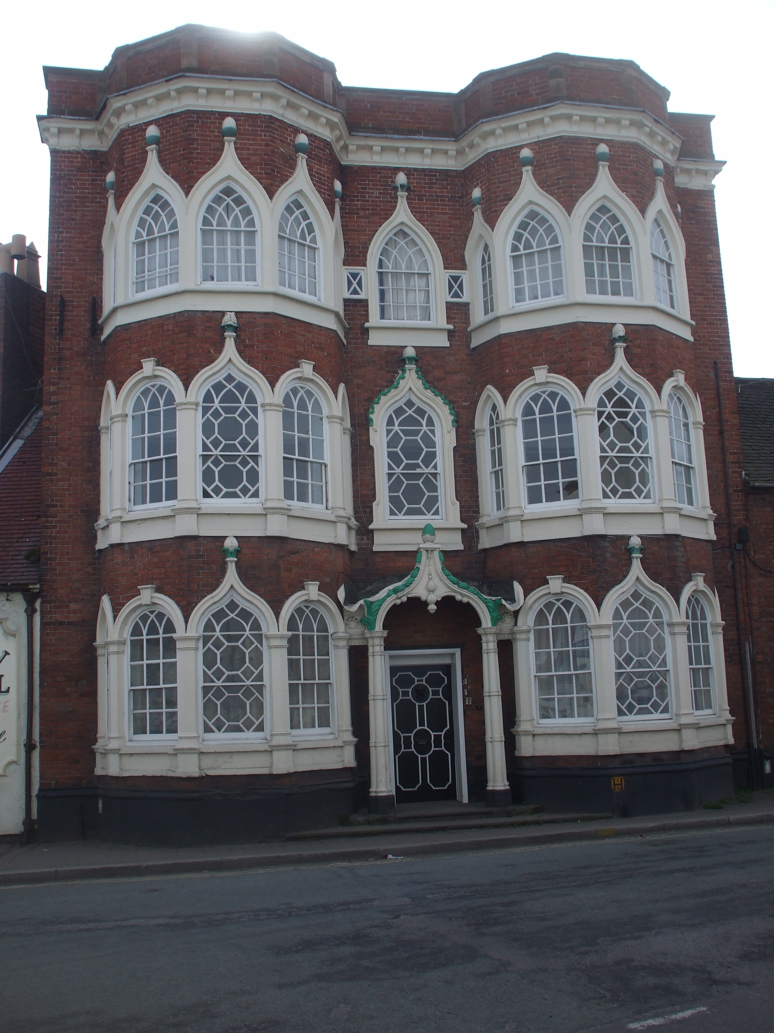
The village is known for its historical significance, dating back to the Saxon era. Its narrow streets are lined with a variety of well-preserved timber-framed buildings, showcasing the village's rich architectural heritage. St. Mary and St. Chad Church, a prominent landmark in Brewood, exemplifies the village's historical significance with its stunning Norman and Gothic architecture.

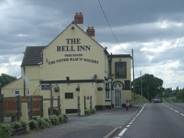
Brewood offers a range of amenities and services for its residents. The village boasts a primary school, a library, a post office, and a variety of shops and businesses, including local pubs and restaurants. The Staffordshire and Worcestershire Canal passes through the village, providing opportunities for leisurely walks and boating activities.

The surrounding countryside of Brewood offers picturesque landscapes and numerous outdoor activities. The nearby Shropshire Hills Area of Outstanding Natural Beauty provides ample opportunities for hiking, cycling, and exploring the great outdoors. Additionally, the village is conveniently located near several major roadways, making it easily accessible to nearby towns and cities.

The annual Brewood Music Festival, held in the summer, draws visitors from far and wide to enjoy a weekend of live music and entertainment. The village also hosts a variety of community events throughout the year, including a popular farmers' market and a Christmas lights switch-on ceremony.

Brewood's historical charm, thriving community, and beautiful surroundings make it a desirable place to live and visit in Staffordshire.

If you have any feedback on the listing, please let us know in the comments section below.

Brewood Images

Images are sourced within 2km of 52.6769/-2.173831 or Grid Reference SJ8808. Thanks to Geograph Open Source API. All images are credited.

Engleton Hall
Engleton Hall
Near Engleton Hall
Near Engleton Hall
Horsebrook Farm
Horsebrook Farm
Canal milepost Autherley Junction to the south is on the outskirts of Wolverhampton with a connection to the Birmingham Canal Navigation.
Canal milepost
Autherley Junction to the south is on the outskirts of Wolverhampton with a connection to the Birmingham Canal Navigation.
Broomhall Bridge The Canal Bridge on the Shropshire Union .
Broomhall Bridge
The Canal Bridge on the Shropshire Union .
Broom Hall approached from the canal
Streetway house Certified location Typical view from a caravan on this Caravan Club 5-Van site (CL).
Streetway house Certified location
Typical view from a caravan on this Caravan Club 5-Van site (CL).
The Bell Inn on Watling Street
Narrowboat on the Shropshire Union Canal, Staffordshire The narrowboat "Platypus" is waiting to navigate southwards through Broomhall Bridge (behind the camera). 
This canal was built by Thomas Telford and opened in 1835. His plan was to minimise the distance by adopting straight lines wherever possible, so his canal includes many long embankments and cuttings, a difficult and expensive strategy. Competition from the rapidly expanding railways was making it necessary to use all methods possible to speed up the progress of working boats, especially straighter routes and minimal use of locks.
Narrowboat on the Shropshire Union Canal, Staffordshire
The narrowboat "Platypus" is waiting to navigate southwards through Broomhall Bridge (behind the camera). This canal was built by Thomas Telford and opened in 1835. His plan was to minimise the distance by adopting straight lines wherever possible, so his canal includes many long embankments and cuttings, a difficult and expensive strategy. Competition from the rapidly expanding railways was making it necessary to use all methods possible to speed up the progress of working boats, especially straighter routes and minimal use of locks.
River Penk downstream near Engleton Mill
Bullocks - Across the River Penk The footpath crossing the River Penk opened into a field full of frisky bullocks. Given the way they had scampered about as I walked up towards the bridge I decided that crossing their field was perhaps not a very good idea.
Bullocks - Across the River Penk
The footpath crossing the River Penk opened into a field full of frisky bullocks. Given the way they had scampered about as I walked up towards the bridge I decided that crossing their field was perhaps not a very good idea.
Canal milepost near Brewood, Staffordshire The Birmingham and Liverpool Canal was constructed between the years 1825 and 1835, the year it finally opened after long delays because of embankment instability, and after Thomas Telford's death.

Although named the Birmingham and Liverpool Canal, it went to neither, but formed a link between older canals leading there. At Nantwich, it joined the Chester Canal. At Autherley it joined the Staffordshire and Worcestershire Canal, which linked nearby to the Birmingham Canal. At Norbury a branch, long closed, linked via Newport to the Shrewsbury Canal.

Later merger of companies resulted in the canal being renamed the Shropshire Union.
Canal milepost near Brewood, Staffordshire
The Birmingham and Liverpool Canal was constructed between the years 1825 and 1835, the year it finally opened after long delays because of embankment instability, and after Thomas Telford's death. Although named the Birmingham and Liverpool Canal, it went to neither, but formed a link between older canals leading there. At Nantwich, it joined the Chester Canal. At Autherley it joined the Staffordshire and Worcestershire Canal, which linked nearby to the Birmingham Canal. At Norbury a branch, long closed, linked via Newport to the Shrewsbury Canal. Later merger of companies resulted in the canal being renamed the Shropshire Union.
Shropshire Union Canal near Shutt Green, Staffordshire Broomhall Bridge (No 16) is in the distance.
Shropshire Union Canal near Shutt Green, Staffordshire
Broomhall Bridge (No 16) is in the distance.
Somerford Bridge, Clay Gates Rd The river Penk is just out of sight behind the grass.
Somerford Bridge, Clay Gates Rd
The river Penk is just out of sight behind the grass.
Entering Brewood from Somerford Bridge
Street View, Brewood, Staffordshire The Swan hotel, the Lion pub and Post Office all together. The poor chap in the van, came running across to tell me he was just going, he thought I was a traffic warden taking photos for evidence.
Street View, Brewood, Staffordshire
The Swan hotel, the Lion pub and Post Office all together. The poor chap in the van, came running across to tell me he was just going, he thought I was a traffic warden taking photos for evidence.
Bargate Street, Brewood The building on the junction of Bargate street and Bargate lane is St. Dominic's High School for girls.
Bargate Street, Brewood
The building on the junction of Bargate street and Bargate lane is St. Dominic's High School for girls.
Across Horse Paddocks to Brewood
Show me another place!

Brewood is located at Grid Ref: SJ8808 (Lat: 52.6769, Lng: -2.173831)

Administrative County: Staffordshire

District: South Staffordshire

Police Authority: Staffordshire

What 3 Words

///fastening.rationing.breathing. Near Brewood, Staffordshire

Nearby Locations

Brewood Hill Top

Related Wikis

Brewood

Brewood is an ancient market town in the civil parish of Brewood and Coven, in the South Staffordshire district, in the county of Staffordshire, England...

Speedwell Castle

Speedwell Castle is a mid-18th-century house at the centre of Brewood, Staffordshire, between Wolverhampton and Stafford. Described by Pevsner as a "peach...

St Dominic's Grammar School

St Dominic's Grammar School (formerly St Dominic's Brewood and St Dominic's High School For Girls) is a private day school for girls and boys aged 2 to...

Brewood Grammar School

Brewood Grammar School was a boys' school in the village of Brewood in South Staffordshire, England. Founded in the mid 15th century by the Bishop of Lichfield...

Nearby Amenities

Located within 500m of 52.6769,-2.173831
Brewood
Created By: Potlatch 0.10b
Is In: Staffordshire
Place: village
Wikidata: Q2411070
Lat/Long: 52.6773726/-2.1716339
Bus Stop
Post Office
Bus: yes
Naptan AtcoCode: 3800C601100
Naptan Bearing: SE
Naptan CommonName: Post Office
Naptan Indicator: Adj
Naptan Landmark: Post Office
Naptan Street: Sandy Lane
Naptan Verified: no
Public Transport: platform
Source: naptan_import
Lat/Long: 52.6767813/-2.1732192
Post Office
Naptan AtcoCode: 3800C601101
Naptan Bearing: NE
Naptan BusStopType: CUS
Naptan CommonName: The Swan Hotel PH
Naptan Indicator: Adj
Naptan Landmark: The Swan Hotel PH
Naptan Street: Market Place
Naptan Verified: no
Public Transport: platform
Source: naptan_import
Lat/Long: 52.6767187/-2.1739372
Bus Stop
Hyde Mill Croft
Bus: yes
Naptan AtcoCode: 3800C639501
Naptan Bearing: N
Naptan CommonName: Hyde Mill Croft
Naptan Indicator: Adj
Naptan Landmark: Hyde Mill Croft
Naptan Street: Coven Rd
Naptan Verified: no
Public Transport: platform
Source: naptan_import
Lat/Long: 52.6734318/-2.1716465
Bus Stop
Dean Street
Bus: yes
Naptan AtcoCode: 3800C639601
Naptan Bearing: SW
Naptan CommonName: Dean Street
Naptan Indicator: Opp
Naptan Landmark: Dean Street
Naptan Street: The Pavement
Naptan Verified: no
Public Transport: platform
Source: naptan_import
Lat/Long: 52.6737649/-2.1713225
Bus Stop
Deansfield Close
Bus: yes
Naptan AtcoCode: 3800C639701
Naptan Bearing: W
Naptan CommonName: Deansfield Close
Naptan Indicator: Adj
Naptan Landmark: Deansfield Close
Naptan Street: Deansfield Road
Naptan Verified: no
Public Transport: platform
Source: naptan_import
Lat/Long: 52.678687/-2.1680433
Bus Stop
Deansfield Close
Bus: yes
Naptan AtcoCode: 3800C639702
Naptan Bearing: E
Naptan BusStopType: CUS
Naptan Indicator: Adj
Naptan Landmark: Bishops Drive
Naptan Street: Deansfield Road
Naptan Verified: no
Public Transport: platform
Source: naptan_import
Lat/Long: 52.6788129/-2.1680142
Telephone
Booth: K6
Covered: booth
Listed Status: Grade II
Operator: BT
Phone: +44 1902 850320
Lat/Long: 52.6772967/-2.1771275
Cafe
The Mess Bistro
Lat/Long: 52.6767789/-2.1735922
Cafe
Lazy Days
Lat/Long: 52.677968/-2.1729651
Information: board
Tourism: information
Lat/Long: 52.6769777/-2.1785744
Bench
Lat/Long: 52.6761545/-2.178088
Bench
Lat/Long: 52.6768292/-2.178471
Bench
Lat/Long: 52.6731231/-2.175792
Bench
Lat/Long: 52.6725945/-2.1752475
Barrier: kissing_gate
Lat/Long: 52.6730996/-2.1747205
Barrier: kissing_gate
Lat/Long: 52.6745196/-2.1749051
Barrier: kissing_gate
Lat/Long: 52.6736155/-2.174849
W Maiden and Son
Shop: butcher
Lat/Long: 52.6779064/-2.1726675
Spar
Brand: Spar
Brand Wikidata: Q610492
Brand Wikipedia: en:SPAR (retailer)
Shop: convenience
Lat/Long: 52.6772413/-2.173727
Andre Pastor Hair and Beauty
Shop: hairdresser
Lat/Long: 52.6773551/-2.1733139
Information: board
Tourism: information
Lat/Long: 52.6770835/-2.1739362
Village Flowers
Shop: florist
Lat/Long: 52.6773958/-2.1732764
Information: board
Tourism: information
Lat/Long: 52.6804139/-2.1722088
Man Made: surveillance
Source: survey
Lat/Long: 52.6769957/-2.173844
Coopers Food
Shop: deli
Lat/Long: 52.6766593/-2.1740374
Pharmacy
Lloyds Pharmacy
Brand: Lloyds Pharmacy
Brand Wikidata: Q6662870
Brand Wikipedia: en:LloydsPharmacy
Healthcare: pharmacy
Lat/Long: 52.6765582/-2.1738252
Post Box
Post Box Type: wall
Ref: ST19 314
Royal Cypher: EIIR
Royal Cypher Wikidata: Q33102113
Source: GPS Survey
Lat/Long: 52.6768661/-2.1734975
Toilets
Brewood Public Toilets
Access: yes
Fee: no
Operator: South Staffordshire District Council
Toilets Disposal: flush
Wheelchair: yes
Lat/Long: 52.6766755/-2.1731816
Entrance: main
Lat/Long: 52.6762797/-2.1755278
Entrance: main
Lat/Long: 52.6765185/-2.1754728
vehicle entrance
Entrance: main
Lat/Long: 52.6754774/-2.1750591
pedestrian entrance
Entrance: main
Lat/Long: 52.6757069/-2.1756226
Generator Method: photovoltaic
Generator Output Electricity: yes
Generator Source: solar
Generator Type: solar_photovoltaic_panel
Location: roof
Power: generator
Lat/Long: 52.676478/-2.1764302
Generator Method: photovoltaic
Generator Output Electricity: yes
Generator Source: solar
Generator Type: solar_photovoltaic_panel
Location: roof
Power: generator
Lat/Long: 52.6767268/-2.1770605
Generator Method: photovoltaic
Generator Output Electricity: yes
Generator Source: solar
Generator Type: solar_photovoltaic_panel
Location: roof
Power: generator
Lat/Long: 52.676056/-2.1704771
Generator Method: photovoltaic
Generator Output Electricity: yes
Generator Source: solar
Generator Type: solar_photovoltaic_panel
Location: roof
Power: generator
Lat/Long: 52.6763097/-2.1705093
Barrier: stile
Bicycle: no
Foot: yes
Horse: no
Material: wood
Motor Vehicle: no
Stile: stepover
Lat/Long: 52.6797648/-2.178663
Bench
Lat/Long: 52.6773385/-2.1770939
Restaurant
Staffordshire Grill
Website: https://www.grill.co.uk/staffordshire/
Lat/Long: 52.6770394/-2.173742
Post Office
Brewood Post Office
Brand: Post Office
Brand Wikidata: Q1783168
Check Date: 2023-09-27
Operator: The Co-operative Food
Operator Wikidata: Q107617274
Ref Pol Id: 12151
Lat/Long: 52.6769887/-2.1733926
The data included in this document is from www.openstreetmap.org. The data is made available under ODbL.

Have you been to Brewood?

Leave your review of Brewood below (or comments, questions and feedback).