Brewlands Bridge

Settlement in Angus

Scotland

Brewlands Bridge

Heather burning along line of wall Heather burning to the north-west of the minor hill, Lindalla.
Mount Blair lies in the distance.
Heather burning along line of wall Credit: Trevor Littlewood

Brewlands Bridge is a small rural settlement located in the county of Angus, Scotland. Situated within the picturesque Glenisla Valley, it lies approximately 15 miles northwest of the town of Kirriemuir. The village gets its name from a historic stone bridge that spans the River Isla, which flows through the area.

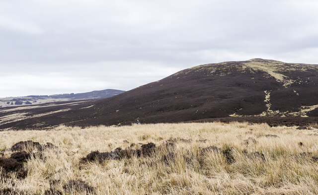
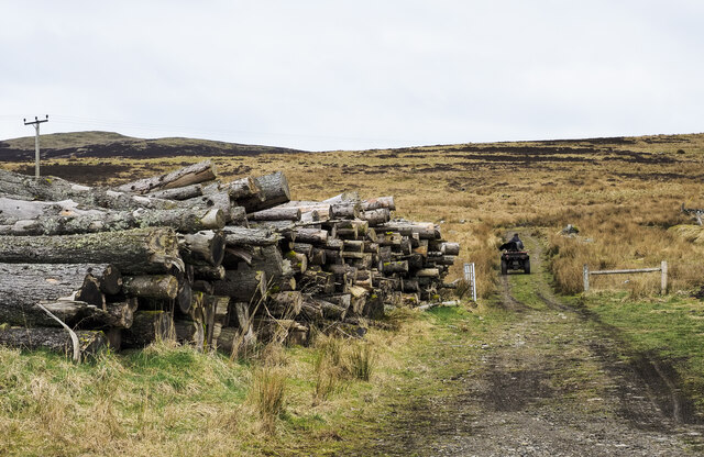
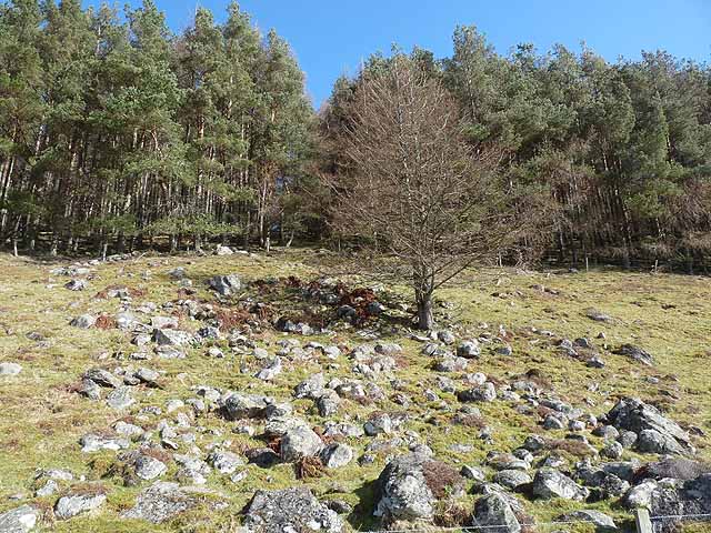
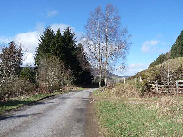
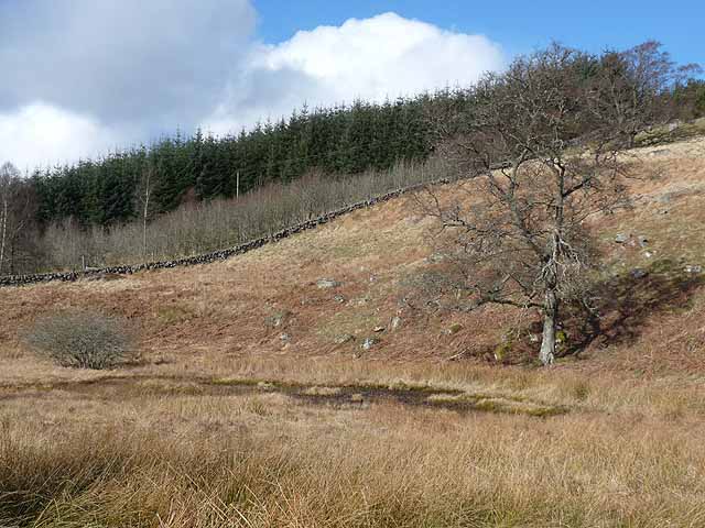
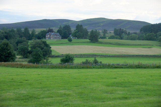
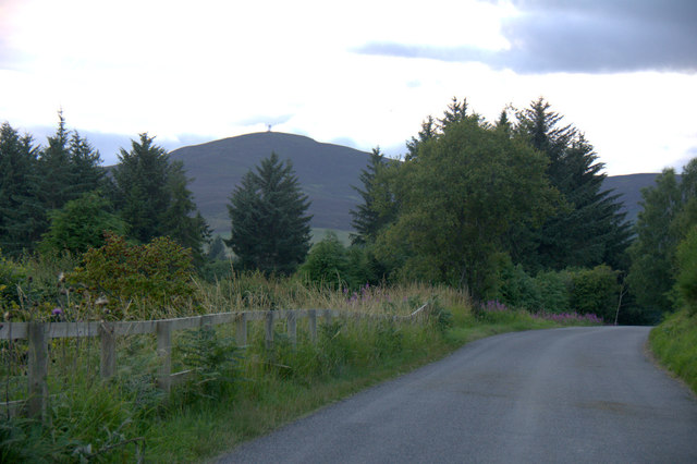
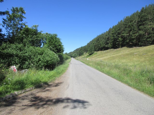
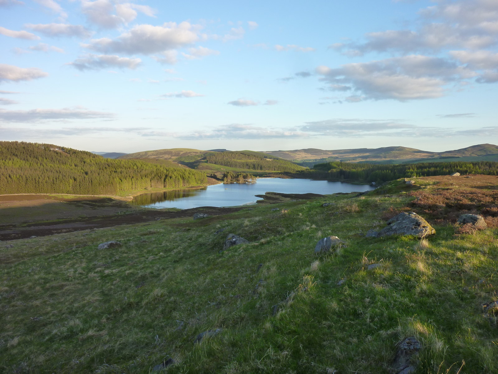
Surrounded by stunning natural beauty, Brewlands Bridge is a popular destination for outdoor enthusiasts. The village is encompassed by rolling hills, lush forests, and winding rivers, making it an ideal location for hiking, fishing, and wildlife watching. The nearby Glenisla Golf Course also attracts golfers from both near and far.

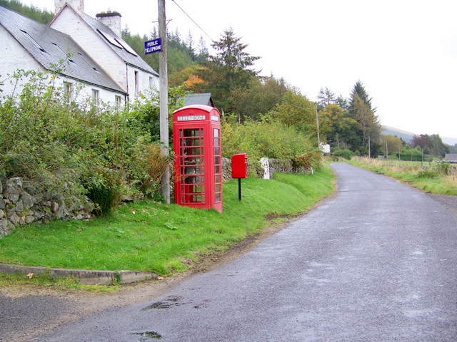
Despite its small size, Brewlands Bridge has a strong community spirit. The village is home to a charming primary school and a friendly local pub, providing a focal point for residents to gather and socialize. The pub, known for its warm hospitality and traditional Scottish fare, also attracts visitors who wish to experience the local culture.

While Brewlands Bridge may lack the amenities of larger towns, its peaceful and tranquil environment is highly sought after by those looking to escape the hustle and bustle of city life. With its stunning natural landscapes and welcoming community, Brewlands Bridge offers a truly idyllic retreat for both residents and visitors alike.

If you have any feedback on the listing, please let us know in the comments section below.

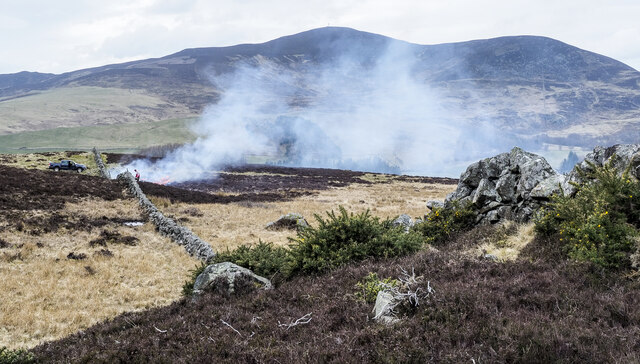
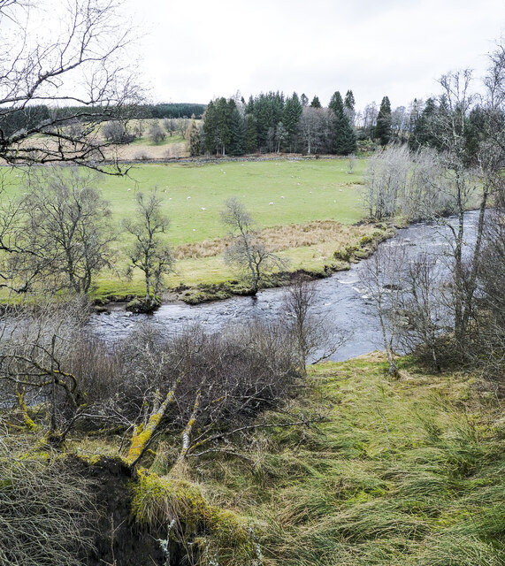
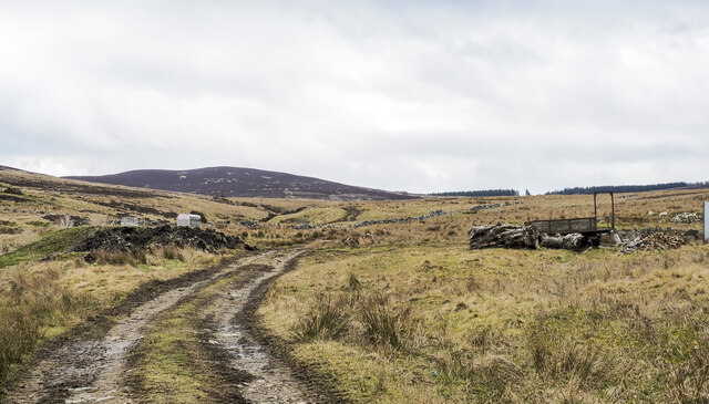
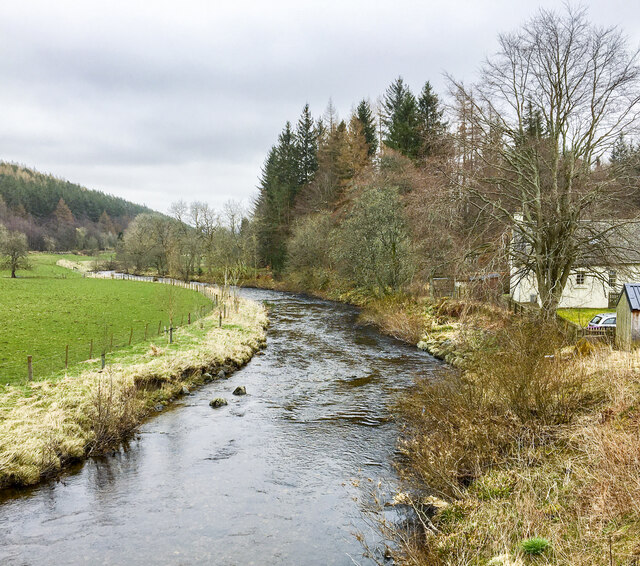
Brewlands Bridge Images

Images are sourced within 2km of 56.736297/-3.316165 or Grid Reference NO1961. Thanks to Geograph Open Source API. All images are credited.

Heather burning along line of wall Heather burning to the north-west of the minor hill, Lindalla.
Mount Blair lies in the distance.
Heather burning along line of wall
Heather burning to the north-west of the minor hill, Lindalla. Mount Blair lies in the distance.
'Improved' land on south side of Lindalla Lindalla is a hill on the north side of Glen Isla above Kirkton of Glenisla; it rises to 450 metres; it is cultivated over its entire southern side though much of it would be regarded as rough grazing.
Crock is the hill away to the east.
'Improved' land on south side of Lindalla
Lindalla is a hill on the north side of Glen Isla above Kirkton of Glenisla; it rises to 450 metres; it is cultivated over its entire southern side though much of it would be regarded as rough grazing. Crock is the hill away to the east.
Walled lane descending to Kirkton of Glenisla OS mapping shows a track or path descending from the minor hill Lindalla, towards Kirkton of Glenisla and reaching a road in the village. The route is faint on the hill but can be followed to the walled lane in the image which is surely the way which by it enters the settlement. There are however obstacles on the way beyond the lane: barbed wire, excessive bush & tree growth, and a streamlet.
Walled lane descending to Kirkton of Glenisla
OS mapping shows a track or path descending from the minor hill Lindalla, towards Kirkton of Glenisla and reaching a road in the village. The route is faint on the hill but can be followed to the walled lane in the image which is surely the way which by it enters the settlement. There are however obstacles on the way beyond the lane: barbed wire, excessive bush & tree growth, and a streamlet.
Trees beside the River Isla, standing and fallen A bend of the river near to Kirkton of Glenisla with trees standing on both banks and fallen trees on the south side no doubt knocked over during a storm in the winter of 2021 to 2022.
Trees beside the River Isla, standing and fallen
A bend of the river near to Kirkton of Glenisla with trees standing on both banks and fallen trees on the south side no doubt knocked over during a storm in the winter of 2021 to 2022.
Hill road climbing into valley of Cressfit Burn The stream drains slopes of the moorland hills, Cairn Gibbs and Knockton. The way initially is unattractive passing apparently abandoned farm equipment and various debris.
Hill road climbing into valley of Cressfit Burn
The stream drains slopes of the moorland hills, Cairn Gibbs and Knockton. The way initially is unattractive passing apparently abandoned farm equipment and various debris.
Footbridge over River Isla at Kirkton of Glenisla The bridge is of some antiquity and carries the long distance path, Cateran Trail. Currently in April 2022 the bridge is 'closed' as it's deemed to be unsafe. There's a notice but no barrier to crossing at the road access to the bridge which is out of view to the right. At the other end there's no notice so the first warning that a walker would have comes only after a crossing has been made!
Footbridge over River Isla at Kirkton of Glenisla
The bridge is of some antiquity and carries the long distance path, Cateran Trail. Currently in April 2022 the bridge is 'closed' as it's deemed to be unsafe. There's a notice but no barrier to crossing at the road access to the bridge which is out of view to the right. At the other end there's no notice so the first warning that a walker would have comes only after a crossing has been made!
River Isla flowing downstream The river seen from Brewlands old bridge which has an OS flush bracket - No. G846.
River Isla flowing downstream
The river seen from Brewlands old bridge which has an OS flush bracket - No. G846.
Rushes concealing Craigness Burn The Craigness Burn flows through the bed of rushes beyond which rises to the heather dome of Cairn Gibbs.
Rushes concealing Craigness Burn
The Craigness Burn flows through the bed of rushes beyond which rises to the heather dome of Cairn Gibbs.
Timber stack beside hill track Timber stacks are generally temporary stores of felled logs prior to them being taken away for use. Occasionally, for some reason the wood is just left in its pile and that's what seems to have happened here.
Timber stack beside hill track
Timber stacks are generally temporary stores of felled logs prior to them being taken away for use. Occasionally, for some reason the wood is just left in its pile and that's what seems to have happened here.
Rocky slope and plantation above Glen Isla
The road up Glen Isla The B951 from Kirriemuir to Glenshee.
The road up Glen Isla
The B951 from Kirriemuir to Glenshee.
Dried up pond at Holmiry In Glen Isla.
Dried up pond at Holmiry
In Glen Isla.
Glenisla Primary School In Kirkton of Glenisla.
Glenisla Primary School
In Kirkton of Glenisla.
Rickety bridge It looks fragile but is quite sturdy, taking walkers on the Cateran Trail across the river Isla, just south of Kirkton of Glenisla.
Rickety bridge
It looks fragile but is quite sturdy, taking walkers on the Cateran Trail across the river Isla, just south of Kirkton of Glenisla.
Glen Isla at Auchenleish Looking across the glen to Auchenleish House which is just outside the square.
Glen Isla at Auchenleish
Looking across the glen to Auchenleish House which is just outside the square.
Roadkill, Glen Isla A female Pheasant; this area has a very high density of Pheasant-rearing.
Roadkill, Glen Isla
A female Pheasant; this area has a very high density of Pheasant-rearing.
Road through Glen Isla Mount Blair in the background.
Road through Glen Isla
Mount Blair in the background.
B951 through Glen Isla The B951 heading up Glen Isla between the Kirkton and Brewlands.
B951 through Glen Isla
The B951 heading up Glen Isla between the Kirkton and Brewlands.
Show me another place!

Brewlands Bridge is located at Grid Ref: NO1961 (Lat: 56.736297, Lng: -3.316165)

Unitary Authority: Angus

Police Authority: Tayside

What 3 Words

///choppers.smoke.dare. Near Alyth, Perth & Kinross

Related Wikis

Brewlands Bridge

Brewlands Bridge is a hamlet in Glen Isla, Angus, Scotland. It is lies situated on the River Isla, eleven miles north-west of Kirriemuir and ten miles...

Auchinleish

Auchinleish is a village in Angus, Scotland. == References ==

Kirkton of Glenisla

Kirkton of Glenisla consists of a church and graveyard, a hotel, hall and several homes forming the largest concentration of habitation in Glenisla, Angus...

Folda, Angus

Folda is a hamlet in Glen Isla, Angus, Scotland. It is situated on the River Isla, twelve miles north-west of Kirriemuir and eleven miles north of Blairgowrie...

Mount Blair (Scotland)

Mount Blair is a large hill on the Perth and Kinross and Angus border, Scotland, in the southern foothills of the Grampian Mountains. It lies between the...

Auchintaple Loch

Auchintaple Loch also known as Auchenchapel Loch, is a small shallow freshwater loch that is located in Glen Isla in Angus, Scotland. == See also == List...

Forter Castle

Forter Castle is located in Glenisla, Perthshire, Scotland. It was built in 1560 by James Ogilvy, the 5th Lord of Airlie. In 1640, it was burned by Archibald...

Little Forter

Little Forter is a hamlet in Glen Isla, Angus, Scotland. It is on the River Isla, 13 miles (21 kilometres) north-west of Kirriemuir and 11 miles (18 kilometres...

Nearby Amenities

Located within 500m of 56.736297,-3.316165
Old Schoolhouse
Naptan AtcoCode: 6490IM501
Naptan Bearing: N
Naptan BusStopType: CUS
Naptan CommonName: Old Schoolhouse
Naptan Indicator: opp
Naptan Landmark: Brewlands Bridge
Naptan NaptanCode: 26423834
Naptan Verified: no
Source: naptan_import
Lat/Long: 56.7375317/-3.3167938
Wester Doldy Farm
Local Ref: AT
Naptan AtcoCode: 6490IM875
Naptan Bearing: N
Naptan BusStopType: CUS
Naptan CommonName: Wester Doldy Farm
Naptan Indicator: at
Naptan Landmark: Doldy Farm
Naptan NaptanCode: 26426849
Naptan Street: Glenisla
Naptan Verified: no
Source: naptan_import
Lat/Long: 56.7387227/-3.314612
Doldy Farm
Naptan AtcoCode: 6490IM907
Naptan Bearing: S
Naptan BusStopType: CUS
Naptan CommonName: Doldy Farm
Naptan Indicator: at Road End
Naptan Landmark: Doldy Farm Road End
Naptan NaptanCode: 26423987
Naptan Street: B951
Naptan Verified: no
Source: naptan_import
Lat/Long: 56.7390944/-3.314298
Brewlands Bridge
Place: hamlet
Lat/Long: 56.7382123/-3.316975
Brewlands
Place: hamlet
Lat/Long: 56.7327287/-3.318155
Wester Brewlands
Place: isolated_dwelling
Lat/Long: 56.7349573/-3.317609
Doldy
Place: isolated_dwelling
Lat/Long: 56.7376172/-3.3141114
Power: pole
Lat/Long: 56.7380684/-3.314807
Power: pole
Lat/Long: 56.7381167/-3.3154556
Power: pole
Lat/Long: 56.7382027/-3.3164785
Power: pole
Lat/Long: 56.7386195/-3.3166346
Power: pole
Lat/Long: 56.7392914/-3.3168668
Power: pole
Lat/Long: 56.7398892/-3.317079
Power: pole
Lat/Long: 56.7406099/-3.3167697
Power: pole
Lat/Long: 56.7406127/-3.3162132
Power: pole
Lat/Long: 56.7406182/-3.3154706
Power: pole
Lat/Long: 56.740628/-3.3149371
Power: pole
Lat/Long: 56.7388599/-3.3187765
Power: pole
Lat/Long: 56.7385427/-3.3186083
Power: pole
Lat/Long: 56.7380223/-3.3183081
Power: pole
Lat/Long: 56.737571/-3.3180519
Power: pole
Lat/Long: 56.7374634/-3.3180278
Power: pole
Lat/Long: 56.7384933/-3.3172471
Power: pole
Lat/Long: 56.7376841/-3.3168083
Power: pole
Lat/Long: 56.7377983/-3.3167357
Power: pole
Lat/Long: 56.7376885/-3.319388
Power: pole
Lat/Long: 56.7371955/-3.31935
Power: pole
Lat/Long: 56.7366147/-3.319296
Power: pole
Lat/Long: 56.7360218/-3.3192249
Power: pole
Lat/Long: 56.7355925/-3.3191788
Power: pole
Lat/Long: 56.7350534/-3.3191128
Power: pole
Lat/Long: 56.7345143/-3.3195031
Power: pole
Lat/Long: 56.7342387/-3.3189426
Power: pole
Lat/Long: 56.7339927/-3.318166
Power: pole
Lat/Long: 56.7336995/-3.3171931
Power: pole
Lat/Long: 56.7376221/-3.3206371
Power: pole
Lat/Long: 56.7375639/-3.3217521
Power: pole
Lat/Long: 56.7375068/-3.3227991
Power: pole
Lat/Long: 56.7374486/-3.3237379
Post Box
Collection Plate: CP7D
Collection Plate Date: 2023-11-09
Collection Times: Mo-Fr 09:00; Sa 07:00
Manufacturer: Abbot Engineering
Operator: Royal Mail
Post Box Mounting: pier
Post Box Type: lamp
Ref: PH11 212D
Royal Cypher: scottish_crown
Source: survey;local knowledge
Lat/Long: 56.7379062/-3.3138399
The data included in this document is from www.openstreetmap.org. The data is made available under ODbL.

Have you been to Brewlands Bridge?

Leave your review of Brewlands Bridge below (or comments, questions and feedback).