Brewlands Loch

Lake, Pool, Pond, Freshwater Marsh in Angus

Scotland

Brewlands Loch

Heather burning along line of wall Heather burning to the north-west of the minor hill, Lindalla.
Mount Blair lies in the distance.
Heather burning along line of wall Credit: Trevor Littlewood

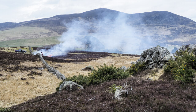
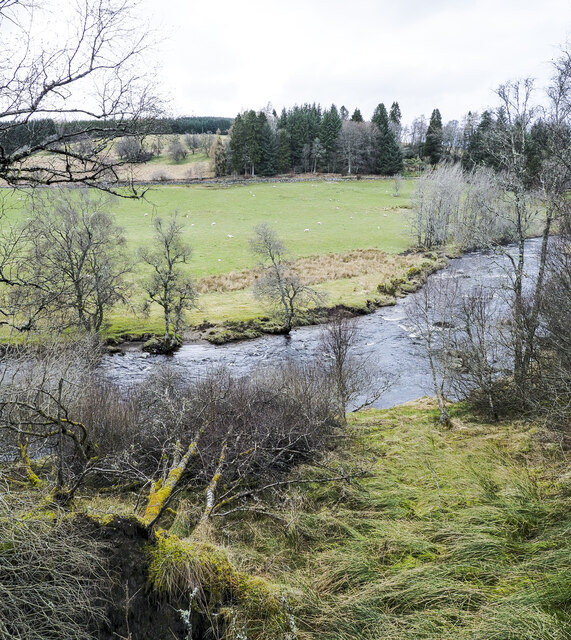
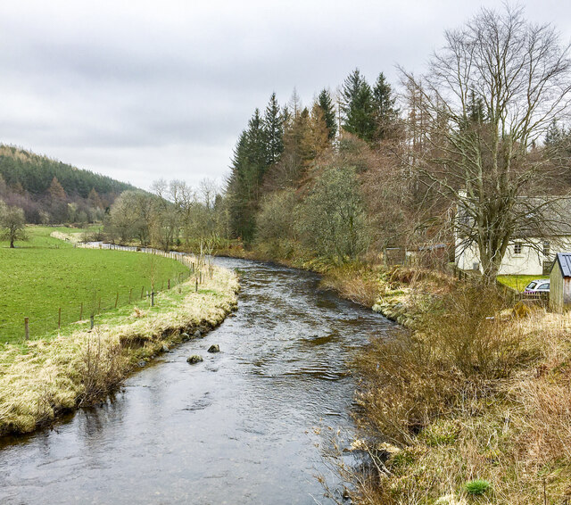
Brewlands Loch is a picturesque freshwater loch situated in the Angus region of Scotland. Nestled amidst the stunning landscapes of the Cairngorms National Park, the loch spans an area of approximately 50 hectares, making it a significant body of water in the area.

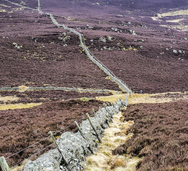
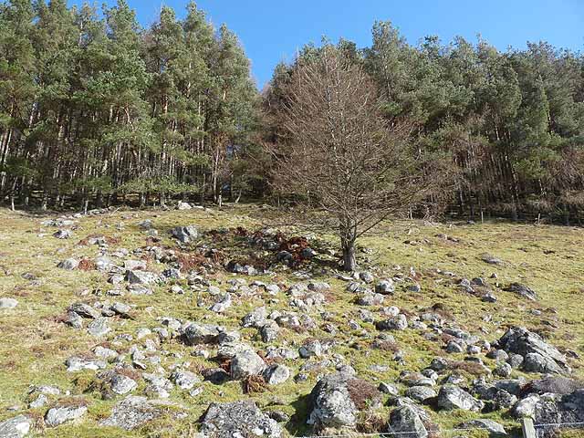
Surrounded by lush greenery and rolling hills, Brewlands Loch is a haven for nature enthusiasts and wildlife lovers. The loch is home to a diverse range of plant and animal species, including several species of waterfowl, fish, and aquatic plants. It serves as an important habitat for various bird species, making it a popular destination for birdwatchers.

The tranquil shores of Brewlands Loch offer a peaceful retreat for visitors seeking relaxation or a spot of angling. The loch is well-known for its excellent fishing opportunities, particularly for brown trout, which thrive in its clear waters. Anglers can be seen casting their lines from the banks or from small boats, enjoying the serene surroundings as they wait for a bite.

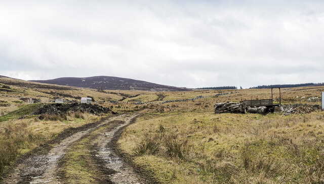
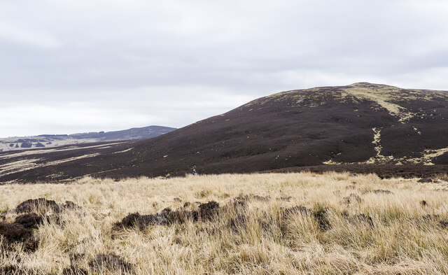
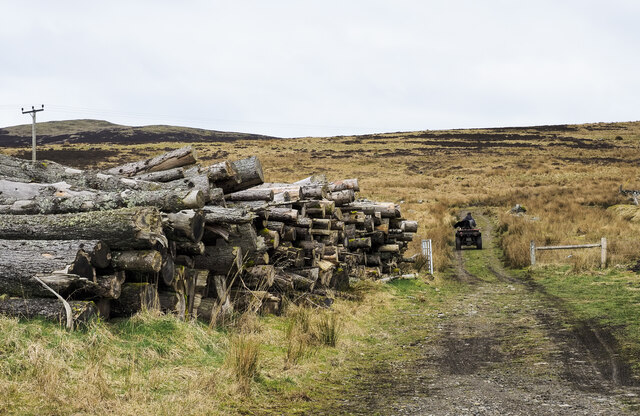
The surrounding area of Brewlands Loch offers numerous walking trails and picnic spots, allowing visitors to explore the natural beauty of the region. The loch also serves as a starting point for hikers venturing into the surrounding hills and mountains.

Overall, Brewlands Loch is a breathtaking freshwater loch, offering a peaceful and idyllic setting for nature lovers, anglers, and outdoor enthusiasts alike. Its stunning natural beauty and diverse wildlife make it a must-visit destination in Angus.

If you have any feedback on the listing, please let us know in the comments section below.

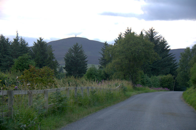
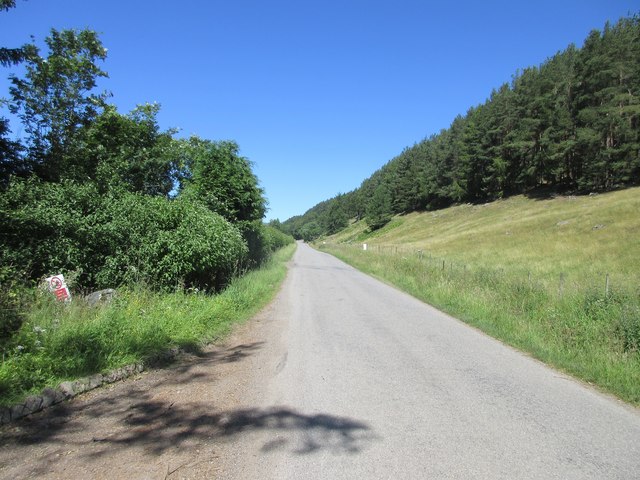
Brewlands Loch Images

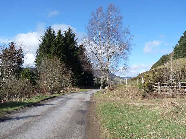
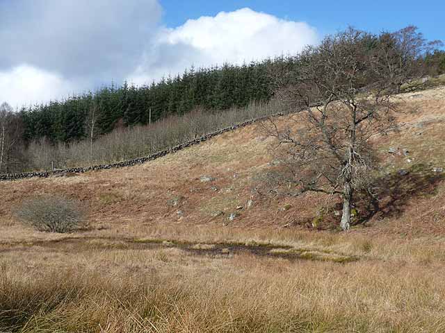
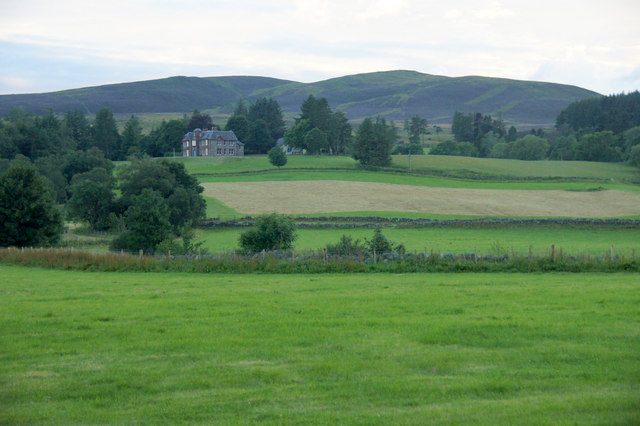
Images are sourced within 2km of 56.735343/-3.3231661 or Grid Reference NO1961. Thanks to Geograph Open Source API. All images are credited.

Heather burning along line of wall Heather burning to the north-west of the minor hill, Lindalla.
Mount Blair lies in the distance.
Heather burning along line of wall
Heather burning to the north-west of the minor hill, Lindalla. Mount Blair lies in the distance.
'Improved' land on south side of Lindalla Lindalla is a hill on the north side of Glen Isla above Kirkton of Glenisla; it rises to 450 metres; it is cultivated over its entire southern side though much of it would be regarded as rough grazing.
Crock is the hill away to the east.
'Improved' land on south side of Lindalla
Lindalla is a hill on the north side of Glen Isla above Kirkton of Glenisla; it rises to 450 metres; it is cultivated over its entire southern side though much of it would be regarded as rough grazing. Crock is the hill away to the east.
Col between Meall Mòr and Cairn Gibbs The wall is descending from Cairn Gibbs. Meall Mòr rises from the col where there's a hill walker about to begin the ascent - a rough and arduous climb hampered by the thickness of the heather.
Col between Meall Mòr and Cairn Gibbs
The wall is descending from Cairn Gibbs. Meall Mòr rises from the col where there's a hill walker about to begin the ascent - a rough and arduous climb hampered by the thickness of the heather.
Trees beside the River Isla, standing and fallen A bend of the river near to Kirkton of Glenisla with trees standing on both banks and fallen trees on the south side no doubt knocked over during a storm in the winter of 2021 to 2022.
Trees beside the River Isla, standing and fallen
A bend of the river near to Kirkton of Glenisla with trees standing on both banks and fallen trees on the south side no doubt knocked over during a storm in the winter of 2021 to 2022.
Hill road climbing into valley of Cressfit Burn The stream drains slopes of the moorland hills, Cairn Gibbs and Knockton. The way initially is unattractive passing apparently abandoned farm equipment and various debris.
Hill road climbing into valley of Cressfit Burn
The stream drains slopes of the moorland hills, Cairn Gibbs and Knockton. The way initially is unattractive passing apparently abandoned farm equipment and various debris.
River Isla flowing downstream The river seen from Brewlands old bridge which has an OS flush bracket - No. G846.
River Isla flowing downstream
The river seen from Brewlands old bridge which has an OS flush bracket - No. G846.
Rushes concealing Craigness Burn The Craigness Burn flows through the bed of rushes beyond which rises to the heather dome of Cairn Gibbs.
Rushes concealing Craigness Burn
The Craigness Burn flows through the bed of rushes beyond which rises to the heather dome of Cairn Gibbs.
Timber stack beside hill track Timber stacks are generally temporary stores of felled logs prior to them being taken away for use. Occasionally, for some reason the wood is just left in its pile and that's what seems to have happened here.
Timber stack beside hill track
Timber stacks are generally temporary stores of felled logs prior to them being taken away for use. Occasionally, for some reason the wood is just left in its pile and that's what seems to have happened here.
Rocky slope and plantation above Glen Isla
The road up Glen Isla The B951 from Kirriemuir to Glenshee.
The road up Glen Isla
The B951 from Kirriemuir to Glenshee.
Dried up pond at Holmiry In Glen Isla.
Dried up pond at Holmiry
In Glen Isla.
Glen Isla at Auchenleish Looking across the glen to Auchenleish House which is just outside the square.
Glen Isla at Auchenleish
Looking across the glen to Auchenleish House which is just outside the square.
Roadkill, Glen Isla A female Pheasant; this area has a very high density of Pheasant-rearing.
Roadkill, Glen Isla
A female Pheasant; this area has a very high density of Pheasant-rearing.
Road through Glen Isla Mount Blair in the background.
Road through Glen Isla
Mount Blair in the background.
B951 through Glen Isla The B951 heading up Glen Isla between the Kirkton and Brewlands.
B951 through Glen Isla
The B951 heading up Glen Isla between the Kirkton and Brewlands.
Stone-built barns at Auchenleish Farm Stone-built, slate-roofed barns at the farm; there are modern examples and the farmhouse out of view to the right.
Meall Mòr is the hill on the horizon.
Stone-built barns at Auchenleish Farm
Stone-built, slate-roofed barns at the farm; there are modern examples and the farmhouse out of view to the right. Meall Mòr is the hill on the horizon.
Cleared woodland at Auchenleish Looking up the Cressfit Burn. Cairn Gibbs <a href="https://www.geograph.org.uk/gridref/NO1859">NO1859</a> on the skyline to the right.
Cleared woodland at Auchenleish
Looking up the Cressfit Burn. Cairn Gibbs NO1859 on the skyline to the right.
Brewlands Bridge Carrying B851 over the River Isla.
Brewlands Bridge
Carrying B851 over the River Isla.
Show me another place!

Brewlands Loch is located at Grid Ref: NO1961 (Lat: 56.735343, Lng: -3.3231661)

Unitary Authority: Angus

Police Authority: Tayside

What 3 Words

///tanks.pictures.disco. Near Alyth, Perth & Kinross

Related Wikis

Brewlands Bridge

Brewlands Bridge is a hamlet in Glen Isla, Angus, Scotland. It is lies situated on the River Isla, eleven miles north-west of Kirriemuir and ten miles...

Auchinleish

Auchinleish is a village in Angus, Scotland. == References ==

Kirkton of Glenisla

Kirkton of Glenisla consists of a church and graveyard, a hotel, hall and several homes forming the largest concentration of habitation in Glenisla, Angus...

Mount Blair (Scotland)

Mount Blair is a large hill on the Perth and Kinross and Angus border, Scotland, in the southern foothills of the Grampian Mountains. It lies between the...

Nearby Amenities

Located within 500m of 56.735343,-3.3231661
Old Schoolhouse
Naptan AtcoCode: 6490IM501
Naptan Bearing: N
Naptan BusStopType: CUS
Naptan CommonName: Old Schoolhouse
Naptan Indicator: opp
Naptan Landmark: Brewlands Bridge
Naptan NaptanCode: 26423834
Naptan Verified: no
Source: naptan_import
Lat/Long: 56.7375317/-3.3167938
Brewlands Bridge
Place: hamlet
Lat/Long: 56.7382123/-3.316975
Brewlands
Place: hamlet
Lat/Long: 56.7327287/-3.318155
Wester Brewlands
Place: isolated_dwelling
Lat/Long: 56.7349573/-3.317609
Power: pole
Lat/Long: 56.7388599/-3.3187765
Power: pole
Lat/Long: 56.7385427/-3.3186083
Power: pole
Lat/Long: 56.7380223/-3.3183081
Power: pole
Lat/Long: 56.737571/-3.3180519
Power: pole
Lat/Long: 56.7374634/-3.3180278
Power: pole
Lat/Long: 56.7376841/-3.3168083
Power: pole
Lat/Long: 56.7377983/-3.3167357
Power: pole
Lat/Long: 56.7376885/-3.319388
Power: pole
Lat/Long: 56.7371955/-3.31935
Power: pole
Lat/Long: 56.7366147/-3.319296
Power: pole
Lat/Long: 56.7360218/-3.3192249
Power: pole
Lat/Long: 56.7355925/-3.3191788
Power: pole
Lat/Long: 56.7350534/-3.3191128
Power: pole
Lat/Long: 56.7345143/-3.3195031
Power: pole
Lat/Long: 56.7342387/-3.3189426
Power: pole
Lat/Long: 56.7339927/-3.318166
Power: pole
Lat/Long: 56.7336995/-3.3171931
Power: pole
Lat/Long: 56.7376221/-3.3206371
Power: pole
Lat/Long: 56.7375639/-3.3217521
Power: pole
Lat/Long: 56.7375068/-3.3227991
Power: pole
Lat/Long: 56.7374486/-3.3237379
Power: pole
Lat/Long: 56.7373959/-3.3246687
Power: pole
Lat/Long: 56.7373553/-3.3254094
Power: pole
Lat/Long: 56.7375552/-3.3263119
Power: pole
Lat/Long: 56.7377571/-3.327223
Power: pole
Lat/Long: 56.7380788/-3.3287323
Power: pole
Lat/Long: 56.7311502/-3.3235818
Power: pole
Lat/Long: 56.7317357/-3.3243056
Power: pole
Lat/Long: 56.7323341/-3.3250451
Power: pole
Lat/Long: 56.7331095/-3.3252261
Power: pole
Lat/Long: 56.7338172/-3.3253992
Power: pole
Lat/Long: 56.7345782/-3.3255906
Power: pole
Lat/Long: 56.7353837/-3.3257847
Power: pole
Lat/Long: 56.7361576/-3.3259814
Power: pole
Lat/Long: 56.7369372/-3.3261649
The data included in this document is from www.openstreetmap.org. The data is made available under ODbL.

Have you been to Brewlands Loch?

Leave your review of Brewlands Loch below (or comments, questions and feedback).