Cardigan
Community in Cardiganshire
Wales
Cardigan
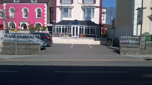
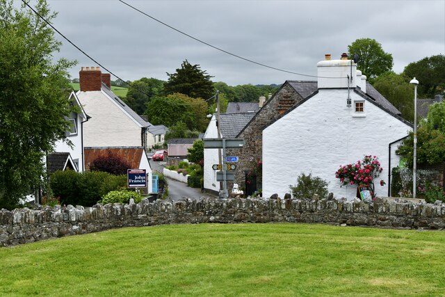
Cardigan is a community located in Cardiganshire, Wales. It is situated along the River Teifi and is known for its picturesque landscapes and historic landmarks. The town of Cardigan itself is a charming market town with a rich history dating back to medieval times.
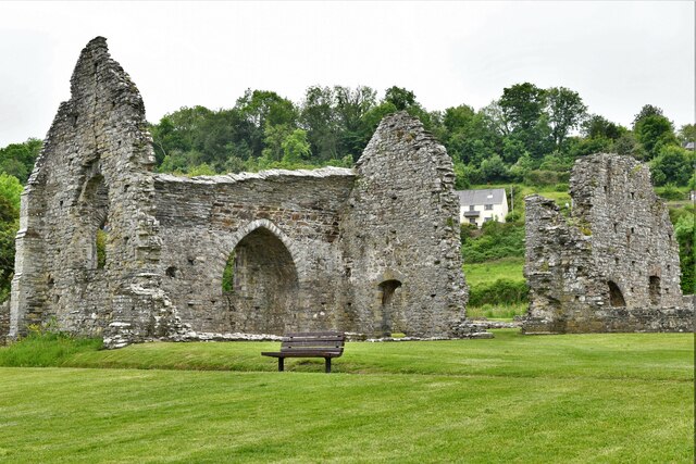
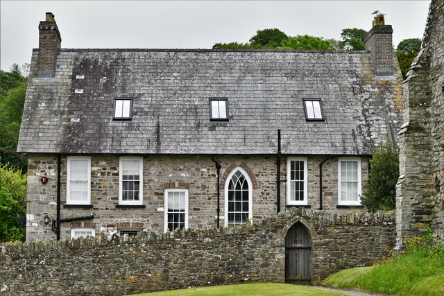
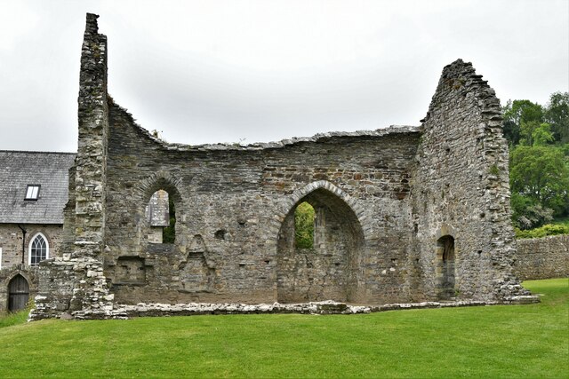
One of the main attractions in Cardigan is Cardigan Castle, a 12th-century fortress that has been restored and opened to the public as a heritage site. Visitors can explore the castle grounds, learn about its history, and enjoy events and activities held on the site.
Cardigan is also a popular destination for outdoor enthusiasts, with opportunities for hiking, fishing, and boating along the River Teifi and nearby coastline. The town has a vibrant arts and culture scene, with galleries, theaters, and music venues showcasing local talent.
In addition to its natural beauty and cultural offerings, Cardigan is a thriving community with a range of shops, restaurants, and accommodations for visitors to enjoy. Whether exploring the historic sites, taking in the stunning scenery, or simply relaxing by the river, Cardigan offers something for everyone to enjoy.
If you have any feedback on the listing, please let us know in the comments section below.
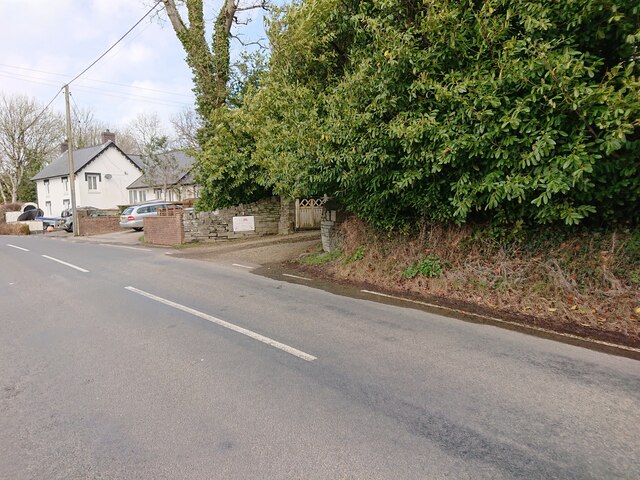
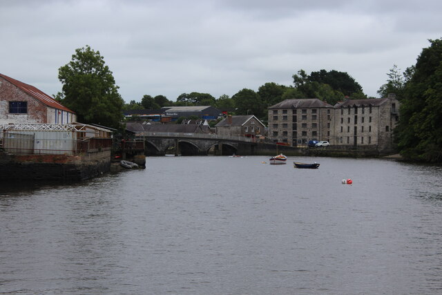
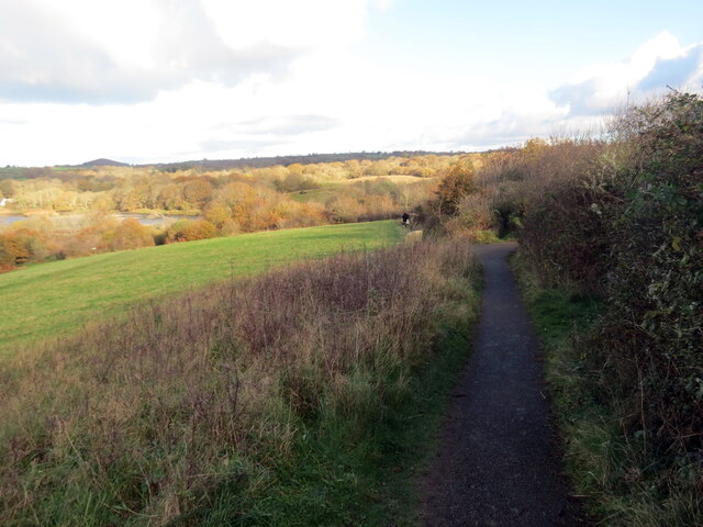
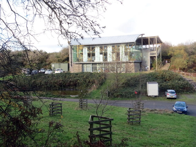
Cardigan Images
Images are sourced within 2km of 52.088247/-4.655752 or Grid Reference SN1846. Thanks to Geograph Open Source API. All images are credited.
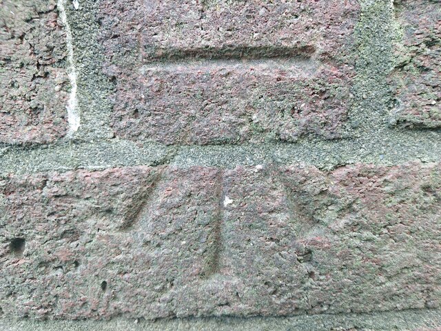
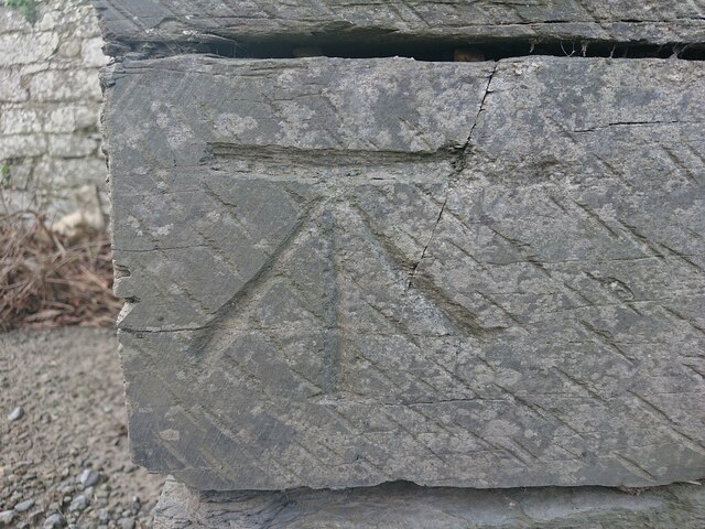
![OSBM Flush Bracket S0557 - Cardigan, St. Mary's School Ordnance Survey Benchmark (OSBM) used for levelling height above Ordnance Datum (OD).
Height (1954): 7.3333m OD (Newlyn). Mark verified by the Ordnance Survey in 1973. Description: FL BR S0557 S FACE 4.3M SW ANG SCH N SIDE RD. 1st Order BM.
The bracket was used on the Aberaeron to Carmarthen secondary line of the Second Geodetic Levelling of England &amp; Wales in 1927-1928. It was levelled with a height of 24.282&#039; above OD (Newlyn). Description: S face, 10&#039; from SW angle of school, N side of Pont-y-Cleifion, Cardigan. Abstract A 471: <span class="nowrap"><a title="http://discovery.nationalarchives.gov.uk/details/r/C11178815" rel="nofollow ugc noopener" href="http://discovery.nationalarchives.gov.uk/details/r/C11178815">Link</a><img style="margin-left:2px;" alt="External link" title="External link - shift click to open in new window" src="https://s1.geograph.org.uk/img/external.png" width="10" height="10"/></span> [OS 54/136].
The bracket was used on the Aberayron to Carmarthen secondary line of the Second Geodetic Levelling of England &amp; Wales in 1953-1954. It was levelled with a height of 24.117&#039; above OD (Newlyn). Abstract S 7: <span class="nowrap"><a title="http://discovery.nationalarchives.gov.uk/details/r/C11225155" rel="nofollow ugc noopener" href="http://discovery.nationalarchives.gov.uk/details/r/C11225155">Link</a><img style="margin-left:2px;" alt="External link" title="External link - shift click to open in new window" src="https://s1.geograph.org.uk/img/external.png" width="10" height="10"/></span> [OS 54/639].
The bracket was used on the Haverford West to Cardigan line (G077) of the Third Geodetic Levelling of England &amp; Wales in 1954. Abstract G 65: <span class="nowrap"><a title="http://discovery.nationalarchives.gov.uk/SearchUI/details?Uri=C11264473" rel="nofollow ugc noopener" href="http://discovery.nationalarchives.gov.uk/SearchUI/details?Uri=C11264473">Link</a><img style="margin-left:2px;" alt="External link" title="External link - shift click to open in new window" src="https://s1.geograph.org.uk/img/external.png" width="10" height="10"/></span> [OS 54/754].
Context: <a href="https://www.geograph.org.uk/photo/7106896">SN1846 : OSBM Flush Bracket S0557 - Cardigan, St. Mary's School</a>](https://s0.geograph.org.uk/geophotos/07/10/68/7106892_78427bcb.jpg)
![OSBM Flush Bracket S0557 - Cardigan, St. Mary's School Ordnance Survey Benchmark (OSBM) used for levelling height above Ordnance Datum (OD).
Height (1954): 7.3333m OD (Newlyn). Mark verified by the Ordnance Survey in 1973. Description: FL BR S0557 S FACE 4.3M SW ANG SCH N SIDE RD. 1st Order BM.
The bracket was used on the Aberaeron to Carmarthen secondary line of the Second Geodetic Levelling of England &amp; Wales in 1927-1928. It was levelled with a height of 24.282&#039; above OD (Newlyn). Description: S face, 10&#039; from SW angle of school, N side of Pont-y-Cleifion, Cardigan. Abstract A 471: <span class="nowrap"><a title="http://discovery.nationalarchives.gov.uk/details/r/C11178815" rel="nofollow ugc noopener" href="http://discovery.nationalarchives.gov.uk/details/r/C11178815">Link</a><img style="margin-left:2px;" alt="External link" title="External link - shift click to open in new window" src="https://s1.geograph.org.uk/img/external.png" width="10" height="10"/></span> [OS 54/136].
The bracket was used on the Aberayron to Carmarthen secondary line of the Second Geodetic Levelling of England &amp; Wales in 1953-1954. It was levelled with a height of 24.117&#039; above OD (Newlyn). Abstract S 7: <span class="nowrap"><a title="http://discovery.nationalarchives.gov.uk/details/r/C11225155" rel="nofollow ugc noopener" href="http://discovery.nationalarchives.gov.uk/details/r/C11225155">Link</a><img style="margin-left:2px;" alt="External link" title="External link - shift click to open in new window" src="https://s1.geograph.org.uk/img/external.png" width="10" height="10"/></span> [OS 54/639].
The bracket was used on the Haverford West to Cardigan line (G077) of the Third Geodetic Levelling of England &amp; Wales in 1954. Abstract G 65: <span class="nowrap"><a title="http://discovery.nationalarchives.gov.uk/SearchUI/details?Uri=C11264473" rel="nofollow ugc noopener" href="http://discovery.nationalarchives.gov.uk/SearchUI/details?Uri=C11264473">Link</a><img style="margin-left:2px;" alt="External link" title="External link - shift click to open in new window" src="https://s1.geograph.org.uk/img/external.png" width="10" height="10"/></span> [OS 54/754].
Close-up: <a href="https://www.geograph.org.uk/photo/7106892">SN1846 : OSBM Flush Bracket S0557 - Cardigan, St. Mary's School</a>](https://s0.geograph.org.uk/geophotos/07/10/68/7106896_ba61c266.jpg)
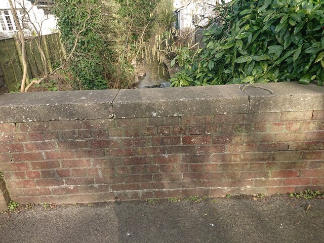
![Site of bridge, Grange Town, Cardigan There used to be a bridge at this location, over a small stream from the common, opposite. The drainage of the area was probably re-organised when the common was converted from allotments to King George’s Field c.1920. The bridge bore an Ordnance Survey benchmark:
The mark was used on the Warrington to Pembroke Docks line of the First Primary Levelling of England &amp; Wales in 1851-1852. It was levelled with a height of 75.663&#039; above OD (Liverpool). Description: 745. Mark on East battlement of small bridge ; 1.72 ft. below top of battlement. Page 536 of the abstract: <span class="nowrap"><a title="https://www.bench-marks.org.uk/abstract/ew1gl/1GLA_536.png" rel="nofollow ugc noopener" href="https://www.bench-marks.org.uk/abstract/ew1gl/1GLA_536.png">Link</a><img style="margin-left:2px;" alt="External link" title="External link - shift click to open in new window" src="https://s1.geograph.org.uk/img/external.png" width="10" height="10"/></span>
A mark at this location was used on the Aberaeron to Carmarthen secondary line of the Second Geodetic Levelling of England &amp; Wales in 1927-1928. Its height of 77.50&#039; above OD (Newlyn) suggests the original mark was replaced by a pivot on top of the parapet. Abstract A 471: <span class="nowrap"><a title="http://discovery.nationalarchives.gov.uk/details/r/C11178815" rel="nofollow ugc noopener" href="http://discovery.nationalarchives.gov.uk/details/r/C11178815">Link</a><img style="margin-left:2px;" alt="External link" title="External link - shift click to open in new window" src="https://s1.geograph.org.uk/img/external.png" width="10" height="10"/></span> [OS 54/136].](https://s3.geograph.org.uk/geophotos/07/10/70/7107051_75cf3c61.jpg)
![Castle Street, Cardigan There used to be a roadside house at this location which bore an Ordnance Survey benchmark.
The mark was used on the Warrington to Pembroke Docks line of the First Primary Levelling of England &amp; Wales in 1851-1852. It was levelled with a height of 56.910&#039; above OD (Liverpool). Description: 749. Mark on corner of James Thomas&#039;s house ; 2.75 ft. above surface. Page 536 of the abstract: <span class="nowrap"><a title="https://www.bench-marks.org.uk/abstract/ew1gl/1GLA_536.png" rel="nofollow ugc noopener" href="https://www.bench-marks.org.uk/abstract/ew1gl/1GLA_536.png">Link</a><img style="margin-left:2px;" alt="External link" title="External link - shift click to open in new window" src="https://s1.geograph.org.uk/img/external.png" width="10" height="10"/></span>
The mark was included on the Aberaeron to Carmarthen secondary line of the Second Geodetic Levelling of England &amp; Wales in 1927-1928. It was levelled with a height of 57.08&#039; above OD (Newlyn). Abstract A 471: <span class="nowrap"><a title="http://discovery.nationalarchives.gov.uk/details/r/C11178815" rel="nofollow ugc noopener" href="http://discovery.nationalarchives.gov.uk/details/r/C11178815">Link</a><img style="margin-left:2px;" alt="External link" title="External link - shift click to open in new window" src="https://s1.geograph.org.uk/img/external.png" width="10" height="10"/></span> [OS 54/136].](https://s0.geograph.org.uk/geophotos/07/10/82/7108200_793803eb.jpg)
Cardigan is located at Grid Ref: SN1846 (Lat: 52.088247, Lng: -4.655752)
Unitary Authority: Ceredigion
Police Authority: Dyfed-Powys
Also known as: Aberteifi
What 3 Words
///padding.fakes.available. Near Cardigan, Ceredigion
Related Wikis
Ysgol Uwchradd Aberteifi
Ysgol Uwchradd Aberteifi, translated as Cardigan Secondary School is a bilingual secondary school in Cardigan, Ceredigion, Wales. It offers secondary education...
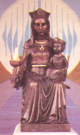
Our Lady of Cardigan
Our Lady of Cardigan (Welsh: Mair o Aberteifi), also known as Our Lady of the Taper, the Catholic national shrine of Wales, is a statue of the Blessed...

Ceibwr Bay Fault
The Ceibwr Bay Fault is a WSW-ENE trending fault zone that cuts Ordovician rocks of the Ashgill Nantmel Mudstones Formation and the Caradoc Dinas Island...
Cardigan County School
Cardigan County School is the name given to the endowed grammar school in Cardigan which was founded there in the mid seventeenth century (1653). The Intermediate...
Nearby Amenities
Located within 500m of 52.088247,-4.655752Have you been to Cardigan?
Leave your review of Cardigan below (or comments, questions and feedback).