Caldicot

Community in Monmouthshire

Wales

Caldicot

Symondscliff Way, Caldicot
Symondscliff Way, Caldicot Credit: JThomas

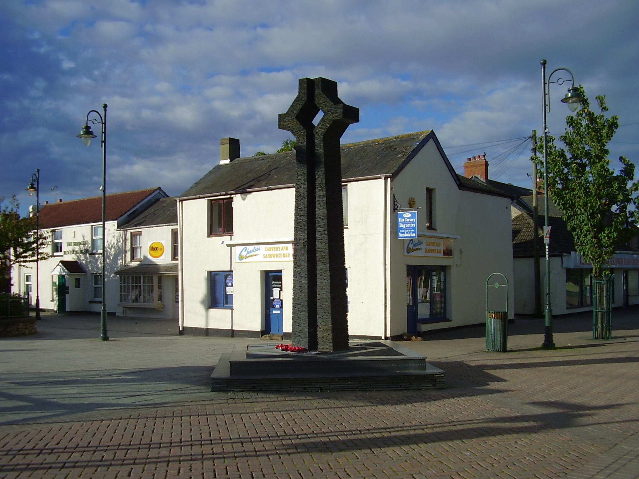
Caldicot is a small community located in the county of Monmouthshire, Wales. Situated on the banks of the River Severn, it is approximately 5 miles southwest of Chepstow and 10 miles east of Newport. The community covers an area of around 2.5 square miles and has a population of approximately 11,000 people.

Caldicot is known for its rich history, with evidence of human settlement in the area dating back to Roman times. The town's most prominent landmark is Caldicot Castle, a medieval fortress that was built in the late 11th century. Today, the castle is a popular tourist attraction and offers visitors a glimpse into the region's historical past.

The community of Caldicot is well-served by a range of amenities and facilities. There are several schools in the area, including Caldicot School, which is the largest secondary school in Monmouthshire. The town also has a leisure centre, library, and a variety of shops, restaurants, and pubs.

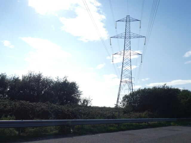
Caldicot benefits from excellent transport links, with the M4 motorway running nearby, providing easy access to Cardiff and Bristol. The town also has a railway station, connecting it to other parts of Wales and England.

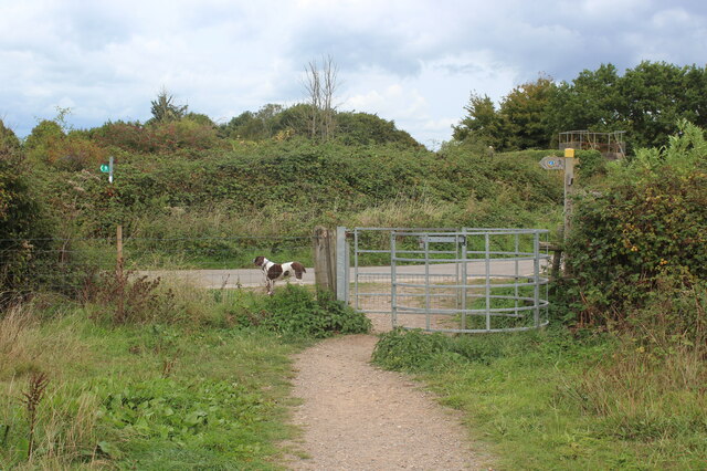
The natural beauty of the surrounding countryside makes Caldicot an attractive place to live and visit. The nearby Caldicot Levels, an area of wetland and saltmarsh, are designated as a Site of Special Scientific Interest and provide a habitat for a wide range of plant and animal species.

Overall, Caldicot is a charming community with a rich history, offering its residents and visitors a blend of historical attractions, modern amenities, and beautiful natural surroundings.

If you have any feedback on the listing, please let us know in the comments section below.
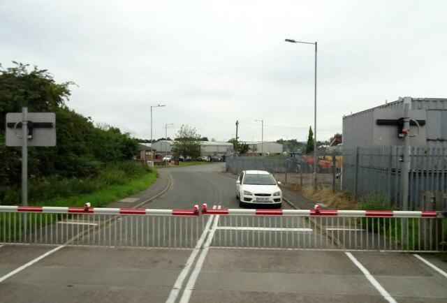
Caldicot Images

Images are sourced within 2km of 51.582575/-2.743754 or Grid Reference ST4887. Thanks to Geograph Open Source API. All images are credited.

Symondscliff Way, Caldicot
Ordnance Survey Cut Mark This OS cut mark can be found on the west buttress of the railway bridge. It marks a point 7.087m above mean sea level.
Ordnance Survey Cut Mark
This OS cut mark can be found on the west buttress of the railway bridge. It marks a point 7.087m above mean sea level.
Ordnance Survey 1GL Bolt This OS Bolt can be found on the south angle of St Mary's Church. It marks a point 13.591m above mean sea level.
Ordnance Survey 1GL Bolt
This OS Bolt can be found on the south angle of St Mary's Church. It marks a point 13.591m above mean sea level.
Ordnance Survey Cut Mark This OS cut mark can be found on the east face of St Mary's Church. It marks a point 15.383m above mean sea level.
Ordnance Survey Cut Mark
This OS cut mark can be found on the east face of St Mary's Church. It marks a point 15.383m above mean sea level.
Ordnance Survey Cut Mark This OS cut mark can be found on the SW face of Caldicot Castle. It marks a point 10.574m above mean sea level.
Ordnance Survey Cut Mark
This OS cut mark can be found on the SW face of Caldicot Castle. It marks a point 10.574m above mean sea level.
Ordnance Survey Cut Mark This OS cut mark can be found on No204 Newport Road. It marks a point 11.970m above mean sea level.
Ordnance Survey Cut Mark
This OS cut mark can be found on No204 Newport Road. It marks a point 11.970m above mean sea level.
Ordnance Survey Cut Mark This OS cut mark can be found on the east angle of the Methodist Chapel. It marks a point 11.107m above mean sea level.
Ordnance Survey Cut Mark
This OS cut mark can be found on the east angle of the Methodist Chapel. It marks a point 11.107m above mean sea level.
M4 motorway descending westwards from Severn Bridge  The M4 is 190 miles long and runs from London to South Wales. Major centres close to the motorway include Reading, Swindon, Bristol, Newport, Cardiff and Swansea. The motorway was constructed between 1961 and 1996. The M4 originally crossed the first Severn Road Bridge. It has now been diverted to use the Second Severn Crossing and the motorway over the older bridge has been renumbered as M48.
Wikipedia: <span class="nowrap"><a title="http://en.wikipedia.org/wiki/M4_motorway" rel="nofollow ugc noopener" href="http://en.wikipedia.org/wiki/M4_motorway">Link</a><img style="margin-left:2px;" alt="External link" title="External link - shift click to open in new window" src="https://s1.geograph.org.uk/img/external.png" width="10" height="10"/></span>
M4 motorway descending westwards from Severn Bridge
The M4 is 190 miles long and runs from London to South Wales. Major centres close to the motorway include Reading, Swindon, Bristol, Newport, Cardiff and Swansea. The motorway was constructed between 1961 and 1996. The M4 originally crossed the first Severn Road Bridge. It has now been diverted to use the Second Severn Crossing and the motorway over the older bridge has been renumbered as M48. Wikipedia: LinkExternal link
Tidal flats by Severn estuary seen from M4 The M4 is 190 miles long and runs from London to South Wales. Major centres close to the motorway include Reading, Swindon, Bristol, Newport, Cardiff and Swansea. The motorway was constructed between 1961 and 1996. The M4 originally crossed the first Severn Road Bridge. It has now been diverted to use the Second Severn Crossing and the motorway over the older bridge has been renumbered as M48.
Wikipedia: <span class="nowrap"><a title="http://en.wikipedia.org/wiki/M4_motorway" rel="nofollow ugc noopener" href="http://en.wikipedia.org/wiki/M4_motorway">Link</a><img style="margin-left:2px;" alt="External link" title="External link - shift click to open in new window" src="https://s1.geograph.org.uk/img/external.png" width="10" height="10"/></span>
Tidal flats by Severn estuary seen from M4
The M4 is 190 miles long and runs from London to South Wales. Major centres close to the motorway include Reading, Swindon, Bristol, Newport, Cardiff and Swansea. The motorway was constructed between 1961 and 1996. The M4 originally crossed the first Severn Road Bridge. It has now been diverted to use the Second Severn Crossing and the motorway over the older bridge has been renumbered as M48. Wikipedia: LinkExternal link
Pylon on Rogiet Moor by M4
Caldicot Castle Bailey A view of the 19th century additions to the gatehouse
Caldicot Castle Bailey
A view of the 19th century additions to the gatehouse
Road bridge, Ifton Reen, Rogiet Moor Restricted byway over land drain.
Road bridge, Ifton Reen, Rogiet Moor
Restricted byway over land drain.
East end of Caldicot Station Unmanned station on Newport - Gloucester line. The level crossing is for high vehicles on Station Road; The white railings, left, are over a low bridge <a href="https://www.geograph.org.uk/photo/7299287">ST4787 : Low railway bridge, Station Road</a> on Station Road.
East end of Caldicot Station
Unmanned station on Newport - Gloucester line. The level crossing is for high vehicles on Station Road; The white railings, left, are over a low bridge ST4787 : Low railway bridge, Station Road on Station Road.
Caldicot Railway Station platforms Looking west towards Newport.
Caldicot Railway Station platforms
Looking west towards Newport.
Low railway bridge, Station Road The signs top left refer to the user operated leval crossing.
Low railway bridge, Station Road
The signs top left refer to the user operated leval crossing.
Kissing gate on Wales Coast Path Behind the camera the footpath heads to the coast. NCR 4 runs along the road.
Kissing gate on Wales Coast Path
Behind the camera the footpath heads to the coast. NCR 4 runs along the road.
Gate on approach to footbridge over M4 Heading towards the coast on the Wales Coast Path.
Gate on approach to footbridge over M4
Heading towards the coast on the Wales Coast Path.
Western approach to Prince of Wales Bridge, M4
Show me another place!

Caldicot is located at Grid Ref: ST4887 (Lat: 51.582575, Lng: -2.743754)

Unitary Authority: Monmouthshire

Police Authority: Gwent

What 3 Words

///brink.above.chair. Near Caldicot, Monmouthshire

Related Wikis

Severn (Caldicot ward)

Severn is the name of an electoral ward in the town of Caldicot, Monmouthshire, Wales. The ward elects councillors to Caldicot Town Council and Monmouthshire...

Caldicot School

Caldicot School (Welsh: Ysgol Cil-y-coed) is a coeducational and non-selective secondary school in Caldicot, Monmouthshire, South Wales, with around 1...

Caldicot

Caldicot (Welsh: Cil-y-coed) is a market town and community in Monmouthshire, Wales. The town is located between Chepstow and the city of Newport. The...

West End (Caldicot ward)

West End is an electoral ward in the town of Caldicot, Monmouthshire, Wales. The ward elects councillors to Caldicot Town Council and Monmouthshire County...

Nearby Amenities

Located within 500m of 51.582575,-2.743754
Source: PGS
Lat/Long: 51.579616/-2.7491768
Source: PGS
Lat/Long: 51.580108/-2.7486492
Source: PGS
Lat/Long: 51.5801783/-2.748132
Source: PGS
Lat/Long: 51.5802297/-2.7475397
Source: PGS
Lat/Long: 51.5805077/-2.7452737
Source: PGS
Lat/Long: 51.580627/-2.7440599
Source: PGS
Lat/Long: 51.5807987/-2.7437381
Source: PGS
Lat/Long: 51.5808944/-2.7419913
Source: PGS
Lat/Long: 51.5808257/-2.7417155
Source: PGS
Lat/Long: 51.58088/-2.7405983
Source: PGS
Lat/Long: 51.5810647/-2.7392731
Source: PGS
Lat/Long: 51.581148/-2.738195
Source: Landsat photo
Lat/Long: 51.5849078/-2.7410285
Source: Landsat photo
Lat/Long: 51.5849761/-2.7388847
Source: extrapolation / guesswork
Lat/Long: 51.5852075/-2.7457423
Source: extrapolation / guesswork
Lat/Long: 51.5854473/-2.7401083
Power: tower
Lat/Long: 51.5837723/-2.7399762
Power: tower
Lat/Long: 51.5837776/-2.7456206
Power: tower
Lat/Long: 51.5826187/-2.7502012
Power: tower
Lat/Long: 51.5826454/-2.7464334
Power: tower
Lat/Long: 51.5826927/-2.7416198
Power: tower
Lat/Long: 51.582708/-2.7373223
Power: tower
Lat/Long: 51.5831027/-2.7499704
Power: tower
Lat/Long: 51.5831767/-2.7449067
Power: tower
Lat/Long: 51.583252/-2.7395498
Source: extrapolation / guesswork
Lat/Long: 51.5852369/-2.7457135
Source: extrapolation / guesswork
Lat/Long: 51.5854767/-2.7400795
Power: pole
Lat/Long: 51.5840696/-2.7372068
Direction: SE
Generator Method: photovoltaic
Generator Output Electricity: yes
Generator Solar Modules: 10
Generator Source: solar
Generator Type: solar_photovoltaic_panel
Location: roof
Power: generator
Lat/Long: 51.5869514/-2.7422345
Direction: SE
Generator Method: photovoltaic
Generator Output Electricity: yes
Generator Solar Modules: 10
Generator Source: solar
Generator Type: solar_photovoltaic_panel
Location: roof
Power: generator
Lat/Long: 51.5866998/-2.7426846
Direction: SE
Generator Method: photovoltaic
Generator Output Electricity: yes
Generator Solar Modules: 15
Generator Source: solar
Generator Type: solar_photovoltaic_panel
Location: roof
Power: generator
Lat/Long: 51.586655/-2.7427477
Direction: SE
Generator Method: photovoltaic
Generator Output Electricity: yes
Generator Solar Modules: 8
Generator Source: solar
Generator Type: solar_photovoltaic_panel
Location: roof
Power: generator
Lat/Long: 51.5863748/-2.7416588
Direction: SE
Generator Method: photovoltaic
Generator Output Electricity: yes
Generator Solar Modules: 10
Generator Source: solar
Generator Type: solar_photovoltaic_panel
Location: roof
Power: generator
Lat/Long: 51.5864431/-2.7414751
Direction: SE
Generator Method: photovoltaic
Generator Output Electricity: yes
Generator Solar Modules: 8
Generator Source: solar
Generator Type: solar_photovoltaic_panel
Location: roof
Power: generator
Lat/Long: 51.5860449/-2.739737
Direction: SE
Generator Method: photovoltaic
Generator Output Electricity: yes
Generator Solar Modules: 8
Generator Source: solar
Generator Type: solar_photovoltaic_panel
Location: roof
Power: generator
Lat/Long: 51.5860099/-2.7397826
Direction: SW
Generator Method: photovoltaic
Generator Output Electricity: yes
Generator Solar Modules: 8
Generator Source: solar
Generator Type: solar_photovoltaic_panel
Location: roof
Power: generator
Lat/Long: 51.5858915/-2.7392945
Direction: SW
Generator Method: photovoltaic
Generator Output Electricity: yes
Generator Solar Modules: 8
Generator Source: solar
Generator Type: solar_photovoltaic_panel
Location: roof
Power: generator
Lat/Long: 51.5856649/-2.7389941
Direction: SW
Generator Method: photovoltaic
Generator Output Electricity: yes
Generator Solar Modules: 8
Generator Source: solar
Generator Type: solar_photovoltaic_panel
Location: roof
Power: generator
Lat/Long: 51.5856949/-2.739045
Direction: SE
Generator Method: photovoltaic
Generator Output Electricity: yes
Generator Solar Modules: 8
Generator Source: solar
Generator Type: solar_photovoltaic_panel
Location: roof
Power: generator
Lat/Long: 51.5856999/-2.7392945
Direction: SE
Generator Method: photovoltaic
Generator Output Electricity: yes
Generator Solar Modules: 8
Generator Source: solar
Generator Type: solar_photovoltaic_panel
Location: roof
Power: generator
Lat/Long: 51.5856165/-2.7394125
Direction: SW
Generator Method: photovoltaic
Generator Output Electricity: yes
Generator Solar Modules: 8
Generator Source: solar
Generator Type: solar_photovoltaic_panel
Location: roof
Power: generator
Lat/Long: 51.5857265/-2.7399918
Direction: SW
Generator Method: photovoltaic
Generator Output Electricity: yes
Generator Solar Modules: 8
Generator Source: solar
Generator Type: solar_photovoltaic_panel
Location: roof
Power: generator
Lat/Long: 51.5859265/-2.7410164
Direction: SW
Generator Method: photovoltaic
Generator Output Electricity: yes
Generator Solar Modules: 8
Generator Source: solar
Generator Type: solar_photovoltaic_panel
Location: roof
Power: generator
Lat/Long: 51.5855682/-2.7411237
Direction: SW
Generator Method: photovoltaic
Generator Output Electricity: yes
Generator Solar Modules: 8
Generator Source: solar
Generator Type: solar_photovoltaic_panel
Location: roof
Power: generator
Lat/Long: 51.5856535/-2.7412601
Direction: SW
Generator Method: photovoltaic
Generator Output Electricity: yes
Generator Solar Modules: 8
Generator Source: solar
Generator Type: solar_photovoltaic_panel
Location: roof
Power: generator
Lat/Long: 51.5857362/-2.7413924
Direction: SW
Generator Method: photovoltaic
Generator Output Electricity: yes
Generator Solar Modules: 8
Generator Source: solar
Generator Type: solar_photovoltaic_panel
Location: roof
Power: generator
Lat/Long: 51.5857856/-2.7414713
Direction: SW
Generator Method: photovoltaic
Generator Output Electricity: yes
Generator Solar Modules: 8
Generator Source: solar
Generator Type: solar_photovoltaic_panel
Location: roof
Power: generator
Lat/Long: 51.5858299/-2.7415421
Direction: SW
Generator Method: photovoltaic
Generator Output Electricity: yes
Generator Solar Modules: 8
Generator Source: solar
Generator Type: solar_photovoltaic_panel
Location: roof
Power: generator
Lat/Long: 51.5858207/-2.7418828
Direction: SE
Generator Method: photovoltaic
Generator Output Electricity: yes
Generator Solar Modules: 8
Generator Source: solar
Generator Type: solar_photovoltaic_panel
Location: roof
Power: generator
Lat/Long: 51.5862432/-2.7418788
Direction: SE
Generator Method: photovoltaic
Generator Output Electricity: yes
Generator Solar Modules: 8
Generator Source: solar
Generator Type: solar_photovoltaic_panel
Location: roof
Power: generator
Lat/Long: 51.5861982/-2.7419432
Direction: SW
Generator Method: photovoltaic
Generator Output Electricity: yes
Generator Solar Modules: 8
Generator Source: solar
Generator Type: solar_photovoltaic_panel
Location: roof
Power: generator
Lat/Long: 51.5859666/-2.742088
Direction: S
Generator Method: photovoltaic
Generator Output Electricity: yes
Generator Solar Modules: 13
Generator Source: solar
Generator Type: solar_photovoltaic_panel
Location: roof
Power: generator
Lat/Long: 51.5857794/-2.7437813
Direction: 165
Generator Method: photovoltaic
Generator Output Electricity: yes
Generator Solar Modules: 13
Generator Source: solar
Generator Type: solar_photovoltaic_panel
Location: roof
Power: generator
Lat/Long: 51.5865859/-2.7444415
Direction: 165
Generator Method: photovoltaic
Generator Output Electricity: yes
Generator Solar Modules: 12
Generator Source: solar
Generator Type: solar_photovoltaic_panel
Location: roof
Power: generator
Lat/Long: 51.5865555/-2.7445914
Direction: 165
Generator Method: photovoltaic
Generator Output Electricity: yes
Generator Solar Modules: 10
Generator Source: solar
Generator Type: solar_photovoltaic_panel
Location: roof
Power: generator
Lat/Long: 51.5863006/-2.7457673
Direction: 165
Generator Method: photovoltaic
Generator Output Electricity: yes
Generator Solar Modules: 18
Generator Source: solar
Generator Type: solar_photovoltaic_panel
Location: roof
Power: generator
Lat/Long: 51.5863404/-2.7455151
Direction: 175
Generator Method: photovoltaic
Generator Output Electricity: yes
Generator Solar Modules: 13
Generator Source: solar
Generator Type: solar_photovoltaic_panel
Location: roof
Power: generator
Lat/Long: 51.5857455/-2.7451291
Direction: 175
Generator Method: photovoltaic
Generator Output Electricity: yes
Generator Solar Modules: 10
Generator Source: solar
Generator Type: solar_photovoltaic_panel
Location: roof
Power: generator
Lat/Long: 51.5861441/-2.7477146
Direction: S
Generator Method: photovoltaic
Generator Output Electricity: yes
Generator Solar Modules: 16
Generator Source: solar
Generator Type: solar_photovoltaic_panel
Location: roof
Power: generator
Lat/Long: 51.5857807/-2.747254
Direction: S
Generator Method: photovoltaic
Generator Output Electricity: yes
Generator Solar Modules: 18
Generator Source: solar
Generator Type: solar_photovoltaic_panel
Location: roof
Power: generator
Lat/Long: 51.5857551/-2.7474157
Direction: E
Generator Method: photovoltaic
Generator Output Electricity: yes
Generator Solar Modules: 9
Generator Source: solar
Generator Type: solar_photovoltaic_panel
Location: roof
Power: generator
Lat/Long: 51.5850108/-2.7494872
Direction: SE
Generator Method: photovoltaic
Generator Output Electricity: yes
Generator Solar Modules: 8
Generator Source: solar
Generator Type: solar_photovoltaic_panel
Location: roof
Power: generator
Lat/Long: 51.5855965/-2.7405095
Direction: SE
Generator Method: photovoltaic
Generator Output Electricity: yes
Generator Solar Modules: 8
Generator Source: solar
Generator Type: solar_photovoltaic_panel
Location: roof
Power: generator
Lat/Long: 51.5861982/-2.7409789
Direction: SE
Generator Method: photovoltaic
Generator Output Electricity: yes
Generator Solar Modules: 8
Generator Source: solar
Generator Type: solar_photovoltaic_panel
Location: roof
Power: generator
Lat/Long: 51.5862715/-2.7408341
Direction: S
Generator Method: photovoltaic
Generator Output Electricity: yes
Generator Solar Modules: 11
Generator Source: solar
Generator Type: solar_photovoltaic_panel
Location: roof
Power: generator
Lat/Long: 51.5851266/-2.7443558
Direction: S
Generator Method: photovoltaic
Generator Output Electricity: yes
Generator Solar Modules: 11
Generator Source: solar
Generator Type: solar_photovoltaic_panel
Location: roof
Power: generator
Lat/Long: 51.5851432/-2.7445516
Direction: S
Generator Method: photovoltaic
Generator Output Electricity: yes
Generator Solar Modules: 10
Generator Source: solar
Generator Type: solar_photovoltaic_panel
Location: roof
Power: generator
Lat/Long: 51.5850332/-2.7483255
Direction: W
Generator Method: photovoltaic
Generator Output Electricity: yes
Generator Solar Modules: 9
Generator Source: solar
Generator Type: solar_photovoltaic_panel
Location: roof
Power: generator
Lat/Long: 51.585009/-2.7495457
Direction: SE
Generator Method: photovoltaic
Generator Output Electricity: yes
Generator Solar Modules: 12
Generator Source: solar
Generator Type: solar_photovoltaic_panel
Location: roof
Power: generator
Lat/Long: 51.5866509/-2.7441111
Direction: 165
Generator Method: photovoltaic
Generator Output Electricity: yes
Generator Solar Modules: 18
Generator Source: solar
Generator Type: solar_photovoltaic_panel
Location: roof
Power: generator
Lat/Long: 51.5865399/-2.7447033
Railway: crossing
Lat/Long: 51.5848212/-2.7432957
Railway: crossing
Lat/Long: 51.5848631/-2.7432952
Bus Stop
Moorland View
Bus: yes
Naptan AtcoCode: 5330AWB32130
Naptan Bearing: SW
Naptan CommonName: Moorland View
Naptan Indicator: nr
Naptan NaptanCode: gweawdg
Naptan Street: Caldicot By-pass
Naptan Verified: no
Network: Newport Bus
Operator: Monmouthshire County Council
Public Transport: platform
Ref: gweawdj
Lat/Long: 51.5865533/-2.7436303
Bus Stop
Lapwing Avenue
Bus: yes
Naptan AtcoCode: 5330AWB32131
Naptan Bearing: NE
Naptan CommonName: Lapwing Avenue
Naptan Indicator: nr
Naptan NaptanCode: gweawdj
Naptan Street: Caldicot By-pass
Naptan Verified: no
Network: Newport Bus
Operator: Monmouthshire County Council
Public Transport: platform
Ref: gweawgd
Lat/Long: 51.5867614/-2.7433378
The data included in this document is from www.openstreetmap.org. The data is made available under ODbL.

Have you been to Caldicot?

Leave your review of Caldicot below (or comments, questions and feedback).