Angle

Community in Pembrokeshire

Wales

Angle

Pennar Cants Wooded shore, near Pembroke Power Station. The old map shows most of the sea in this shot once dried out at low tide. Not now - presumably dredged by the oil industry.
Pennar Cants Credit: Richard Webb

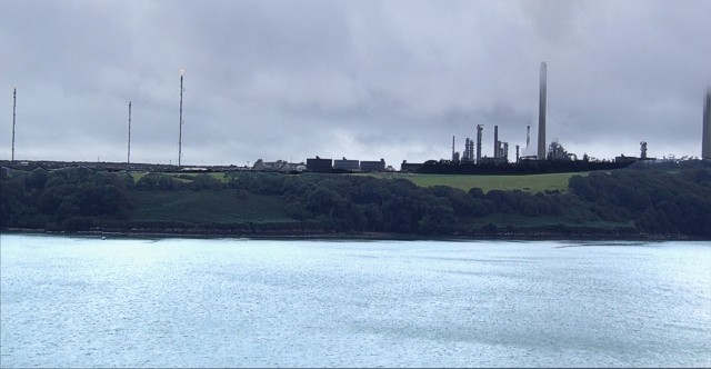
Angle is a small coastal village in Pembrokeshire, Wales. It is located on the western tip of the county, overlooking the Milford Haven Waterway. The village is known for its picturesque scenery, with rugged cliffs, sandy beaches, and panoramic views of the sea.

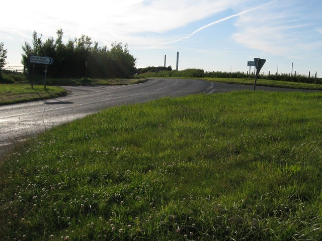
Angle is a popular destination for outdoor enthusiasts, with opportunities for hiking, fishing, and water sports. The Pembrokeshire Coast Path runs through the village, offering stunning walks along the coastline.

The village has a rich history, with evidence of prehistoric settlements in the area. The nearby Angle Bay is also home to a historic fort, dating back to the 18th century, which played a key role in defending the area during times of conflict.

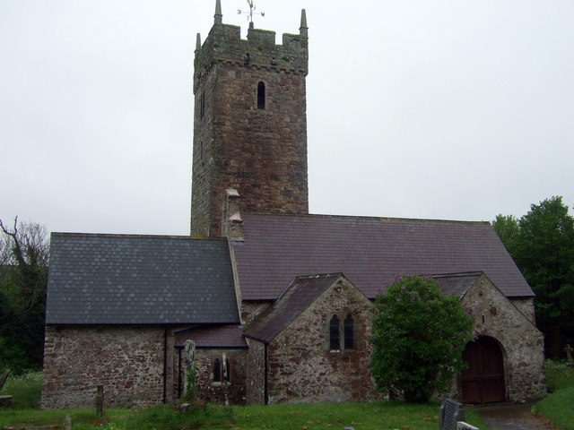
Today, Angle is a peaceful and charming community, with a small population of residents who enjoy a relaxed coastal lifestyle. The village has a primary school, a pub, and a church, as well as a few shops and cafes for visitors to enjoy. Angle is a hidden gem in Pembrokeshire, offering a tranquil escape for those seeking a peaceful retreat by the sea.

If you have any feedback on the listing, please let us know in the comments section below.

Angle Images

Images are sourced within 2km of 51.67863/-5.009313 or Grid Reference SM9202. Thanks to Geograph Open Source API. All images are credited.

Pennar Cants Wooded shore, near Pembroke Power Station. The old map shows most of the sea in this shot once dried out at low tide. Not now - presumably dredged by the oil industry.
Pennar Cants
Wooded shore, near Pembroke Power Station. The old map shows most of the sea in this shot once dried out at low tide. Not now - presumably dredged by the oil industry.
Rhoscrowther Oil Terminal across Angle Bay Taken in the early morning after a night of heavy rain. The brooding presence of Rhoscrowther Oil Terminal squats on the far side of tranquil Angle Bay (Cf: <a href="https://www.geograph.org.uk/photo/82236">SM8602 : Angle Bay</a>)
Rhoscrowther Oil Terminal across Angle Bay
Taken in the early morning after a night of heavy rain. The brooding presence of Rhoscrowther Oil Terminal squats on the far side of tranquil Angle Bay (Cf: SM8602 : Angle Bay)
Pembroke Power Station Image taken from Pennar side of the Pembroke River. The site is disused, it lost its 'land mark' chimneys a couple of years ago.
Pembroke Power Station
Image taken from Pennar side of the Pembroke River. The site is disused, it lost its 'land mark' chimneys a couple of years ago.
Popton Oil Refinery, Rhoscrowther, Pembrokeshire The site, now owned by Chevron, takes its name from fort at Popton point out of shot to the left.
In this shot the tower of Rhoscrowther church is diminutive in the valley to the right and below the industrial complex.
Popton Oil Refinery, Rhoscrowther, Pembrokeshire
The site, now owned by Chevron, takes its name from fort at Popton point out of shot to the left. In this shot the tower of Rhoscrowther church is diminutive in the valley to the right and below the industrial complex.
Welsh Water reservoir North of the B4320 by the turn for Wogaston.
Welsh Water reservoir
North of the B4320 by the turn for Wogaston.
Wallaston Farm House
Stubble field near Wallaston Cross
Footbridge over a stream The road from Hundleton to Rhoscrowther passes this spot which in wetter conditions creates a ford.
Footbridge over a stream
The road from Hundleton to Rhoscrowther passes this spot which in wetter conditions creates a ford.
Coastline at Pwllcochran Texaco's Popton refinery is half-shrouded in low cloud.
Coastline at Pwllcochran
Texaco's Popton refinery is half-shrouded in low cloud.
Cow weather forecasters sitting on the fence Possibly a question of timescale: the official forecast at the time was for two more dry sunny days but torrential rain on the third.
Cow weather forecasters sitting on the fence
Possibly a question of timescale: the official forecast at the time was for two more dry sunny days but torrential rain on the third.
Not (as one might think) a small chapel... ... just an associated building of the substantial church behind. (My guess would be the church hall.) See <a href="https://www.geograph.org.uk/photo/863265">SM9002 : Church at Rhoscrowther with matching building at the gate</a> for a wider view.
Not (as one might think) a small chapel...
... just an associated building of the substantial church behind. (My guess would be the church hall.) See SM9002 : Church at Rhoscrowther with matching building at the gate for a wider view.
Cows drinking from a trough next to the road
Lay-by large enough to make it onto the map This is one of a pair of laybys along the road near the Chevron oil refinery whose chimneys can be seen on the right hand side of the picture, much more substantial and straight than usual to allow for oil tankers.

The oil refinery would have made a much more interesting picture: however, I was stopped by Chevron security officials who were not happy having their premises photographed "in the current climate" - a hauliers' demonstration would arrive there about an hour later. (See <span class="nowrap"><a title="http://news.bbc.co.uk/1/hi/wales/7456312.stm" rel="nofollow ugc noopener" href="http://news.bbc.co.uk/1/hi/wales/7456312.stm">Link</a><img style="margin-left:2px;" alt="External link" title="External link - shift click to open in new window" src="https://s1.geograph.org.uk/img/external.png" width="10" height="10"/></span> for the story.)
Lay-by large enough to make it onto the map
This is one of a pair of laybys along the road near the Chevron oil refinery whose chimneys can be seen on the right hand side of the picture, much more substantial and straight than usual to allow for oil tankers. The oil refinery would have made a much more interesting picture: however, I was stopped by Chevron security officials who were not happy having their premises photographed "in the current climate" - a hauliers' demonstration would arrive there about an hour later. (See LinkExternal link for the story.)
Rhoscrowther oil refinery, seen from near Angle Point
Entrance to Neath Farm Like so many others round here, the lease is available for you to take over.
Entrance to Neath Farm
Like so many others round here, the lease is available for you to take over.
Church at Rhoscrowther with matching building at the gate
Wallaston Cross A contrast between rural and industrial - the two signs point to the power station and the oil refinery.
Wallaston Cross
A contrast between rural and industrial - the two signs point to the power station and the oil refinery.
Rhoscrowther oil refinery chimneys seen from a country lane
Show me another place!

Angle is located at Grid Ref: SM9202 (Lat: 51.67863, Lng: -5.009313)

Unitary Authority: Pembrokeshire

Police Authority: Dyfed-Powys

What 3 Words

///cursing.rejoins.purest. Near Castlemartin, Pembrokeshire

Nearby Locations

Pwllcrochan Angle

Related Wikis

Milford Haven Waterway SSSI

Milford Haven Waterway, is a Site of Special Scientific Interest (SSSI) on Milford Haven Waterway in Pembrokeshire, South Wales, designated since 2002...

St Decuman's Church, Rhoscrowther

St Decuman's is a Grade I listed building in Rhoscrowther, Pembrokeshire, Wales. == History == The parish church is on a very early Christian site and...

Rhoscrowther

Rhoscrowther (Welsh: Rhoscrowdder) was a village, ecclesiastical parish and civil parish in Pembrokeshire, Wales on the south shore of the Milford Haven...

Pembroke Power Station

Pembroke B Power Station is a 2,200 MWe natural gas-fired power station near Pembroke in Wales. The power station was officially opened in September 2012...

Nearby Amenities

Located within 500m of 51.67863,-5.009313
Bus Stop
Lat/Long: 51.6784798/-5.0149019
Power: pole
Lat/Long: 51.6778644/-5.0139821
Power: pole
Lat/Long: 51.6774186/-5.0117612
Power: pole
Lat/Long: 51.6771126/-5.0100178
Power: pole
Lat/Long: 51.6763841/-5.0065094
Power: pole
Lat/Long: 51.6767367/-5.0028294
The data included in this document is from www.openstreetmap.org. The data is made available under ODbL.

Have you been to Angle?

Leave your review of Angle below (or comments, questions and feedback).