Amroth

Community in Pembrokeshire

Wales

Amroth

Track to Trenewydd
Track to Trenewydd Credit: Alan Hughes

Amroth is a picturesque community located in the county of Pembrokeshire, Wales. It is situated on the southern coast of the country, overlooking the Bristol Channel. With its stunning natural beauty and rich history, Amroth attracts both locals and tourists alike.

The community is known for its beautiful sandy beach, which stretches for approximately half a mile and offers breathtaking views of the surrounding coastline. The beach is a popular destination for sunbathers, swimmers, and water sports enthusiasts during the summer months.

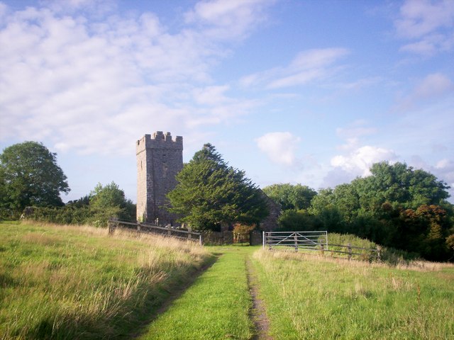
Amroth is also home to several notable landmarks and attractions. One of the most prominent is the Amroth Castle, a Grade II listed building that dates back to the 18th century. The castle is surrounded by beautiful gardens and offers guided tours and events for visitors.

For those interested in history, Amroth is situated along the Pembrokeshire Coast Path, a renowned long-distance walking trail. The path offers stunning views of the rugged coastline, as well as the opportunity to explore ancient castles, churches, and archaeological sites.

The community of Amroth also boasts a range of amenities and facilities for residents and visitors. There are several accommodation options, including hotels, guesthouses, and self-catering cottages. Additionally, there are a variety of shops, cafes, and restaurants that cater to the needs of both locals and tourists.

Overall, Amroth is a charming coastal community that offers a perfect blend of natural beauty, historical landmarks, and modern amenities.

If you have any feedback on the listing, please let us know in the comments section below.

Amroth Images

Images are sourced within 2km of 51.764189/-4.642697 or Grid Reference SN1710. Thanks to Geograph Open Source API. All images are credited.

Track to Trenewydd
Track to Trenewydd
Site of Lanteague Chapel, Llanteg
St Elidyr’s Church, Crunwere Grade II listed building.  The church ceased to function in 2009.
St Elidyr’s Church, Crunwere
Grade II listed building. The church ceased to function in 2009.
Entrance to Brynely
Entrance to Brynely
Mountain (Lanteague) Chapel, Llanteg Gravestone and yard.
Mountain (Lanteague) Chapel, Llanteg
Gravestone and yard.
Mountain (Lanteague) Chapel, Llanteg The southern part of the yard.
Mountain (Lanteague) Chapel, Llanteg
The southern part of the yard.
Mountain (Lanteague) Chapel, Llanteg The western graveyard area.
Mountain (Lanteague) Chapel, Llanteg
The western graveyard area.
Mountain (Lanteague) Chapel, Llanteg Eastern graveyard area.
Mountain (Lanteague) Chapel, Llanteg
Eastern graveyard area.
Mountain (Lanteague) Chapel, Llanteg Old name plaque of chapel.
Mountain (Lanteague) Chapel, Llanteg
Old name plaque of chapel.
Mountain (Lanteague) Chapel, Llanteg Memorial garden inside footprint of old chapel.
Mountain (Lanteague) Chapel, Llanteg
Memorial garden inside footprint of old chapel.
Mountain (Lanteague) Chapel, Llanteg Large tree in graveyard and old relocated village pump in Memorial garden.
Mountain (Lanteague) Chapel, Llanteg
Large tree in graveyard and old relocated village pump in Memorial garden.
Mountain (Lanteague) Chapel, Llanteg Old tree in graveyard.
Mountain (Lanteague) Chapel, Llanteg
Old tree in graveyard.
Mountain (Lanteague) Chapel, Llanteg Information board.
Mountain (Lanteague) Chapel, Llanteg
Information board.
Mountain (Lanteague) Chapel, Llanteg Large tree on corner.
Mountain (Lanteague) Chapel, Llanteg
Large tree on corner.
Mountain (Lanteague) Chapel, Llanteg New bee posts with the name Mountain Chapel inscribed.
Mountain (Lanteague) Chapel, Llanteg
New bee posts with the name Mountain Chapel inscribed.
Mountain (Lanteague) Chapel, Llanteg Reverse side of the new bee posts.
Mountain (Lanteague) Chapel, Llanteg
Reverse side of the new bee posts.
The Claypits, Llanteg The pond in the centre of The Claypits.
The Claypits, Llanteg
The pond in the centre of The Claypits.
The Claypits, Llanteg Newish bollards to prevent cars parking on the grass verge.
The Claypits, Llanteg
Newish bollards to prevent cars parking on the grass verge.
Show me another place!

Amroth is located at Grid Ref: SN1710 (Lat: 51.764189, Lng: -4.642697)

Unitary Authority: Pembrokeshire

Police Authority: Dyfed-Powys

What 3 Words

///connector.reclusive.doctors. Near Whitland, Carmarthenshire

Nearby Locations

Amroth

Related Wikis

Llanteg

Llanteg (also previously known, and still regularly pronounced, as Lanteague) is a small village in Pembrokeshire, Wales, belonging to the community of...

Crunwere

Crunwere (Welsh: Cronwern - also written Crunwear and Cronwere) is a hamlet and parish in Pembrokeshire, Wales. It is situated 3 km north of the Carmarthen...

Tavernspite

Tavernspite (Welsh: Tafarn-sbeit) is a small village about 6 miles (9.7 km) southeast of Narberth in Pembrokeshire, southwest Wales. It lies on the B4314...

Colby Woodland Garden

Colby Woodland Garden (Welsh: Gardd Goedwig Colby) is a National Trust woodland garden in a secluded valley, approximately ¾ of a mile north of Amroth...

Nearby Amenities

Located within 500m of 51.764189,-4.642697
Give Way
Direction: forward
Lat/Long: 51.7662247/-4.6389773
Defibrillator
Access: yes
Defibrillator Location: outside Llanteg Village Hall
Emergency: defibrillator
Indoor: no
Lat/Long: 51.7607657/-4.6407776
Generator Method: wind_turbine
Generator Source: wind
Power: generator
Lat/Long: 51.7666144/-4.6432414
Direction: 175
Generator Method: photovoltaic
Generator Output Electricity: yes
Generator Solar Modules: 4
Generator Source: solar
Generator Type: solar_photovoltaic_panel
Location: roof
Power: generator
Lat/Long: 51.7627144/-4.6362071
Direction: 175
Generator Method: photovoltaic
Generator Output Electricity: yes
Generator Solar Modules: 10
Generator Source: solar
Generator Type: solar_photovoltaic_panel
Location: roof
Power: generator
Lat/Long: 51.7627088/-4.6362676
Entrance: yes
Lat/Long: 51.760789/-4.6407899
The data included in this document is from www.openstreetmap.org. The data is made available under ODbL.

Have you been to Amroth?

Leave your review of Amroth below (or comments, questions and feedback).