Ambleston

Community in Pembrokeshire

Wales

Ambleston

Wallis Pond viewed from Wallis Bridge Looking south-westward.
[Since its glory year of restoration in 1978 nature seems to be reclaiming it as its own.]
Wallis Pond viewed from Wallis Bridge Credit: Peter Wood

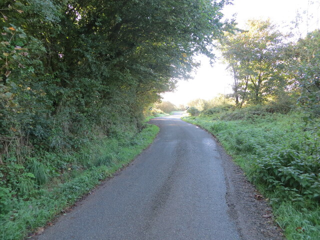
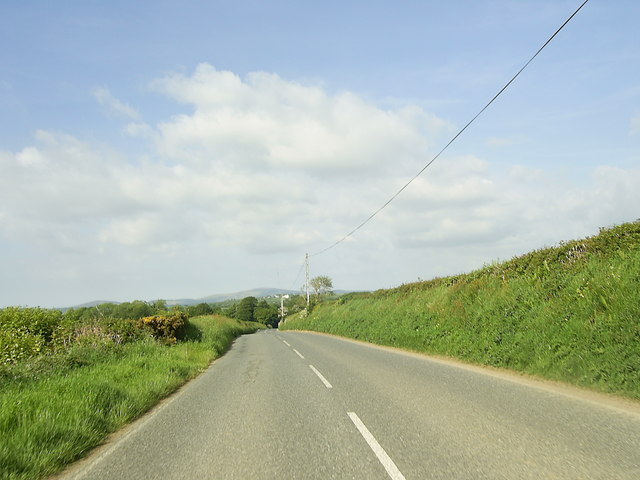
Ambleston is a small rural community located in the county of Pembrokeshire, Wales. Situated in the southwestern part of the country, it is nestled amongst picturesque countryside and rolling hills. The community covers an area of approximately 7 square kilometers and is home to a population of around 300 people.

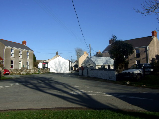
The village itself is characterized by its peaceful and tranquil atmosphere, with its charming stone cottages and traditional buildings adding to its rustic appeal. The community is surrounded by farmland, offering stunning views of the countryside and serving as a reminder of its agricultural roots.

Despite its small size, Ambleston boasts a strong community spirit, with a range of local amenities and facilities available to residents. These include a village hall, a primary school, and a place of worship. The community also benefits from excellent transport links, with regular bus services connecting it to nearby towns and villages.

The natural beauty of Ambleston makes it an ideal destination for outdoor enthusiasts. The surrounding area offers ample opportunities for hiking, cycling, and nature walks. Additionally, the nearby Pembrokeshire Coast National Park, renowned for its stunning coastal scenery, is easily accessible from the community.

Overall, Ambleston offers a peaceful and idyllic lifestyle, with its scenic surroundings and close-knit community making it a desirable place to live for those seeking a rural retreat in Pembrokeshire.

If you have any feedback on the listing, please let us know in the comments section below.

Ambleston Images

Images are sourced within 2km of 51.893799/-4.897848 or Grid Reference SN0025. Thanks to Geograph Open Source API. All images are credited.

Wallis Pond viewed from Wallis Bridge Looking south-westward.
[Since its glory year of restoration in 1978 nature seems to be reclaiming it as its own.]
Wallis Pond viewed from Wallis Bridge
Looking south-westward. [Since its glory year of restoration in 1978 nature seems to be reclaiming it as its own.]
St Mary's Churchyard and Tower House, Ambleston Viewed from the north-east. St Mary's Church building is now a private dwelling.
St Mary's Churchyard and Tower House, Ambleston
Viewed from the north-east. St Mary's Church building is now a private dwelling.
Minor road leaving Ambleston Looking south-westward.
Minor road leaving Ambleston
Looking south-westward.
Hedge-lined minor road to the north-east of Ambleston Looking north-westward.
Hedge-lined minor road to the north-east of Ambleston
Looking north-westward.
Hedge-lined minor road near Fleming's Castle Looking eastward.
Hedge-lined minor road near Fleming's Castle
Looking eastward.
Minor road at Henne Lodge Farm Looking eastward.
Minor road at Henne Lodge Farm
Looking eastward.
Ambleston Village from the south Moorland-topped Mynydd Cilceffeth (335 m) rises behind.
Ambleston Village from the south
Moorland-topped Mynydd Cilceffeth (335 m) rises behind.
Woodstock, Ambleston Woodstock (local Welsh Wstog) is really the cluster of farms 0.7 km to the east. This settlement, set up on the main road at the time of the Enclosures, was previously called Woodstock Slop. Behind it (0.8 km) is the Woodstock television transmitter.
Woodstock, Ambleston
Woodstock (local Welsh Wstog) is really the cluster of farms 0.7 km to the east. This settlement, set up on the main road at the time of the Enclosures, was previously called Woodstock Slop. Behind it (0.8 km) is the Woodstock television transmitter.
The Manse Near Woodstock
The Manse
Near Woodstock
Heading for Tufton on the B4329 This short stretch of the B4329 road beyond the entrance to North Farm heading for Tufton, is just within the relevant grid square.
Heading for Tufton on the B4329
This short stretch of the B4329 road beyond the entrance to North Farm heading for Tufton, is just within the relevant grid square.
The B4329 just south of Woodstock
Road Past Scollock West On the Cardigan road from Haverfordwest.
Road Past Scollock West
On the Cardigan road from Haverfordwest.
House At Scollock Cross Despite the name, it is barely a crossroads, but more an intersection on B road and bridleway.
House At Scollock Cross
Despite the name, it is barely a crossroads, but more an intersection on B road and bridleway.
Wallis Lodge On the outskirts of the Hamlet of Wallis, in the Preseli foothills.
Wallis Lodge
On the outskirts of the Hamlet of Wallis, in the Preseli foothills.
Pengarn, Wallis Seemingly a farm/scrapyard!
Pengarn, Wallis
Seemingly a farm/scrapyard!
Moorland At Wallis Near Pengarn (Top of the Rock).
Moorland At Wallis
Near Pengarn (Top of the Rock).
Approaching Ambleston/Treamlod The placenames, both English and Welsh place names, mean "Amlot's farm", Amlot being a Norman-French name.
Approaching Ambleston/Treamlod
The placenames, both English and Welsh place names, mean "Amlot's farm", Amlot being a Norman-French name.
Cattle at Bigws, Ambleston The horizon is dominated by Foel Cwmcerwyn. To the right are the stay cables of the Woodstock TV mast.
Cattle at Bigws, Ambleston
The horizon is dominated by Foel Cwmcerwyn. To the right are the stay cables of the Woodstock TV mast.
Show me another place!

Ambleston is located at Grid Ref: SN0025 (Lat: 51.893799, Lng: -4.897848)

Unitary Authority: Pembrokeshire

Police Authority: Dyfed-Powys

Also known as: Treamlod

What 3 Words

///nibbled.goodnight.investor. Near Ambleston, Pembrokeshire

Related Wikis

Ambleston

Ambleston (Welsh: Treamlod) is a village, parish, and community in Pembrokeshire, Wales, lying seven miles (11 km) north-north-east of Haverfordwest. The...

Wallis Moor

Wallis Moor is a Site of Special Scientific Interest (or SSSI) 12 km to the north of Haverfordwest near the village of Ambleston in Pembrokeshire, South...

Woodstock, Pembrokeshire

Woodstock (Welsh: Wstog) is a rural village in the southern foothills of the Preseli Hills in the community and parish of Ambleston, Pembrokeshire, Wales...

102.5 Radio Pembrokeshire

Radio Pembrokeshire is an Independent Local Radio station that broadcasts to Pembrokeshire. It is owned and operated by Nation Broadcasting and broadcasts...

Nearby Amenities

Located within 500m of 51.893799,-4.897848
Give Way
Direction: forward
Lat/Long: 51.8948975/-4.891156
Give Way
Direction: backward
Lat/Long: 51.8947786/-4.8916496
The data included in this document is from www.openstreetmap.org. The data is made available under ODbL.

Have you been to Ambleston?

Leave your review of Ambleston below (or comments, questions and feedback).