Treamlod
Community in Pembrokeshire
Wales
Treamlod
Treamlod is a small community located in Pembrokeshire, a county in the southwestern part of Wales, United Kingdom. Situated near the town of Tenby, Treamlod is known for its picturesque countryside and charming atmosphere.
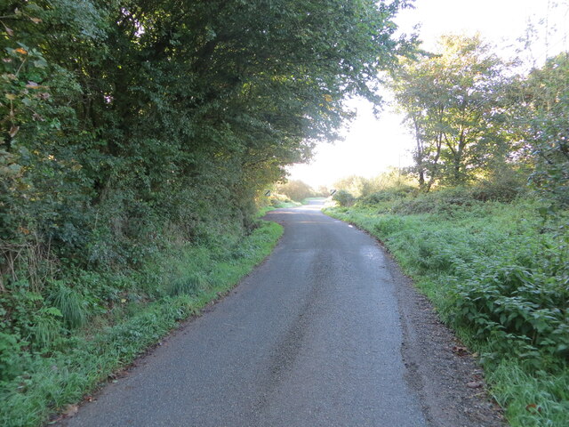
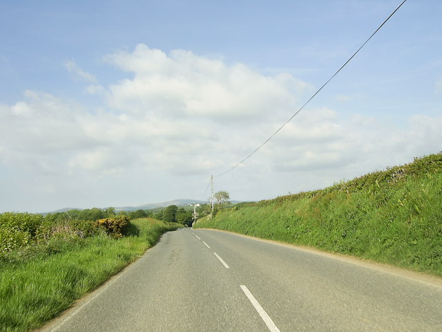
The community is surrounded by rolling hills, lush green fields, and beautiful coastal areas, making it a popular destination for nature lovers and outdoor enthusiasts. The nearby Pembrokeshire Coast National Park offers stunning views of the coastline, with opportunities for hiking, birdwatching, and exploring the diverse flora and fauna.
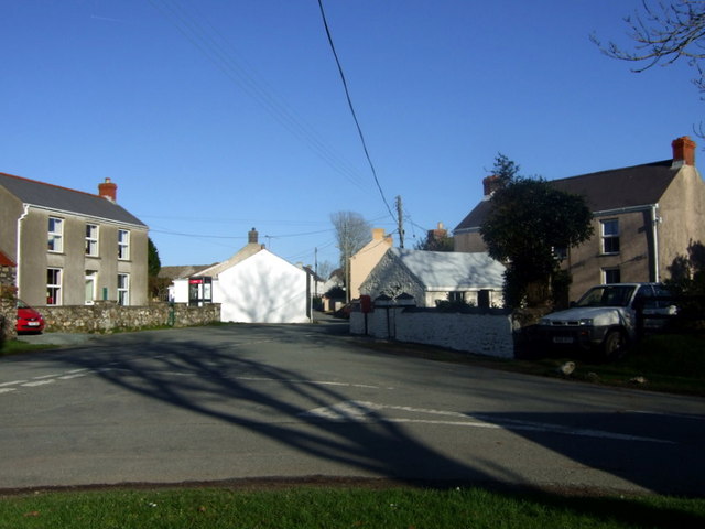
Treamlod itself is a quiet and peaceful village, with a tight-knit community that takes pride in its heritage and traditional way of life. The village is dotted with historic buildings, including a centuries-old church that serves as a focal point for the community.
While Treamlod is primarily a residential area, there are a few local amenities available to residents and visitors. These include a small convenience store, a post office, and a community center where various activities and events are held.
The community is well-connected to neighboring towns and cities by road, with regular bus services operating in the area. The town of Tenby, located just a short distance away, offers a wider range of amenities, including shops, restaurants, and leisure facilities.
Overall, Treamlod offers a tranquil escape from the hustle and bustle of urban life, providing residents and visitors alike with a chance to immerse themselves in the natural beauty of Pembrokeshire's countryside.
If you have any feedback on the listing, please let us know in the comments section below.
Treamlod Images
Images are sourced within 2km of 51.893799/-4.897848 or Grid Reference SN0025. Thanks to Geograph Open Source API. All images are credited.

![Wallis Pond viewed from Wallis Bridge Looking south-westward.
[Since its glory year of restoration in 1978 nature seems to be reclaiming it as its own.]](https://s2.geograph.org.uk/geophotos/07/32/58/7325894_0547e396.jpg)


Treamlod is located at Grid Ref: SN0025 (Lat: 51.893799, Lng: -4.897848)
Unitary Authority: Pembrokeshire
Police Authority: Dyfed-Powys
Also known as: Ambleston
What 3 Words
///nibbled.goodnight.investor. Near Ambleston, Pembrokeshire
Related Wikis
Ambleston
Ambleston (Welsh: Treamlod) is a village, parish, and community in Pembrokeshire, Wales, lying seven miles (11 km) north-north-east of Haverfordwest. The...

Wallis Moor
Wallis Moor is a Site of Special Scientific Interest (or SSSI) 12 km to the north of Haverfordwest near the village of Ambleston in Pembrokeshire, South...

Woodstock, Pembrokeshire
Woodstock (Welsh: Wstog) is a rural village in the southern foothills of the Preseli Hills in the community and parish of Ambleston, Pembrokeshire, Wales...

102.5 Radio Pembrokeshire
Radio Pembrokeshire is an Independent Local Radio station that broadcasts to Pembrokeshire. It is owned and operated by Nation Broadcasting and broadcasts...

Haverfordwest transmitting station
The Haverfordwest transmitting station is a broadcasting and telecommunications facility located at Woodstock about 13 km (8 mi) to the north east of the...

Castlebythe
Castlebythe (Welsh: Cas-fuwch) is a village and parish in Pembrokeshire, Wales, on the southern slopes of the Preseli Hills, 10 km south-east of Fishguard...

Colston, Pembrokeshire
Colston is a hamlet in the community of Puncheston in Pembrokeshire, Wales. The hamlet is the site of a Neolithic chambered tomb, known as The Altar....
Martell Bridge Halt railway station
Martell Bridge Halt railway station served the village of Little Newcastle, Pembrokeshire, Wales, from 1930 to 1937 on the North Pembrokeshire and Fishguard...
Nearby Amenities
Located within 500m of 51.893799,-4.897848Have you been to Treamlod?
Leave your review of Treamlod below (or comments, questions and feedback).