Amlwch

Community in Anglesey

Wales

Amlwch

Melin Adda, Pentrefelin Thought to have been constructed sometime in the 1790s. It closed in 1912. Now converted to a dwelling.
Melin Adda, Pentrefelin Credit: Chris Andrews

Amlwch is a community located on the north coast of the Isle of Anglesey in Wales. It is situated about 15 miles northeast of Holyhead and 10 miles northwest of Llangefni. With a population of approximately 3,700 people, it is the fourth-largest town on the island.

Historically, Amlwch was a prominent mining town. It was once known as the "Copper Kingdom" due to its rich deposits of copper ore. The Parys Mountain, located just outside the town, was one of the largest copper mines in the world during the 18th and 19th centuries. Today, remnants of the mining industry can still be seen in the form of old mine buildings and quarries.

The town of Amlwch has a charming and picturesque harbor, which was once bustling with ships exporting copper. The harbor area is now a popular spot for fishing and leisure activities. Amlwch Port, as it is called, offers stunning views of the coastline and is a starting point for coastal walks.

In terms of amenities, Amlwch has a range of shops, cafes, pubs, and restaurants, catering to both locals and visitors. The town also boasts a leisure center, library, primary school, and a secondary school.

Amlwch is surrounded by beautiful coastal scenery and offers access to several stunning beaches, including Lligwy Beach and Traeth Bychan. The area is popular for outdoor activities such as hiking, cycling, and water sports.

Overall, Amlwch is a historic mining town with a charming harbor, beautiful coastal surroundings, and a range of amenities to cater to residents and visitors alike.

If you have any feedback on the listing, please let us know in the comments section below.
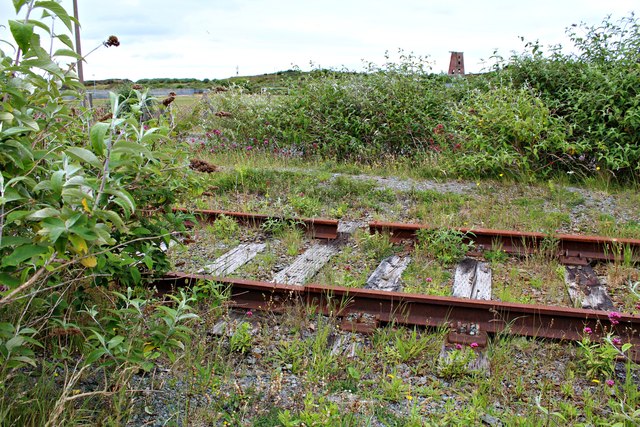
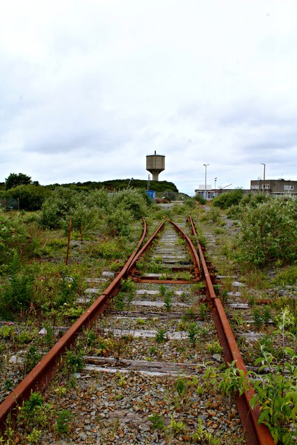
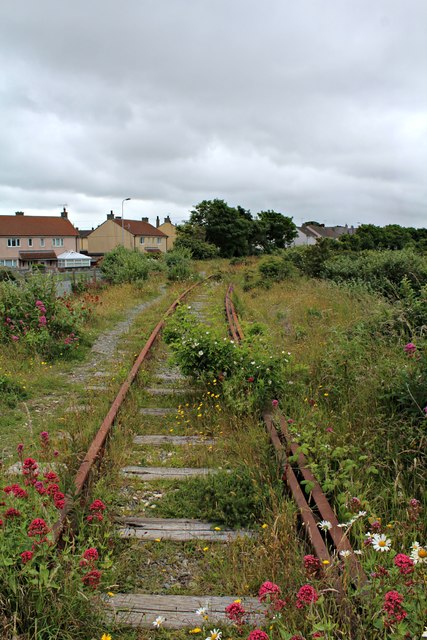
Amlwch Images

Images are sourced within 2km of 53.403831/-4.363332 or Grid Reference SH4292. Thanks to Geograph Open Source API. All images are credited.

Melin Adda, Pentrefelin Thought to have been constructed sometime in the 1790s. It closed in 1912. Now converted to a dwelling.
Melin Adda, Pentrefelin
Thought to have been constructed sometime in the 1790s. It closed in 1912. Now converted to a dwelling.
Disused Railway, Amlwch This line led to the Associated Octel/Great Lakes Chemicals bromine production plant.
Disused Railway, Amlwch
This line led to the Associated Octel/Great Lakes Chemicals bromine production plant.
Level crossing gates closed The redundant and disused line which led to the Associated Octel/Great Lakes Chemicals bromine production plant.
<a href="https://www.geograph.org.uk/photo/5024465">SH4493 : Level crossing gates closed (2)</a>
Level crossing gates closed
The redundant and disused line which led to the Associated Octel/Great Lakes Chemicals bromine production plant. SH4493 : Level crossing gates closed (2)
Level crossing gates closed (2) The redundant and disused line which led from the Associated Octel/Great Lakes Chemicals bromine production plant. 
<a href="https://www.geograph.org.uk/photo/5024460">SH4493 : Level crossing gates closed</a>
Level crossing gates closed (2)
The redundant and disused line which led from the Associated Octel/Great Lakes Chemicals bromine production plant. SH4493 : Level crossing gates closed
Disused and broken railway track This line led to the Associated Octel/Great Lakes Chemicals bromine production plant.
Disused and broken railway track
This line led to the Associated Octel/Great Lakes Chemicals bromine production plant.
Disused railway track at Amlwch This line led to the Associated Octel/Great Lakes Chemicals bromine production plant.
Disused railway track at Amlwch
This line led to the Associated Octel/Great Lakes Chemicals bromine production plant.
Coastline above Bull Bay
Disused railway track at Amlwch (2) Talk of leaves on the line.
This line led to the Associated Octel/Great Lakes Chemicals bromine production plant.
Disused railway track at Amlwch (2)
Talk of leaves on the line. This line led to the Associated Octel/Great Lakes Chemicals bromine production plant.
Disused railway track at Amlwch (3) This line leads from the Associated Octel/Great Lakes Chemicals bromine production plant.
Disused railway track at Amlwch (3)
This line leads from the Associated Octel/Great Lakes Chemicals bromine production plant.
"The King's Head", Amwlch
View To Bull Bay
View To Bull Bay
Penybonc Road in Amlwch Looking south-eastward.
Penybonc Road in Amlwch
Looking south-eastward.
Lane approaching Pen y Fynwent Looking eastward.
Lane approaching Pen y Fynwent
Looking eastward.
Road approaching Pen Parc Mawr Looking south-eastward.
Road approaching Pen Parc Mawr
Looking south-eastward.
Mona Street (B5111) in Amlwch approaching the A5025 Looking eastward.
Mona Street (B5111) in Amlwch approaching the A5025
Looking eastward.
The junction of Mona Street and Bathesda Street (B5111) in Amlwch Looking south-westward.
The junction of Mona Street and Bathesda Street (B5111) in Amlwch
Looking south-westward.
Ordnance Survey Flush Bracket S7550 This can be found on the wall of a Council/Police Office building in Amlwch. The benchmark height is ecorded as being 26.257 metres above sea level. For more detail see : <span class="nowrap"><a title="http://www.bench-marks.org.uk/bm16373" rel="nofollow ugc noopener" href="http://www.bench-marks.org.uk/bm16373">Link</a><img style="margin-left:2px;" alt="External link" title="External link - shift click to open in new window" src="https://s1.geograph.org.uk/img/external.png" width="10" height="10"/></span>
Ordnance Survey Flush Bracket S7550
This can be found on the wall of a Council/Police Office building in Amlwch. The benchmark height is ecorded as being 26.257 metres above sea level. For more detail see : LinkExternal link
Ordnance Survey Flush Bracket S7551 This can be found on the wall of a school in Amlwch. The benchmark height is recorded as being 37.908 metres above sea level. For more detail see : <span class="nowrap"><a title="http://www.bench-marks.org.uk/bm16372" rel="nofollow ugc noopener" href="http://www.bench-marks.org.uk/bm16372">Link</a><img style="margin-left:2px;" alt="External link" title="External link - shift click to open in new window" src="https://s1.geograph.org.uk/img/external.png" width="10" height="10"/></span>
Ordnance Survey Flush Bracket S7551
This can be found on the wall of a school in Amlwch. The benchmark height is recorded as being 37.908 metres above sea level. For more detail see : LinkExternal link
Show me another place!

Amlwch is located at Grid Ref: SH4292 (Lat: 53.403831, Lng: -4.363332)

Unitary Authority: Isle of Anglesey

Police Authority: North Wales

What 3 Words

///foreheads.neatly.snips. Near Amlwch, Isle of Anglesey

Nearby Locations

Amlwch

Related Wikis

Penrhyd Lastra

Penrhyd Lastra is a hamlet in the community of Amlwch, Anglesey, Wales, which is 141.9 miles (228.3 km) from Cardiff and 221.2 miles (355.9 km) from London...

Ysgol Syr Thomas Jones

Ysgol Syr Thomas Jones is a mixed bilingual community school for pupils between 11 and 18 years of age in the Pentrefelin area of Amlwch, Anglesey. The...

Tyddyn Dai

Tyddyn Dai is a hamlet in the community of Amlwch, Anglesey, Wales, which is 141.4 miles (227.6 km) from Cardiff and 220.7 miles (355.1 km) from London...
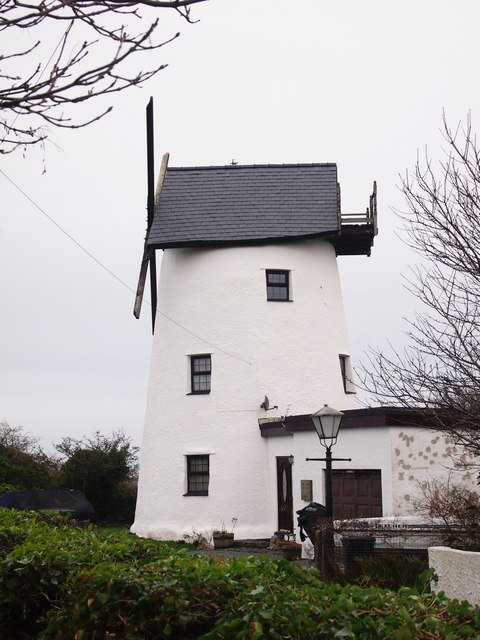
Melin Adda

Melin Adda is a windmill near Amlwch, Anglesey, (OS reference: SH 440921) which was built in the 1790s and closed down in 1912. The mill was turned into...

Nearby Amenities

Located within 500m of 53.403831,-4.363332
Restaurant
Lat/Long: 53.4035519/-4.360413
Lastra Farm Hotel
Addr Postcode: LL68 9TF
Fhrs Id: 372123
Source Postcode: FHRS Open Data
Tourism: hotel
Lat/Long: 53.4035583/-4.3609607
Source: OS VectorMap District
Lat/Long: 53.4073788/-4.3588947
Source: OS VectorMap District
Lat/Long: 53.4074535/-4.3592547
Power: pole
Lat/Long: 53.4038161/-4.3693685
Power: pole
Lat/Long: 53.4038145/-4.3683787
Power: pole
Lat/Long: 53.4038081/-4.366992
Power: pole
Lat/Long: 53.4038001/-4.3659325
Power: pole
Lat/Long: 53.4037954/-4.3651574
Power: pole
Lat/Long: 53.4035747/-4.3643527
Power: pole
Lat/Long: 53.4033604/-4.3636419
Power: pole
Lat/Long: 53.403298/-4.3634354
Power: pole
Lat/Long: 53.4026184/-4.3628936
Power: pole
Lat/Long: 53.4020955/-4.3615901
Power: pole
Lat/Long: 53.4013599/-4.3608498
Power: pole
Lat/Long: 53.4008098/-4.3602865
Power: pole
Lat/Long: 53.4001206/-4.3595864
Power: pole
Lat/Long: 53.3997998/-4.3648785
Power: pole
Lat/Long: 53.4005438/-4.3642993
Power: pole
Lat/Long: 53.4014586/-4.3629313
Power: pole
Lat/Long: 53.4038347/-4.3702995
The data included in this document is from www.openstreetmap.org. The data is made available under ODbL.

Have you been to Amlwch?

Leave your review of Amlwch below (or comments, questions and feedback).