Aberdâr Gorllewin
Community in Glamorgan
Wales
Aberdâr Gorllewin

Aberdâr Gorllewin is a community located in the county of Glamorgan, Wales. It is situated in the western part of Aberdare, a town renowned for its industrial heritage. Aberdâr Gorllewin covers an area of approximately 1.5 square miles and is home to a population of around 3,000 residents.
The community is characterized by its mix of residential and industrial areas. Historically, Aberdâr Gorllewin played a significant role in the coal mining industry, which was the backbone of the local economy for many years. Today, while the mining industry has declined, there are still remnants of the coal mining heritage visible in the form of old collieries and mining artifacts.
In recent years, Aberdâr Gorllewin has undergone urban redevelopment, with efforts focused on improving the local infrastructure and facilities. There are several schools in the community, providing education to children of different age groups.
Nature enthusiasts can enjoy the nearby countryside, with beautiful landscapes and scenic walks available in the surrounding area. Additionally, the Brecon Beacons National Park is just a short distance away, offering opportunities for outdoor activities such as hiking and cycling.
Aberdâr Gorllewin has a strong sense of community, with various local events and activities organized throughout the year. These include festivals, sports tournaments, and cultural celebrations that bring residents together.
Overall, Aberdâr Gorllewin in Glamorgan offers a mix of industrial history, natural beauty, and a close-knit community, making it a desirable place to live for many.
If you have any feedback on the listing, please let us know in the comments section below.
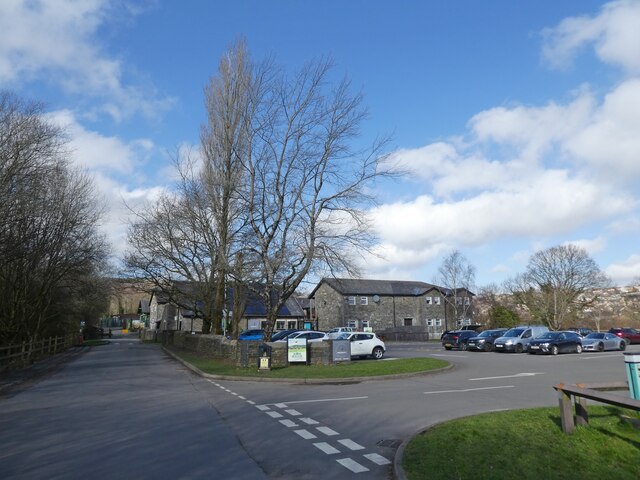
Aberdâr Gorllewin Images
Images are sourced within 2km of 51.711007/-3.484006 or Grid Reference SN9702. Thanks to Geograph Open Source API. All images are credited.


Aberdâr Gorllewin is located at Grid Ref: SN9702 (Lat: 51.711007, Lng: -3.484006)
Unitary Authority: Rhondda Cynon Taf
Police Authority: South Wales
Also known as: Aberdare West
What 3 Words
///splints.travel.conga. Near Aberdare, Rhondda Cynon Taf
Nearby Locations
Related Wikis

Bwllfa Colliery
Bwllfa Colliery was a coal mine located in the Dare valley near Cwmdare in Rhondda Cynon Taf, South Wales. It operated from 1856 to 1957, remaining open...

Elim Chapel, Cwmdare
Elim, Cwmdare was an Independent (Congregationalist) chapel in Cwmdare, Aberdare, Wales. == Early history == The church was established as a direct result...

Dare Valley Country Park
Dare Valley Country Park (Welsh: Parc Gwledig Cwm Dâr) is a public park in Wales. It lies near the village of Cwmdare and the town of Aberdare, Cynon Valley...
Cwmdare
Cwmdare (Welsh: Cwmdâr) is a village very close to Aberdare, in Rhondda Cynon Taf, Wales. The village's history is intertwined with coal-mining, and since...
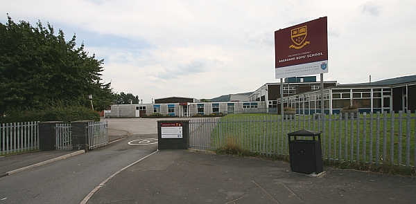
Aberdare High School
Aberdare High School (Welsh: Ysgol Uwchradd Aberdâr) was a comprehensive school in Aberdare, Wales. The school was situated between the villages of Trecynon...
Aberdare Community School
Aberdare Community School (Welsh: Ysgol Gymunedol Aberdâr) is a secondary school located in Aberdare, Wales. The school was formed in September 2014 as...
St John the Baptist School, Aberdare
St. John Baptist Church in Wales High School is a church secondary school located in Aberdare, Wales. The school serves children from all over Rhondda...

Aberdare Park
Aberdare Park (Welsh: Parc Aberdâr) is a well-preserved Victorian public park located in the village of Trecynon, near the town of Aberdare in South Wales...
Nearby Amenities
Located within 500m of 51.711007,-3.484006Have you been to Aberdâr Gorllewin?
Leave your review of Aberdâr Gorllewin below (or comments, questions and feedback).