Aberdare West

Community in Glamorgan

Wales

Aberdare West

Green Meadow Riding Centre
Green Meadow Riding Centre Credit: Roger Cornfoot

Aberdare West is a community located in the county of Glamorgan, Wales. It is situated in the Cynon Valley and covers an area of approximately 5 square miles. The community is part of the larger town of Aberdare, which lies within the Rhondda Cynon Taf local authority area.

Aberdare West is predominantly a residential area, with a mix of houses and apartments. The community is known for its close-knit community spirit and friendly atmosphere. It offers a range of amenities and services for its residents, including schools, healthcare facilities, and recreational spaces.

The community is well-connected in terms of transportation, with easy access to major roads and public transport links. The nearby A4059 road provides a direct route to the town center of Aberdare and connects to the wider road network, facilitating travel to other parts of Glamorgan and beyond.

Nature enthusiasts will appreciate the community's proximity to beautiful natural landscapes. The nearby Dare Valley Country Park offers opportunities for outdoor activities such as walking, cycling, and picnicking, providing a tranquil escape from the hustle and bustle of daily life.

Overall, Aberdare West is a pleasant and convenient place to live, offering a range of amenities, a strong sense of community, and easy access to both urban and natural attractions.

If you have any feedback on the listing, please let us know in the comments section below.

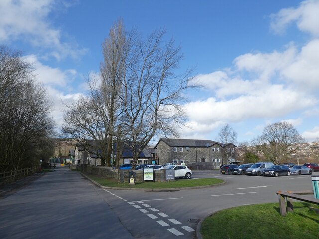
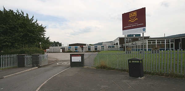
Aberdare West Images

Images are sourced within 2km of 51.711007/-3.484006 or Grid Reference SN9702. Thanks to Geograph Open Source API. All images are credited.

Green Meadow Riding Centre
Equestrian training, Green Meadow Riding Centre
Visitor Centre, Dare Valley, Country Park
Path through Panwen Garreg Wen
Fern Crescent, Cwmdare
Maesgwyn School, Cwmdare
Ordnance Survey Rivet This OS rivet can be found on a stone NE side of the track. It marks a point 262.137m above mean sea level.
Ordnance Survey Rivet
This OS rivet can be found on a stone NE side of the track. It marks a point 262.137m above mean sea level.
Ordnance Survey Rivet This OS rivet can be found on a stone south side of the track. It marks a point 271.138m above mean sea level.
Ordnance Survey Rivet
This OS rivet can be found on a stone south side of the track. It marks a point 271.138m above mean sea level.
Ordnance Survey Rivet This OS rivet can be found on a stone NW side of the track. It marks a point 324.911m above mean sea level.
Ordnance Survey Rivet
This OS rivet can be found on a stone NW side of the track. It marks a point 324.911m above mean sea level.
Ordnance Survey Rivet This OS rivet can be found on a stone SE side of the track. It marks a point 354.604m above mean sea level.
Ordnance Survey Rivet
This OS rivet can be found on a stone SE side of the track. It marks a point 354.604m above mean sea level.
Ordnance Survey Cut Mark This OS cut mark can be found on the rock outcrop SE side of the track. It marks a point 375.852m above mean sea level.
Ordnance Survey Cut Mark
This OS cut mark can be found on the rock outcrop SE side of the track. It marks a point 375.852m above mean sea level.
Ordnance Survey Rivet This OS rivet can be found on a stone SE side of the track. It marks a point 389.282m above mean sea level.
Ordnance Survey Rivet
This OS rivet can be found on a stone SE side of the track. It marks a point 389.282m above mean sea level.
Ordnance Survey Pivot This OS pivot can be found on rock outcrop at the edge of the track.
Ordnance Survey Pivot
This OS pivot can be found on rock outcrop at the edge of the track.
Ordnance Survey Rivet This OS rivet can be found on a rock outcrop south side of the track. It marks a point 393.506m above mean sea level.
Ordnance Survey Rivet
This OS rivet can be found on a rock outcrop south side of the track. It marks a point 393.506m above mean sea level.
Ordnance Survey Rivet This OS rivet can be found NW of the track. It marks a point 394.692m above mean sea level.
Ordnance Survey Rivet
This OS rivet can be found NW of the track. It marks a point 394.692m above mean sea level.
Ordnance Survey Rivet This OS rivet can be found on a stone SE side of the track. It marks a point 380.823m above mean sea level.
Ordnance Survey Rivet
This OS rivet can be found on a stone SE side of the track. It marks a point 380.823m above mean sea level.
Ordnance Survey Rivet This OS rivet can be found on a stone east of the track. It marks a point 429.354m above mean sea level.
Ordnance Survey Rivet
This OS rivet can be found on a stone east of the track. It marks a point 429.354m above mean sea level.
Craig Rhiw Ddu trig
Craig Rhiw Ddu trig
Show me another place!

Aberdare West is located at Grid Ref: SN9702 (Lat: 51.711007, Lng: -3.484006)

Unitary Authority: Rhondda Cynon Taf

Police Authority: South Wales

Also known as: Aberdâr Gorllewin

What 3 Words

///splints.travel.conga. Near Aberdare, Rhondda Cynon Taf

Related Wikis

Bwllfa Colliery

Bwllfa Colliery was a coal mine located in the Dare valley near Cwmdare in Rhondda Cynon Taf, South Wales. It operated from 1856 to 1957, remaining open...

Elim Chapel, Cwmdare

Elim, Cwmdare was an Independent (Congregationalist) chapel in Cwmdare, Aberdare, Wales. == Early history == The church was established as a direct result...

Dare Valley Country Park

Dare Valley Country Park (Welsh: Parc Gwledig Cwm Dâr) is a public park in Wales. It lies near the village of Cwmdare and the town of Aberdare, Cynon Valley...

Cwmdare

Cwmdare (Welsh: Cwmdâr) is a village very close to Aberdare, in Rhondda Cynon Taf, Wales. The village's history is intertwined with coal-mining, and since...

Aberdare High School

Aberdare High School (Welsh: Ysgol Uwchradd Aberdâr) was a comprehensive school in Aberdare, Wales. The school was situated between the villages of Trecynon...

Aberdare Community School

Aberdare Community School (Welsh: Ysgol Gymunedol Aberdâr) is a secondary school located in Aberdare, Wales. The school was formed in September 2014 as...

St John the Baptist School, Aberdare

St. John Baptist Church in Wales High School is a church secondary school located in Aberdare, Wales. The school serves children from all over Rhondda...

Aberdare Park

Aberdare Park (Welsh: Parc Aberdâr) is a well-preserved Victorian public park located in the village of Trecynon, near the town of Aberdare in South Wales...

Nearby Amenities

Located within 500m of 51.711007,-3.484006
Railway: dismantled_colliery
Lat/Long: 51.7136475/-3.4852679
Bench
Lat/Long: 51.7151798/-3.4820511
Bench
Lat/Long: 51.7151787/-3.4821166
Barrier: stile
Lat/Long: 51.7112562/-3.4883731
Barrier: stile
Lat/Long: 51.7119195/-3.4812235
Cwm Dar Gravity Family Bike Park
Tourism: attraction
Lat/Long: 51.710892/-3.4778011
Direction: 45
Tourism: viewpoint
Lat/Long: 51.7121094/-3.4908604
Information: route_marker
Tourism: information
Lat/Long: 51.7113399/-3.4873649
The data included in this document is from www.openstreetmap.org. The data is made available under ODbL.

Have you been to Aberdare West?

Leave your review of Aberdare West below (or comments, questions and feedback).