Aberdare East

Community in Glamorgan

Wales

Aberdare East

Entrance, Dare Valley Country Park
Entrance, Dare Valley Country Park Credit: Roger Cornfoot

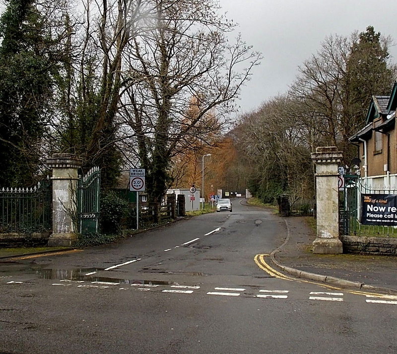
Aberdare East is a community located in the county of Glamorgan, Wales. It is situated in the Cynon Valley, approximately 20 miles north of Cardiff. The community encompasses a number of small villages and hamlets, including Abernant, Cwmaman, Abercwmboi, and Trecynon.

Aberdare East is known for its rich industrial history, particularly in coal mining. In the 19th and early 20th centuries, the area experienced significant growth and prosperity due to the mining industry. However, with the decline of the coal industry, the community has undergone a period of transformation, adapting to a more diverse economic landscape.

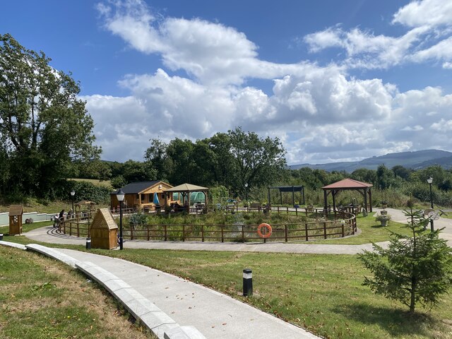
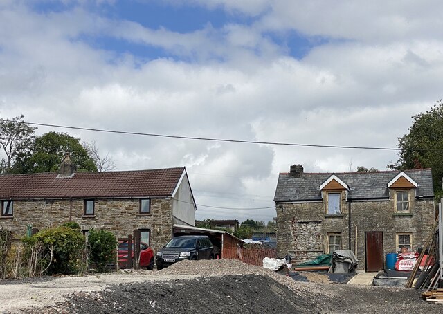
Today, Aberdare East is a vibrant community with a population of approximately 25,000 residents. It offers a range of amenities and services to its residents, including schools, healthcare facilities, and retail outlets. The area is also home to several parks and recreational spaces, providing opportunities for outdoor activities and leisure.

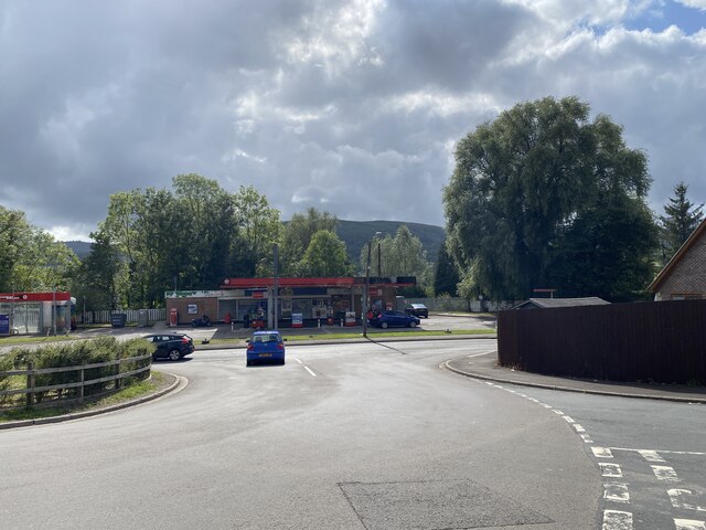
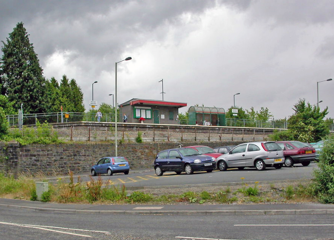
Transportation links in Aberdare East are well-developed, with regular bus services connecting the community to nearby towns and cities. The community is also served by Aberdare railway station, which provides direct links to Cardiff and other major cities in Wales.

Overall, Aberdare East, Glamorgan is a community that combines its industrial heritage with a modern and diverse economy. It offers a high quality of life for its residents, with a range of amenities, beautiful surroundings, and convenient transportation links.

If you have any feedback on the listing, please let us know in the comments section below.

Aberdare East Images

Images are sourced within 2km of 51.721675/-3.431511 or Grid Reference SO0103. Thanks to Geograph Open Source API. All images are credited.

Entrance, Dare Valley Country Park
Monk Street, Aberdare
Panorama from Merthyr Tydfil to Aberdare View from Mynydd Aberdâr.
Panorama from Merthyr Tydfil to Aberdare
View from Mynydd Aberdâr.
New trackwork at Aberdare station Part of the Cardiff Metro project.
New trackwork at Aberdare station
Part of the Cardiff Metro project.
Aberdare station The 15.51 to Barry Island will be departing shortly.
Aberdare station
The 15.51 to Barry Island will be departing shortly.
Aberdare station car park
Recreation area, Ysgubor Wen
Woodland path A path through a narrow strip of woodland near Ysgubor Wen.
Woodland path
A path through a narrow strip of woodland near Ysgubor Wen.
House refurbishment The building on the right looks as if it might once have been a farmhouse.
House refurbishment
The building on the right looks as if it might once have been a farmhouse.
St Matthew Church, Abernant Clad with corrugated sheeting, this is one of only a handful of tin tabernacles in South Wales.  

See <span class="nowrap"><a title="https://en.wikipedia.org/wiki/St_Matthew%27s_Church,_Abernant" rel="nofollow ugc noopener" href="https://en.wikipedia.org/wiki/St_Matthew%27s_Church,_Abernant">Link</a><img style="margin-left:2px;" alt="External link" title="External link - shift click to open in new window" src="https://s1.geograph.org.uk/img/external.png" width="10" height="10"/></span>. 

See also <span class="nowrap"><a title="https://en.wikipedia.org/wiki/Tin_tabernacle" rel="nofollow ugc noopener" href="https://en.wikipedia.org/wiki/Tin_tabernacle">Link</a><img style="margin-left:2px;" alt="External link" title="External link - shift click to open in new window" src="https://s1.geograph.org.uk/img/external.png" width="10" height="10"/></span>.
St Matthew Church, Abernant
Clad with corrugated sheeting, this is one of only a handful of tin tabernacles in South Wales. See LinkExternal link. See also LinkExternal link.
Woodland track Track alongside Nant y Wenallt.
Woodland track
Track alongside Nant y Wenallt.
Track over stream The track originally served the Werfa Colliery.
Track over stream
The track originally served the Werfa Colliery.
Approaching Canal Road On the outskirts of Aberdare.
Approaching Canal Road
On the outskirts of Aberdare.
Old track serving the Werfa Colloery
Track to Werfa Colliery Further uphill from <a href="https://www.geograph.org.uk/photo/7260517">SO0201 : Old track serving the Werfa Colloery</a>.
Track to Werfa Colliery
Ysgol Gynradd Abernant Abernant Junior School.
Ysgol Gynradd Abernant
Abernant Junior School.
Fence between woodland and lane As close as I could get to the corner of grid square SO 0004.  The viewing angle is very slightly south of east and the lane is in SO 0003.
Fence between woodland and lane
As close as I could get to the corner of grid square SO 0004. The viewing angle is very slightly south of east and the lane is in SO 0003.
Rhoswenallt Inn Public house in Abernant.
Rhoswenallt Inn
Public house in Abernant.
Show me another place!

Aberdare East is located at Grid Ref: SO0103 (Lat: 51.721675, Lng: -3.431511)

Unitary Authority: Rhondda Cynon Taf

Police Authority: South Wales

Also known as: Aberdâr Dwyrain

What 3 Words

///vote.snow.moss. Near Aberdare, Rhondda Cynon Taf

Related Wikis

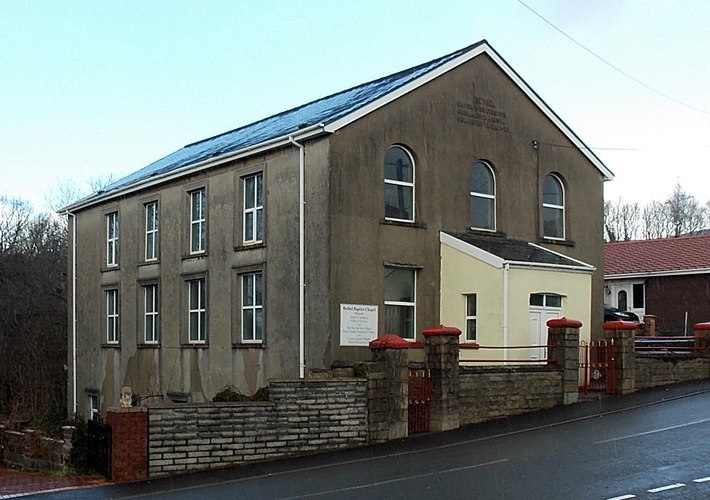
Bethel Chapel, Abernant

Bethel, Abernant is a Baptist Chapel at Abernant in the Aberdare Valley in Wales and one of the few nonconformist chapels in the area that remained open...

St Matthew's Church, Abernant

St Matthew's Church, Abernant is in the Parish of Aberdare in Rhondda Cynon Taf. It is one of only a handful of tin tabernacles left in Wales. The church...

Abernant railway station

Abernant railway station served the village of Abernant in Wales. Served by the Vale of Neath railway, the station lay at the other end of the 2497 yard...

Abernant, Rhondda Cynon Taf

Abernant (or Abernant-y-Wenallt) is a small village north-east of the town of Aberdare, Rhondda Cynon Taf, Wales. Like many in the South Wales Valleys...

Aberdare General Hospital

Aberdare General Hospital (Welsh: Ysbyty Cyffredinol Aberdâr) was a health facility on Abernant Road, Aberdare, Rhondda Cynon Taf, Wales. It was managed...

Aberdare Girls' School

Aberdare Girls' School was a state secondary school for girls aged 11–18 in the town of Aberdare, Rhondda Cynon Taf, Wales. It closed in July 2014. �...

Aberdare railway station

Aberdare railway station (Welsh: Aberdâr) is a railway station serving the town of Aberdare in Rhondda Cynon Taf, Wales. It is the terminus of the Aberdare...

Ynys (Aberdare)

The Athletic Ground, also known as Aberdare Stadium and the Ynys Stadium, was a mixed sports venue in Aberdare, Wales, which was predominantly used for...

Nearby Amenities

Located within 500m of 51.721675,-3.431511
Abernant
Place: village
Wikidata: Q4667137
Lat/Long: 51.7192929/-3.4326526
Abernant
Historic Railway: station
Railway: site
Wikidata: Q4667142
Wikipedia: en:Abernant railway station
Lat/Long: 51.7217954/-3.4277816
Power: tower
Lat/Long: 51.7239122/-3.4327971
Power: tower
Lat/Long: 51.7251823/-3.4279437
Pub
Lat/Long: 51.7224498/-3.4285275
Direction: SSE
Generator Method: photovoltaic
Generator Output Electricity: yes
Generator Solar Modules: 2
Generator Source: solar
Generator Type: solar_photovoltaic_panel
Location: roof
Power: generator
Lat/Long: 51.7209749/-3.4305356
Direction: SW
Generator Method: photovoltaic
Generator Output Electricity: yes
Generator Solar Modules: 14
Generator Source: solar
Generator Type: solar_photovoltaic_panel
Location: roof
Power: generator
Lat/Long: 51.7210784/-3.4374976
Direction: 125
Generator Method: photovoltaic
Generator Output Electricity: yes
Generator Solar Modules: 16
Generator Source: solar
Generator Type: solar_photovoltaic_panel
Location: roof
Power: generator
Lat/Long: 51.7215434/-3.4382828
Direction: SW
Generator Method: photovoltaic
Generator Output Electricity: yes
Generator Solar Modules: 14
Generator Source: solar
Generator Type: solar_photovoltaic_panel
Location: roof
Power: generator
Lat/Long: 51.7201545/-3.4265918
Direction: 165
Generator Method: photovoltaic
Generator Output Electricity: yes
Generator Solar Modules: 14
Generator Source: solar
Generator Type: solar_photovoltaic_panel
Location: roof
Power: generator
Lat/Long: 51.7202513/-3.4268325
Direction: 165
Generator Method: photovoltaic
Generator Output Electricity: yes
Generator Solar Modules: 12
Generator Source: solar
Generator Type: solar_photovoltaic_panel
Location: roof
Power: generator
Lat/Long: 51.7199509/-3.4276509
Direction: SSE
Generator Method: photovoltaic
Generator Output Electricity: yes
Generator Solar Modules: 10
Generator Source: solar
Generator Type: solar_photovoltaic_panel
Location: roof
Power: generator
Lat/Long: 51.7209986/-3.430542
Direction: ENE
Generator Method: photovoltaic
Generator Output Electricity: yes
Generator Solar Modules: 7
Generator Source: solar
Generator Type: solar_photovoltaic_panel
Location: roof
Power: generator
Lat/Long: 51.7199044/-3.4343071
Direction: SSE
Generator Method: photovoltaic
Generator Output Electricity: yes
Generator Solar Modules: 5
Generator Source: solar
Generator Type: solar_photovoltaic_panel
Location: roof
Power: generator
Lat/Long: 51.7199468/-3.4342964
The data included in this document is from www.openstreetmap.org. The data is made available under ODbL.

Have you been to Aberdare East?

Leave your review of Aberdare East below (or comments, questions and feedback).