An t-Àth Leathann

Settlement in Inverness-shire

Scotland

An t-Àth Leathann

Footbridge across Broadford River
Footbridge across Broadford River Credit: Rod Allday

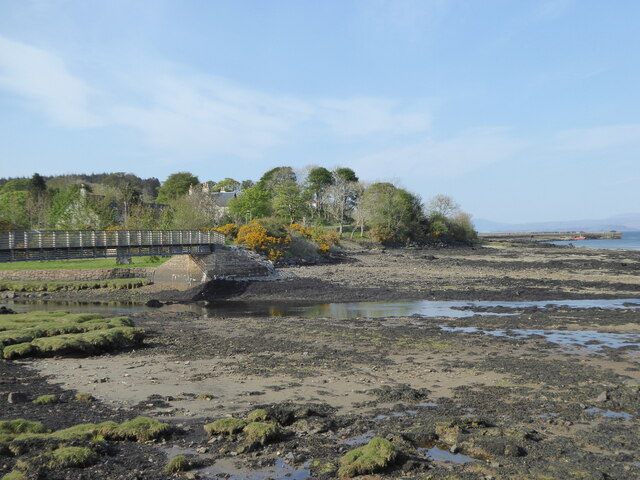
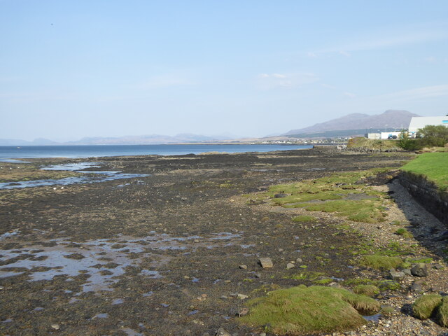
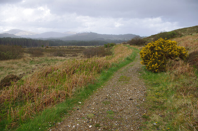
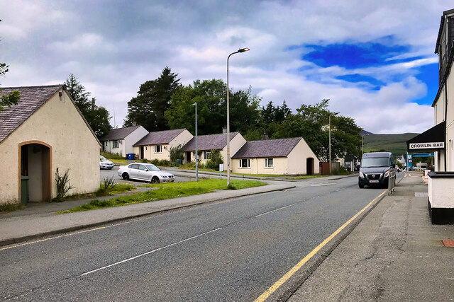
An t-Àth Leathann, also known as Broadford, is a picturesque village located in the county of Inverness-shire, Scotland. Situated on the Isle of Skye, it is nestled along the southern coast of the island, overlooking the stunning waters of Loch Alsh.

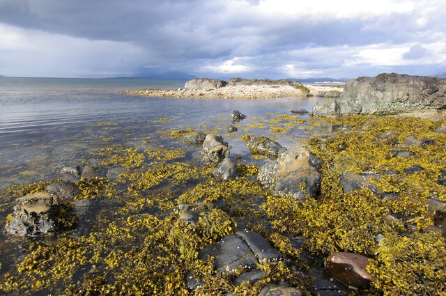
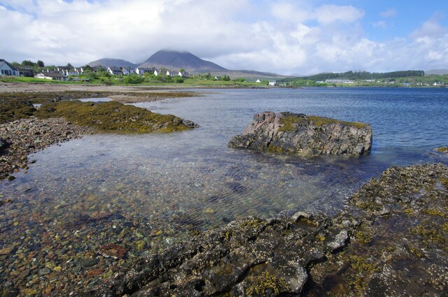
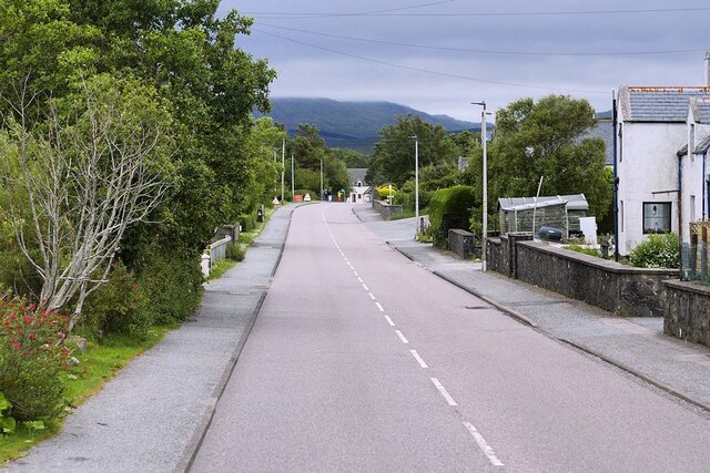
With a population of around 600 people, An t-Àth Leathann is a close-knit community that exudes a warm and welcoming atmosphere. The village is renowned for its natural beauty, characterized by rolling hills, rugged landscapes, and breathtaking views of the surrounding mountains, including the iconic Cuillin Hills.

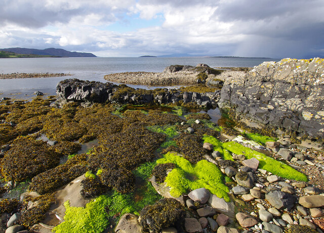
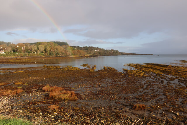
One of the main attractions in An t-Àth Leathann is the Broadford Bay, a picturesque bay that stretches out into the Loch Alsh. It provides a haven for wildlife enthusiasts, with a variety of bird species and marine life thriving in its waters. The bay is also a popular spot for water sports such as kayaking and sailing.

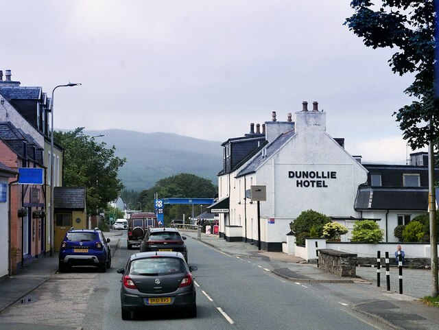
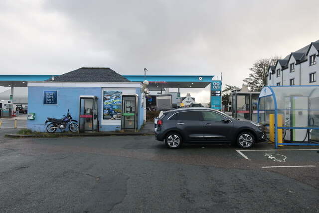
The village itself offers a range of amenities for both residents and visitors. There are several charming local shops, cafes, and restaurants, where visitors can enjoy traditional Scottish cuisine and locally sourced produce. Additionally, there are a number of accommodation options available, including cozy bed and breakfasts and self-catering cottages, which cater to the growing tourism industry in the area.

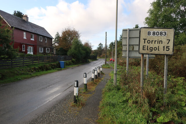
An t-Àth Leathann serves as an excellent base for exploring the wider Isle of Skye, with a multitude of attractions just a short drive away. Visitors can explore the enchanting Fairy Pools, hike the Quiraing, or visit the historic Dunvegan Castle.

Overall, An t-Àth Leathann offers a tranquil and idyllic setting, making it a perfect destination for those seeking a peaceful escape in the stunning Scottish Highlands.

If you have any feedback on the listing, please let us know in the comments section below.

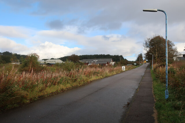
An t-Àth Leathann Images

Images are sourced within 2km of 57.241805/-5.911134 or Grid Reference NG6423. Thanks to Geograph Open Source API. All images are credited.

Footbridge across Broadford River
Foreshore on the Broadford River
Foreshore, Broadford Bay
Foreshore, Broadford Bay Beinn na Caillich (centre) and Beinn Dearg Bheag (left) are in the background.
Foreshore, Broadford Bay
Beinn na Caillich (centre) and Beinn Dearg Bheag (left) are in the background.
Marble line, Broadford This path follows the route of the railway from the marble quarries at Torrin to the quay at Broadford. This view is looking north on the approach to Broadford. The wooded hill in the centre background is Cnoc na Cachaille. The hills of Scalpay are beyond.
Marble line, Broadford
This path follows the route of the railway from the marble quarries at Torrin to the quay at Broadford. This view is looking north on the approach to Broadford. The wooded hill in the centre background is Cnoc na Cachaille. The hills of Scalpay are beyond.
Cable bridge, Allt a' Mhuilinn
Road bridge, Broadford Carries the A87 over the Allt a' Mhuilinn. Looking upstream. <a href="https://www.geograph.org.uk/photo/1113446">NG6423 : Allt a' Mhuillin</a> shows a downstream view.
Road bridge, Broadford
Carries the A87 over the Allt a' Mhuilinn. Looking upstream. NG6423 : Allt a' Mhuillin shows a downstream view.
Foreshore, Broadford Bay
Broadford, Isle of Skye Broadford, together with nearby Harrapool, is the second-largest settlement on the Isle of Skye.
Broadford, Isle of Skye
Broadford, together with nearby Harrapool, is the second-largest settlement on the Isle of Skye.
Isle of Skye, Broadford Broadford, together with nearby Harrapool, is the second-largest settlement on the Isle of Skye.
Isle of Skye, Broadford
Broadford, together with nearby Harrapool, is the second-largest settlement on the Isle of Skye.
A87, Harrapool The A87 is a primary route  in the Highland region of Scotland. It runs west for 99 miles from its junction with the A82 at Invergarry, along the north shores of Loch Garry and Loch Cluanie, then through Glen Shiel and along Loch Duich to Kyle of Lochalsh before crossing the Skye Bridge to Kyleakin, Broadford, and Portree, before terminating at Uig in the north of the Isle of Skye.
A87, Harrapool
The A87 is a primary route in the Highland region of Scotland. It runs west for 99 miles from its junction with the A82 at Invergarry, along the north shores of Loch Garry and Loch Cluanie, then through Glen Shiel and along Loch Duich to Kyle of Lochalsh before crossing the Skye Bridge to Kyleakin, Broadford, and Portree, before terminating at Uig in the north of the Isle of Skye.
High Road, Broadford
B8083 out of Broadford
Rainbow at Broadford Good views of an otter from the car park.
Rainbow at Broadford
Good views of an otter from the car park.
Electric car charging at Broadford, Skye With the large petrol station beyond.
Electric car charging at Broadford, Skye
With the large petrol station beyond.
A87, Broadford Bridge
Path by Broadford River
Broadford Pier
Broadford Pier
Show me another place!

An t-Àth Leathann is located at Grid Ref: NG6423 (Lat: 57.241805, Lng: -5.911134)

Unitary Authority: Highland

Police Authority: Highlands and Islands

Also known as: Broadford

What 3 Words

///automatic.without.fuzz. Near Broadford, Highland

Related Wikis

Broadford Parish Church

Broadford Parish Church, Skye is a parish church in the Church of Scotland in Broadford, Skye. == History == The church was built between 1839 and 1841...

Broadford, Skye

Broadford (Scottish Gaelic: An t-Àth Leathann [ən̪ˠ t̪aːh ˈʎɛhən̪ˠ]), together with nearby Harrapool, is the second-largest settlement on the Isle of Skye...

Mackinnon Memorial Hospital

The former Mackinnon Memorial Hospital building is now vacant; it sits adjacent to the new Broadford Hospital, all services having moved into this new...

Harrapool

Harrapool (Scottish Gaelic: Harrapul) is a village, that lies on the right hand side of Broadford Bay, in Isle of Skye, Scottish Highlands and is in the...

Corriechatachan

Corriechatachan (Gaelic for “Corrie of the wild cats”) is a farmstead (now ruined), lying at the foot of Beinn na Caillich, near Broadford, on the Isle...

Skye and Lochalsh

Skye and Lochalsh (Scottish Gaelic: 'An t-Eilean Sgitheanach agus Loch Aillse') is one of eight former local government districts of the two-tier Highland...

Skye Marble Railway

The Skye Marble Railway was a 3 ft (914 mm) narrow gauge industrial railway on the Isle of Skye, Scotland which operated from 1910 to 1912. Marble was...

Ross, Skye and Lochaber (UK Parliament constituency)

Ross, Skye and Lochaber is a constituency of the House of Commons of the Parliament of the United Kingdom (Westminster). It elects one Member of Parliament...

Nearby Amenities

Located within 500m of 57.241805,-5.911134
Crossing
Check Date Crossing: 2021-06-03
Crossing: traffic_signals
Crossing Island: no
Kerb: lowered
Source: survey
Tactile Paving: yes
Traffic Signals Sound: no
Lat/Long: 57.2428453/-5.9133137
Broadford
Name En: Broadford
Name Gd: An t-Àth Leathann
Name Non: Breiðafjorðr
Name Sco: Braidfuird
Place: village
Population: 1150
Wikidata: Q922593
Wikipedia: en:Broadford, Skye
Lat/Long: 57.2410146/-5.9061803
Post Box
Ref: IV49 137
Source: survey
Lat/Long: 57.2434794/-5.9116875
Crossing
Crossing: unmarked
Crossing Island: no
Crossing Markings: no
Tactile Paving: no
Lat/Long: 57.2427857/-5.9135492
Post Office
Broadford Post Office
Addr Postcode: IV49 9AB
Brand: Post Office
Brand Wikidata: Q1783168
Operator: Spar
Ref Pol Id: 2492
Source: survey
Lat/Long: 57.2430814/-5.915042
Disused Amenity: bank
Operator: Bank of Scotland
Source: survey
Lat/Long: 57.2426738/-5.9135796
Pharmacy
Broadford Pharmacy
Healthcare: pharmacy
Opening Hours: Mo-Sa 09:00-17:30
Source: survey
Lat/Long: 57.2426118/-5.9134052
Operator: Buth na h-Abhainn
Shop: gift
Lat/Long: 57.2425543/-5.91317
Mini Roundabout
Direction: clockwise
Source: survey
Lat/Long: 57.2398633/-5.9085626
Telephone
Booth: KX100
Check Date: 2022-11-05
Covered: booth
Source: survey
Lat/Long: 57.2413766/-5.9079462
Telephone
Booth: KX100
Check Date: 2022-11-05
Covered: booth
Source: survey
Lat/Long: 57.2412619/-5.9079695
Parking
Access: private
Parking: surface
Lat/Long: 57.2408141/-5.9059725
Pub
Gabbro Bar
Lat/Long: 57.2415118/-5.9124727
Post Box
Collection Times: Mo-Fr 14:30; Sa 14:00
Operator: Royal Mail
Ref: IV49 131
Lat/Long: 57.2430629/-5.9148039
Bus Stop
Crowlin Bar
Naptan AtcoCode: 670030025
Naptan Bearing: W
Naptan CommonName: Crowlin Bar
Naptan Indicator: opp
Naptan Landmark: Crowlin Bar
Naptan NaptanCode: 45326464
Naptan Street: A87
Naptan Verified: no
Source: naptan_import
Lat/Long: 57.2408986/-5.9059912
Bus Stop
Hospital
Naptan AtcoCode: 6700713462
Naptan Bearing: S
Naptan CommonName: Hospital
Naptan Indicator: o/s
Naptan Landmark: Broadford Hospital
Naptan NaptanCode: 45328748
Naptan Street: Hospital Road
Naptan Verified: no
Source: naptan_import
Lat/Long: 57.2460738/-5.911897
Bus Stop
A87 Post Office
Bench: yes
Bin: yes
Bus: yes
Departures Board: timetable
Lit: yes
Naptan AtcoCode: 670084946A
Naptan Bearing: W
Naptan CommonName: opp. Post Office
Naptan Indicator: Bus Shelter
Naptan Landmark: Post Office
Naptan NaptanCode: 45326463
Naptan Street: A87
Naptan Verified: no
Network: Stagecoach
Operator: Stagecoach
Public Transport: platform
Shelter: yes
Source: naptan_import;survey;Traveline Scotland
Source Ref: Traveline Scotland
Tactile Paving: no
Lat/Long: 57.2428934/-5.9140358
Calum Robertson memorial
Historic: memorial
Start Date: 1995
Wikimedia Commons: File:Memorial to Calum Robertson in Broadford - geograph.org.uk - 4016100.jpg
Lat/Long: 57.2424886/-5.9113302
Restaurant
Cafe Sia
Contact Phone: +44 1471 822616
Contact Website: http://www.cafesia.co.uk/
Cuisine: pizza;seafood
Internet Access: wlan
Internet Access Fee: no
Opening Hours: Mo-Su 09:30-20:30
Smoking: outside
Wheelchair: yes
Lat/Long: 57.2429617/-5.9146526
Telephone
Booth: KX100
Check Date: 2024-01-05
Covered: booth
Source: survey
Lat/Long: 57.2428828/-5.9135463
The Co-operative Food
Shop: supermarket
Lat/Long: 57.2414831/-5.9071022
Riverdale Bed & Breakfast
Internet Access: wlan
Internet Access Fee: no
Smoking: no
Tourism: guest_house
Lat/Long: 57.2413765/-5.911511
Passing Place
Lat/Long: 57.2385719/-5.9156595
Crossing: informal
Lat/Long: 57.243245/-5.9133684
Broadford House Skye
Tourism: guest_house
Lat/Long: 57.2409835/-5.9066961
Check Date: 2021-06-03
Leisure: picnic_table
Lat/Long: 57.2420956/-5.9115096
Crossing
Crossing: uncontrolled
Crossing Island: no
Lat/Long: 57.244408/-5.9170659
Disused Amenity: atm
Operator: Bank of Scotland
Lat/Long: 57.2427344/-5.9135534
Fast Food
Siaway
Cuisine: fish_and_chips
Diet Vegan: yes
Diet Vegetarian: yes
Opening Hours: Mo-Sa 07:00-20:00; Su 16:00-20:00
Phone: +441471822158
Takeaway: yes
Website: https://www.cafesia.co.uk/
Lat/Long: 57.2414939/-5.9106847
Spar
Brand: Spar
Brand Wikidata: Q610492
Opening Hours: Mo-Sa 08:00-19:00; Su 09:00-17:00
Shop: convenience
Wheelchair: yes
Lat/Long: 57.2430523/-5.9149481
Atm
Lat/Long: 57.2431049/-5.9150349
Recycling
Opening Hours: 24/7
Recycling Glass Bottles: yes
Recycling Shoes: yes
Recycling Type: container
Lat/Long: 57.241493/-5.9079759
Charging Station
Access: yes
Capacity: 50Kw
Charge: 30p
Fee: yes
Operator: ChargePlace Scotland
Operator Wikidata: Q105359316
Payment App: yes
Lat/Long: 57.2412655/-5.9080426
Defibrillator
Defibrillator Location: On wall of small building
Emergency: defibrillator
Indoor: no
Opening Hours: 24/7
Lat/Long: 57.2414013/-5.907932
James Ross
Historic: memorial
Memorial: stone
Lat/Long: 57.2415906/-5.9095641
Bench
Backrest: yes
Lat/Long: 57.2416795/-5.9098129
Board Type: nature
Check Date: 2021-06-03
Description: Information about Broadford Bay
Information: board
Tourism: information
Lat/Long: 57.2414753/-5.9093171
Bench
Backrest: yes
Lat/Long: 57.2416884/-5.909707
Bench
Backrest: yes
Lat/Long: 57.2417155/-5.9100203
Liveras Cairn
Board Type: history
Information: board
Tourism: information
Lat/Long: 57.2434597/-5.9104367
Bus Stop
A87 opp. Post Office
Bench: yes
Bin: yes
Bus: yes
Departures Board: timetable
Direction: SE
Lit: yes
Local Ref: AT
Long Name: Broadford, opposite Post Office
Naptan AtcoCode: 670084946
Naptan Bearing: E
Naptan CommonName: Hospital Road End
Naptan Indicator: at
Naptan Landmark: opp. Post Office
Naptan NaptanCode: 45326462
Naptan Street: A87
Naptan Verified: no
Operator: Citylink;Stagecoach
Public Transport: platform
Shelter: yes
Source: naptan_import;survey
Source Ref: Traveline Scotland
Tactile Paving: no
Lat/Long: 57.2432088/-5.9140318
Dunedin B&B
Addr Postcode: IV49 9AB
Addr Street: Shore Road
Tourism: guest_house
Website: https://www.dunedinbnb.com
Lat/Long: 57.2413095/-5.9105372
Hotel Dunollie
Addr City: Broadford
Addr Country: GB
Addr Postcode: IV49 9AE
Contact Phone: +44 1471 822 253
Tourism: hotel
Website: https://bespokehotels.com/dunolliehotel
Lat/Long: 57.241021/-5.9054887
Bar
Crowlin Bar
Lat/Long: 57.2410423/-5.9057302
Fuel
Asda Express Fuel Station
Brand: Co-op
Check Date: 2023-06-13
Fuel Petrol: yes
Fuel Diesel: yes
Mapillary: 201452062055586
Opening Hours: 24/7
Survey Date: 2021-09-19
Lat/Long: 57.2413279/-5.9074522
Isle of Skye Candle Company
Shop: gift
Lat/Long: 57.242713/-5.9139115
Wittet's Architects
Office: architect
Website: http://www.wittets.co.uk/
Lat/Long: 57.2428233/-5.9142387
Parking
Access: customers
Fee: no
Parking: surface
Surface: gravel
Lat/Long: 57.2414124/-5.9051272
Material: wood
Power: pole
Lat/Long: 57.2413909/-5.9136298
Material: wood
Power: pole
Lat/Long: 57.2414591/-5.9145418
Material: wood
Power: pole
Lat/Long: 57.2418669/-5.9160545
Material: wood
Power: pole
Lat/Long: 57.2421267/-5.9169611
Material: wood
Power: pole
Lat/Long: 57.2426971/-5.918667
Entrance: main
Lat/Long: 57.24134/-5.907876
Entrance: main
Lat/Long: 57.2412314/-5.9068267
An t-Àth Leathann - Broadford
Traffic Sign: city_limit
Traffic Sign Direction: forward
Lat/Long: 57.2435479/-5.915262
Crossing
Crossing: traffic_signals
Crossing Island: no
Tactile Paving: no
Traffic Signals Sound: no
Lat/Long: 57.2428832/-5.9133998
Bus Stop
Lat/Long: 57.2448515/-5.9114995
Parking
Access: customers
Capacity: 1
Capacity Disabled: 1
Fee: no
Parking: surface
Lat/Long: 57.244354/-5.9131967
Check Date: 2021-06-03
Leisure: picnic_table
Lat/Long: 57.2421539/-5.9116021
Check Date: 2021-06-03
Leisure: picnic_table
Lat/Long: 57.2421271/-5.9115981
Shop: hairdresser
Lat/Long: 57.2410726/-5.9040084
Restaurant
The Harbour Restaurant - El Puerto
Cuisine: spanish
Lat/Long: 57.2408009/-5.9051778
The Selkie Collective
Diet Vegan: yes
Diet Vegetarian: yes
Opening Hours: Mo-Sa 09:30-17:00
Shop: health_food
Website: https://www.theselkiecollective.com/
Lat/Long: 57.241508/-5.9108051
West Highland Free Press
Addr City: Isle of Skye
Addr Postcode: IV49 9AP
Addr Street: Pàirc nan Craobh
Addr Unit: 1B
Office: newspaper
Website: http://www.whfp.com/
Wikidata: Q3997705
Wikipedia: en:West Highland Free Press
Lat/Long: 57.2442189/-5.9156845
Street Lamp
Support: pole
Lat/Long: 57.2418256/-5.9110603
Street Lamp
Support: pole
Lat/Long: 57.2414685/-5.9125945
Entrance: yes
Lat/Long: 57.2414881/-5.9123598
Street Lamp
Support: pole
Lat/Long: 57.2414105/-5.9123544
Man Made: street_cabinet
Lat/Long: 57.2414801/-5.911932
Man Made: street_cabinet
Lat/Long: 57.2414838/-5.9119052
Street Lamp
Support: pole
Lat/Long: 57.2414903/-5.9118783
Entrance: yes
Lat/Long: 57.2415904/-5.9121009
Street Lamp
Support: pole
Lat/Long: 57.2412697/-5.9098332
Give Way
Direction: forward
Lat/Long: 57.2413742/-5.9097017
Street Lamp
Support: pole
Lat/Long: 57.2414395/-5.909628
Street Lamp
Support: pole
Lat/Long: 57.2412291/-5.9090526
Street Lamp
Support: pole
Lat/Long: 57.2412886/-5.9093852
Entrance: yes
Lat/Long: 57.2411869/-5.9093799
Street Lamp
Support: pole
Lat/Long: 57.2414221/-5.9100156
Street Lamp
Support: pole
Lat/Long: 57.2416594/-5.9110214
Street Lamp
Support: pole
Lat/Long: 57.2416224/-5.9112319
Street Lamp
Support: pole
Lat/Long: 57.2415302/-5.9105158
Give Way
Direction: backward
Lat/Long: 57.2450009/-5.9124529
Give Way
Direction: forward
Lat/Long: 57.2449164/-5.9115468
Give Way
Direction: backward
Lat/Long: 57.2449914/-5.9121329
Crossing
Crossing: uncontrolled
Crossing Markings: yes
Lat/Long: 57.245228/-5.9112257
Give Way
Direction: forward
Lat/Long: 57.2456627/-5.9115873
Toilets
Charge: 0.50
Check Date: 2024-04-15
Fee: yes
Payment Credit Cards: yes
Payment Debit Cards: yes
Payment Visa: yes
Source: survey
Toilets Disposal: flush
Toilets Handwashing: yes
Toilets Position: seated
Wheelchair: yes
Lat/Long: 57.2414874/-5.9078392
The data included in this document is from www.openstreetmap.org. The data is made available under ODbL.

Have you been to An t-Àth Leathann?

Leave your review of An t-Àth Leathann below (or comments, questions and feedback).