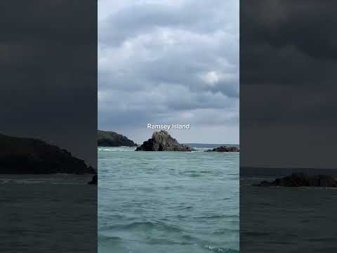
Ramsey Island

Island in Pembrokeshire

Wales

Ramsey Island

Port Lieuog With adult grey seals and their pups.
Port Lieuog Credit: David Lally

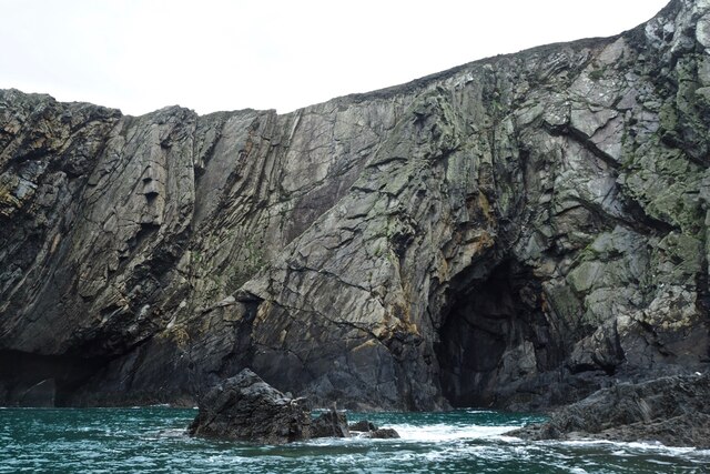
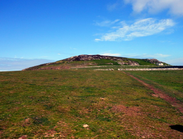
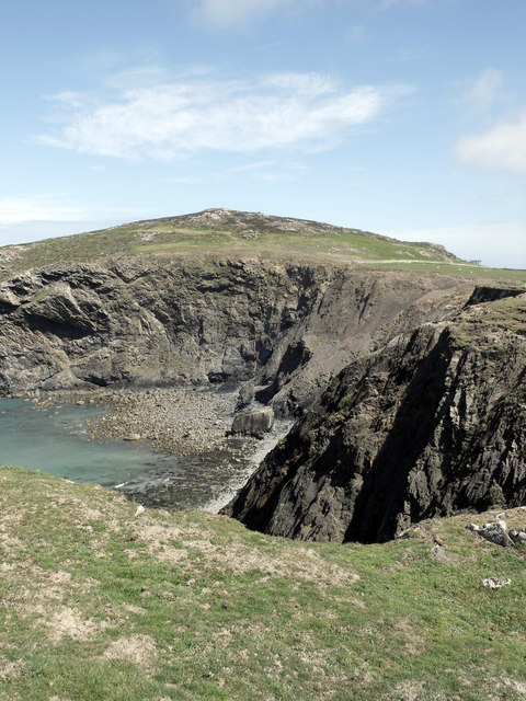
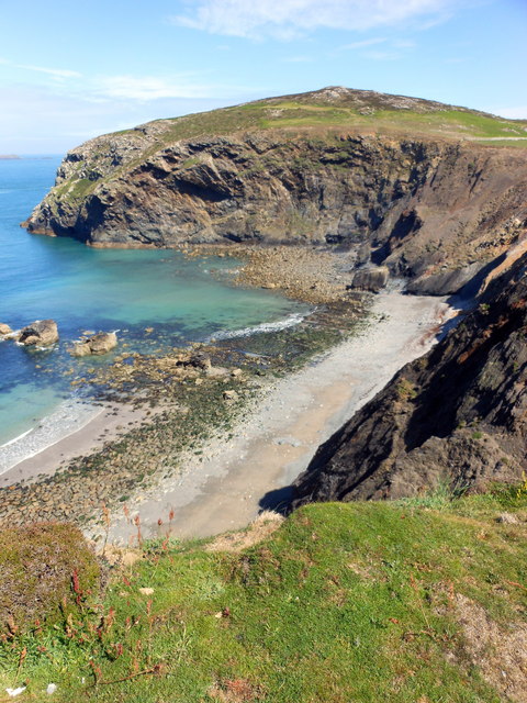
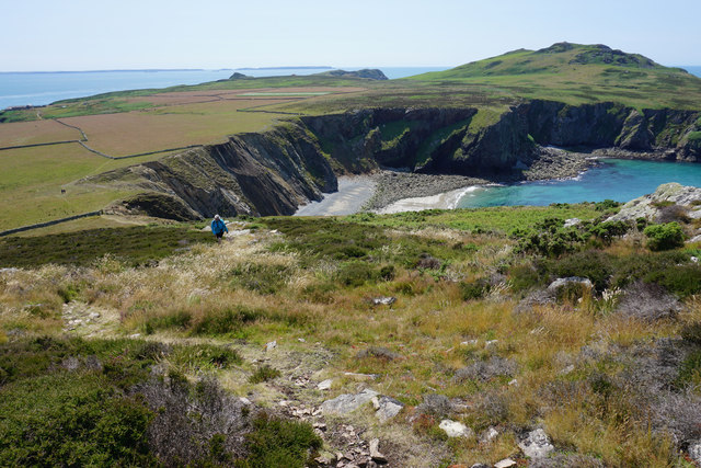
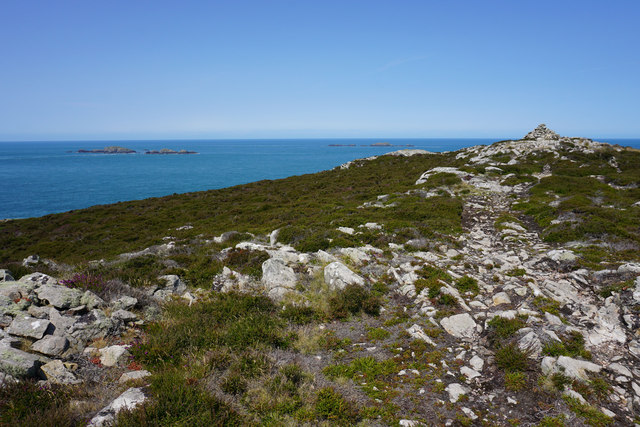
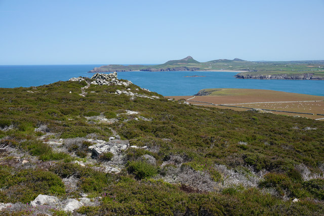
Ramsey Island is a small, uninhabited island located off the coast of Pembrokeshire in southwest Wales. The island is approximately 1.5 miles long and 0.6 miles wide, with rugged cliffs and rocky shores that provide habitat for a variety of seabirds and marine life. The island is designated as a nature reserve and is managed by the Royal Society for the Protection of Birds (RSPB).

Ramsey Island is known for its diverse wildlife, including populations of seals, dolphins, and a variety of bird species such as puffins, razorbills, and guillemots. The island also boasts a rich history, with archaeological sites dating back to the Iron Age and evidence of medieval settlement.

Visitors to Ramsey Island can take guided boat trips to the island from St. Justinian's, where they can explore the rugged coastline, observe the wildlife, and learn about the island's history and conservation efforts. The island offers stunning views of the surrounding coastline and is a popular destination for birdwatchers, nature enthusiasts, and outdoor adventurers.

If you have any feedback on the listing, please let us know in the comments section below.

Ramsey Island Images

Images are sourced within 2km of 51.8643/-5.3419 or Grid Reference SM6923. Thanks to Geograph Open Source API. All images are credited.

Port Lieuog With adult grey seals and their pups.
Port Lieuog
With adult grey seals and their pups.
Ramsey Island cave Not sure if this is Ogof Tywood or Ogof Organ.  The rock here is a metamorphic sandstone with strata at what looks to be about a 70 degree incline.  According to our guide this distortion is due to the igneous intrusion to the south which is now Carnllundain.
Ramsey Island cave
Not sure if this is Ogof Tywood or Ogof Organ. The rock here is a metamorphic sandstone with strata at what looks to be about a 70 degree incline. According to our guide this distortion is due to the igneous intrusion to the south which is now Carnllundain.
Pembrokeshire skyline View from the arched doorway of St Non’s Chapel, Ramsey Island silhouetted by the evening sun.

From Ynys Bery, Ynys Cantwr and Foel Fawr on the left, to Carn Llundain, the highest point of Ramsey Island, on the right.
Pembrokeshire skyline
View from the arched doorway of St Non’s Chapel, Ramsey Island silhouetted by the evening sun. From Ynys Bery, Ynys Cantwr and Foel Fawr on the left, to Carn Llundain, the highest point of Ramsey Island, on the right.
Ramsey Island at sunset Across the bay from St Justinian’s.
Ramsey Island at sunset
Across the bay from St Justinian’s.
Carn Llundain The highest point on Ramsey Island.
Carn Llundain
The highest point on Ramsey Island.
Sunset behind Ramsey Island
Carreg-gwylan and Trwyn Bendro: Ramsey
Trig point on Ramsey Island The rustic triangulation pillar which has an Ordnance Survey flush bracket bench mark serial number S7057 is described in detail at <span class="nowrap"><a title="http://trigpointinguk.com/trigs/trig-details.php?t=5580" rel="nofollow ugc noopener" href="http://trigpointinguk.com/trigs/trig-details.php?t=5580">Link</a><img style="margin-left:2px;" alt="External link" title="External link - shift click to open in new window" src="https://s1.geograph.org.uk/img/external.png" width="10" height="10"/></span>
Trig point on Ramsey Island
The rustic triangulation pillar which has an Ordnance Survey flush bracket bench mark serial number S7057 is described in detail at LinkExternal link
Carnllundain, Ramsey Island
Carnysgubor and The Bungalow, Ramsey Island
Aber Mawr Cliffs & Carnysgubor, Ramsey Island
Llechau-Uchaf rocks from Ramsey Island
Aber Mawr, Ramsey Island
Ogof Colomennod, Ramsey Island
The eastern side of Carnllundain From the trig point, you can see all over the island and also to the mainland, where Whitesands and St David's are clearly visible. In the far distance are the Preseli Hills.
The eastern side of Carnllundain
From the trig point, you can see all over the island and also to the mainland, where Whitesands and St David's are clearly visible. In the far distance are the Preseli Hills.
Path on Carnysgubor The main route to the third highest point on Ramsey Island (Carnllundain has a subsidiary peak higher than this). The view extends over Aber Mawr to Carnllundain with Skomer Island on the far skyline.
Path on Carnysgubor
The main route to the third highest point on Ramsey Island (Carnllundain has a subsidiary peak higher than this). The view extends over Aber Mawr to Carnllundain with Skomer Island on the far skyline.
The summit of Carnysgubor The hill has a small summit ridge with a couple of subsidiary lumps.
The summit of Carnysgubor
The hill has a small summit ridge with a couple of subsidiary lumps.
Subsidiary peak and cairn on Carnysgubor Carn Llidi and Whitesands Bay are very clear on the mainland. The image also shows the flat north eastern corner of the island where most of its farming takes place.
Subsidiary peak and cairn on Carnysgubor
Carn Llidi and Whitesands Bay are very clear on the mainland. The image also shows the flat north eastern corner of the island where most of its farming takes place.
Show me another place!

Ramsey Island is located at Grid Ref: SM6923 (Lat: 51.8643, Lng: -5.3419)

Unitary Authority: Pembrokeshire

Police Authority: Dyfed Powys

Also known as: Ynys Dewi

What 3 Words

///present.botanists.enlarge. Near St Davids, Pembrokeshire

Related Wikis

Ramsey Island

Ramsey Island (Welsh: Ynys Dewi) is an island about 1 kilometre (1⁄2 nautical mile) off St David's Head in Pembrokeshire on the northern side of St Brides...

Carnllundain

Carnllundain or Carn Llundain is the highest elevation of Ramsey Island in Pembrokeshire, Wales. == Geography == The 136-metre (446 ft) high hill stands...

The Bitches

The Bitches (also known as Bitches and Whelps) are a tidal race and set of rocks between Ramsey Island and the west Welsh coastline near St Davids. They...

Pen Dal-aderyn

Pen Dal-aderyn is the westernmost point of mainland Wales. It is in Pembrokeshire, west of St Davids. It means 'Bird-catching Head' in Welsh. == External... ==

Related Videos

Did you know that Wales has over 50 islands around its coastline and you can visit some of them?

Did you know that Wales has over 50 islands around its coastline, and guess what? You can actually visit some of them! Ramsey ...

St Justinian's looking at Ramsey island [ Wales ]

St Justinian's looking out at Ramsey Island. #wales.

Nearby Amenities

Located within 500m of 51.8643,-5.3419
Carnllundain
Name Cy: Carnllundain
Natural: peak
Wikidata: Q20589403
Lat/Long: 51.8619747/-5.3474309
The data included in this document is from www.openstreetmap.org. The data is made available under ODbL.

Have you been to Ramsey Island?

Leave your review of Ramsey Island below (or comments, questions and feedback).