Allt Felin-fawr
Coastal Feature, Headland, Point in Pembrokeshire
Wales
Allt Felin-fawr

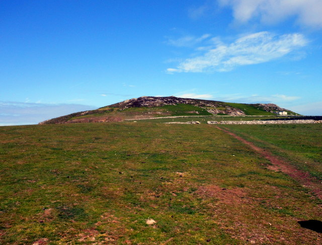
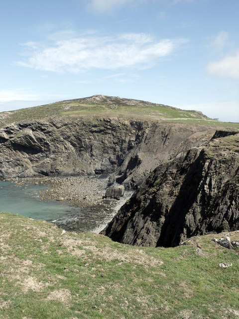
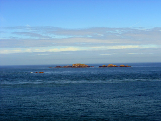
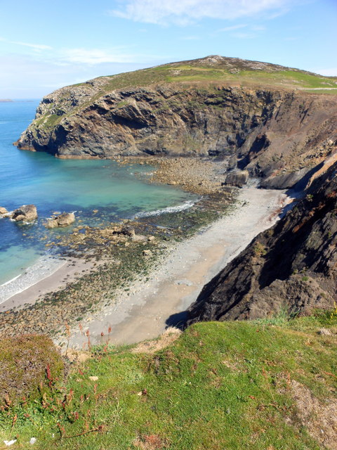
Allt Felin-fawr is a prominent headland situated in Pembrokeshire, Wales. It is located on the western coast of the county, overlooking the Celtic Sea. This coastal feature is known for its rugged beauty and is a popular destination for tourists and nature enthusiasts.
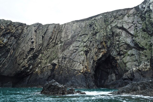
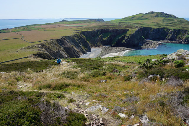
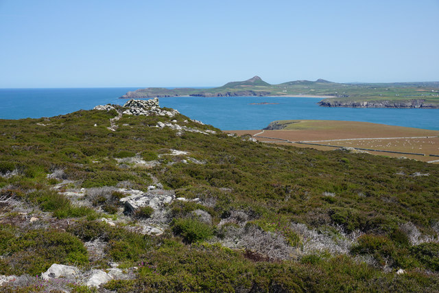
The headland is characterized by its steep cliffs, which offer magnificent views of the surrounding coastline and turquoise waters below. The cliffs are composed of sedimentary rock formations, showcasing layers of different colors and textures. Allt Felin-fawr also features several small caves and rocky outcrops, adding to its picturesque appeal.
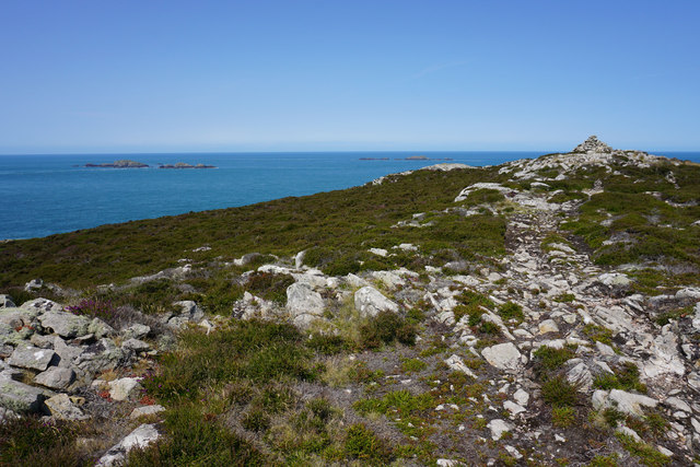
The headland is covered in a variety of vegetation, including grasses, heather, and wildflowers that thrive in the coastal environment. The area is home to a diverse range of wildlife, with seabirds such as gulls and razorbills nesting on the cliffs, and occasional sightings of seals and porpoises in the water below.
Access to Allt Felin-fawr is relatively easy, with a well-maintained footpath leading visitors to the headland. Along the path, there are informative signs providing details about the local flora, fauna, and geological features. The headland also offers ample parking facilities for those arriving by car.
Allt Felin-fawr is not only a natural wonder but also holds historical significance. It is believed to have been a site of human activity dating back thousands of years, with archaeological remains suggesting ancient settlements in the area.
Overall, Allt Felin-fawr is a remarkable coastal feature that showcases the natural beauty and rich history of Pembrokeshire. Its combination of stunning views, diverse wildlife, and accessible trails make it a must-visit destination for anyone exploring the region.
If you have any feedback on the listing, please let us know in the comments section below.
Allt Felin-fawr Images
Images are sourced within 2km of 51.858229/-5.3495496 or Grid Reference SM6923. Thanks to Geograph Open Source API. All images are credited.


Allt Felin-fawr is located at Grid Ref: SM6923 (Lat: 51.858229, Lng: -5.3495496)
Unitary Authority: Pembrokeshire
Police Authority: Dyfed Powys
What 3 Words
///beakers.trains.became. Near St Davids, Pembrokeshire
Nearby Locations
Related Wikis

Carnllundain
Carnllundain or Carn Llundain is the highest elevation of Ramsey Island in Pembrokeshire, Wales. == Geography == The 136-metre (446 ft) high hill stands...

Ramsey Island
Ramsey Island (Welsh: Ynys Dewi) is an island about 1 kilometre (1⁄2 nautical mile) off St David's Head in Pembrokeshire on the northern side of St Brides...

Ynys Bery
Ynys Bery is a small island south of Ramsey Island, Pembrokeshire, Wales, in the community of St David's and the Cathedral Close. == Etymology == The island...

The Bitches
The Bitches (also known as Bitches and Whelps) are a tidal race and set of rocks between Ramsey Island and the west Welsh coastline near St Davids. They...
Pen Dal-aderyn
Pen Dal-aderyn is the westernmost point of mainland Wales. It is in Pembrokeshire, west of St Davids. It means 'Bird-catching Head' in Welsh. == External... ==

Bishops and Clerks
The Bishops and Clerks are a group of rocks and islets, approximately 1+1⁄2 miles (2.4 km) west of Ramsey Island, Pembrokeshire, Wales. == Origins... ==

St Justinian
St Justinian (or St Justinian's or St Justinians; Welsh: Porth Stinan) is a coastal location of indeterminate area in the extreme northwest of Pembrokeshire...

St Justinian's Chapel
St Justinian's Chapel in Pembrokeshire, Wales, is now a roofless shell; the current structure was probably erected in the 16th century on earlier foundations...
Nearby Amenities
Located within 500m of 51.858229,-5.3495496Have you been to Allt Felin-fawr?
Leave your review of Allt Felin-fawr below (or comments, questions and feedback).