Bredon's Hardwick

Settlement in Worcestershire Wychavon

England

Bredon's Hardwick

Riverside patio at the Fleet Inn Looking east across the river Avon flood plain. Just the place to relax on a sunny afternoon!
<span class="nowrap"><a title="http://www.fleet-inn.co.uk/" rel="nofollow ugc noopener" href="http://www.fleet-inn.co.uk/">Link</a><img style="margin-left:2px;" alt="External link" title="External link - shift click to open in new window" src="https://s1.geograph.org.uk/img/external.png" width="10" height="10"/></span>
<a href="https://www.geograph.org.uk/photo/1567284">SO9036 : Fleet Inn, Twyning</a>
Riverside patio at the Fleet Inn Credit: Trevor Rickard

Bredon's Hardwick is a small village located in the county of Worcestershire, England. Situated near the River Avon, it is a rural settlement surrounded by picturesque countryside and rolling hills. The village is part of the Bredon Hill area, which is known for its natural beauty and historical significance.

Bredon's Hardwick is home to a close-knit community and offers a peaceful and idyllic setting for its residents. The village primarily consists of traditional stone-built houses, some of which date back to the 17th century, giving it a charming and historic character.

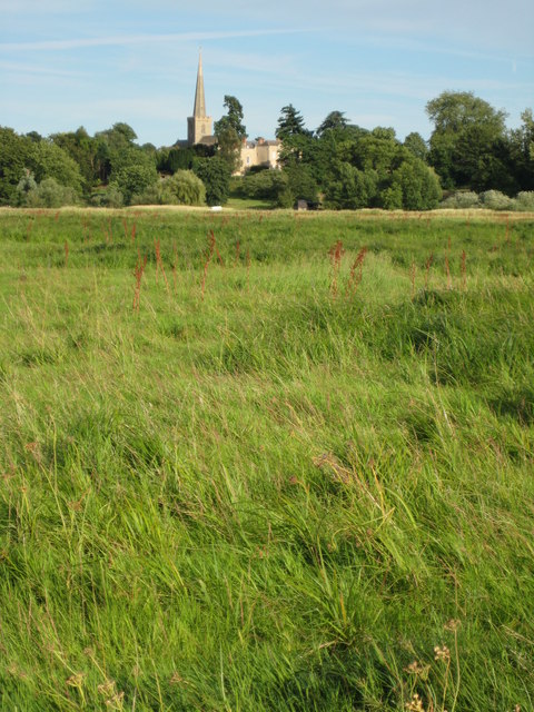
One of the prominent landmarks in Bredon's Hardwick is the St. Leonard's Church, a beautiful medieval church that adds to the village's cultural heritage. The church showcases stunning architecture and interesting historical features, making it an attractive destination for visitors.

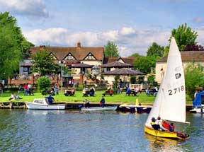
Surrounding the village, there are ample opportunities for outdoor activities and exploration. Bredon Hill, which lies to the east of the village, provides excellent hiking trails and panoramic views of the surrounding countryside. Additionally, the River Avon offers opportunities for boating, fishing, and wildlife spotting.

Despite its rural nature, Bredon's Hardwick is conveniently located near larger towns such as Tewkesbury and Pershore, which offer a range of amenities including shops, schools, and healthcare facilities.

In conclusion, Bredon's Hardwick is a charming village nestled in the Worcestershire countryside, renowned for its natural beauty, historical landmarks, and a close community spirit. It is an ideal place for those seeking a peaceful and picturesque rural lifestyle.

If you have any feedback on the listing, please let us know in the comments section below.

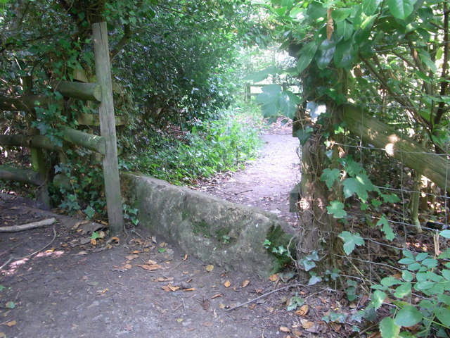
Bredon's Hardwick Images

Images are sourced within 2km of 52.016916/-2.127472 or Grid Reference SO9135. Thanks to Geograph Open Source API. All images are credited.

Riverside patio at the Fleet Inn Looking east across the river Avon flood plain. Just the place to relax on a sunny afternoon!
<span class="nowrap"><a title="http://www.fleet-inn.co.uk/" rel="nofollow ugc noopener" href="http://www.fleet-inn.co.uk/">Link</a><img style="margin-left:2px;" alt="External link" title="External link - shift click to open in new window" src="https://s1.geograph.org.uk/img/external.png" width="10" height="10"/></span>
<a href="https://www.geograph.org.uk/photo/1567284">SO9036 : Fleet Inn, Twyning</a>
Riverside patio at the Fleet Inn
Looking east across the river Avon flood plain. Just the place to relax on a sunny afternoon! LinkExternal link SO9036 : Fleet Inn, Twyning
Old stone on footpath/boundary No barrier to cyclists or horse-riders, Bredon.
Old stone on footpath/boundary
No barrier to cyclists or horse-riders, Bredon.
How old do you feel ? Abandoned stile and sign inside Bredon Tithe Barn, National Trust property.
How old do you feel ?
Abandoned stile and sign inside Bredon Tithe Barn, National Trust property.
M5 Motorway - Worcestershire Border Sign Northbound
Twyning - Village Inn
Twyning - the village green
Long straight at Mitton Lodge The road has just passed into Worcestershire.
Long straight at Mitton Lodge
The road has just passed into Worcestershire.
Tractor trying to access the B4080 Road scene near Bredon's Hardwick as 2011's harvest is brought in.
Tractor trying to access the B4080
Road scene near Bredon's Hardwick as 2011's harvest is brought in.
Road junction at Bredon's Hardwick
Restored Quarry The unlovely aspect of the water park at Bredon's Hardwick, not enhanced by scruffy signs or the displeasing sight of a caravan park.
Restored Quarry
The unlovely aspect of the water park at Bredon's Hardwick, not enhanced by scruffy signs or the displeasing sight of a caravan park.
Access to Croft Farm water park
Bus stop in Bredon's Hardwick
Roadworks at the M5 bridge The B4080's remarkably oblique bridge is receiving attention.
Roadworks at the M5 bridge
The B4080's remarkably oblique bridge is receiving attention.
B4080 in Bredon
B4080 in Bredon
Old pub in Bredon village
Northway level crossing The barriers are just rising after the passage of a lengthy southbound freight train.
Northway level crossing
The barriers are just rising after the passage of a lengthy southbound freight train.
Level crossing warning sign 1 The eastern access to Northway level crossing is via two 90-degree bends on a single-track lane.  Sign placement is "creative"!
Level crossing warning sign 1
The eastern access to Northway level crossing is via two 90-degree bends on a single-track lane. Sign placement is "creative"!
Level crossing warning sign 2 The eastern access to Northway level crossing is via two 90-degree bends on a single-track lane.  Sign placement is "creative"!  Large vehicles would have some difficulty negotiating the bends, let alone the level crossing.
Level crossing warning sign 2
The eastern access to Northway level crossing is via two 90-degree bends on a single-track lane. Sign placement is "creative"! Large vehicles would have some difficulty negotiating the bends, let alone the level crossing.
Show me another place!

Bredon's Hardwick is located at Grid Ref: SO9135 (Lat: 52.016916, Lng: -2.127472)

Administrative County: Worcestershire

District: Wychavon

Police Authority: West Mercia

What 3 Words

///arranges.muscular.snoozing. Near Bredon, Worcestershire

Nearby Locations

Bredon's Hardwick

Related Wikis

Bredon

Bredon is a village and civil parish in Wychavon district at the southern edge of Worcestershire in England. It lies on the banks of the River Avon on...
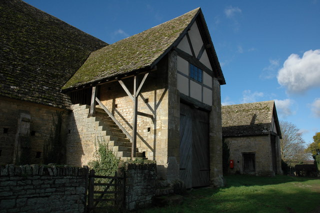
Bredon Barn

Bredon Barn is a large 14th-century threshing barn located at Bredon, Worcestershire, England, standing close to the River Avon.The barn was built for...

Northway, Gloucestershire

Northway is a village and civil parish in Gloucestershire, England, 2 miles north-east of Tewkesbury, and is in effect a suburb of that town. The parish...

Bredon railway station

Bredon railway station was on the Birmingham–Gloucester railway line to the north of Ashchurch for Tewkesbury railway station. The station closed in 1965...

Twyning

Twyning is a village and civil parish on the River Avon in the north of Gloucestershire, near Tewkesbury, England. The parish is first mentioned in the...

Upham Meadow and Summer Leasow

Upham Meadow and Summer Leasow (grid reference SO917375) is a 104.0-hectare (257-acre) biological Site of Special Scientific Interest on the border between...

Alderman Knight School

Alderman Knight School is a mixed special school located in Tewkesbury in the English county of Gloucestershire.The school is named after Cameron Knight...

Tewkesbury School

Tewkesbury Academy (previously Tewkesbury School) is a secondary school in the English town of Tewkesbury in Gloucestershire. It has been an academy since...

Nearby Amenities

Located within 500m of 52.016916,-2.127472
Bredon's Hardwick
Place: hamlet
Postal Code: GL20 7
Lat/Long: 52.0182953/-2.1294057
Post Box
Collection Times: Mo-Fr 09:00; Sa 07:00
Post Box Design: 2010_pattern
Post Box Mounting: pier
Post Box Type: lamp
Ref: GL20 19D
Royal Cypher: EIIR
Royal Cypher Wikidata: Q33102113
Lat/Long: 52.018781/-2.1275017
Bus Stop
Shelter
Bus: yes
Naptan AtcoCode: 2000G083101
Naptan Bearing: NE
Naptan CommonName: Shelter
Naptan Indicator: opp
Naptan NaptanCode: wocdgjwa
Naptan Street: Tewkesbury Road
Public Transport: platform
Source: naptan_import
Lat/Long: 52.0179136/-2.1284842
Cross Keys Inn
Naptan AtcoCode: 2000G083199
Naptan Bearing: N
Naptan BusStopType: CUS
Naptan CommonName: Cross Keys Inn
Naptan Indicator: opp
Naptan NaptanCode: wocdgjwg
Naptan Street: Tewkesbury Road
Naptan Verified: no
Source: naptan_import
Lat/Long: 52.0162057/-2.1299531
Fixme: Check for public footpath here
Note: Historic OS1:25k and Definitive Statement suggests as Public Footpath leaves the read heading ESE from here.
Lat/Long: 52.0186063/-2.1273124
Fixme: Check for public footpath here
Note: Historic OS1:25k and Definitive Statement suggests as Public Footpath leaves the read heading ESE from here.
Lat/Long: 52.0174436/-2.128514
Barrier: lift_gate
Lat/Long: 52.0156058/-2.1338136
Noexit: yes
Lat/Long: 52.0174533/-2.1212229
Fixme: Does the path join the road here?
Lat/Long: 52.0186591/-2.12719
Noexit: yes
Lat/Long: 52.015239/-2.1210571
Fixme: How does path cross field boundary here?
Lat/Long: 52.0161542/-2.1232587
Location Transition: yes
Power: pole
Lat/Long: 52.0156298/-2.1343289
Bredons Hardwick Bank
Location Transition: yes
Power: pole
Transformer: distribution
Voltage Primary: 11000
Lat/Long: 52.0144343/-2.126684
Power: pole
Lat/Long: 52.0150211/-2.12761
Power: pole
Lat/Long: 52.0157087/-2.1286768
Bredons Hardwick South
Power: pole
Transformer: distribution
Voltage Primary: 11000
Lat/Long: 52.0160574/-2.1292334
Power: pole
Lat/Long: 52.016286/-2.1298624
Power: pole
Lat/Long: 52.0164829/-2.1303733
Power: pole
Lat/Long: 52.0168501/-2.1313034
Western Aggregate Bredon
Power: pole
Transformer: distribution
Voltage Primary: 11000
Lat/Long: 52.0167746/-2.1340084
Power: pole
Lat/Long: 52.0174035/-2.131467
Location Transition: yes
Power: pole
Lat/Long: 52.0168279/-2.132387
Power: pole
Lat/Long: 52.017595/-2.1311592
Bredons Hardwick
Power: pole
Transformer: distribution
Voltage Primary: 11000
Lat/Long: 52.0178612/-2.1307234
Power: pole
Lat/Long: 52.018179/-2.1302788
Power: pole
Lat/Long: 52.0185371/-2.1297745
Power: pole
Lat/Long: 52.0188532/-2.1293467
Power: pole
Lat/Long: 52.0195948/-2.1221074
Power: pole
Lat/Long: 52.0195626/-2.12358
Bredons Hardwick Barns
Power: pole
Transformer: distribution
Voltage Primary: 11000
Lat/Long: 52.0195473/-2.1244188
Power: pole
Lat/Long: 52.0195201/-2.125719
Power: pole
Lat/Long: 52.0194986/-2.126631
Power: pole
Lat/Long: 52.0194689/-2.1279701
Bredons Hardwick North
Power: pole
Transformer: distribution
Voltage Primary: 11000
Lat/Long: 52.0191365/-2.128652
Power: pole
Lat/Long: 52.0191974/-2.1288448
Power: pole
Lat/Long: 52.0194788/-2.1299019
Power: pole
Lat/Long: 52.0197991/-2.1311579
Defibrillator
Defibrillator Location: On exterior wall of Cross Keys Pub, around the corner on the left-hand side, when looking from the main road.
Emergency: defibrillator
Lat/Long: 52.0161679/-2.1296949
The data included in this document is from www.openstreetmap.org. The data is made available under ODbL.

Have you been to Bredon's Hardwick?

Leave your review of Bredon's Hardwick below (or comments, questions and feedback).