Bredon

Settlement in Worcestershire Wychavon

England

Bredon

Riverside patio at the Fleet Inn Looking east across the river Avon flood plain. Just the place to relax on a sunny afternoon!
<span class="nowrap"><a title="http://www.fleet-inn.co.uk/" rel="nofollow ugc noopener" href="http://www.fleet-inn.co.uk/">Link</a><img style="margin-left:2px;" alt="External link" title="External link - shift click to open in new window" src="https://s1.geograph.org.uk/img/external.png" width="10" height="10"/></span>
<a href="https://www.geograph.org.uk/photo/1567284">SO9036 : Fleet Inn, Twyning</a>
Riverside patio at the Fleet Inn Credit: Trevor Rickard

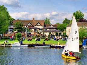
Bredon is a small village situated in the county of Worcestershire, England. It is located at the base of Bredon Hill, a prominent landmark in the region. The village is nestled in the picturesque Vale of Evesham, surrounded by beautiful countryside and scenic views.

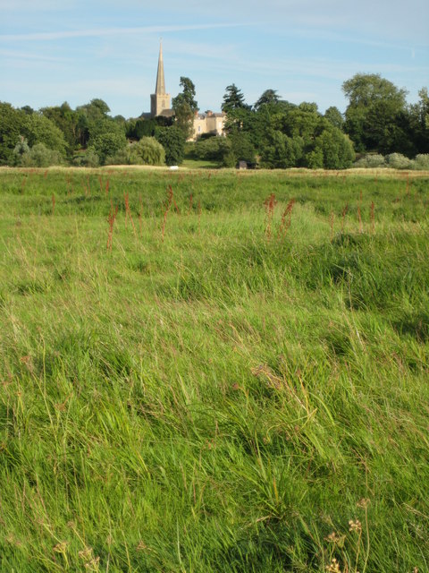
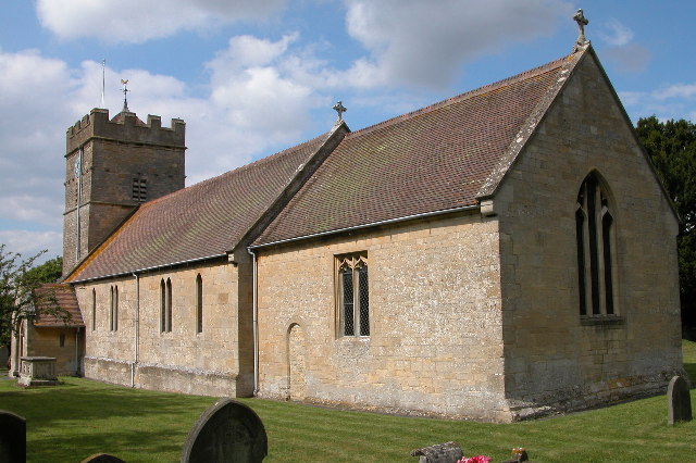
With a population of around 2,000 residents, Bredon has a close-knit community feel. The village boasts a variety of historic buildings, including the 13th-century St. Giles' Church, which is a focal point of the community. The church has a unique Norman tower and houses notable stained glass windows.

Bredon offers a range of amenities and services to its residents. There is a local primary school, village hall, and a few shops and pubs that cater to the needs of the community. The village also benefits from good transportation links, with nearby access to major roads and railway stations.

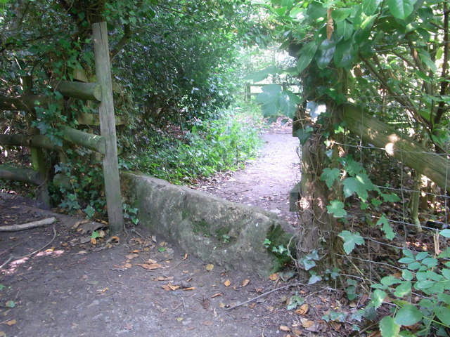
The countryside surrounding Bredon Hill provides ample opportunities for outdoor activities such as walking, cycling, and horse riding. The hill itself is a popular destination for hikers, offering panoramic views of the surrounding area from its summit.

Bredon is ideally situated for exploring the wider Worcestershire area. The nearby town of Pershore is just a short drive away, with its historic abbey and bustling market square. Additionally, the city of Worcester is within easy reach, offering a range of cultural attractions, shopping centers, and entertainment venues.

Overall, Bredon is a charming village with a rich history and a strong sense of community. It offers a peaceful and idyllic setting for residents and visitors alike to enjoy the beauty of the Worcestershire countryside.

If you have any feedback on the listing, please let us know in the comments section below.

Bredon Images

Images are sourced within 2km of 52.03083/-2.113985 or Grid Reference SO9236. Thanks to Geograph Open Source API. All images are credited.

Riverside patio at the Fleet Inn Looking east across the river Avon flood plain. Just the place to relax on a sunny afternoon!
<span class="nowrap"><a title="http://www.fleet-inn.co.uk/" rel="nofollow ugc noopener" href="http://www.fleet-inn.co.uk/">Link</a><img style="margin-left:2px;" alt="External link" title="External link - shift click to open in new window" src="https://s1.geograph.org.uk/img/external.png" width="10" height="10"/></span>
<a href="https://www.geograph.org.uk/photo/1567284">SO9036 : Fleet Inn, Twyning</a>
Riverside patio at the Fleet Inn
Looking east across the river Avon flood plain. Just the place to relax on a sunny afternoon! LinkExternal link SO9036 : Fleet Inn, Twyning
Pond near R.Avon,  Bredon Taken from footpath 512.
Pond near R.Avon, Bredon
Taken from footpath 512.
Footpath over railway bridge, Bredon
Cross-field to B 4080 Footpath over to the main road, Bredon/Westmancote area.
Cross-field to B 4080
Footpath over to the main road, Bredon/Westmancote area.
Old stone on footpath/boundary No barrier to cyclists or horse-riders, Bredon.
Old stone on footpath/boundary
No barrier to cyclists or horse-riders, Bredon.
How old do you feel ? Abandoned stile and sign inside Bredon Tithe Barn, National Trust property.
How old do you feel ?
Abandoned stile and sign inside Bredon Tithe Barn, National Trust property.
M5 Motorway - Worcestershire Border Sign Northbound
Bus stop in Bredon's Hardwick
Roadworks at the M5 bridge The B4080's remarkably oblique bridge is receiving attention.
Roadworks at the M5 bridge
The B4080's remarkably oblique bridge is receiving attention.
B4080 in Bredon
B4080 in Bredon
Old pub in Bredon village
Curve on Moreton Lane (B4080)
B4080 at the junction for Westmancote
Across the valley to Rectory Farm
B4080 at the junction for Bredon's Norton
Kemerton Lake View of architectural sculpture at Kemerton Lake
Kemerton Lake
View of architectural sculpture at Kemerton Lake
Kemerton Park with redpoll cattle Kemerton Park after the 2007 floods, with redpoll cattle
Kemerton Park with redpoll cattle
Kemerton Park after the 2007 floods, with redpoll cattle
Fields beside the M5 Looking towards a house on Downfield Lane, in <a href="https://www.geograph.org.uk/gridref/SO9137">SO9137</a>. The trees on the left are at the corner of a new wood, or possibly an orchard.
Fields beside the M5
Looking towards a house on Downfield Lane, in SO9137. The trees on the left are at the corner of a new wood, or possibly an orchard.
Show me another place!

Bredon is located at Grid Ref: SO9236 (Lat: 52.03083, Lng: -2.113985)

Administrative County: Worcestershire

District: Wychavon

Police Authority: West Mercia

What 3 Words

///gazette.releasing.language. Near Bredon, Worcestershire

Nearby Locations

Bredon Bredon

Related Wikis

Bredon

Bredon is a village and civil parish in Wychavon district at the southern edge of Worcestershire in England. It lies on the banks of the River Avon on...
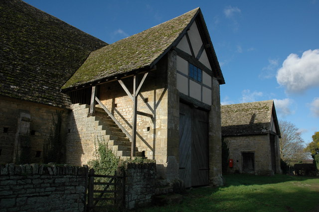
Bredon Barn

Bredon Barn is a large 14th-century threshing barn located at Bredon, Worcestershire, England, standing close to the River Avon.The barn was built for...

Bredon railway station

Bredon railway station was on the Birmingham–Gloucester railway line to the north of Ashchurch for Tewkesbury railway station. The station closed in 1965...

Upham Meadow and Summer Leasow

Upham Meadow and Summer Leasow (grid reference SO917375) is a 104.0-hectare (257-acre) biological Site of Special Scientific Interest on the border between...

Bredon's Norton

Bredon's Norton or Norton-by-Bredon is a village and civil parish 11 miles (18 km) south east of Worcester, in the Wychavon district, in the county of...

Kemerton Court

Kemerton Court is the principal manor house of the village of Kemerton, near Tewkesbury in Gloucestershire. The house is built of local Cotswold stone...

Twyning

Twyning is a village and civil parish on the River Avon in the north of Gloucestershire, near Tewkesbury, England. The parish is first mentioned in the...

Kemerton

Kemerton is a village and civil parish in Worcestershire in England. It lies at the extreme south of the county in the local government district of Wychavon...

Nearby Amenities

Located within 500m of 52.03083,-2.113985
Bredon
Name La: Briodunum
Place: village
Postal Code: GL20 7
Source: NPE
Wikidata: Q1877352
Lat/Long: 52.0311079/-2.112163
Barrier: stile
Foot: yes
Lat/Long: 52.032607/-2.1130147
Post Box
Brand: Royal Mail
Brand Wikidata: Q638098
Collection Times: Mo-Fr 17:00; Sa 12:30
Operator: Royal Mail
Operator Wikidata: Q638098
Post Box Mounting: wall
Post Box Type: wall
Postal Code: GL20 7
Ref: GL20 15
Royal Cypher: GR
Royal Cypher Wikidata: Q33102273
Lat/Long: 52.0309553/-2.1141231
Turning Circle
Lat/Long: 52.0314438/-2.1109889
HE Ref: 1319647
Listed Status: Grade II
Man Made: obelisk
Wikidata: Q26605713
Lat/Long: 52.0297991/-2.1187514
Barrier: stile
Foot: yes
Lat/Long: 52.032575/-2.1075338
Turning Circle
Lat/Long: 52.0291647/-2.107316
Maxheight: 2.2 m
Lat/Long: 52.0305507/-2.1071859
Bus Stop
Shelter
Bus: yes
Naptan AtcoCode: 2000G066601
Naptan Bearing: SW
Naptan CommonName: Shelter
Naptan Indicator: adj
Naptan NaptanCode: wocgadam
Naptan Street: High Street
Public Transport: platform
Shelter: yes
Source: naptan_import;survey
Lat/Long: 52.0303969/-2.1140024
Barrier: kissing_gate
Lat/Long: 52.0312181/-2.1174646
Parking
Access: customers
Lat/Long: 52.0315708/-2.1175739
Bus Stop
Shelter
Bus: yes
Naptan AtcoCode: 2000G066600
Naptan Bearing: NE
Naptan BusStopType: CUS
Naptan CommonName: Shelter
Naptan Indicator: opp
Naptan NaptanCode: wocgadaj
Naptan Street: High Street
Public Transport: platform
Shelter: no
Source: naptan_import
Lat/Long: 52.0305679/-2.1138784
Bus Stop
St Giles Road
Bus: yes
Naptan AtcoCode: 2000G673001
Naptan Bearing: W
Naptan CommonName: St Giles Road
Naptan Crossing: St Giles Road
Naptan Indicator: adj
Naptan NaptanCode: wocdatwd
Naptan Street: High St
Public Transport: platform
Shelter: yes
Source: naptan_import;survey
Lat/Long: 52.0297197/-2.1183132
Bus Stop
St Giles Road
Bus: yes
Naptan AtcoCode: 2000G673002
Naptan Bearing: E
Naptan CommonName: St Giles Road
Naptan Crossing: St Giles Road
Naptan Indicator: opp
Naptan NaptanCode: wocdatwg
Naptan Street: High Street
Public Transport: platform
Shelter: no
Source: naptan_import
Lat/Long: 52.0297951/-2.1182998
Bus Stop
Blenheim Drive
Bus: yes
Naptan AtcoCode: 2000G673013
Naptan Bearing: E
Naptan CommonName: Blenheim Drive
Naptan Indicator: Opp
Naptan Landmark: Blenheim Drive
Naptan NaptanCode: wocdawaw
Naptan Street: Kemerton Road
Naptan Verified: no
Public Transport: platform
Source: naptan_import
Lat/Long: 52.0305315/-2.1069035
Leisure: slipway
Lat/Long: 52.0338961/-2.1167208
Barrier: kissing_gate
Lat/Long: 52.030707/-2.118165
Barrier: lytch_gate
Lat/Long: 52.0312568/-2.1174692
Telephone
Booth: K6
Covered: booth
Listed Status: Grade II
Operator: BT
Phone: +44 1684 772511
Lat/Long: 52.0304291/-2.113926
Cotswold Beauty Station
Addr City: Tewkesbury
Addr Housenumber: 5
Addr Parentstreet: Main Road
Addr Postcode: GL20 7LU
Addr Street: Station Villas
Addr Village: Bredon
Shop: beauty
Url: https://www.cotswoldbeautystation.co.uk/
Lat/Long: 52.0306123/-2.1095699
Bredon Central
Location Transition: yes
Power: pole
Source: Bing
Transformer: distribution
Voltage Primary: 11000
Lat/Long: 52.032266/-2.1136612
Dock Lane
Power: pole
Source: Bing
Transformer: distribution
Voltage Primary: 11000
Lat/Long: 52.0335758/-2.114494
Power: pole
Source: Bing
Lat/Long: 52.0333756/-2.1135741
Power: pole
Source: Bing
Lat/Long: 52.033181/-2.1126667
Power: pole
Source: Bing
Lat/Long: 52.0327102/-2.1129189
The Dog House
Old Name: Tangles
Pet: dog
Shop: pet_grooming
Website: https://www.facebook.com/bredondoghousegrooming/
Lat/Long: 52.0306191/-2.1094701
Entrance: main
Lat/Long: 52.0309334/-2.1140185
Defibrillator
Defibrillator Location: On exterior wall of Drapers Shop, just to the left of the main entrance.
Emergency: defibrillator
Indoor: no
Ref: RT-1335
Lat/Long: 52.0309404/-2.1140476
Generator Method: photovoltaic
Generator Output Electricity: yes
Generator Source: solar
Generator Type: solar_photovoltaic_panel
Location: roof
Power: generator
Lat/Long: 52.0292636/-2.1071872
Waste Basket
Lat/Long: 52.0305483/-2.1073059
Grit Bin
Lat/Long: 52.0306765/-2.1076622
Grit Bin
Operator: Worcesterhire Highways
Ref: A128
Lat/Long: 52.0331219/-2.1163683
Fixme: There are 3 houses signed at the bottom of this drive: Springbank, The Quest. and Dock Cottage. Where is the third one?
Lat/Long: 52.0326257/-2.1155514
Generator Location: roof
Generator Method: photovoltaic
Generator Orientation: 235
Generator Output Electricity: yes
Generator Solar Modules: 16
Generator Source: solar
Generator Type: solar_photovoltaic_panel
Power: generator
Lat/Long: 52.0326748/-2.1155057
Atlantic Coast Studios Ltd
Addr City: Tewkesbury
Addr Housenumber: 11-14
Addr Postcode: GL20 7HH
Addr Street: Station Drive
Addr Village: Bredon
Shop: printer
Lat/Long: 52.0288072/-2.1082409
Emotive Design
Business: engineering
Fixme: Check location
Note: Business has one of the units here, but I'm not sure which one.
Website: http://www.emotivedesignlimited.co.uk/
Lat/Long: 52.0284951/-2.1081244
Crossing
Crossing: uncontrolled
Lat/Long: 52.0305063/-2.1104601
Generator Method: photovoltaic
Generator Output Electricity: yes
Generator Source: solar
Generator Type: solar_photovoltaic_panel
Location: roof
Power: generator
Lat/Long: 52.0291817/-2.1074854
Power: pole
Lat/Long: 52.0351128/-2.1118527
Power: pole
Lat/Long: 52.0344148/-2.1110386
Power: pole
Lat/Long: 52.0317643/-2.1078877
Material: wood
Power: pole
Lat/Long: 52.0319153/-2.1083289
Location Transition: yes
Power: pole
Lat/Long: 52.0316042/-2.1074545
Power: pole
Transformer: distribution
Voltage Primary: 11000
Lat/Long: 52.0321529/-2.1089847
Power: pole
Lat/Long: 52.0329173/-2.1095688
Power: pole
Lat/Long: 52.0337226/-2.110238
Power: pole
Lat/Long: 52.033459/-2.1113887
Bredon West
Location Transition: yes
Power: pole
Transformer: distribution
Voltage Primary: 11000
Lat/Long: 52.0297346/-2.1207375
Pam Frith Art
Addr City: Tewkesbury
Addr Housename: Cover Point
Addr Postcode: GL20 7LH
Addr Street: Back Lane
Addr Village: Bredon
Alt Name: Back Lane Garage Shop
Contact Facebook: https://www.facebook.com/Pam-Frith-Art-105927167545150/
Shop: art
Lat/Long: 52.0314808/-2.1142665
Speed Display
Direction: WSW
Lat/Long: 52.0298183/-2.117205
Speed Display
Direction: E
Lat/Long: 52.0304194/-2.1068966
Turning Circle
Lat/Long: 52.0291716/-2.1072236
Post Office
Bredon Post Office
Addr City: Tewkesbury
Addr Country: GB
Addr Postcode: GL20 7LA
Addr Street: Church Street
Addr Village: Bredon
Brand: Post Office
Brand Wikidata: Q1783168
Opening Hours: Mo-Fr 09:00-17:00; Sa 09:00-12:00
Operator: Spar
Operator Wikidata: Q610492
Ref Pol Id: 3771
Website: https://www.postoffice.co.uk/branch-finder/1615238/bredon
Lat/Long: 52.0310275/-2.1139857
Bench
Backrest: yes
Lat/Long: 52.0335379/-2.1166696
Bench
Backrest: yes
Lat/Long: 52.0332951/-2.1169538
Bench
Backrest: yes
Lat/Long: 52.0332959/-2.1168185
Bench
Backrest: yes
Seats: 4
Lat/Long: 52.0334594/-2.1165722
Mann's Barbershop
Addr City: Tewkesbury
Addr Housenumber: 4
Addr Parentstreet: Main Road
Addr Postcode: GL20 7LU
Addr Street: Station Villas
Addr Village: Bredon
Shop: hairdresser
Lat/Long: 52.0306365/-2.1094569
Waste Basket
Lat/Long: 52.0333715/-2.116619
Backrest: no
Leisure: picnic_table
Material: wood
Lat/Long: 52.0334728/-2.1168522
Waste Basket
Lat/Long: 52.0335176/-2.1166241
Bench
Backrest: yes
Lat/Long: 52.033331/-2.1169049
Bench
Backrest: yes
Lat/Long: 52.0333578/-2.1166249
Bench
Backrest: yes
Lat/Long: 52.0297841/-2.1187507
The data included in this document is from www.openstreetmap.org. The data is made available under ODbL.

Have you been to Bredon?

Leave your review of Bredon below (or comments, questions and feedback).