Wreyland

Settlement in Devon Teignbridge

England

Wreyland

Bovey Tracey : Ponies Ponies on Dartmoor who were happy to pose for a photograph.
Bovey Tracey : Ponies Credit: Lewis Clarke

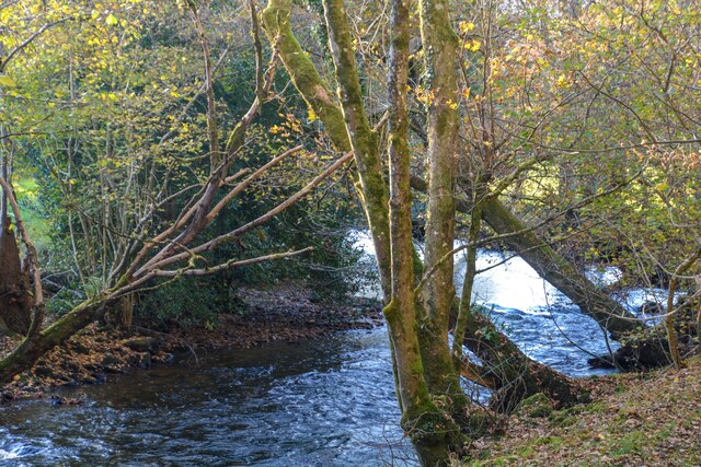
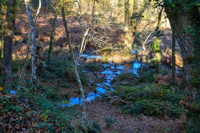
Wreyland is a small village located in the county of Devon, in the southwestern part of England. Nestled amidst the picturesque countryside, it is situated approximately 10 miles northwest of the bustling market town of Tiverton. The village is surrounded by rolling hills, lush green fields, and scenic woodlands, making it an ideal destination for nature lovers and those seeking a peaceful retreat.

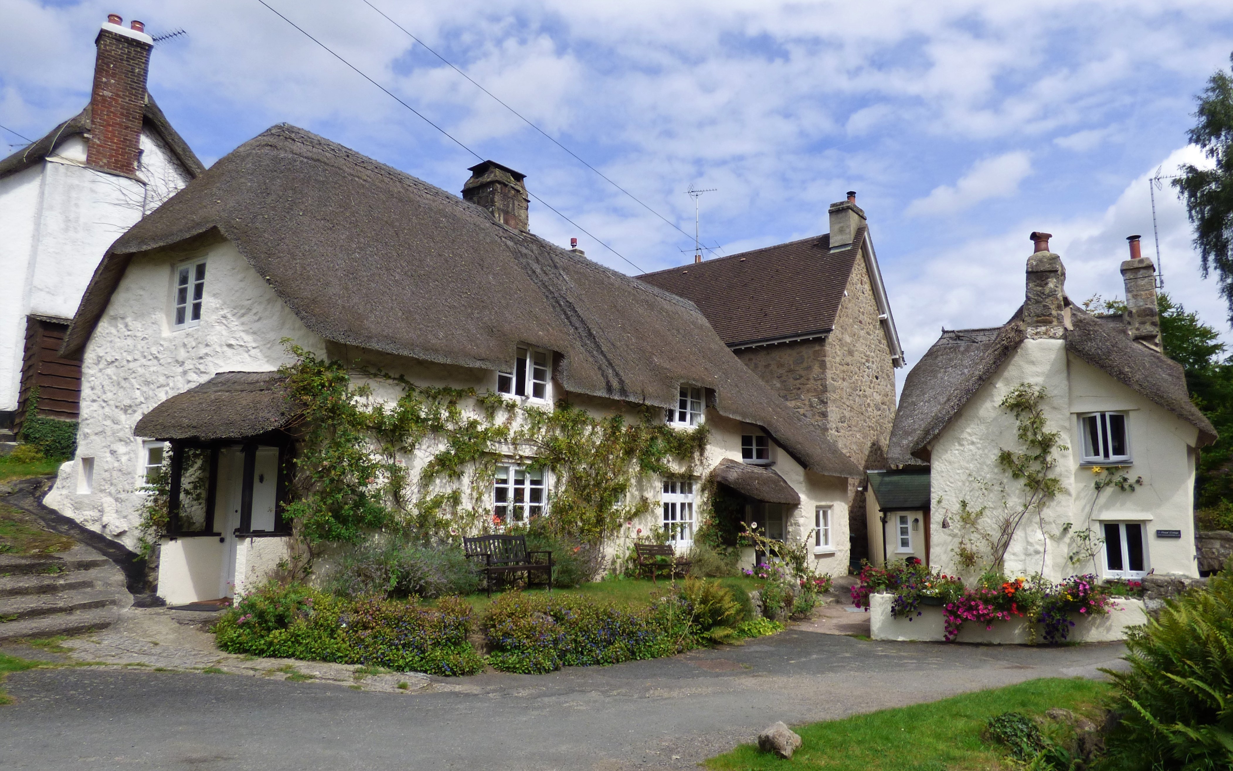
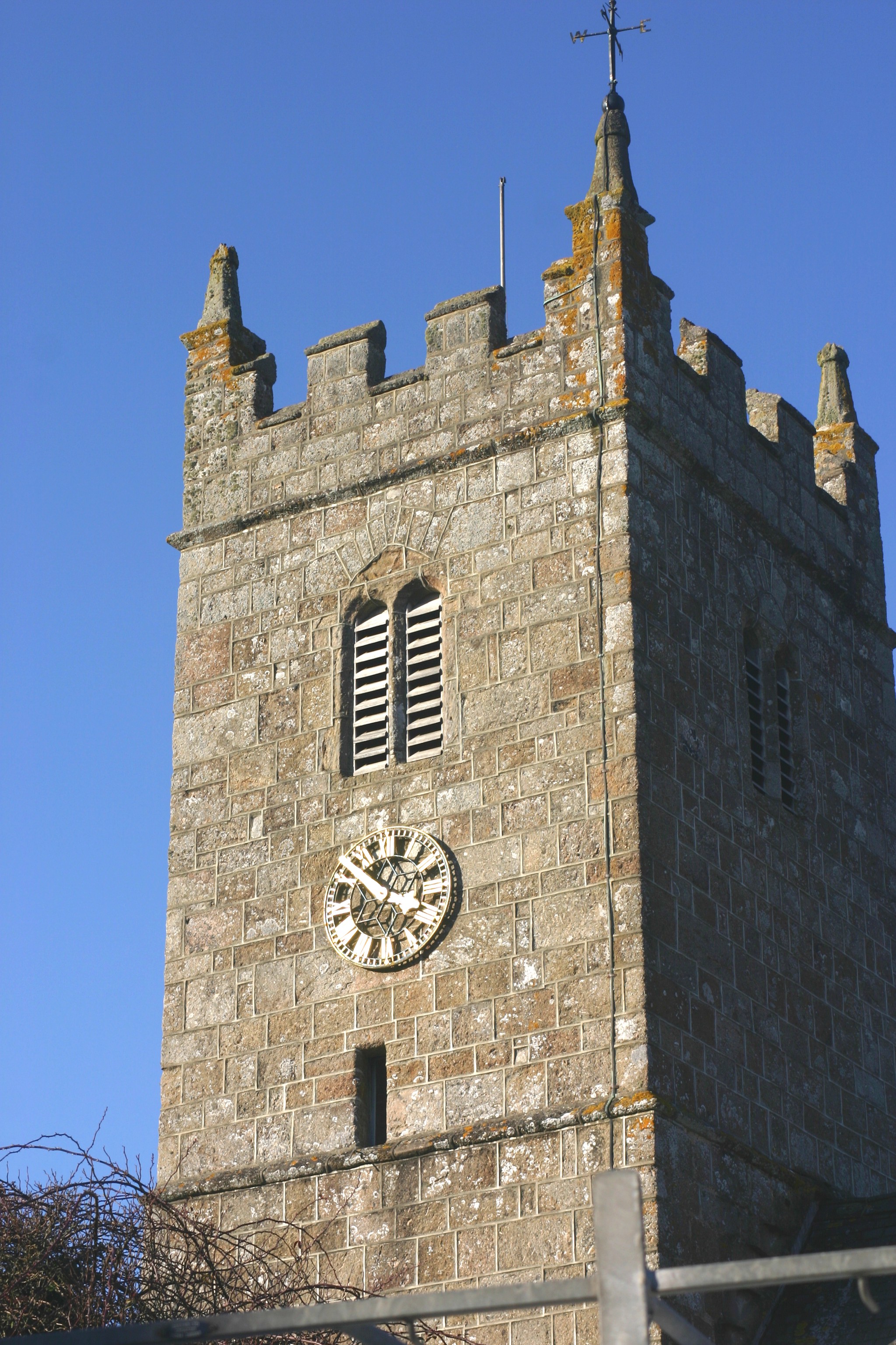
Wreyland has a population of around 300 residents, giving it a close-knit and friendly community atmosphere. The village is known for its charming thatched-roof cottages, which date back several centuries, adding to its rustic and traditional appeal. The local parish church, St. Mary's, is a notable landmark and showcases stunning architecture.

Although Wreyland is a relatively secluded village, it benefits from its proximity to nearby towns, providing residents with convenient access to essential amenities. The village is well-connected to the transportation network, with regular bus services operating to Tiverton and other neighboring towns.

The natural beauty surrounding Wreyland offers numerous opportunities for outdoor activities such as hiking, cycling, and horse riding. Additionally, the nearby River Exe provides opportunities for fishing and boating enthusiasts. The village also hosts various community events throughout the year, including summer fairs and seasonal celebrations, fostering a strong sense of community spirit.

Overall, Wreyland is a tranquil and idyllic village, offering residents and visitors alike a chance to experience the charm of rural Devonshire life amidst stunning natural surroundings.

If you have any feedback on the listing, please let us know in the comments section below.

Wreyland Images

Images are sourced within 2km of 50.615913/-3.7258076 or Grid Reference SX7881. Thanks to Geograph Open Source API. All images are credited.

Bovey Tracey : Ponies Ponies on Dartmoor who were happy to pose for a photograph.
Bovey Tracey : Ponies
Ponies on Dartmoor who were happy to pose for a photograph.
Bovey Tracey : Pony A pony on Dartmoor.
Bovey Tracey : Pony
A pony on Dartmoor.
Bovey Tracey : Pony A pony on Dartmoor.
Bovey Tracey : Pony
A pony on Dartmoor.
Bovey Tracey : Track A track heads through the open land.
Bovey Tracey : Track
A track heads through the open land.
Bovey Tracey : Track A track heads across the open land.
Bovey Tracey : Track
A track heads across the open land.
Lustleigh : River Bovey Looking towards the River Bovey.
Lustleigh : River Bovey
Looking towards the River Bovey.
Lustleigh : Lower Knowle Road Looking along Lower Knowle Road as it approaches a bridge under the old railway line.
Lustleigh : Lower Knowle Road
Looking along Lower Knowle Road as it approaches a bridge under the old railway line.
Lustleigh : Lower Knowle Road Looking along Lower Knowle Road heading under the former railway bridge.
Lustleigh : Lower Knowle Road
Looking along Lower Knowle Road heading under the former railway bridge.
Lustleigh : Footpath A footpath heads through the woods.
Lustleigh : Footpath
A footpath heads through the woods.
Lustleigh : Dartmoor Scenery Looking across the heaths.
Lustleigh : Dartmoor Scenery
Looking across the heaths.
Lustleigh : Footpath A footpath through the woods.
Lustleigh : Footpath
A footpath through the woods.
Lustleigh : Footpath A footpath through the woods.
Lustleigh : Footpath
A footpath through the woods.
Lustleigh : Restricted byway A restricted byway heading through the woods.
Lustleigh : Restricted byway
A restricted byway heading through the woods.
Lustleigh : Footpath A footpath through the woods.
Lustleigh : Footpath
A footpath through the woods.
Lustleigh : Footpath Looking along the footpath.
Lustleigh : Footpath
Looking along the footpath.
Lustleigh : Stream Looking along a small stream.
Lustleigh : Stream
Looking along a small stream.
Lustleigh : Stream Looking along a small stream.
Lustleigh : Stream
Looking along a small stream.
Lustleigh : Footpath Looking along a path.
Lustleigh : Footpath
Looking along a path.
Show me another place!

Wreyland is located at Grid Ref: SX7881 (Lat: 50.615913, Lng: -3.7258076)

Administrative County: Devon

District: Teignbridge

Police Authority: Devon and Cornwall

What 3 Words

///popular.campus.marginal. Near Bovey Tracey, Devon

Related Wikis

Lustleigh

Lustleigh is a small village and civil parish in the Wray Valley, inside the Dartmoor National Park in Devon, England. It is between the towns of Bovey...

Church of St John the Baptist, Lustleigh

The Church of St John the Baptist is the Church of England parish church of the village of Lustleigh, Devon, located in the centre of the village. ��2...

Lustleigh railway station

Lustleigh station was on the Moretonhampstead and South Devon Railway serving the village of Lustleigh, Devon, England. Lustleigh was the penultimate station...

Pullabrook Halt railway station

Pullabrook Halt was a railway station opened in 1931 by the Great Western Railway to serve the hamlet of Pullabrook that lies between Bovey Tracey and...

Nearby Amenities

Located within 500m of 50.615913,-3.7258076
Rudge Cross
Place: locality
Lat/Long: 50.6132064/-3.7209651
Heavens Gate
Wpt Symbol: Dot
Lat/Long: 50.6144284/-3.7294311
Pethy Bridge
Wpt Symbol: Dot
Lat/Long: 50.6158444/-3.7258692
Post Box
Brand: Royal Mail
Brand Wikidata: Q638098
Brand Wikipedia: en:Royal Mail
Collection Plate: CP7
Collection Times: Mo-Fr 12:00; Sa 11:00; Su off
Drive Through: no
Operator: Royal Mail
Operator Wikidata: Q638098
Post Box Mounting: pier
Post Box Type: lamp
Ref: TQ13 220
Royal Cypher: EIIR
Royal Cypher Wikidata: Q33102113
Source: survey;streetlevel imagery;aerial imagery
Lat/Long: 50.6161398/-3.7254819
Tourism: picnic_site
Lat/Long: 50.6185649/-3.7204498
May Day Rock
Designation: May Day Rock
Historic: monument
Lat/Long: 50.6183986/-3.7210393
Barrier: kissing_gate
Lat/Long: 50.619327/-3.7226852
Power: pole
Lat/Long: 50.6144927/-3.7194327
Power: pole
Lat/Long: 50.6163951/-3.7191969
Power: pole
Lat/Long: 50.6170825/-3.7194605
Direction: S
Generator Method: photovoltaic
Generator Output Electricity: yes
Generator Solar Modules: 16
Generator Source: solar
Generator Type: solar_photovoltaic_panel
Location: roof
Power: generator
Lat/Long: 50.619191/-3.7210864
Generator Method: photovoltaic
Generator Output Electricity: yes
Generator Source: solar
Generator Type: solar_photovoltaic_panel
Location: roof
Power: generator
Lat/Long: 50.6121172/-3.7240702
Post Box
Brand: Royal Mail
Brand Wikidata: Q638098
Brand Wikipedia: en:Royal Mail
Collection Times: Mo-Fr 12:00; Sa 11:30; Su off
Drive Through: no
Operator: Royal Mail
Operator Wikidata: Q638098
Post Box Design: hovis
Post Box Mounting: stone_wall
Post Box Type: lamp
Ref: TQ13 173
Royal Cypher: GR
Royal Cypher Wikidata: Q33102273
Source: survey;streetlevel imagery;aerial imagery
Lat/Long: 50.6178521/-3.7219587
Waye Farm
Place: farm
Lat/Long: 50.6181744/-3.7308937
Ellimore
Place: farm
Lat/Long: 50.6196064/-3.7296934
The data included in this document is from www.openstreetmap.org. The data is made available under ODbL.

Have you been to Wreyland?

Leave your review of Wreyland below (or comments, questions and feedback).