Worthing
Settlement in Sussex Worthing
England
Worthing

Worthing is a coastal town located in West Sussex, England. Situated on the south coast, it lies approximately 60 miles south of London and is part of the larger Brighton/Worthing/Littlehampton conurbation. With a population of around 110,000, Worthing is the second largest town in West Sussex.
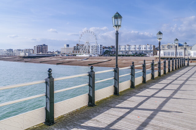
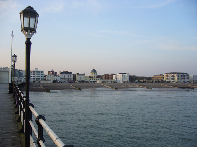
Known for its Victorian and Edwardian architecture, Worthing offers a mix of traditional charm and modern amenities. The town boasts a long, sandy beach, which stretches for several miles and attracts visitors from all over the country during the summer months. Along the promenade, there are numerous cafes, restaurants, and shops, making it a popular destination for tourists and locals alike.
Worthing is renowned for its cultural scene, with several theaters, art galleries, and museums scattered throughout the town. The Pavilion Theatre, located in the heart of Worthing, hosts a variety of performances, including plays, musicals, and comedy shows. Additionally, the Worthing Museum and Art Gallery showcases a diverse collection of artwork and historical artifacts.
For outdoor enthusiasts, Worthing offers ample opportunities to enjoy the surrounding natural beauty. With the South Downs National Park located just a few miles inland, visitors can explore picturesque countryside, go hiking, or take part in various outdoor activities.
Worthing also benefits from excellent transport links, with direct train services to London and other major cities. The town's proximity to the A27 and A24 roads makes it easily accessible by car as well.
Overall, Worthing is a vibrant coastal town that combines history, culture, and natural beauty, making it an attractive destination for residents and tourists alike.
If you have any feedback on the listing, please let us know in the comments section below.
Worthing Images
Images are sourced within 2km of 50.814188/-0.371212 or Grid Reference TQ1402. Thanks to Geograph Open Source API. All images are credited.


Worthing is located at Grid Ref: TQ1402 (Lat: 50.814188, Lng: -0.371212)
Administrative County: West Sussex
District: Worthing
Police Authority: Sussex
What 3 Words
///ready.ranges.lovely. Near Worthing, West Sussex
Nearby Locations
Related Wikis
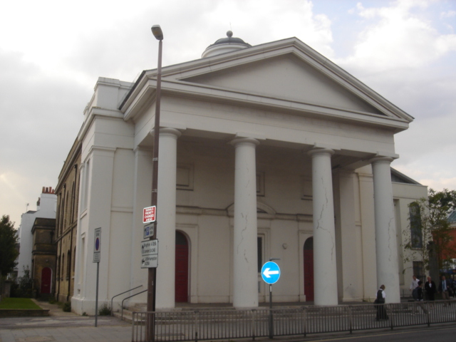
St Paul's Church, Worthing
The Venue (formerly St Paul's Church) in Worthing, England hosts live music events. It was opened in 1812 as the Worthing Chapel of Ease. It was built...
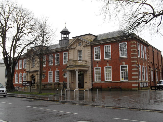
Worthing Museum and Art Gallery
Worthing Museum and Art Gallery is in the centre of Worthing near the grade II* listed St Paul's. The building, which celebrated its centenary in 2008...
Worthing
Worthing () is a seaside resort town in West Sussex, England, at the foot of the South Downs, 11 miles (18 km) west of Brighton, and 18 miles (29 km) east...
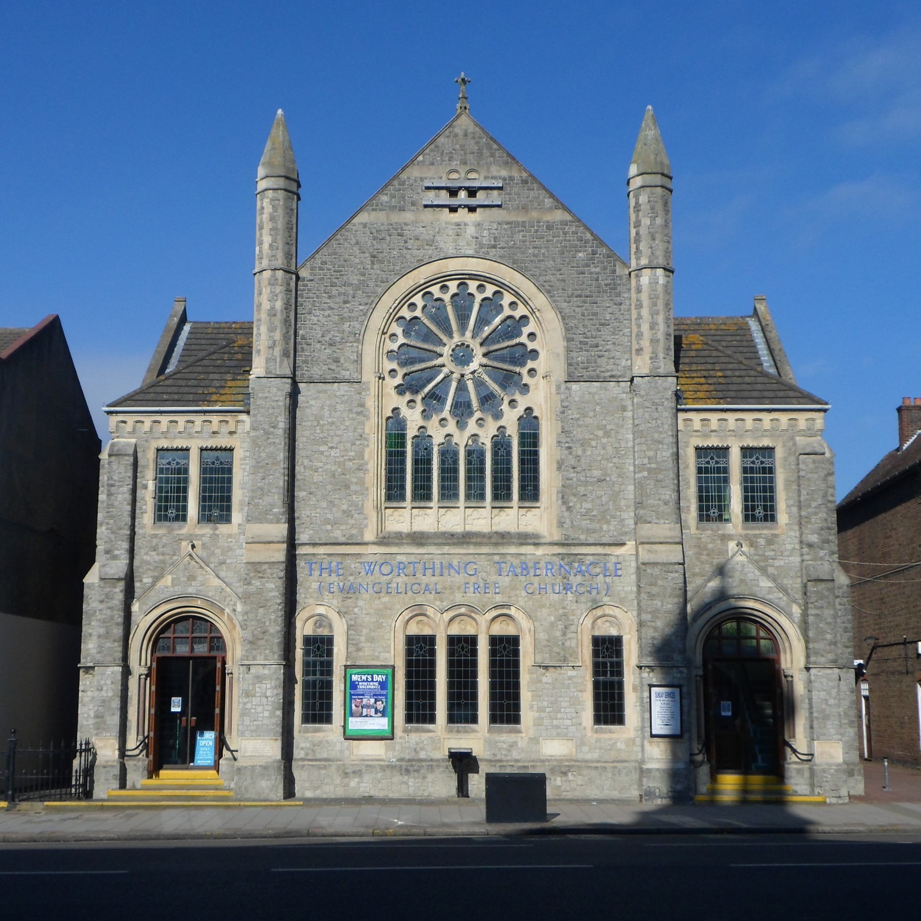
Worthing Tabernacle
Worthing Tabernacle is an independent Evangelical Christian church in the town and borough of Worthing, one of seven local government districts in the...
Nearby Amenities
Located within 500m of 50.814188,-0.371212Have you been to Worthing?
Leave your review of Worthing below (or comments, questions and feedback).